
-
 4268 Hits
-
 72.08% Score
-
 2 Votes
|
|
Route |
|---|---|
|
|
28.19463°N / 16.64557°W |
|
|
Hiking, Scrambling |
|
|
Spring, Summer, Fall, Winter |
|
|
Half a day |
|
|
Hike and short scramble |
|
|
Overview
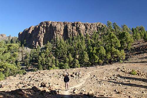 Sombrero de Chasna from Lomo de los Pegueros Sombrero de Chasna from Lomo de los Pegueros |
There are two routes to Sombrero de Chasna, which both start at the same trailhead and run in parallel through and above Barranco de la Magdalena. Both are easy hikes until they recombine beneath the Sombrero de Chasna north face. They run through a beautiful forest of Canarian pines until they head out into the desolation near the caldera rim.
The final ascent to Sombrero de Chasna is a UIAA I scramble through a short chimney onto the summit plateau.
Getting There
See the Getting There information on the main page. The route starts from TF21, the road from Vilaflor to Boca Tauce.Route Description
 Sombrero de Chasna from the north
- Start altitude: 2050m
- Summit altitude: 2411m
- Prevailing exposure: S
- Type: 3h one way
- Protection: None
The route starts near the two ruined cabins near the road from Vilaflor to Boca Tauce. It starts with a slope traverse above the road, leading in south-eastern direction. After a couple of switchbacks the route splits in two, one heading further on southwards, one heading straight up in further switchbacks.
The former route runs through Baranco de la Magdalena, which is reached by a wide, sweeping curve. There are two trails running along the eastern and western sides of the little canyon. While the route is not obvious in its detail, the general direction is crystal clear. Just follow the canyon to its end and then - in another sweeping curve - head up to the north face of Sombrero de Chasna where you meet the second trail.
This latter trail runs along Lomo de los Pegueros a broad back, separating Barranco de la Magdalena from the road from Vilaflor. After about half an hour of switchbacks the path levels and leads into a saddle with nice views towards Roque de los Almendros and Sombrero de Chasna. From this saddle the route heads up towards the caldera rim to the north of Sombrero de Chasna. Again it reaches a saddle with a spectacular view of the Cañadas del Teide. To reach Sombrero de Chasna turn east and descent into the saddle between the caldera rim and the mountain where it joins the trail from Barranco de la Magdalena.
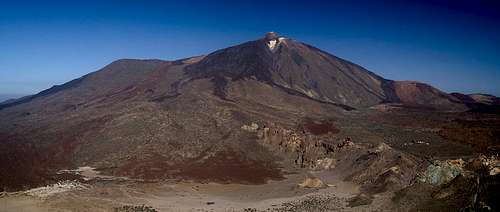 The Cañadas del Teide seen from the saddle north of Sombrero de Chasna
Head for the north-western edge of the big hat, where a wide chimney offers the easiest route to the summit plateau. Though you need to use your hands the way up the chimney is nevertheless rather easy. The high point of Sombrero de Chasna is qlose to the chimney but a little further to the west.
