
|
|
Route |
|---|---|
|
|
40.24823°N / 111.54666°W |
|
|
Hiking |
|
|
Spring |
|
|
Half a day |
|
|
Steep snow |
|
|
Overview
Of all the Wasatch 11000 footers, East Provo Peak is the least often climbed. It is surrounded by rugged terrain on all sides, making summer ascents unpleasant scree scrambles on top of a bumpy hour or so ride on a 4x4 road. Normally, hikers climb Provo Peak first and then make their way to East Provo Peak. Here's a description found in the Provo Peak log of abrennalinerush of what this entails."Whatever you do, do not attempt a traverse across to East Provo Peak. Unless you really like loose shale, you have a lot of time to kill, you hate fun, and you have a death wish."
This route presents a more enjoyable way to climb East Provo Peak, and does not require a high clearance 4x4 vehicle. Approaching the peak via Bartholomew Canyon on snow in the spring avoids all the unpleasantness.
Getting There
Bartholomew Canyon is located southeast of the peak, i.e. on the other side of the peak from Provo. It takes about 1 hr 10 min to get there from Salt Lake City.Find your way to exit 260 (400 South, Springville) on I15. Head east 3.2 miles on 400 South to 1300 East. Turn right on 1300 East which soon becomes Canyon Drive. Follow Canyon Drive 4.9 miles to where it splits into the left and right forks of Hobble Creek. Bear left onto the left fork. Note that the way the road is designed will naturally take you to the left fork and you might not even realize that you have passed the fork. Continue 2.7 miles up the left fork to Bartholomew Canyon on the left.
Start of Bartholomew Canyon road
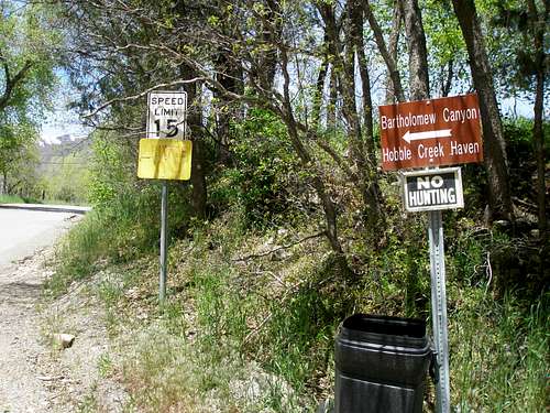
Note the yellow sign in the picture above. It has been painted over, but unfortunately the words "PRIVATE ROAD" can still be read. This road is valid access to the national forest boundary. However, the property on both sides of the road is private and no parking is allowed on the road before the boundary, but it is so narrow, that it would be hard to find a place to park anyway.
Turn left onto Bartholomew Canyon road. The pavement soon ends. After about .7 miles you will encounter this sign and fork.
Bear right. East Provo Peak is left of the pole.
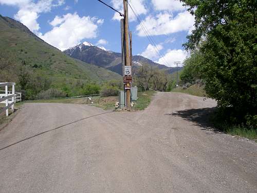
Take the rightmost fork towards Bartholomew Canyon. A short distance later you will encounter another sign.
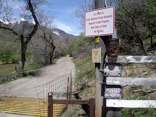
.6 miles to the forest boundary
After going the .6 miles you reach the National Forest boundary and the road gets a little rougher, but is still suitable for virtually all passenger vehicles. If your car is super prissy, you might not like it, but I had no problem with a Subaru Legacy (not Outback). Continue another .5 miles and park just past the water tank on the right. Note that the total distance from the turn up Bartholomew Canyon to the water tank is 1.8 miles.
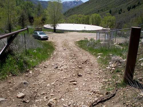
Looking back at the parking area
Route Description
At the water tank, the road deteriorates and is no longer suitable for passenger cars. However, if you have a high clearance 4x4 vehicle you can keep driving. Drive through the gate and go .2 miles to an unsigned junction and turn left. Follow the road another 1.7 miles (estimated) until it ends. There is a very small sloped clearing on the right at the end of the road where you can park.If walking, when the road starts to make switchbacks, there is always a foot path you can take to avoid them, so the distance after the left turn is a little less, about 1.3 miles. It is a pleasant walk, as most of the way, the road is lined with bright green grass and aspens, and you are typically walking on dirt, not rocks.
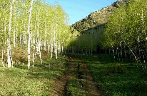
Typical section of 4x4 road
Once you get to the end of the road, there is a path leading a few feet left into a couloir (N40.23047 W111.53167). Simply follow the main couloir which is always obvious, until the terrain opens up.
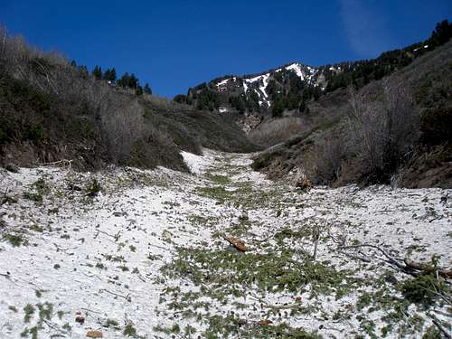
The main couloir
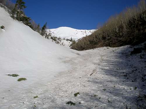
Starting to open up, E Provo Peak will be to the right
Once you are out in the open, you will first see the south ridge of Provo Peak ahead of you. Head to the right/north following the bottom of the main drainage, and you will see the ridge running from Provo Peak to East Provo Peak. Head towards East Provo Peak following the bottom of the drainage, and then ascend the steep slope to the ridge.
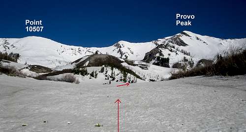
South ridge of Provo Peak
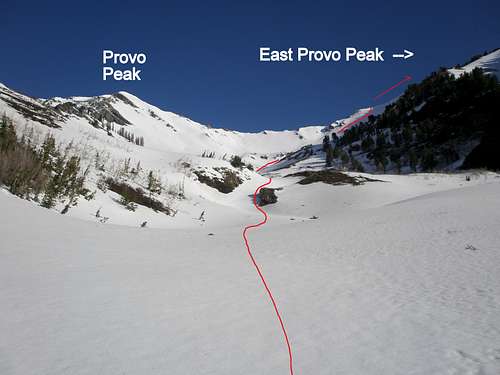
Provo/E Provo ridge
It is all a moderate grade until the last 1000 vertical feet to the ridge and then the grade steepens to at most 45 degrees.
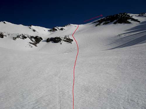
The last 1000' to the ridge starts just below the rocks.
Once on the ridge it is a straightforward walk to the summit, which I unfortunately found to be bare. Except for this little bit, there was solid snow and lots of it from the start of the couloir all the way to the top, even though surrounding hillsides were dry.
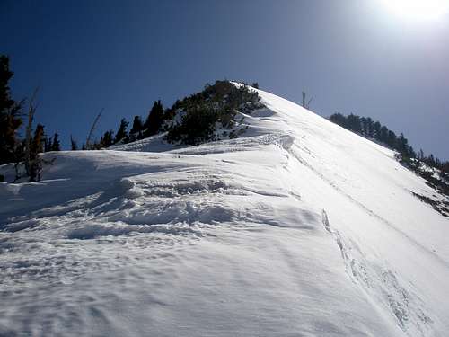
On the ridge, looking towards the summit
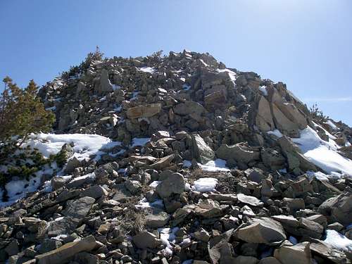
Pesky rocks at the top
Essential Gear
Crampons and ice axe.When to Climb
Avalanche debris
This route is only suitable on a cool spring day on stable snow. There was much evidence of prior avalanche activity so it would not be advisable in the winter. Note that all surrounding slopes funnel into the couloir where you start. There was also much evidence of fresh wet slides, so be sure to start early in the day and be done before the snow starts heating up.
Stats
Elevation at water tank parking: 6220'
Elevation at end of 4x4 road: 7600'
East Provo Peak elevation: 11044'
Vertical feet climbed on road: 1400'
Vertical feet from end of 4x4 road to top: 3444'
Distance from water tank to summit: 3.4 miles
Distance from water tank to end of 4x4 road: 1.5 miles
Distance from end of 4x4 road to top: 1.9 miles
Map
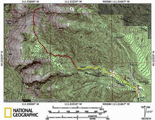
East Provo Peak route map