Welcome to SP!  -   
 
  MbPost.com -- It's SP for Mountain Biking!
Areas & Ranges·Mountains & Rocks·Routes·Images·Articles·Trip Reports·Gear·Other·People·Plans & Partners·What's New·Forum

Bat Cave Mountain Route Info

 
[ Sizes: Orig | Large | Med | Small | Thumb ]
Bat Cave Mountain Route Info

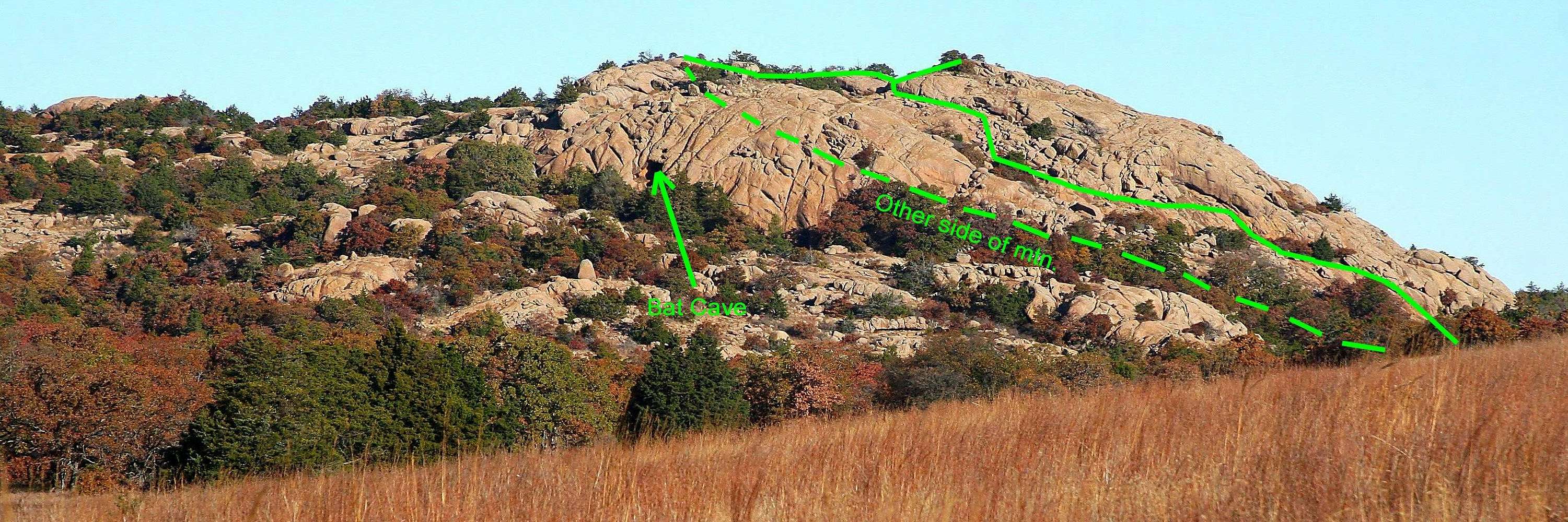
This image of Bat Cave Mountain in the Wichita Mountains Wildlife Refuge, OK, is annotated for one of many possible class 3 hiking routes to the summit. This one is easily accessed from the two turn-outs that are located due east of the mountain, 2.3 miles south of the turn-off from Highway 49 onto Indiahoma Road. The descent on the far side of the mountain requires hiking along Indiahoma Road for a short distance to return to the vehicles. The view in this image is looking north; Indiahoma road is hidden behind the prairie. Imaged in November 2008.


Comments

No comments posted yet.


Sign in to post!

Don't have an account? Register now.


Rate This Image
Current Score: 0

Log In To Vote
 Bat Cave Mountain (Mountain/Rock)

A profile of Bat Cave...
« PREV

Viewing
#8 of 9
GALLERY
Bat Cave Mtn Map (Rv)
NEXT »

 Mark Doiron's Image Gallery

Troop 275 on Quanah Parker Dam
« PREV

Viewing
#538 of 538
GALLERY

You are at
the Last
Image
Image Data

Mark DoironSubmitted by Mark Doiron
on Nov 17, 2008 10:03 am

Image ID: 464033
Hits: 624 

Lat/Lon: 34.70634°N / 98.70958°W

Image Type(s): Hiking, Topo/Diagram


"A mind that is stretched by a new experience can never go gack to its old dimensions."   --Oliver Wendell Holmes   

© 2006-2012 SummitPost.org. All Rights Reserved.