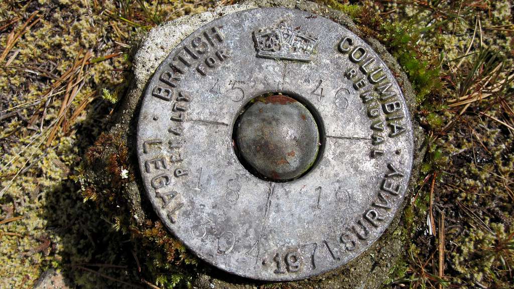
BC Legal Survey Monument on Mt Braden
1971 Legal survey monument on a bench on the south slopes of Mt Braden, Sooke Hills Regional Park Reserve, Vancouver Island, BC. The marker is buried inside the remains an old surveyers cairn. Position coordinates: N48 26.375 W123 36.110 measured May 04, 2011.
The post was set in 1971 by Charles O. Smythies whilst preparing a Right of Way plan for BC Hydro through the area. The post was a replacement of the common corners of the four sections 45, 46, 18 & 19 shown on the face of the cap and this "P/ROCK" monument was set in place of the original corner post. Information kindly supplied by Mr George C. Smythies.
Note that this is not a BC Control Survey monument and, therefore, does not appear in the Crown Registry database.


