

tashi - Jun 8, 2014 4:18 pm - Hasn't voted
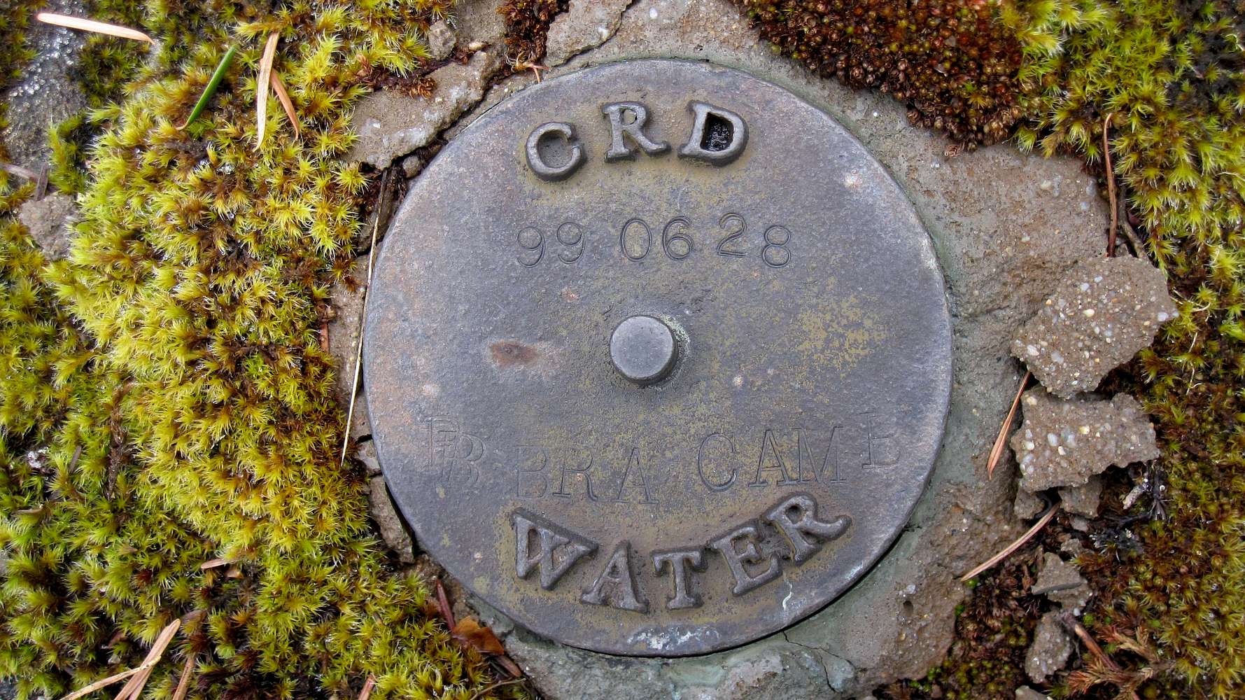
PhtotoPoint Monitoring LocationThis marks a PhotoPoint Monitoring location. I, along with my crewmates, installed PhotoPoint monitoring locations throughout the watershed and the newly transferred (at the time) park reserve lands. Locations were installed on Mt. Braden along a potential hiking route to monitor impact to the area from recreational use. I have no idea if CRD Parks has followed up with this initiative.

vancouver islander - Jul 5, 2014 3:47 pm - Hasn't voted
Re: PhtotoPoint Monitoring LocationInteresting and a mystery solved. We've found marks so far at N48 26 19.8 W123 35 54.7 and N48 26 31.2 W123 35 58.2. Are there more and if so could you supply the coordinates please.
The 2 so far lie on what used to be the standard hiking route up Braden. The route that most now use and that is described in my write-up lies on a roughly parallel course about 200 metres to the west before meeting the old route at the base of the final climb.
tashi - Jul 19, 2014 1:59 pm - Hasn't voted
other PPM locations.There are other PhotoPoint Monitoring locations on Mt. Braden at/near these UTMs: 53652550455736, 53652550455735, 53653140455710, 53654930455661, 53655670455676, 53655810455812, 53656200455829, amongst others. 53655810455812 was considered to be the junction of a few possible routes to the top, while 53656200455829 was a potential viewpoint spot where folks are likely to gather. These markers were used where the ground was solid rock, otherwise short sections of rebar were pounded in to mark camera locations.
vancouver islander - Jul 21, 2014 10:41 pm - Hasn't voted
Re: other PPM locations.Great. Many thanks.


Comments
Post a Comment