
-
 21158 Hits
-
 88.19% Score
-
 26 Votes
|
|
Route |
|---|---|
|
|
46.11801°N / 7.71403°E |
|
|
Mountaineering, Skiing |
|
|
Spring, Summer |
|
|
Most of a day |
|
|
Alpine F |
|
|
Overview
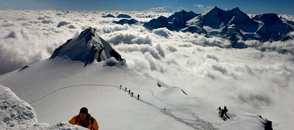
Bishorn NW Flank Normal Route
Bishorn 4153 m, belonging to the Weisshorn Group, Wallis, is one of the northernmost Fourthousand of the Alps. It's an often visited summit, located just North of the Weisshorn. The mountain has two distinct summits, separated by a 600 meter long snow ridge: the Western summit is the highest one, while the Eastern summit at 4134 m is a fore-summit named Pointe Burnaby. Check here the complete list of the 82 alpine Fourthousanders and the 46 minor summits: Club4000.


The Bishorn is considered one of the easiest 4000 of the Alps, because the climb is not particularly difficult along the North-Western snowy slopes, covered by the broad Turtmanngletscher, but not to be underestimated in reason of the presence of some crevasses. The mountain in the distance is not particularly spectacular, as it is overshadowed by the stunning and superb pyramid of the Weisshorn, with which it's connected by one of the most beautiful and majestic ridge of the Wallis.It is quite advisable to stay overnight at the Cabane de Tracuit 3256 m, as the approach from Zinal to the shelter is long and with a significant difference in level, although never particularly tiring (about 1600 m of difference in level).
Getting there
The nearest village is Zinal, a charming tourist resort at 1670 m, located at the head of Valle d'Anniviers in the Wallis.
Getting to Zinal
- By plane - To Geneva International Airport
- By car - A9 motorway to Sierre-est, then follow the road signposted Val d'Anniviers, Vissoie, Ayer-Zinal. The access roads are cleared all year round. Free parking in all the municipality of Ayer.
- By car from Italy - The easiest and fastest access from Italy is from Domodossola via the Simplon Pass, passing close to Visp and then Brig in Rhone Valley. You reach Zinal, with a convenient road from the Rhone Valley near Sierre.


Approach to Cabane de Tracuit
From the village of Zinal follow the signpost to the Cabane de Tracuit, getting to a parking lot a bit out of the village, where it starts the trail (signpost Cabane de Tracuit). The path is well marked with red and white signs. After a starting part inside the forest, the trail called du Roc de la Vache becomes more steep and twisty, getting the mountain pasture Combautanna (2578 m) and huge heap of stones heading to the Col de Tracuit. In about 4 hours the trail leads us to the base of an easy rocky gully equipped with chains. Just above, in a few minutes, you will get the Cabane de Tracuit (3256 m) situated on the pass between the Turtmannan and Anniviers valleys.

Enjoy the awesome view over Bishorn and many peaks belonging to the Imperial Crown (Weisshorn, Zinalrothorn, Ober Gabelhorn, Dent Blanche).
Route Description
North-West Flank (Normal and ski route)
Difficulty: F (Alpine)
Difference in level: 900 m from Cabane de Tracuit 3256 m
A good and advisable route - not too demanding - with breathtaking views.

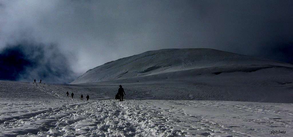
The glacier begins at a few minutes from the refuge and its first part is a flat traverse. From the refuge bypass a stony hump and head to the Turtmanngletscher, proceeding with a short descent which leads to a shelf with cairns near the start of the glacier. Although there are a few crevasses, here you must rope up. Begin to proceed on the glacier with a long and almost flat traverse, crossing a crevasse area and reach slightly downhill a basin on the glacier that must be crossed heading towards an obvious snowy saddle, situated between the rocky ridge on the left (rocky band extending from the top of Bishorn until a point at 3469 of altitude) and the wide snowy slope on the right.


Take the slope, steeper at the beginning, giving access to the North-Western snowy ramp of the mountain. The ascent increases in intensity up to take the foot of the long glacial slope, north-west oriented, which leads to the summit. Climb up along keeping more or less in the middle of the slope (easy ramp at about 35°), avoiding some big crevasses. The itinerary can be made with a few bends to mitigate the steepnes of the slope, anyhow rapidly reaching 4000m altitude at a point where the slope is attenuated a little. In the higher section take some steep ramps heading and exiting to the wide snowy saddle that separates the fore-summit (Punta Burnaby 4135m) to the left from Bishorn to the right. After reaching the saddle the view becomes spectacular: all the peaks of the Imperial Crown appear in front of the climber with a privileged view of the impressive North ridge of the Weisshorn.
There is a big creasse just below the summit. Turn sharp right, pass the crevasse and climb a short snowy wall to get the summit (3 hours from the refuge).


From the summit you can admire the imposing Weisshorn and many other mountains of the Couronne imperial (Dent Blanche, Zinalrothorn, Obergabelhorn) and Monte Rosa.


Wishing to climb also the close Pointe Burnaby 4135 m descend to the saddle and in a few minutes you can climb to the peak keeping slightly below the edge of the ridge, on snow, debris and rocks, and finally coming out on the final crest to the fore-summit. Easy.
Essential Gear
Ice-axe, crampons, rope, a good pair of sunglasses and warm clothes.
Red Tape
No fees no permits required.
Hut


- Cabane de Tracuit - S.A.C. Sect. Chaussy
Situation: Turtmanngletscher
Owner: S.A.C. Sect. Chaussy
Open: from March to September
Size: 120 persons
Winter shelter: 15 persons
Guardian: Anne-Lise Bourgeois, Pralonzet 3961
Zinal Hut Phone: 0041-027-4751500 e-mail: cabane@tracuit.ch website: www.tracuit.ch
When to climb
- Mountaineering: the best period goes to the end of June to middle September

- Ski-mountaineering: from April to June
Guidebooks and maps


 Guidebook")
"Il grande libro dei 4000" by Marco Romelli, Valentino Cividini - Idea Montagna Editore, 2015
“Tutti i 4000” – L’aria sottile dell’alta quota” – CLUB 4000 CAI TORINO – Vivalda Editori
“The 4000 of the Alps” by Richard Goedeke (CAAI) – All the normal routes to the 4000m. summits of the Alps – Libris Edition