
|
|
Mountain/Rock |
|---|---|
|
|
43.11370°N / 111.1278°W |
|
|
Bonneville |
|
|
Hiking |
|
|
Spring, Summer, Fall |
|
|
8960 ft / 2731 m |
|
|
Overview
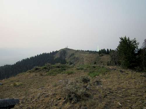
Located in the scenic Star Valley area just west of the Wyoming border, this peak is interesting to prominence peakbaggers thanks to its prominence of slightly over 2040 feet. Communication towers dominate the mountain as seen from the highway but the highest point is north of where the towers are located. Due to the communication towers, there is a road that goes near to the summit area and that road is open after the snow leaves the upper reaches. A gate lower down will stop drivers from going further if snow remains on the road.
Getting There
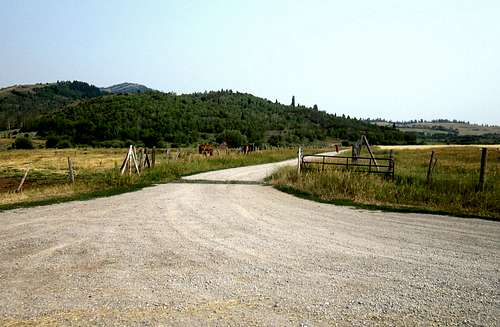
Turn here
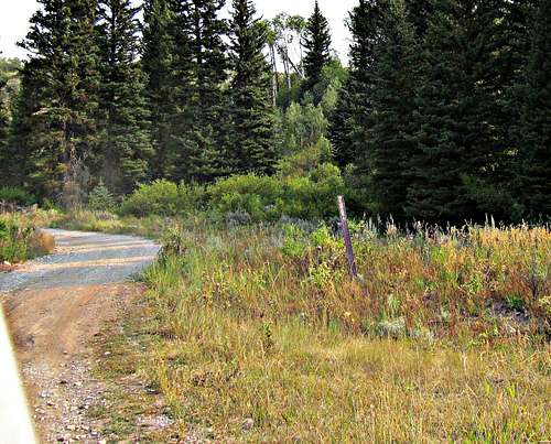
From highway 89, find County road 111 just north of Etna and go west on this paved road for 3.5 miles to an unsigned graded road that goes north. Follow this road and as it crosses a cattle grate, you\'ll find yourself on FR 070. Take it for about a mile and at the first major fork, take the right which is FR 286. This is really a surprisingly good road and it goes all the way to the south summit of Black mountain and then just a bit further on road 004. There is a small stream crossing but it has a rocky bottom and shouldn\'t be a problem for a Honda Accord type vehicle but check it before you plunge in. You will encounter a gate at waypoint 43.0905 111.1021 (elev 7590) From the gate it is about 3.8 miles to the summit (which includes a half mile walk from where I was able to park) If the gate is closed, you will need to begin your hike nearby and realize you\'ve got 3.8 miles with 2500\' of elevation gain to deal with. I think it is open after the snow melts up above. If the gate is open, this is pretty much a drive up. From where I parked, it was a half mile hike with minimal gain to a mound of rocks that has a small register at the base of the higher rocks. It had three signatures after being placed by John Vitz in 2007. Distance from CR 111 to summit rocks 7.53 miles
This is the right fork to take
Route
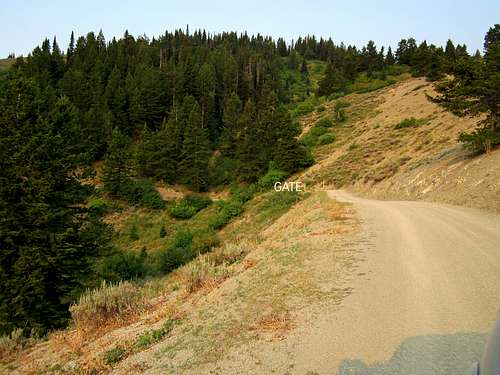
The gate was open
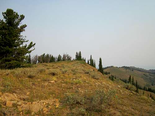
I parked at lat/long (nad 27) 43.1076 111.1251 and walked about a half mile to the highest spot I could find. The elevation gain was minimal and I was rewarded with the find of a register bottle that contained three signatures as well as some great views from the summit area. This is a very easy hike if the road is open but if you choose to make it more of a hike, you could hike from the gate and add another 2500 feet of elevation gain.
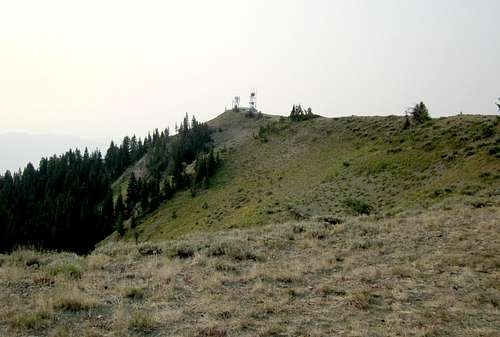
Communication tower
Red Tape and camping
Cross country terrain
Red tape is not a problem on this mountain as it is located in the Caribou National forest. Camping is available at developed campgrounds such as McCoy Creek and Hoffman which are not far from Alpine, Wyoming. You can also car camp at several spots which are along the road but please leave no trace of your visit. Use existing fire rings if you find them and haul out all your trash. This is bear country so beware to safeguard your food.
When to Climb
The highest spot on Black Mountain
Best when no snow to deal with.
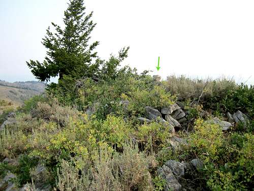
The register
Not many people have ascended this mountain for peakbagging purposes and it is probable that the area sees a lot of hunters during the fall. I did find a register located near the highest rocks and three signatures were present when I signed in. Peakbagger.com also has a register that some people sign and it can be found here.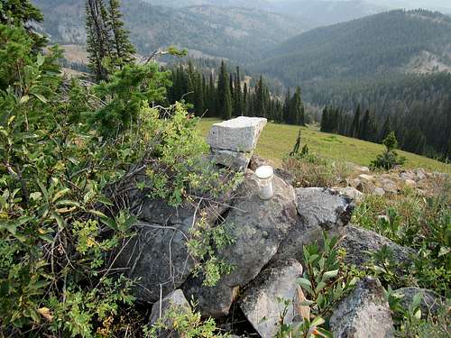
Register
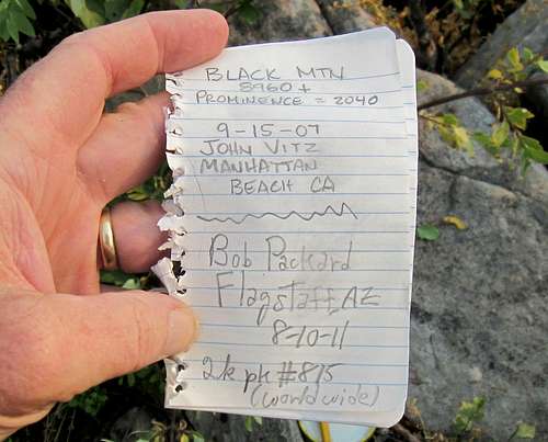
First page in register
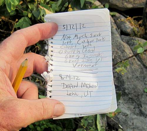
2nd page in register
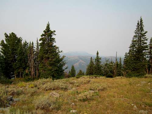
Views
The views would normally be outstanding but due to a lot of smoke from fires in the area, the scenery was not really able to impress me as I would have hoped.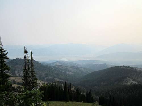
Smokey view to the east
Smokey view to the north
Smokey view to the south