
|
|
Mountain/Rock |
|---|---|
|
|
35.05400°N / 83.151°W |
|
|
4440 ft / 1353 m |
|
|
Overview
 From Blackrock.
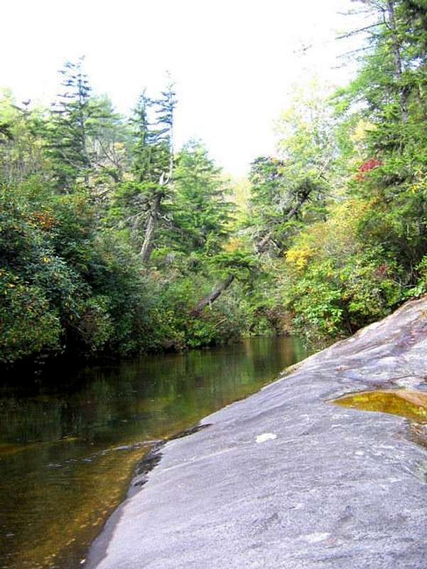
Blackrock Mountain (there are several Blackrock Mountains in NC) located in Panthertown Valley is one of the prominent plutons that mark this amazing high elevation valley in extreme southwestern North Carolina. Recovering forests of hardwoods, pines, and hemlocks cloak its shoulders and cap its summit. Its flanks are cut by streams and are home to a number of stunning waterfalls. And its rocky cliffs present a stark granite face to the viewer, hiker, or climber.
 |  |  |
Getting There
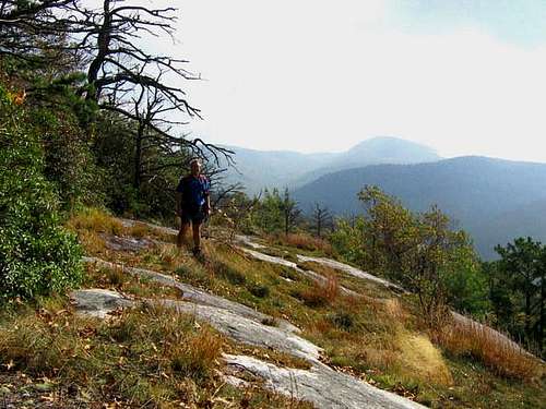
 Trail ford.
I use the Cold Mountain Trailhead which is accessible by taking 64 West out of Brevard, to 281 North, to Cold Mountain Road (eight tenths of a mile beyond 281/64 intersection, then 5.8 miles to a sharp left turn to the parking area for Panthertown Valley.
 |  |  |
Red Tape
None. Panthertown Valley, ostensibly a sensitive protected area, remains one of the no-fee areas in the Nantahala National Forest. It seems to be totally unregulated, beyond the courtesies that the Forest Service asks of all who use our forests. Pack it in, pack it out. Don't build fires when it's dry. Use all precautions for bears (and coyotes, too, I can say from personal experience). The plant communities in Panthertown are EXTREMELY fragile, so walk with care.Also, be aware that currently, there is no official trail system in Panthertown Valley. There are trails, to be sure, HUNDREDS OF THEM! No trail is blazed. No trail is named. For a good trailmap for Panthertown Valley, go here.
 |  |  |
When To Climb
 On the cliffs.
For hiking, all year. For climbing, I would assume that the rock can get really warm in the depth of summer, and ice over during winter storms. That aside, Panthertown Valley is an all-year kind of place.
 |  |
Camping
Camping is allowed all over Panthertown Valley. Please don't tread heavily on the plant communities on the granite domes, nor those around the waterfalls. Camp in establshed sites, but I would not advise camping near bogs or streams when there is heavy rain. Flash flooding is a real and immediate concern in this place.
 Fording the creek.
 |
Mountain Conditions
Check the weather for either Cashiers (the closest town) or Highlands (also close, but roughly the same elevation). |