
Viewing: 1-2 of 2

Klenke - May 10, 2003 8:17 pm - Hasn't voted
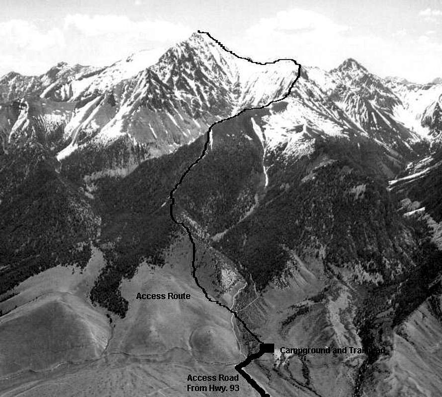
New Standard RouteThe trail as of June 2002 now goes up the forested valley right of the words "Access Route" on the photo. This "new" trail turns left and meets the black line shown here at the ridge crest above the words "Access Route".

reboyles - Feb 8, 2011 5:33 pm - Voted 1/10
WrongThe line on the picture is incorrect as stated above and the trail never ventured that far over towards the Rock Creek drainage. I posted a corrected picture here on SP and wrote to the ranger district. As of 2011 it looks like they've pulled this picture from their site.
Viewing: 1-2 of 2


Comments
Post a Comment