-
 16588 Hits
-
 80.05% Score
-
 13 Votes
|
|
Canyon |
|---|---|
|
|
29.20438°N / 103.65218°W |
|
|
Canyoneering |
|
|
Overview
Bruja Canyon is a technical slot canyon which runs SE off Mesa de Anguila in the far west corner of Big Bend NP, TX. Based on a winter passage under normal dry conditions, it may be classified as 3BIII but does require some natural anchor making and two difficult potholes. But as with all desert slot canyons, conditions can vary with season and change very quickly.Getting There
Getting there is the challenge on this one. Expect to take a day at least to get above the canyon to camp and then a second day to get down the canyon.Option 1: Park near the Terlingua Abajo campsites and walk NW up the dry wash between Mesa de Anguila and the Sierra Aguja hills to the beginning of a stock trail that climbs the mesa beginning near the park boundary at 13R 062880 323520 (UTM NAD 27). Follow the various stock trails (look for cairns marking the indistinct trail) or hike cross country to the first set of falls; about 14 miles total.
Option 2: Park at the trail head of the stock trail from Lajitas (outside the park) and hike up past Canyon Flag and Tinaja Lujan to the canyon. Upon leaving the canyon, a second vehicle will be necessary to return about 45 miles to Lajitas from the Terlingua Abajo area; about 10-15 miles (need trip report to confirm)
Option 3 (not recommended): there are trip reports of climbers picking a way up the north escarpment at the lower mouth of the canyon but this seems like it would be quite risky with gear and should only be tried by the truly experienced.
Regardless of route, you will need a good map (get the USGS Mesa de Anguila Quad), compass, and GPS is highly recommended as the terrain is rugged and diverse making route finding on and off the trails a challenge until entering the Bruja Canyon watercourse. Boots, gaiters, long sleeves, pants, and hat are recommended to protect against the desert vegetation. A dry bag would be wise for use in the canyon. ![WF1]()
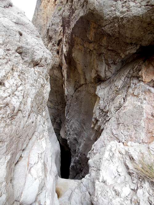
Bruja Canyon begins here (WF#1)!
Continue down climbing and scrambling over various obstacles about 1/2 mile to a series of two falls into a waist deep pool (WF #2). Down climb the first about 10' into a small pool and set up a rappel using a large rock or set up a 25' rappel from the brink above (none established) and skip the first fall completely.
![WF2]()
Water fall #2
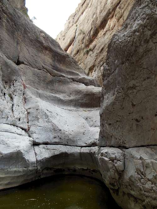
Go another quarter mile to the final continuous section of falls. Next you'll find a 15' fall into a deep (at least 10') pothole (WF #3). There is an abandoned web sling around a rock at the pour-off or establish your own. If the pothole is full, a jump would be reasonable. Set up a zip line or use dry bags to get gear across the hole.
![WF3]()
Water Fall #3 into deep pothole.
![WF4]()
Water fall #4 from above; taken below smaller upper section.
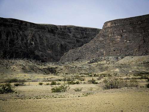
![Bruja Canyon]()
Mouth of Bruja Canyon from wash to the east.
The wash quickly becomes choked with desert vegetation so immediately veer NE to the next valley over for easier navigation back to Terlingua Abajo. The whole canyon takes between 4 and 8 hours from entry at WF1 to the wash below depending on experience level and number of expedition members.
Route
The technical section of the canyon begins at a dry water fall at 063067 323133. This first fall (WF #1) is about 20' into a knee deep pothole from a large boulder at the head of the canyon, there are no established anchors. Either rappel or work along the rim to the left (NE) about 200' to another course that can be down climbed into the main canyon.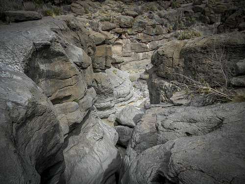
Bruja Canyon begins here (WF#1)!
Water fall #2
Water Fall #3 into deep pothole.
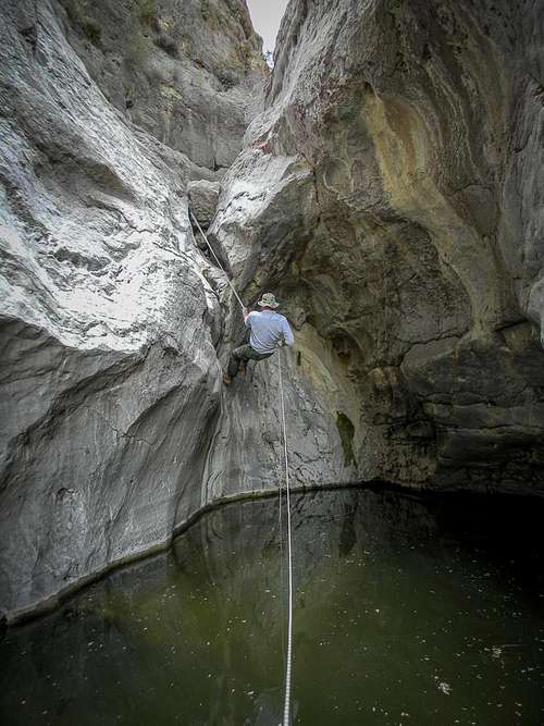
Walk about 50' to the next falls which is the largest on the route (WF#4). There is a convenient natural anchor point at waist height on the rock to the right of the pour-off which should be used for both falls in this series. There is not an obvious anchor in between the two falls. First rappel 10' to the bottom of the first fall then another 35' down the next into a deep long pothole. This pool is about 50' long and about 10' deep throughout making it a challenge to unhook and exit in the cold, deep water with out a resting point. Recommend at least 100' rope to navigate this set of falls; 150 to 175' or a second 100' rope if a zip line is necessary to portage gear between rappelers.
Water fall #4 from above; taken below smaller upper section.
Walk another 50' to the final rappel. This is about a 15' rappel but is made difficult by the lack of an obvious anchor location and that the edge is a single boulder pinched in the canyon hanging over an open drop. Be carefull of getting the rope caught in the pinch. Just below this rappel the canyon begins to open back up. Immediately, a house-sized boulder blocks the whole path; stay left to navigate over and then downclimb the other side. Continue scrambling and down climbing out into the open desert wash.
Mouth of Bruja Canyon from wash to the east.
Red Tape
All backcountry camping in Big Bend National requires a permit which can be obtained for $10 at any of the ranger stations. However, compared to the canyoneering zoos in Utah, this is primitive, undisturbed, and off the beaten path.When to Climb
Avoid summer heat and any time that local weather is imminent or just passed. Water is rare on the mesa and may be scarce depending on season in the canyon. Expect to pack in all required water at worst and resupply from potholes deep in the canyon at best. There are no reliable springs or running water on the route.