
|
|
Mountain/Rock |
|---|---|
|
|
50.42532°N / 114.56431°W |
|
|
Hiking, Scrambling |
|
|
Spring, Summer, Fall, Winter |
|
|
7106 ft / 2166 m |
|
|
Overview
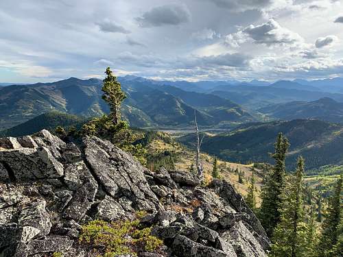
The Bull Creek Hills are a prominent group of hills above the Highwood River in Kananaskis Country, west of Longview, Alberta. They are really a single very large hill with multiple summits rising about 700 vertical meters (about 2300 feet) out of the Highwood River Valley. Like the rest of the chain of hills immediately east of the Front Ranges, their summits are open alpine tundra with little krumholz trees. Like many hills in the Highwood their south slopes are mostly open and quite rocky, so they are very appealing for hiking. Not surprisingly there are numerous hiking and easy scrambling routes onto the summits. Expect to see grazing cattle.
Getting There
These hills are very easy to access since the paved Highway #541 passes immediately underneath them. This area is about an hour's drive southwest of Calgary.
From Calgary, drive west on Highway #22X and then south on Highway #22 (the Cowboy Trail) past the towns of Turner Valley and Black Diamond to the tiny village of Longview. Turn west on the very scenic (and paved) Highway #541 up the Highwood River valley with its historic ranches and amazing views. Eventually you reach the Kananaskis Country boundary with its very large sign. Park in the pullout beside the sign to climb the southeast ridge of top 3 or the south ridge of top 5. Keep going to Sentinel day-use for the Pack Trail Coulee trail.
Route
There are a number of established routes up these hills. The most popular route starts at Sentinel day use area and ascends Pack Trail Coulee to Grass Pass, then ascends the west ridge. I have never done this route so if you are an SP user and want to add it, PM me.
There are two routes starting from the east gate, which can be combined to make a very enjoyable loop with about 750 metres (about 2500 feet) of elevation gain. I recommend ascending the southeast ridge of top 3 and descending the south ridge of top 5, which is how I describe them. However, in the spring when the southeast ridge is caked in isothermal snow the south ridge of top 5 can make a better ascent route. Both routes require some navigation ability as they have only intermittent trails.
Both routes start by climbing to Marston Col. From the parking area by the large entrance sign, cross the small meadow on the north side of the road to find a trail climbing the hillside. It quickly climbs past an enormous old limber pine tree, through a clump of aspens and up a meadow to Marston Col, located about 100 metres (about 320 feet) above the road.
Southeast Ridge of Top 3
At Marston Col, turn left (west), and passing through a clump of aspens, begin climbing the ridge at the demarcation of pine/spruce forest and limber pine meadows. The ridge is arranged in a series of steps alternating with flat sections or slight descents. The second-last step has a rockband below its crest, and the last step climbs very steeply through spruce to a mini-summit with a good view of the Zephyr Creek Hills and Mount Burke across the Highwood Valley.
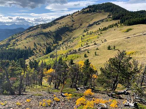
At this point, the ridge turns sharp right and heads pretty much due north to the summit of Top #3. Weaving between small pines, follow the ridge to an open low point below the final rise to the summit.
Continue up the gravelly ridge (amazing views all around). About one-third of the way up, the ridge crest becomes rocky. If you want to bypass the upcoming scramble, traverse the open right side of the ridge the col between tops 3 and 4. However, the scramble is a lot of fun on very good rock, so you should stick to the ridge crest on lichen-covered conglomerate between krumholz spruce trees. The rock fin ends just below the summit of top #3. By now the view to the south is very panoramic.
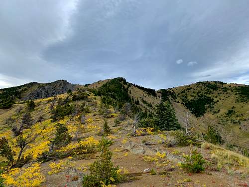
Turn right (east) and descend an avenue between tiny spruce trees to the col between top 3 and top 4, which as mentioned is an open alpine meadow. Simply walk up the meadow to the summit of top 4, which is the highest summit of the hills.
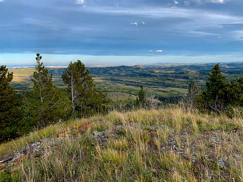
The view is now panoramic in all directions. To the east is the open sweep of the Alberta High Plains. Across the Highwood River Valley to the south rise the Zephyr Creek Hills, Mount Burke, and the Lookout Range. To the southwest across the Highwood's tributary Cataract Creek rise little Mount Mann and the very much higher peaks of the Continental Divide, foremost among them Baril Peak. To the west are the bulky peaks at the south end of the Highwood Range, the nearest one being Holy Cross Mountain. To the north is the scenic valley of Flat Creek and more Highwood Range peaks.
Keep going down the east ridge of top 4 if doing the loop, otherwise return the same way. You can also descend the south ridge of Top 4 into Marston Creek, but I haven't tried this.
South Ridge of Top 5
I describe this in the downhill direction, but as mentioned you can also climb up this way.
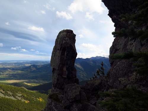
Continuing down the east ridge at the edge of trees and meadow, there will be several rock bluffs that you have to sneak around. The highest one has an amazing pillar on the downhill side.
After around 100 vertical metres of descent, arrive at the col between top 4 and the very much lower top 5. Climb up to the rocky ridge that runs to the summit of Top 5, which is a small rocky knob. Scrabble down the far side onto a wide open plateau, where the ridge curves around and starts heading due south. Mini pine trees spill over onto the crest at this point and becomes slabby. Keep going down the ridge to a crag, which you can easily scramble down. Here the ridge becomes open and has a collapsed drift fence running down it. After the open stretch, the ridge turns back to small, open pines with slabs underfoot.
Curving to the right, a trail develops and takes you down to an open col, beyond which a miniature top rises.
At the col, turn left and follow the trail down an open meadow beneath a crag, through some aspens and pines, and down another open meadow into the valley of Marston Creek (cattle likely). Wend left to cross the creek on a fallen log beside a drift fence. Follow a wide cow trail under big trees up the other side. It turns right and climbs up, then pops out of the trees at Marston Col, from where you descend the ascent route back to your car at the east gate.
Red Tape
The Bull Creek Hills are located in Kananaskis Country, a multi-use recreational area. There are no special regulations affecting non-motorized users.
When to Climb
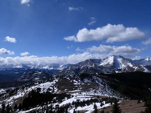
These hills can be climbed at any time of year and are an excellent area for shoulder-season hiking. Snowshoes may be necessary after between January and March if it’s been snowy winter (watch out for avalanche hazard at these times). Between March and June watch out for ticks.
Camping
The nearest campground (other than group and equestrian camps) is Green Ford Provincial Recreation Area a little ways east of Kananaskis Country on Highway #541. You can also camp at Cataract Creek Campground on Hwy 941, about a 20 minute drive to the south.
External Links
Kananaskis Country, Alberta Parks: https://albertaparks.ca/parks/kananaskis/kananaskis-country/
References
These routes are written from my memory, but I learned about them from Gillean Daffern's superb Kananaskis Country Trail Guide, volume 5.
The summit elevation is accurate to 1 meter and was measured by Dr Gérard Lachappelle and his team from the University of Calgary's Department of Geomatics Engineering. Here is a list of accurate summit elevations they have determined: https://kananaskistrails.com/mtnheights/mtnheights.php