
-
 17445 Hits
-
 74.01% Score
-
 4 Votes
|
|
Route |
|---|---|
|
|
44.34939°N / 68.2402°W |
|
|
Hiking, Bouldering |
|
|
Spring, Summer, Fall |
|
|
Half a day |
|
|
Class 3 |
|
|
Overview
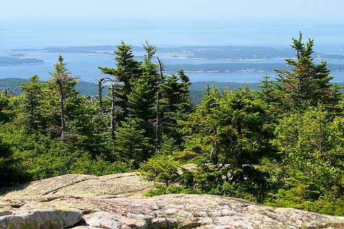
This is a rugged, steep and short (1.4 mile one-way) hike up the western face of Cadillac Mountain in Acadia National Park, ME. It's a fun route with nice views of some of the surrounding mountains (including Pemetic Mountain, Mount Sargent and Dorr Mountain), Bubble Pond, and Eagle Lake. Once higher up you'll also enjoy dramatic views of the islands that dot the rugged Maine coastline.
 View from Cadillac Mountain Summit
Getting There

Route map.
Make your way to Acadia National Park (directions here). From there, travel to the parking lot for Bubble Pond, which is just off Park Loop Road (note that this road is closed to motor vehicle traffic during the winter, but you can still enter the park on foot). The parking lot at Bubble Pond is very small and quite popular. Either arrive very early, or consider using the free shuttle bus service from the visitor center.
Route Description
Although it's rated a Class 3 scramble, this is only because you will encounter an occasional obstacle that will require simple bouldering moves to cross. Most of the first two-thirds of the ascent is class 2 terrain (rocky and steep), and most of the last third is class 1 (easy crossings of large, open slabs of granite).
The route starts from the Bubble Pond parking lot. Head across the pond towards the base of Cadillac Mountain. The route is marked to the top with blue blazes on rocks and trees. Sometimes you'll have to search for them, but they are there all of the way to the top. If you're having trouble finding the route, try traversing across the rock face--sometimes the trail makes a little jig and if you continue heading up you might lose it.
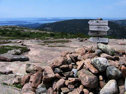 Junction of Cadillac West Face Trail with Cadillac Mountain South Ridge Trail. Note that the sign may have been removed.
About one mile into the hike you'll join up with the Cadillac Mountain South Ridge Trail. If you continue north on this trail, you'll reach the summit of Cadillac Mountain. There is a road to the top, and it may be quite crowded during peak season (it's a popular destination for tourist buses). There is a loop trail on the summit, but the highest point is actually to the south of that near an antenna farm that you'll pass (1522 feet at Loop Trail, 1528 feet to it's southwest). There is also a gift shop at the summit, which does offer some nice snacks (nothing wrong with an ice cream on the summit!).
Once at the summit, there are a variety of trails to hike back down. During tourist season, there is a free shuttle bus that serves the park. If you wish to hike down a different trail, you can use that to return to your vehicle at the Bubble Pond parking lot.
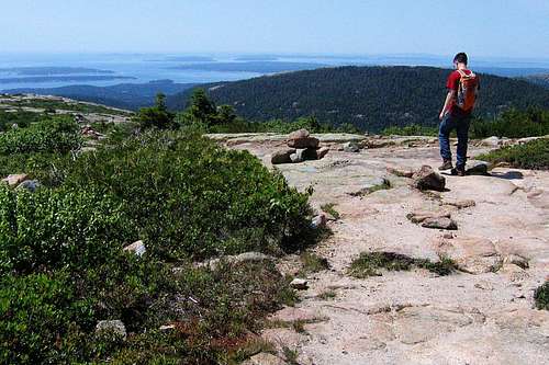 Hiking back down the Cadillac Mountain West Ridge Trail.
Essential Gear
The basic outdoor essentials. If you're inclined to wear sandals for a hike, you should consider hiking boots--the rocks can be pretty rough on the ankles. Also, take a camera along--there's plenty to shoot photos of!