
-
 13774 Hits
-
 79.04% Score
-
 10 Votes
|
|
Mountain/Rock |
|---|---|
|
|
35.86940°N / 106.41272°W |
|
|
Hiking |
|
|
Spring, Summer, Fall, Winter |
|
|
10199 ft / 3109 m |
|
|
Overview
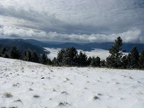
Cerro Grande is one of the 10,000+ foot mountains enclosing the Valles Caldera Caldera that sits in the middle of the Jemez Mountains. A small remnant of an decapitated, extinct supervolcano that exploded over a million years ago, the peak provides a wonderful view of what once was. Redondo Peak and the surrounding valleys teeming with elk dominate the scenery to the west while the Rio Grande Valley from the Sangre de Cristos to the San Mateo Mountains open to the east and south.
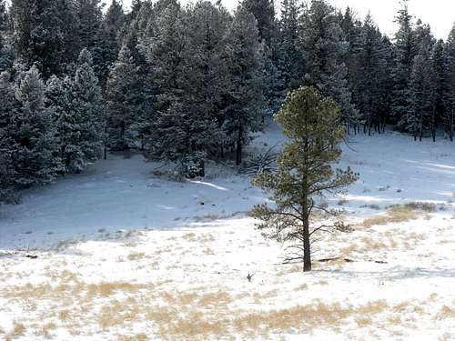
The hike to the summit of this Cerro Grande is fairly short at roughly 2 miles from the parking lot, which makes the effort for the views well worth it.
[I'm having trouble finding the exact elevation of the peak. The marker on the summit claimed 10,100, but was written in marker so I don't know if it is reliable.]
Getting There
From Los Alamos, take NM-502 to the south side of town and merge onto NM-501 beyond the Las Alamos National Labs checkpoint. Drive south several miles and go west on NM-4 towards Jemez Springs and Valles Grande. About four miles in, you'll begin to see the signs for the Cerro Grande parking lot and trail. The parking lot should be on your right side of the road.
Red Tape
The peak rests on the border between the Santa Fe National Forest and the Valles Grande National Preserve. However, the trail runs through National Forest and has several restrictions. There are no guns, pets, bikes, or motor vehicles allowed on the trail during anytime of year.

Camping
This peak shouldn't take more than five hours total, but if spending the night is an option you'd like to pursue, there are several campsites and hotels in the area. There are campsites in Bandelier National Monument near the visitor center (505-672-3861 ext. 517) and also by the Pajarito Ski Area. The campground in the vicinity of the ski area requires a permit acquired from the Larry Walkup Aquatic Center on Canyon Road in Los Alamos (505-662-8170) and closes close to November 1 annually for the winter.
External Links
Bandelier National Monument
Pajarito Ski Area
davebobk47 - Dec 16, 2008 6:42 pm - Hasn't voted
ElevationThe elevation is 10,170. Thanks for adding this page.