Toggle navigation
Mountains
Routes
Images
Trip Reports
Forum
What's New
People
Areas & Ranges
Articles
Trailheads
Canyons
Huts & Campgrounds
Albums
Logistical Centers
Fact Sheets
Lists
Custom Objects
Gear
Plans & Partners
WELCOME TO SUMMITPOST
SIGN IN
REGISTER
Topographical Maps for Guatemalan Volcanoes
Additional Parents
Image
Chicabal, Volcano Topo Map
View High-Resolution Image
Chicabal, Volcano Topo Map
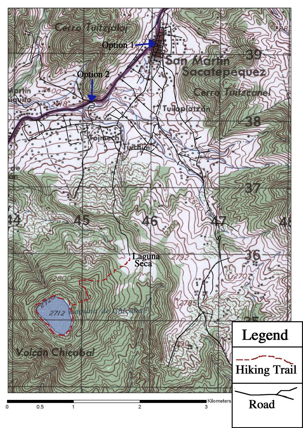
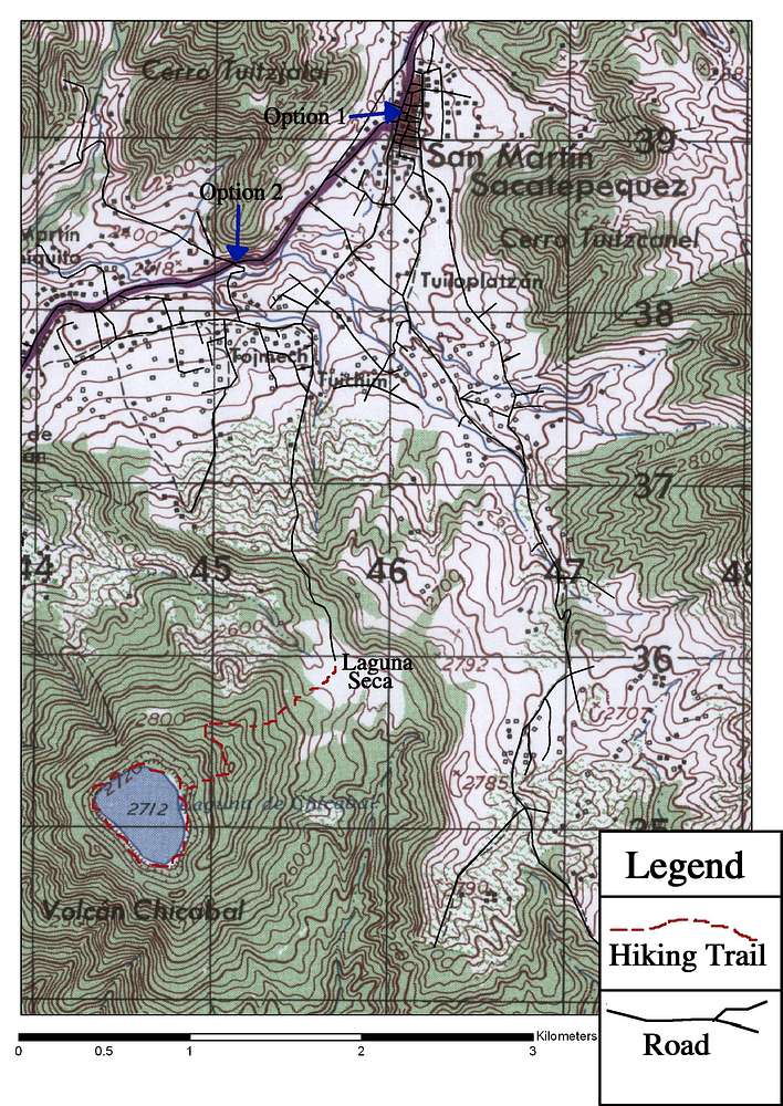
A topographical map for the town of San Martin Sacatepequez, Guatemala and the hike to the Chicabal Volcano and Lake.
« PREV
NEXT »
BLong
on
Oct 4, 2008 12:36 am
Comments & voting
Other parents
Lat/Lon:
14.78766°N / 91.65516°W
Image Type(s):
Topo/Diagram
Image ID:
449474
6162 Hits
72.08
% Score
2
Votes
Log in to vote
Comments
No comments posted yet.
to post!
Don't have an account?
Topographical Maps for Guatemalan Volcanoes
(Album)
« PREV
Viewing
#3 of 22
GALLERY
NEXT »
BLong's Image Gallery
« PREV
Viewing
#189 of 362
GALLERY
NEXT »
Volcán Chicabal
(Mountain/Rock)
Loading....
Guatemala Photos
(Album)
Loading....
Photos of Chicabal Lake and Volcano
(Album)
Loading....
×
You need to login in order to vote!
User Name
Password
Remember me
Forgot your password?
Log me out when I close my browser.
Keep me logged in all the time.
sign in as a user
Don't have an account?
Register now for FREE
Rating available
Suggested routes for you
People who climb the same things as you
Comments Available
Create Albums
Register Here


