In February and March of 2022, I did a month-long solo self-powered trip – without resupply - into the Atacama Desert to climb 11 of the tallest mountains on or near the Chile-Argentina border:
Ojos del Salado (north face - normal route)
El Muerto (northwest ridge)
Vicunas (south ridge)
Incahuasi (west face)
El Fraile (east face)
Nevado San Francisco (west ridge)
Barrancas Blancas (north face)
Volcan Pena Blanca (southeast ridge)
El Ermitano (west face)
Tres Cruces Norte (col to east face)
Tres Cruces Sur (col to north face)
I had planned to climb Tres Cruces Central and El Solo, but after 28 days my food was dwindling and my expedition permit was expired so I left those for next time. Overall, I am very satisfied with this outcome. It was a great experience to be self-sufficient for that length of time and to climb in my own pace and style, not to mention completing almost 10% of the Andes 6000ers in a single push!
Preparation
Chile requires advance notice (through the agency DIFROL) of expeditions in the vicinity of the international border. However, their website indicated that they would generally not permit solo trips. With the fallback option of doing the trip stealthily, I emailed DIFROL and explained what I wanted to do as well as my (slightly embellished) credentials. They approved my trip without hesitation. Based on this and some conversations with the border police (Carabineros) I met along the way, they are more interested to know who is near the border and when they are coming back rather than critiquing any expedition plan or equipment list. Overall, everyone I talked to was very friendly and encouraging.
The only mountain where I knew the route before setting out was Ojos del Salado; for the rest, I climbed whatever line looked reasonable or worked with my hiking approach and camp locations. I assume somebody at some point climbed the same or similar lines previously on each of these peaks, but it was fun to just go out there and figure it out for myself.
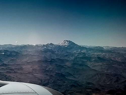
Aconcagua from Plane
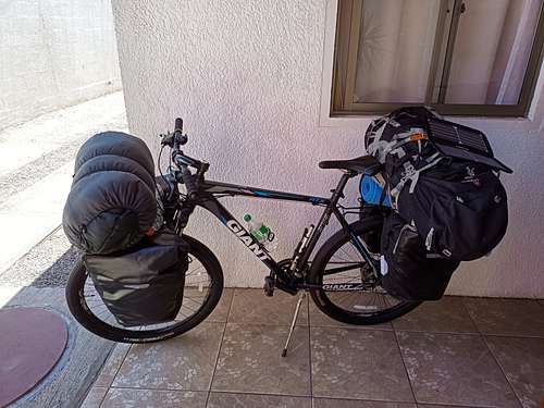
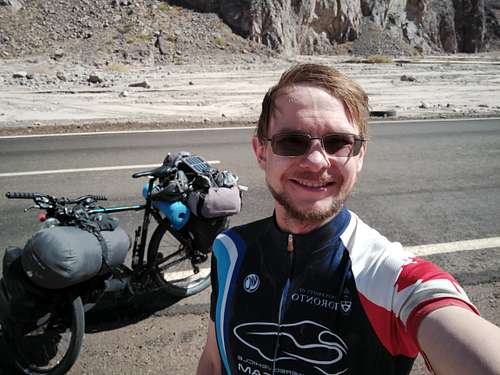
On Feb. 6, I flew with my mountain bike (Giant ATX 27.5 with front and rear racks and 4 x 20 L panniers) from my home city of Toronto, Canada direct to Santiago, Chile and then on to Copiapo, a small city near the southern edge of the Atacama. Chile has notoriously strict food import restrictions, so I only brought with me a few select items: protein bars, instant rice, trail mix, and a few freeze-dried meals. The customs staff in Santiago had some concerns about the trail mix, but in the end they let me continue with everything I had brought.
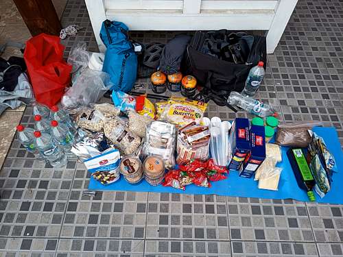
After clearing all required COVID checks, I was free to proceed on the morning of Feb. 8. I stocked up on groceries in Copiapo to amass just over 30 kg of dry food – hopefully enough to last for a month of sustained effort. My meal planning was focused on foods that would be palatable, non-spoiling, simple to prepare, and energy-dense. Maintaining a reasonable balance of carbs, protein, and fat, I was able to manage 4200 calories per kilogram, and my daily ration was about 1.0-1.1 kg. Breakfasts were invariably musli with powdered milk. Lunch – when I bothered to actually stop and eat a meal – was tortillas with peanut butter and Nutella or powdered hummus. I had packaged soup for dinner each night, which I enriched with generous quantities of instant rice, olive oil, and - when I was running out of rice – oatmeal to make a “calorie stew”. Throughout each day, I snacked on protein bars, granola bars, trail mix, and dried fruit. I had 6 freeze-dried meals for special occasions. I did bring a handful of multivitamins, but as often as not forgot to take one each day.
Solo Trip ConsumablesBicycle, Pre-Departure
Lastly, there were a few unplanned food items that I found along the way: an apple from a truck driver, two avocados from a Ukrainian climbing team, and some crackers in Refugio Claudio Lucero. By far the greatest find was at Refugio Tejos where previous expeditions had left behind a veritable smorgasbord including cookies, a pack or ramen, juice crystals, tea, and – to my enduring delight – two unopened cans of tuna.
Solo expeditions are inherently a bit risky, and even more so when they are conducted in remote and hostile environments. My plan was also highly reliant on self-powered mobility; I was to travel purely by bike and on foot, so any illness or injury would impact not only my health but also my ability to get back to safety. Part of the game for me is facing those risks head-on, but it’s also vital to be prepared for a successful failure; if my plans go pear-shaped, I needed to be able to self-rescue or at worst take care of myself long enough for help to arrive.
To that end, I memorized maps of the area and all notable landmarks, including every place that I might be able to find water, food, shelter, or help. I always carried both a Garmin InReach and a smartphone with topos of the entire region. I had an extensive first aid kit with altitude sickness medication in case I needed it. I had comprehensive travel medical insurance including remote evacuation coverage so that there wouldn’t be a financial aspect to any decision to get help. I didn’t end up needing anything more than a few Tylenol for a headache one day, but having all this in place was – in my opinion – the dividing line between an ambitious adventure and reckless thrill-seeking.
The Voyage Out
I set out from Copiapo in the early afternoon on Feb. 8. With all my food, water, and camping gear, my bike weighed in at over 80 kg. Biking along Ruta 31, I made it about 90 km to camp beside the road at 2000 MASL. The weather in that region generally follows a pattern of calm mornings and wind from the west in the afternoons. On the outbound trip this wind was very helpful; I planned to start each morning with a major uphill push (often on foot and rolling the bike) and leave most of my longer-distance rides for the afternoons when I could count on a tailwind. I reached my first water source on the second morning: a groundwater stream that comes to the surface at the top of a narrow canyon. I took a break to rehydrate and fill all my bottles; the next reliable source wouldn’t be until I reached Rio Lamas in 2 days. The afternoon ride covered lots of ground on a consistent 2% uphill slope, and I finished the day at 3600 MASL about 140 km from Copiapo.
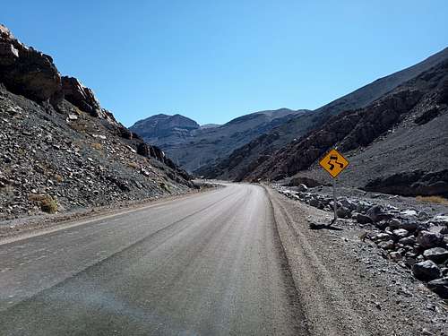
Ruta 31
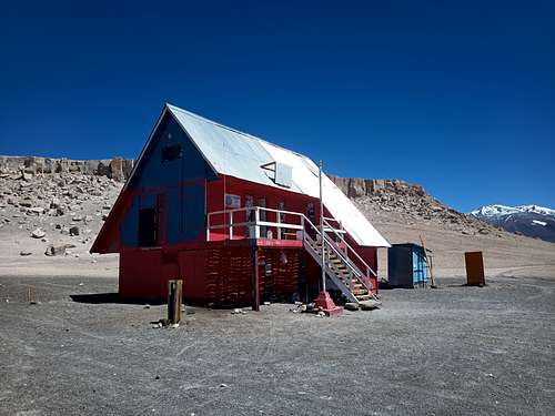
The third day began with a slog up some switchbacks to a pass at 4350 MASL, then a leisurely coast downhill for 20 km to the border control outpost at 3750 MASL. When I arrived, the place seemed to be deserted; the main building was completely unoccupied, and its doors left open despite the strong winds. It seems that with the land border closed on account of the pandemic, the upkeep and attentiveness of this station had been relaxed somewhat. I wandered around for a while and eventually found one of the Carabineros in his cottage. He briefly looked at my permit and passport, then jotted my name down in a small notebook and sent me on my way. The wind shifted soon after and slowed me down a fair bit, so I called it a day about 5 km short of Rio Lamas and camped in the roadside ditch to block some of the wind. The next morning, I re-watered at Rio Lamas and continued up the road to the high plateau upon which all my objectives sit. It was a pleasant day to ride and great to finally be there. I reached Refugio Claudio Lucero (4500 MASL) in the late afternoon on Feb. 11.
Refugio Claudio Lucero
I hadn’t planned to stop moving until I reached the snow-line at about 5300 MASL, but I found some clean ice in a cleft of the bluffs above the Refugio. This allowed me to take a well-earned rest day. I stowed my bike and most of my supplies inside; bike theft is rampant in Toronto, but I figure that nobody is out there except to hike and climb – I would trust the average climber to not steal my bike or my food.
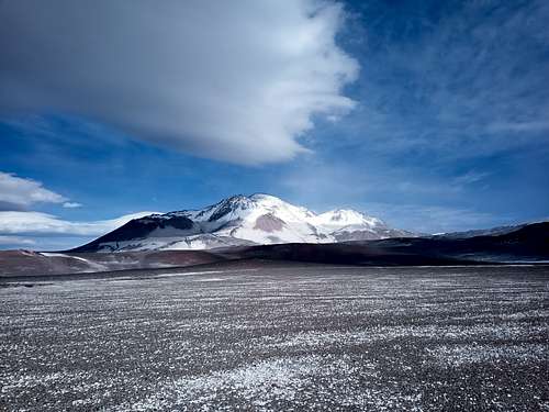
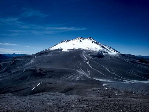
Ojos del Salado
Ojos del Salado
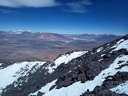
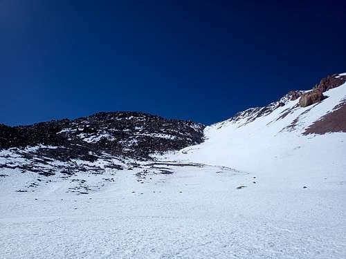
I continued up the trail on Feb. 13 for about 8 km before detouring towards Vicunas and then on a direct line across the plateau to Refugio Atacama. This proved to be an inefficient choice. My route was shorter in terms of distance, but I ended up having to cross a series of gullies and slopes covered in loose sand; the existing jeep track would undoubtedly have been less effort. I reached the second Refugio shortly before sunset and found the main hut occupied by a Santiago guide and his client from Oregon. I left them to their early sleep and retired to the newer satellite hut (el Carbon) for a long and restful night. The next day was extremely windy and considerably colder, but eventually I summoned the initiative to get going on my way up to Refugio Tejos, the highest camp on the mountain at 5830 MASL. It was a short hike and not expected to be challenging, but between my incomplete acclimatization and the -5°C crosswind it was quite a slog. I was relieved to reach shelter and make a hot meal. I took a rest day on Feb. 15, then made my summit bid the following morning.
Ojos del Salado is not a very technical mountaineering objective. I had turned back 400 m short of the summit on a previous trip in 2020 because I couldn’t safely ascend 35° wind slab in hiking shoes. This time, I augmented my hiking shoes with microspikes and carried an ice axe to self-arrest, and this setup was perfectly adequate. I also did things a bit different with respect to timing. The usual strategy as I understand it is to start in the wee hours of the morning and do most of the ascent before sunrise. Call me crazy, but I prefer not to climb in pitch dark and brutal cold when it can be avoided. I started out from the Refugio well after 07:00 - conditions were very nearly pleasant.
Ojos del Salado North FaceOjos del Salado Summit BlockSummit of Ojos del Salado
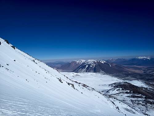
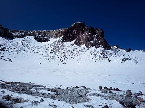
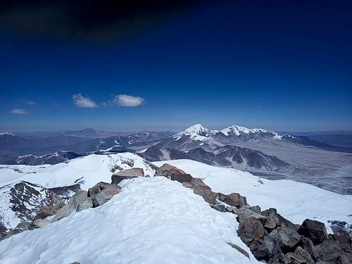
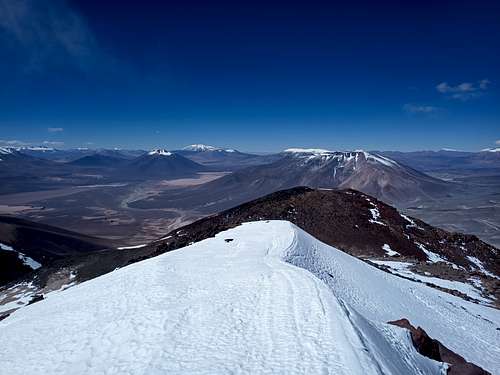
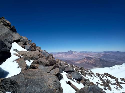
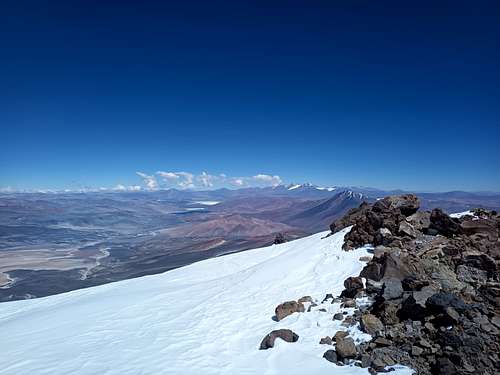
The ascent went swimmingly. While it was much snowier than expected - I hardly stepped on exposed ground from the time I left the Refugio – it was all stable and mostly solid enough not to sink in. I spent a lot of time delicately stepping across wind slab to reach the upper caldera at 6750 MASL, whereupon I took a short break. The route up the caldera itself was a bit more arduous, and I was periodically breaking trail through snow up to thigh-deep. The final scramble to the summit was 4th class at worst, albeit with some impressive exposure on either side. I sat on the summit for a while in calm and clear conditions.
I had brought a video drone (DJI Mini 2) with the hopes of filming a mini documentary for my friends and family. This model is rated to fly up to 4000 MASL, but I’d found some anecdotes online of flights past 5000 MASL in Peru; I figured I’d see how far I could push that envelope. The previous day, I had flown the drone about 300 m up from Refugio Tejos despite a bit of a breeze. That was only the 4th flight I’d ever done. I had planned to fly from the very summit of Ojos del Salado, but upon seeing that there was at most a couple square meters of viable take-off and landing area, I decided that my piloting skill might not yet be so precise. I instead descended to the caldera and started the flight from 6750 MASL.
The flight was amazing. I started by maxing-out the drone to it’s hard-coded limit of 500 m above take-off (7250 MASL), which it reached without issue. Considering that it reached this limit in just a couple minutes and was ascending decisively the whole way, there is every reason to think that it could have flown far higher still. I got some beautiful video and it was fun to try something like this.
The rest of the descent was uneventful, and I returned to the Refugio a little more than 7 hours after setting out. I found a large blue Marmot glove on the lower snowfields during my descent, and carried it with me for the rest of the trip. If you lost such a glove, get in touch so I can mail it back!
El Muerto and Vicuñas
I descended past Refugio Atacama the following day on my way over to El Muerto. After wandering through some rocky and sandy gullies, I found a lovely spot to camp at the base of a ridge leading up the north-west aspect of the mountain. After watching the sunset and reviewing the map on my phone, I settled in for another solid sleep.
El Muerto Route
In the morning I wasted no time in proceeding up the ridge. In actuality, it wasn’t so much a ridge as a modest inflection in the contour of the mountain, which is on the western side basically a heap of sand and loose pumice. Fortunately for me, the snow combined with severe day-night temperature swings had saturated most of the slope with moisture and frozen it rock-solid overnight. While it was later loose and muddy on the descent, the way up was like walking on grip tape.
Nothing on my route up El Muerto was particularly challenging. It was a fair bit of altitude gain (1300 m), but minimal technical difficulty. The final summit block was a 2nd or 3rd class scramble, and otherwise it was mostly moderate-angle snow. The summit is a broad plateau and covered in snow. I managed to find the Banco de Chile summit register and wrote a short entry in the journal. It looked like mine was the first summit of 2022. Assuming everyone who climbs signs the log, it is not a particularly popular mountain.
El Muerto Summit
I flew my drone around until both batteries were depleted, practicing my ability to capture smooth video and keep track of the drone at ever-greater distances. It was another beautiful day.
The next morning (Feb. 19), I trekked back to Refugio Claudio Lucero – about 20 km – which took about 4 hours. I took a rest day on the 20th, sharing the hut with a large (and perhaps over-equipped) Ukranian commercial expedition. On the 21st, I biked back up the trail to the spur that leads up to Cerro Vicuñas. It was a windy day, but I was able to keep out of it mostly by climbing just below the north ridge. I reached the summit a bit later than planned, almost lost the drone while flying in the wind vortex around the summit, then descended through the caldera for a change of scenery. I had originally planned to attempt Barrancas Blancas as well that day, but I was late getting up Vicuñas so I figured one was enough.
El Muerto GulleyVicunas Summit
Incahuasi
On Feb. 22, I re-equipped the bike to move my base of operations east to the bottom of Incahuasi. Laguna Verde was quite a sight, and I spent a couple of hours reading a book near the shoreline. I do not recall seeing a single car on the road that day. I eventually ditched my bike in some sort of gravel pit behind a big boulder and continued on foot with my camping gear and about 5 kg of food. I hiked 12 km southeast through one of the larger valleys and set up camp well after dark at about 4930 MASL.
Laguna VerdeIncahuasi Gulley
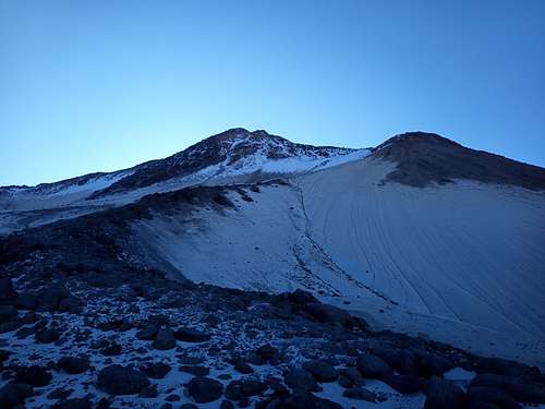
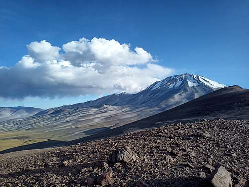
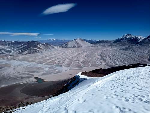
The following day started out well but ended up being one of the least pleasant. I set out from my camp shortly after sunrise and took a direct line up the northwest face of Incahuasi. I do not think this is the usual route – I certainly saw no evidence of any previous foot traffic. Now that I was fully acclimatized and well rested, I opened the throttle a bit and focused on gaining altitude. I took some pictures of the summit as I was ascending. Looking at those pictures later, it was evident even then that the summit was very windy. I maintained a solid pace of nearly 400 m vertical per hour under a cloudless sky, noticing occasionally that there were streamers of snow blowing off some of the ridges higher up. The wind was at my back, and it wasn’t initially uncomfortable.
Things started changing rapidly as I approached the lower (northern) caldera. Passing 6000 MASL, the wind really started to pick up and the windchill dropped accordingly. 200 m further up, it became apparent that summiting was not a good idea; I hadn’t brought most of my insulating layers, and the wind was steadily increasing. My hands were getting dangerously cold, and I felt like I needed to regain some level of control in the situation. The only immediate prospect for getting out of the wind was a short ridge on the edge of the caldera about 50 m above me at that time, so I pushed as hard as I could and quickly got myself into what little shelter there was – just a cleft between some rocks on the leeward side of a 2 m tall ridge. I sat there for a few minutes collecting myself to make a quick and careful descent. As I sat, the wind increased even further, whipping streamers of snow an arm’s length over my head at what looked like 70-80 km/h.
Once my fingers warmed up, I started my descent. The wind was initially high enough that I had to lean out over the slope (which averaged 30-35*) to not be pushed back. I got below the worst of it in about 25 minutes, but the wind was at or above 30 km/h the whole way back to my camp.
I discovered on my return that the wind had picked up the dust I had disturbed around my camp, forcing it through the mesh of my tent to cover everything inside in a thick layer of powder. I spent several hours trying to clean it out and better protect my tent against the wind, but it was several days until my food was no longer gritty.
The following morning was calm at all altitudes, and I took the same route up to reach the summit in about 4.5 hours. The final scramble up the summit block was a bit fun, and the views down into the main caldera were awesome. I looked around for a summit register but didn’t find anything. A modest breeze had picked up and I decided not to fly my drone from the summit – wouldn't want to have to wander down the other side into Argentina to retrieve it. I did manage a short flight to get some video on my way back down at about 5700 MASL.
Incahuasi CalderaIncahuasi
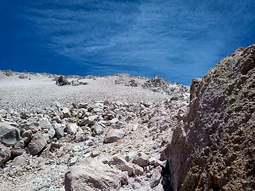
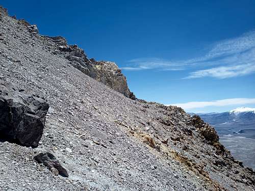
I climbed El Fraile on Feb. 25. Walking out from my camp, it seemed like there might be a feasible line up the center of the east face, pretty much right on the international border. Most of the mountain is covered with loose sand and gravel, but this was one of several protruding rocky ridges. It was an arduous climb. Where there was any solid rock to grab, it often broke off in my hands. Where the material was loose, I’d often loose half of every step backsliding down the scree. The snowy summit plateau was far more enjoyable than the main ascent. El Fraile has two summits at the north and south ends of the summit plateau. It seemed to me that the northern summit was the higher of the two, and I found a small summit register there along with a bamboo pole that appeared to have been struck by lightning. The earliest entries were from 2002, and the notebook was heavily weathered. Descending El Fraile was quick and easy; I simply chose one of the smoother scree paths and plunge-stepped down the slope. It took all of 12 minutes to reach the slope inflection 400 m below!
El Fraile LineEl Fraile Slope
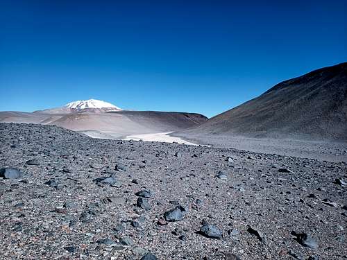
The next objective was Nevado San Francisco. I moved my camp to the base of the west ridge at about 5140 MASL on the 26th, then made a quick run up the ridge the next morning. I reached the summit in just 2.5 hours, wandered around for a bit, then made my way back down the ridge to pack up my camp and hike back to my bicycle.
Incahuasi CloudsSan Francisco West Ridge
Peña Blanca, El Ermitaño, and Barrancas Blancas
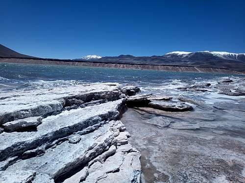
I began biking back along Ruta 31 on Feb. 28. I made good time past the trail up to Ojos del Salado, stopping about 1.5 km past that point to stow my bike in a large culvert under the highway. I hiked north over the plateau towards Volcan Peña Blanca, by nightfall reaching a precarious camp perched on a small bench in the scree mid-way up the southeastern slope. In the morning, I ascended the east ridge of the summit block to find another Banco de Chile summit register on the high point of the summit ridge. The day was still young, so I proceeded northeast towards El Ermitaño. After passing some stunning blue-green ponds, I took a curving line up through some rocky outcrops on the mountain’s southwest face. Aside from some easy scrambling and the occasional deeper drift of snow, this was no more than a steep hike. This summit had another Banco de Chile box, so I signed my name and wrote a few thoughts before very nearly losing my drone in the shifting winds over the ridge. I returned to my camp late in the afternoon and descended the following morning to camp beside the highway in the lee of a large boulder.
Pena Blanca CampPena Blanca and El ErmitanoEl ErmitanoEl Ermitano Slopes
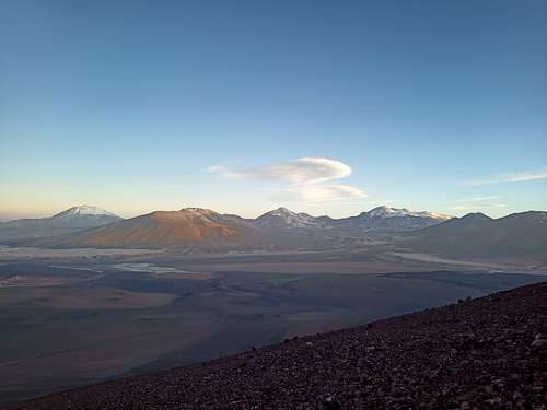
On March 3, I decided to have another run at Barrancas Blancas. I set out south from my camp across the highway to follow a dry gully just north of where the highway cuts through the line of bluffs. I followed this up towards prominent snowfield on the ridge just west of the summit, then up a muddy scree slope to the summit itself. The summit was marked with a small cairn, and the view south (towards El Solo and Argentina) was exquisite. This was a long day – 20 km on foot and more than 1500 m elevation gain with no trail whatsoever. I took a rest day on Mar. 4, hiking around the bluffs and trying out a few unambitious bouldering problems. The rock quality there is actually quite nice, and this would undoubtedly be a popular crag if it wasn’t 230 km from the nearest gas station.
El Solo
Nebado Tres Cruces
I continued by bike westward along the highway on March 5, but I got a bit of a late start; the wind switched on around 10:00 as usual and slowed my progress to a crawl. Nevertheless, two hours of steady effort got me to the jeep track leading around the west side of Nevado Tres Cruces. My expedition permit had officially expired by this point, but I figured the Carabineros wouldn’t worry too much for at least a day or two still (found out later that they didn’t care at all and had more or less forgotten I was out there). I biked out along the trail for a few km, but the trail became sandy making progress slow. I left my bike – partially concealed under some rocks – right where the jeep trail diverged into east and west forks. I took the east fork on foot up to Nevado Tres Cruces, bypassing the lower camp to pitch my tent at 5550 MASL just after sunset.
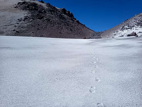
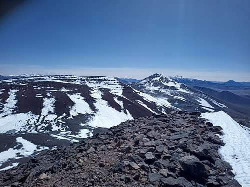
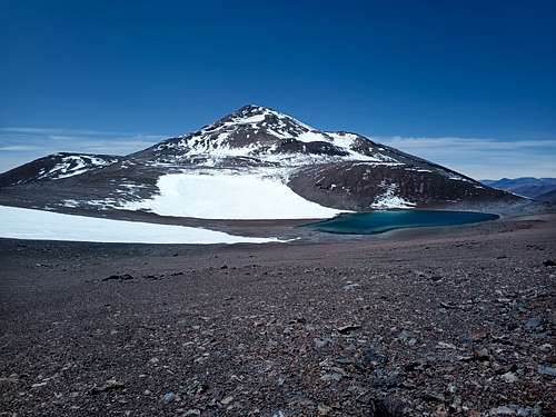
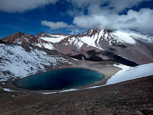
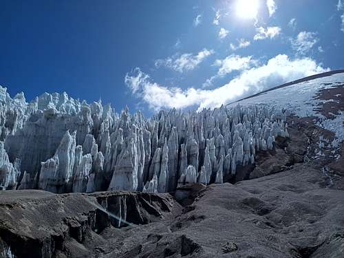
The following morning was a mostly clear but very windy day. I had planned to ascend Tres Cruces Central, but I could see quite clearly that the summit was getting blasted by wind even at 08:00 – the forecast said it would only get worse. Accepting that this wasn’t the day for that objective, I instead traversed north to the col east of the Norte summit where I would be shielded from the wind. The glacial remnant below that col was quite a sight, with penitentes 6-8 m tall that were melting and crumbling before my eyes. I hiked upslope westwards from the col to reach Tres Cruces Norte. There was no summit register, but there was a cairn with a bag of chocolate bars (I grabbed a Snickers). I descended past the blue-green caldera pond – this was one of the most beautiful and pristine sights of the entire trip, and well worth the effort of getting up there.
Tres Cruces Norte PondGlacial Remnant
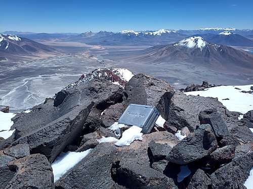
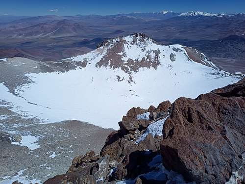
The wind decreased greatly overnight, and I made an early (for me) start on my way up to the main summit. I made great time up to the campsites at the Sur-Central col (6000 MASL), and then followed a clear trail east and south towards the summit. The snowfields proved to be quite tedious – crusty enough to offer substantial resistance, but soft enough that almost every step sunk in deep. I soon abandoned the snow and instead moved to the jumbled boulders on climbers’ left. This was much easier and more interesting – essentially a continuous 2nd class scramble. I reached the short cliff band and surmounted it with nothing worse than a few 4th class moves. After post-holing for a while around the labyrinthine chaos of the summit block, I attained the summit ridge barely 10 m south of the true summit. I signed the summit register using what materials I had (future climbers should bring a pen) and flew my drone for what would be the last time on this trip. Despite having found a summit register and cairn, it looked to me like one of the outcrops to the northeast might be higher. I hiked out to it and discovered it was not higher, so I proceeded to descend.
Tres Cruces Sur
Tres Cruces BouldersTres Cruces Summit
I made it to the high camp at 4:00pm. I did for a while consider trying the Central summit as well, but I doubted I could reach the top before nightfall - I would certainly be descending in complete darkness. Instead, I descended to my camp, packed up quickly, and hiked the 9 km back down to my bike. This is pretty much the only regret I have for this trip; had I brought a bit more food up to my camp with me, I could have stayed out one more day and bagged one more summit.
My original plan was to finish by climbing El Solo. This involved descending east from the Tres Cruces col, crossing the intervening dunes to the apparently all-scree summit, and then hiking back towards and along the highway to reach my bike – 45 km altogether carrying a 15 kg pack, with two-thirds of that distance through sandy gullies. Considering I had overstayed my permit by a couple days already, I decided that Tres Cruces Sur was a good enough last summit for this trip.
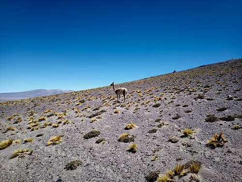
A culpeo fox was skulking around as I set up my tent near my bike stash. As I biked by Rio Lamas the next morning, I encountered an entire family of llamas. These sightings, as well as some free-roaming horses and goats along the one non-arid stretch of the highway, were the only significant wildlife I saw on my trip.
Rio Lamas
Return Journey
I returned to the border station later on March 8, again finding it seemingly deserted except for one Carabineros in his cottage. He didn’t seem to have any record of me, and – probably helped by the fact that I was riding a bike and looking rather well-worn – he took me at my word that I had left when I said I did and not come from Argentina. He offered me some tea and snacks while writing my name and passport number into a somewhat more official ledger than was used on the outbound check, and we shared the last of my fancy trail mix while chatting in what little language we shared (my Spanish was only marginally better than his English).
There was still some hours left in the day, so I continued on uphill - and upwind - along Ruta 31. By early evening I was back to pushing my bike on foot up the ever-steeper grade towards the pass, which I reached just in time to watch the sun dip below the horizon. I coasted down the far side for a careful hour or so, ending up a few kilometers from my campsite on the second night of the expedition. Resolving to get up early and avoid the afternoon headwinds, I set up my tent for what would end up being the last night of my expedition.
I was on my bike just after 06:00 on March 9. Except for a few small dips and rises, the entire route from my camp back to Copiapo was on a downhill grade averaging about 2%. As soon as I got moving, it became apparent that – in the absence of wind – I could easily coast with good speed down the gravel highway. I traveled 80 km over the next 3 hours through thickening air and warming temperatures, putting in no more than a handful of revolutions on the cranks to ease my bike over the occasional rise. By the time the wind turned on around 09:30, I was well past my target distance for the day and barely 60 km from my hotel in Copiapo. The grade in this last stretch decreased until it was negligible and the wind picked up to the usual stiff breeze. This reduced my forwards progress to less than 20 km/h, but I soldiered onwards to reach town around mid-afternoon after several substantial breaks. After a month of cold, thin air, moving to 28 °C and 500 m above sea level was quite the change!
Travel
I spent the next few days wandering around town and eating lots of fresh fruit. The regional museum was cool, especially the exhibit about the famous mine collapse and subsequent rescue (the original rescue pod is on display there). It’s a lovely town full of friendly people. I flew back to Santiago on March 12, then later that afternoon boarded the long flight back home. There was no post-trip relaxation; I successfully defended my PhD scarcely 72 hours after landing in Toronto.
Outcomes and Analyses
In case you haven’t noticed by now, I like to balance comprehensive preparation with flexible (or even deliberately vague) knowledge of what route or itinerary I will take. There were plenty of lessons learned in each of these respects.
Food
A big part of my success this time (and a main reason for my less-than-ideal experience on Ojos del Salado in 2020) concerns the food that I brought. Having enough calories and nutrition with low mass is important, but of similar importance is that the food be enjoyable to eat. Peanut butter and nutella were excellent in all respects, as was most of the cereal and trail mix that I brought. The evening soups were okay, but it would have been nice to have a bit more variety in my main meal. Even knowing that I’d have to carry it uphill for hundreds of kilometers, if I did this trip again, I would bring enough cans of tuna to have one every two or three days. Juice mix – or even sports drink powder – would also be a fantastic addition. Protein powder might also be worth its weight; I noted that my athletic recovery was often slower than I would expect in everyday life (altitude was likely also a factor).
Equipment
Doing this kind of climbing with hiking shoes and microspikes was fine. I did use my ice axe on a few short glissade descents and I appreciated the option of self-arrest if I slipped on one of the steeper faces (Ojos del Salado or Incahuasi), but mostly it was just a short and heavy trekking pole. I certainly would not bring any more tools than what I had for similar mountains in the future.
My tent (Eureka Solitaire AL) is not a 4-season model, but it performed well in most respects. The one feature that could be desired is an ability to seal or cover the mesh areas to keep wind-blown dust out. I got most of my water from melted ice and snow, which – due to the lower than usual snow line – was never any hassle at all to obtain. I melted it with a Jetboil Flash 2 stove, or sometimes by leaving a bottle of snow in the ever-present sunlight. Including cooking meals, I used about one and three quarters out of three packed 650 g fuel canisters over the month I was out there.
Most nights were well below freezing; I rarely woke up without ice crystals in my water bottle. I had a Mountain Hardwear sleeping bag rated to –34 C, and even on the coldest night (-18 C inside Refugio Tejos) I was comfortably warm. My gloves were not ideal. I brought three pairs: merino liner gloves, mid-weight BD mountaineering gloves, and a slightly heavier Outdoor Research mitt. I wore the liner gloves almost constantly – not to stay warm, but to shield my hands from the intense sun. They were brand-new on my departure, but quickly wore through to become fingerless around day 20. The BD gloves are my go-to for Ontario ice climbing, but I found them lacking in insulation on this trip where my arms weren’t working so hard. On the other hand (ha!), the OR mitts were less dexterous but warm enough on most days. Only on my first attempt on Incahuasi did my fingers ever get dangerously cold.
My clothing layers worked fine as long as I remembered to bring them along on each side trip. My merino base layer was still looking (and smelling) fine when I returned, though my socks were pretty awful. I had soap and could have melted some extra ice for wash water, so on future trips each rest day might involve some laundry.
I got a bit too much sun the first day, but otherwise kept ahead of things with generous application of sunscreen and frequent usage of long sleeves (everything except my cycling jersey). I did get a bit of corneal sunburn around day 10, so I ripped holes in my neck warmer to make an impromptu balaclava.
Logistics
My bike worked excellently, and I had adequate tools and supplies to repair anything short of a major structural failure. My solar panel was similarly effective, at least until my charging cable started to intermittently fail. Better-quality cables (or a spare) would have been useful.
On the whole, cycling unsupported in the Atacama is less extreme than it sounds. The conditions are admittedly harsh, but also very predictable. A fit and well-equipped cyclist and hiker can stay out there a long time, and being on foot gave me the freedom to do some different routes and approaches that you probably wouldn’t consider if driving a 4x4. It’s also much more environmentally friendly – hard to take the moral high ground about global warming when your eco-tourism to see receding glaciers requires numerous extra jerry-cans of gasoline!
I like to do things legitimately where I can, and I am glad that I registered my trip properly and got an official permit. That said, I ought to have padded the schedule a fair bit so I would have the flexibility to stay out longer if I wanted to. I did overstay my permit by a couple days and that proved to be no problem at all, but I could have done a bit more climbing if I had registered for an extra week or so (or even told the Carabineros to expect a later return when I checked with them on my outbound trip).
Fitness and Acclimatization
My cycling fitness was generally fine, but I ought to have done a bit more running and hiking in advance of this expedition. Being able to walk 30+ km per day instead of the 20 km or so that I could usually manage would open up some interesting possibilities in similar trips. I had some vague ambitions of trying for the unsupported FKT on Ojos del Salado, but between fatigue and the unusually snowy conditions, this wasn’t in the cards. I also ended up taking a couple more rest days than I had originally planned; three or four days of activity seems feasible before a break, but five days “on” was rough at altitude and with less-than-optimal nutrition.
I left Copiapo (500 MASL) on Feb. 8 and reached the summit of Ojos del Salado (6880 MASL) eight days later, comfortably maintaining an ascent rate of about 250 m/hour on my summit bid. I slept soundly for the entire trip, and only once (briefly) had a headache or any other adverse effects. Perhaps a longer acclimatization interval would have been even better, but what I did was fine for me. I think a major part of my success might be the self-powered approach; I spent every day doing 6+ hours of steady aerobic exercise as the altitude increased. I think this was very effective in teaching my body to handle the change. Even if I had rented a jeep, I doubt I’d have been able to go up any faster.
Conclusion
This was fun. Maybe someday I’ll try for some more noteworthy accomplishment in my climbing, but this time around I spent a month alone in the desert simply because I wanted to. It was made even more fun by obliging myself to take a lot of pictures and video – many previous climbs have resulted in little or nothing that I could show my friends. I even enjoyed reflecting on my experience to write this trip report. I hope you find it interesting, informative, or both.
Lastly, if you lost a blue Marmot high-altitude glove on Ojos del Salado in early 2022, I have it with me in Toronto and will happily mail it anywhere in the world.
Related objects are relevant to each other in some way, but they don't form a parent/child relationship. Also, they don't necessarily share the same parent.


Comments
Post a Comment