Overview
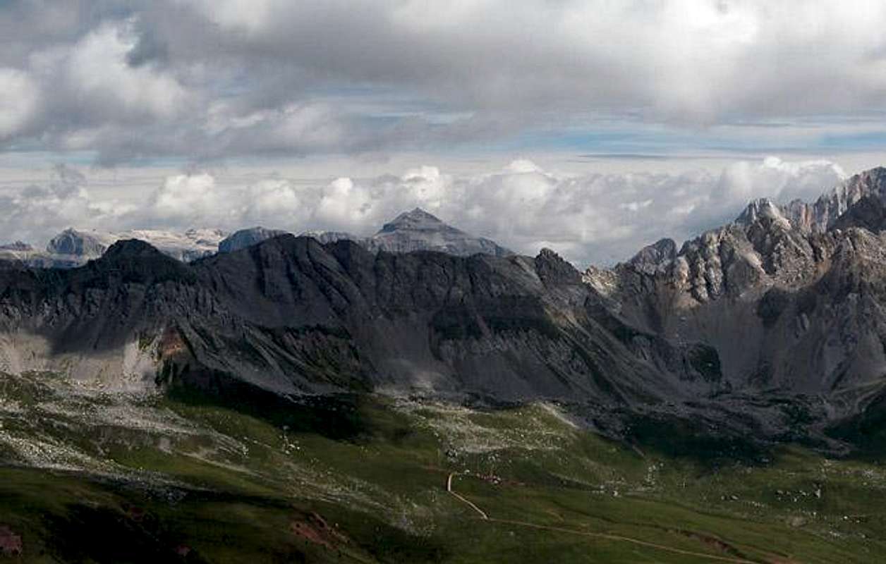
 Cima Iuribrutto as seen from Sentiero della Pace
Cima Iuribrutto (also Giuribrutto and Juribrutto) is the second highest mountain of the small Cima Bocche Group to the south of the Dolomites. The Group itself is mainly composed of red porphyry rocks and rather can be attributed to the similar Catena di Lagorai to its south than the Dolomites to its north. All mountains show shallow slopes to the south and impressive, but broken walls to the north. Cima Iuribrutto is no exception and all routes to the mountain lead across the southern slopes.
The ascent is facilitated by two cable cars / chair lifts to both sides of the Cima Bocche group. Both have been built to serve the winter skiing guests and consequently the areas surrounding these lifts have been destroyed by heavy development. Especially to the north, around Col Margherita you can get depressive. The whole Lastè di Pradazzo slope is used for ski runs and in the summertime you will hear the incessant drone of steam hammers and caterpillars "developing" the slopes.
But I don't want to scare you away - rather otherwise. Cima Iuribrutto is different. It is part of the Parco Naturale Paneveggio - Pale di San Martino and this is closed to development. The only ski run is located far to the west of Iuribrutto and it feels like entering a different world as you enter the park and leave all the noise behind. Moreover Iuribrutto doesn't see too many ascents - neighbouring Cima Bocche is far more popular and the trails pass to the south of Cima Iuribrutto. What a difference 50m can make!
All ascents to Cima Iuribrutto are very easy. The hardest is the direct route from Passo di San Pellegrino which negotiates the crest between Col delle Palùe and Col d'Orso directly below the Iuribrutto north face. All converge in Forca di Iuribrutto from where a pathless scramble leads you to the summit. You will find cairns along the way which can lead you to the summit but finding them (and thus reaching the summit) can be quite a challenge. They blend in with the red porphyry blocks and are hard to make out, it might even be best to simply use your own judgement.
The summit itself is a flat plain, a fact which made it an important position for the Italian Alpini during WW I. All of the summits of the group held these positions but the one on Cima Iuribrutto is massive. An area corresponding to four football fields has been cut off by walls and trenches. The porphyry rocks proved to be a perfect building material. Iuribrutto must have been rather central to the Italian war effort in the area as it commands views of both Passo di San Pellegrino and Passo Vallès. Both are natural passes which can easily be reached by any vehicle. Much of that whole history can still be seen on the summit.
Part of the direct route from Passo di San Pellegrino follows the so called Sentiero della Pace, a long trekking trail which follows and commemorates the old paths built during WW I. It follows the whole former Austrian Italian border between Passo di Stelvio / Stilfser Joch and Marmolada to the east. Passo di San Pellegrino is the last major pass before the Sentiero hits the MArmolada Group and ends at Passo Fedaia.
Summit views
Summit View Cima Iuribrutto: Sas Lonch, Sella and Marmolada Groups Hide / Show annotations
All summits of the Cima Bocche Group are perfect viewpoints. Pale di San Martino and Lagorai to the south, Latemar and Rosengarten / Catinaccio to the west, Sas Lonch / Langkofel and the Marmolada Group to the north and east form a natural amphitheatre. Choose your climbing day carefully! It should be perfect weather!
There are two trailheads, one at Passo di San Pellegrino, one at Passo Vallès. Actually you can traverse the group from pass to pass but the northern route along Col Margherita is a questionable pleasure due to the ski runs.

 5523 Hits
 84.27% Score
 18 Votes
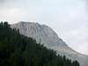
 Cima Iuribrutto as seen from Sentiero della Pace
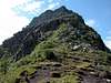
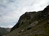


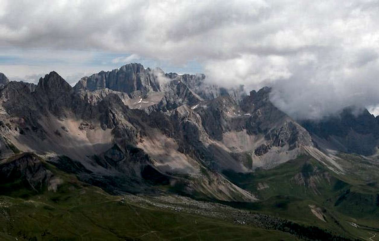


 Cima Iuribrutto, Cima Bocche and Gronton as seen from Sentiero della Pace
 Be careful when you climb Cima Iuribrutto. You'll encounter wild and dangerous animals like this one ;-)