
-
 10647 Hits
-
 77.48% Score
-
 8 Votes
|
|
Mountain/Rock |
|---|---|
|
|
38.31132°N / 112.33894°W |
|
|
Hiking, Mountaineering, Scrambling, Skiing |
|
|
Spring, Summer, Fall, Winter |
|
|
11161 ft / 3402 m |
|
|
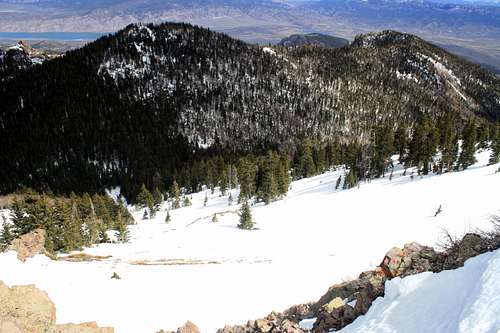
The City Creek Peak Overview
In Utah's Tushar Range there are only a handful of fesible summits to be had in the winter time. Perhaps one of the easiest to spot is City Creek Peak. From Puffer Lake (the winter closing point) it is further away than it appears. Do not let this scare you off though. A simple 2-3 hour hike over 1,500 feet will bring you to this lovely summit. Unlike most of the other mountains in the Tushars this peak is most easily accessed in the winter months. That is when the route is the most straight forward, and the crowds are no where in sight. Although it is not as high nor as steep as the rest of the mountains in the Tushar Range, the views from the top of the surrounding peaks, lakes, and desert Utah Towns will have you returning to this summit for more!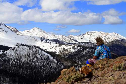
Troy taking a seat at the summit of City Creek Peak with an outstanding view of the Tushar Range
Getting There
The best way to reach this mountain is to come from Beaver Utah. In the town of Beaver you will come to highway 153, which is well marked, thanks to Eagle Point Ski Resort. Drive the 22 miles up this canyon to Puffer Lake. In the winter this is as far as the road is plowed. In the summer this is as far as the road is paved.Check the route section for ways to climb this peak.
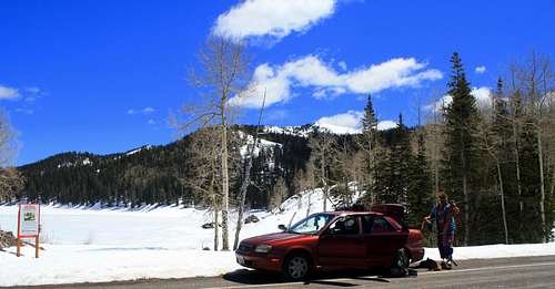
Troy setting up at Puffer Lake with City Creek Peak in the background. April 2012
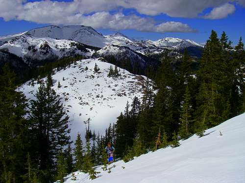
Troy skinning up City Creek Peak
Red Tape
There is some minor red tape in the Tushar Range but for the most part this mountain is untouched by human developement and regulations.NO Dirtbikes, ATV's ect...are allowed off trail.
NO Camping in any site for more than 16 days.
NO Fires during periods of high fire danger.
Mountain Weather
The Tushar Range reaches hights of over 12,000 feet, so weather can go from sunny to stormy in no time. The Tushar Range recieves around 450 inches of snow on average year. High winds are very common. Temps will often hover around freezing during the day to several degrees below zero at night during the winter. Be sure to check the weather before heading out in this mountain range!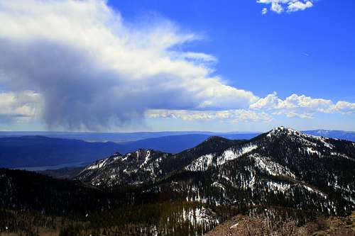
A storm cloud starting to take shape near City Creek Peak
Avalanches
THIS RANGE HAS NO AVALANCHE FORECAST CENTER! BE SURE TO MAKE YOUR OWN AVALANCHE ASSESSMENT BEFORE CLIMBING THIS RANGE!On this mountain there are only a handful of avalanche type slopes. On the typical route (Cullen Creek) the avalanche potential is only possible on a handful of short, steep slopes. Due to the fact that these slopes run into gullies, even a small avalanche could burry someone deeply. The Northeast Face is a major avalanche path that is known to run quite a distance every year. Please stay back from the large cornices that grow at the top of this slide path.
Be sure to carry an avalanche becon, probe, shovel, avalung and a partner with you during your winter travels.
The Northeast Face of City Creek Peak......this is the peaks largest avalanche path.