
-
 8264 Hits
-
 83.69% Score
-
 17 Votes
|
|
Route |
|---|---|
|
|
46.37884°N / 12.04681°E |
|
|
Mountaineering |
|
|
Summer |
|
|
Most of a day |
|
|
EEA, PD-, II UIAA |
|
|
Overview
Monte Civetta Normal route
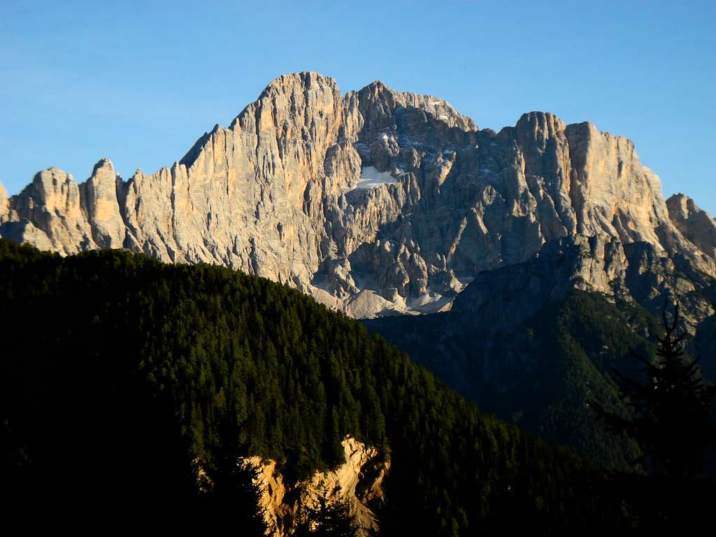
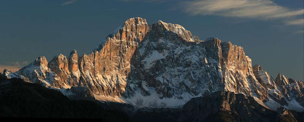
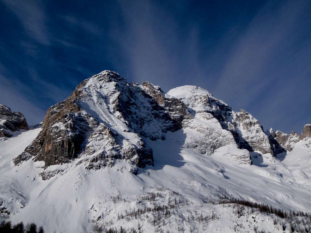
Monte Civetta 3220 m is a magnificent and gigantic rocky structure, one of the most powerful in the Dolomites. It's one of the best known "3000" of the Dolomites and moreover the climax of the Civetta mountain group, extending between the road cols of Forcella Staulanza and Passo Duran. On the NW side - above the village of Alleghe - it looks like a huge rocky castle, with its world famous wall facing NW overlooking the valley. This wonderful and wild wall a thousand meters drop is known as "la parete delle pareti", meaning "the wall of the walls".
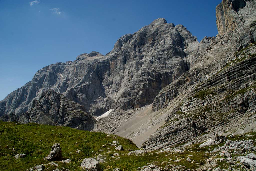
The opposite side, facing East and oriented to the Val di Zoldo, although high and wild shows a much more affordable wall. Incredibly on this side there is a Normal route that allows you to easily climb and summit the mountain. This itinerary takes advantage of the discontinuity of the rock face facing east. It's the itinerary of the first summiters and nowadays it is mainly a via ferrata of moderate difficulty, interspersed with some unequipped sections. The first section of the itinerary is differentiated according to the approach path chosen to reach the start of the climb. The overall committment is remarkable.
Getting There
The start of the climb on Civetta Normal route can be reached by three different itineraries, anyhow all the paths converge at the same point. To take it easy it's possible to choose the first itinerary and stay overnight at the Rifugio Coldai. From here the vertical gain to the summit slightly exceeds 1000 meters, while the other itineraries involves a definitely greater difference in level.
First itinerary - Approach across the Rifugio Coldai
The Rifugio Coldai can be approached:
- From Forcella Staulanza: from the pass descend on the Val di Zoldo side to the first hairpin, where it starts a dirt road (marked 568) getting to Casera del Vescovà. Follow the path n. 561 to Forcella d'Alleghe, Casera Pioda, then the path 556 to the shelter (1,45 hours).
- From Pala Favèra (m. 1505) – Follow the gravel road starting near the camping and rising with some hairpins to Malga Pioda m. 1816, then a good path leading to the hut (2 hours from Pala Favèra) – It’s the shortest way to get the hut
From the Rifugio Coldai 2132 m take the Sentiero Tivàn which heads to South with some slight ups and downs and has a rocky section equipped with a fixed rope. You reach a saddle where it appears the Civetta. From here the path proceeds on level ground to the large saddle named Porta del Masarè 2325 m. Here ignore the path branching to the right and leading at the start of the Via Ferrata Alleghesi and proceed straight through the scree basin called Busa del Zuitòn. At a crossroads go up the scree to the right and crossing rocky slabs reach the attack of the climb at 2425 m (2 hours from the refuge).
Second approach - From Forcella della Grava
From Zoldo follow the road to Passo Duran to the locality of Chiesa, parking near the Osteria Le Vare. From the Le Vare tavern, continue along the narrow road (sometimes also accessible by car, bar at the entrance) to Casera della Grava 1550 m. From here, follow the directions to Forcella della Grava on the path CAI 587 which enters the Val Civetta. The path winds through sparse mountain pines and with some steep turns reaches Col Grand 1927 m, the confluence point of the CAI 557 path coming from Forcella della Grava. Continue on stony ground uphill until you reach a second crossroads with the Sentiero Tivan 2181 m, where a boulder shows us the way forward. A last steep climb on debris leads us to the attack of the first rocks.
Third approach - From Pecol Vecchio, Casera del Zorzi 1400 m
From the car park, follow the forest road with signpost n. 587 and at the crossroads to Baita Civetta continue on the path n. 587 along the Val Civetta. Traverse under the scree slopes that descend from the peaks, through meadows and dwarf pines, up to a crossroads where you take the path n. 557 Sentiero Tivan). Follow the path 557 to the right, climbing the steep scree until reaching a rocky hill and a couloir. Near the couloir follow the signs and the red stamps and soon the first equipped sections will be found.
History
The events related to the first ascent of Monte Civetta are not very documented, the date itself is not certain, but it is believed to be around the 1855. The first ascent was made by the chamois hunter Simeone De Silvestro (1833-1905), named Piovanèl, from Pécol in the Val di Zoldo, with ignotes companions. The ascent was realized more for hunting reasons than mountaineering spirit. Piovanèl himself made also the second ascent, but even this one lacks the details. A confirmation of this event is given by the story of the great English pioneer who in 1867 thought he was the first to climb the mountain and who had precisely from Piovanel himself precise information about it: Francis Fox Tuckett (1834-1913) who accompanied by the famous Swiss guides Melchior and Jakob Anderegg realized the third ascent in May 1867. In the August of the same year it was performed the fourth ascent by Paul Grohmann accompanied by the same Piovanèl.
Civetta in wintertime
Route Description
Civetta Normal route
Difficulty: F+ (Alpine scale) - I and II grade (rocky section)
Difference in level: 800 m from the start of the climb, 1088 m. from Rifugio Coldai, 1820 m from Pecol
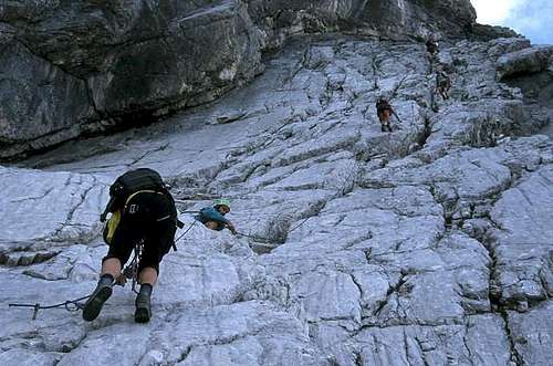
A summit of great satisfaction. The route runs on the Eastern side in a majestic environment with low difficulty, but it's a long ascent and requires a good training and attention in some places. To be avoided in early season when it's possible to find snow or ice. It is mainly a via ferrata of moderate difficulty, interspersed with some unequipped sections. The most difficult points are equipped with metal pegs and ropes, interspersed with some unequipped sections, where there are gravel ground, rocks, and short climbing sections up to grade II UIAA. The whole route is marked with red stamps.
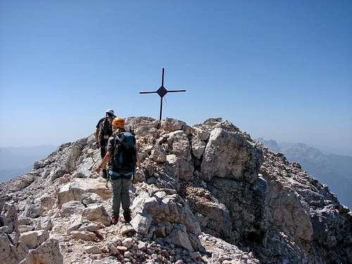
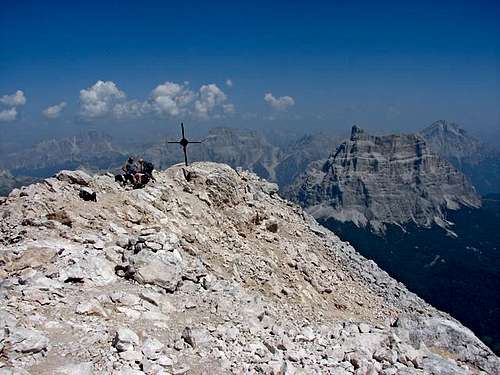
From the attack at an altitude of about 2400 m, at first climb up small walls, then climb an inclined slab cut by a slanting couloir (iron rope), then to the right on smooth rock reach a characteristic and exposed sloping ledge named Passo del Tenente, with steel equipment. Always to the right pass a step equipped with metal pegs then along a gravel reach a wall that is overcome through a couloir-chimney (II). On easier rocks, go to the right, climb up other steps and turn again to the right towards a basin where the snow remains until late in the season. From the basin, go up to the left in a small valley following traces of the path, then by easy rocks reach Pian della Tenda where it is located the Rifugio Torrani at 2985 m. Behind the hut by steep rocky ridge, then by steps (possible presence of snow) and gravel ground reach the summit (cross and summit book).
Descent: reverse the same route
Essential Gear
Helmet, harness, via ferrata set, possibly a rope if you accompany less experienced people
Red Tape
No particulary restrictions in climbing and hiking.
Hut
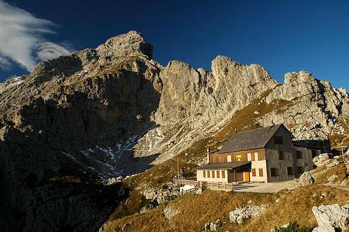
- Rifugio Coldai 2132 m
Owner: C.A.I. Venezia
Size: 88 persons + 8 in the winter hut
Open: from 20-6 to 20-9
Phone:+390437789160
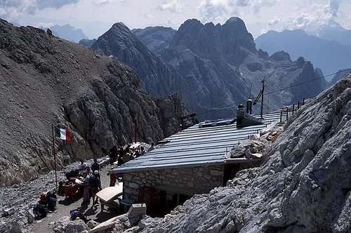
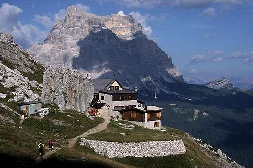
Rifugio Torrani 2984 m
Owner: C.A.I. Conegliano
Size: 18 persons +12 + 4 in the winter hut
Open: from 1-7 to 30-9
Phone: +390437789150 - +393386411763
When to climb
Best season goes from the end of June to middle September
Bibliography
“Civetta” by Ivo Rabanser – Collana CAI-TCI Guide dei Monti d’Italia, june 2012
Maps
Alpi Bellunesi, Kompass sheet n. 77
Civetta, Tabacco sheet 015-025 1:25000
Lagiralpina sheet
Meteo Forecast
ARPAV Dolomiti Meteo
Dolomiti Meteo Veneto
DOLOMITI METEO Phone +390436780007 fax +390436780008 CENTRO VALANGHE DI ARABBA Phone +390436755711 fax 043679319 e-mail cva@arpa.veneto.it