
|
|
Mountain/Rock |
|---|---|
|
|
47.25290°N / 120.98993°W |
|
|
Kittitas |
|
|
Hiking |
|
|
Spring, Summer, Fall, Winter |
|
|
3760 ft / 1146 m |
|
|
Overview
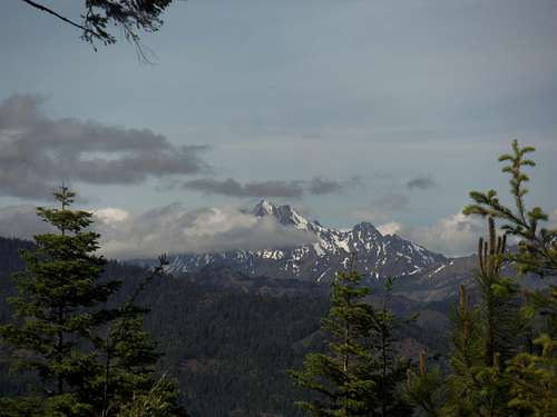
Views of Mount Stuart
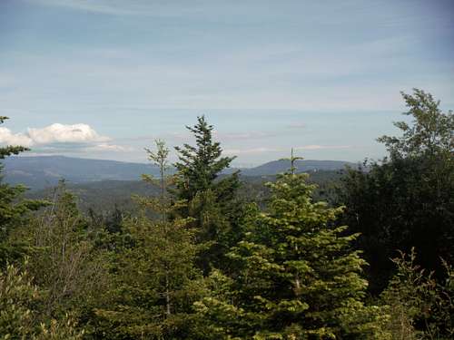
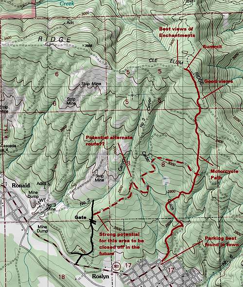
Cle Elum Ridge is the noted high ridge that sets the northern border of the towns of Roslyn and Cle Elum. The summit has 440 feet of prominence but is significantly lower then the peaks to the north of it which is the heart of the Teanaway region. This entire peak and summit is a conglomeration of manybiking trails combined with hiking trails all the way to the top. Along the way, you will encounter some friendly townspeople, mountain bikers as well as the summit seeking enthusiast like me and EastKing. It is not though overpopulated with people and you will during most week be able to hike to the summit with few other people around.
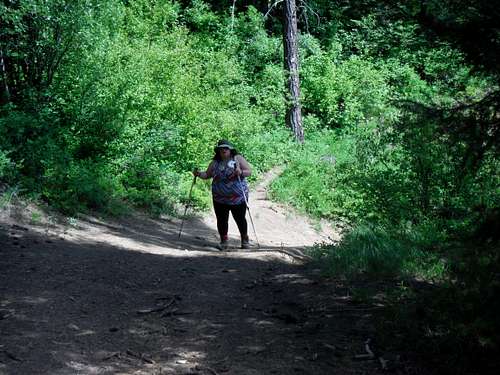
Heading up the trail
Depending on if you choose to leave from the town or from just west of the town, Cle Elum Ridge mountain has an elevation gain of 1200 to the west or 1600 from the town. Both hike are roughly 5 miles and can be completed in a half day. This mountain is accessible from a backwoods residential area in Roslyn, which is near a new development in Roslyn. This may though change in the very near future as some of the real estateis trying to attract the same people that are going to Suncadia.
The view east from the summit
The views from the top are gorgeous, but they are partiallyblocked by the pine forest which are prevalent in this part of Washington. This pine forest does offer shade from what in summer can be a pounding sun in the summer. There are many mountains one can see at the top through the trees, such as Mount Stuart, the Enchantments and on a clear day Mount Daniel.
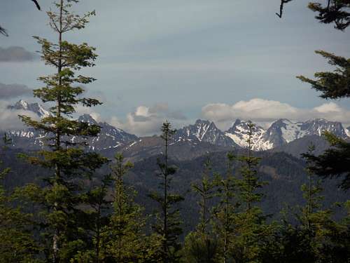
Views of the Enchantments
Getting There
Taking the Downtown Roslyn Trail to the summit: Take 903 into Roslyn. Look for parking just before the road make a 90 degree left hand turn. The trail will be right next to a housing residents on Nevada Ave. Don't park there but more in town and obey the parking signs.The route just west of Roslyn (not recommended due to incoming construction to houses): Just west of Roslyn, turn right and then right again at a T intersection. Take this road up to the gate and park by the gate but not to block traffic. This gate will likely move in the future and there is no telling is access here will be allowed in the future.
![Motorycle Trail]()
A sample of what the trail is like
5 miles
1200 feet or 1600 feet of elevation gain
Class 1 walk up and road walk
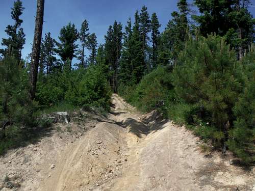
A sample of what the trail is like
Red Tape
The trailhead away from town is very fluid. As of right now there are starting to be No Trespassing Signs on both sides of the road despite many people using the road.In downtown Roslyn make sure to follow the parking rules listed on the signs above.
When to Climb
This peak can be climbed at all times of the year. Because of the grade this peak might make an excellent snowshoe summit. In May this peak is covered with the beautiful Balsamroot flowers. Unfortunately we went up in June so most of the Balsamroot was done but the Indian Paint Brush was out. Avoid this place on a hot day in Seattle. It is 10 degree warmer and the sun is much stronger here in summer. Keep your eye on forest fire danger late in the summer.Camping
Camping is prohibited on this ridge. Much of the south section of the land is private timberland