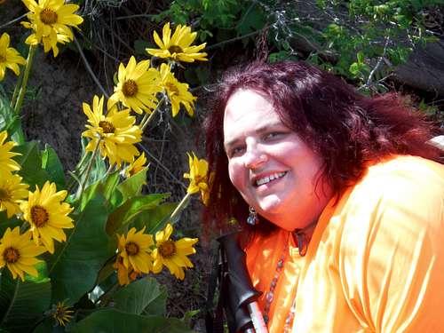
Why Not Me!!!
This now going to be my new motivational trip report. As I hike throughout the winter and spring I will be constantly adding to this trip report. This trip report will be similar to my "Peakbagging for Weight Loss" Albums. They will mostly include summits, but I also love waterfall hikes and lake hikes as well. I hope that there will be great progress here and I am hoping to do larger summits in the summer. I have been grateful for everyone's support throughout the years and I hope to make this trip report interesting as I fight off my 100 pound backpack to enjoy what my husband has enjoyed for so long.
I realized that back in 2013 I did not have one of these threads. Hopefully by starting this thread I will be able to stay motivated throughout the year and turn this year into a good hiking and climbing year. I hope everyone truly enjoys this trip report. I hope to make much more interesting than in years past.
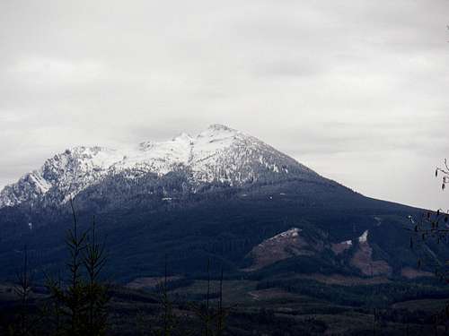
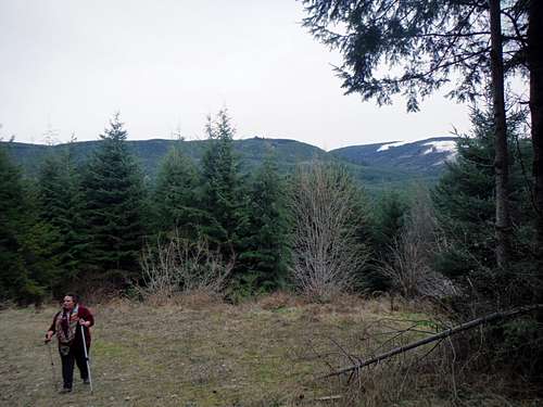
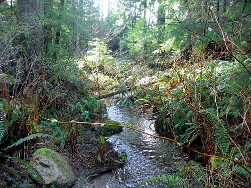
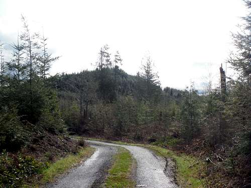
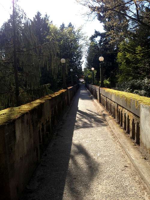
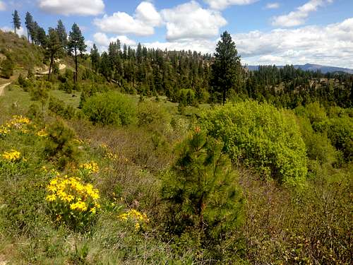
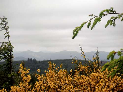
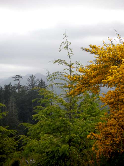
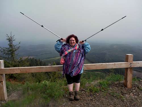
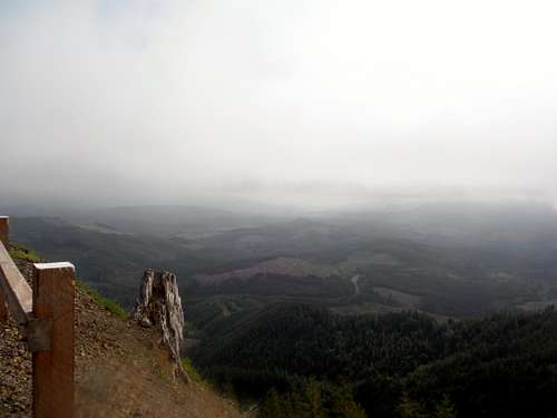
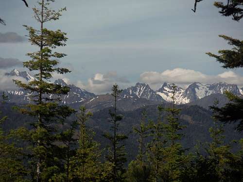
Cedar (Echo) Mountain (3/1/14)
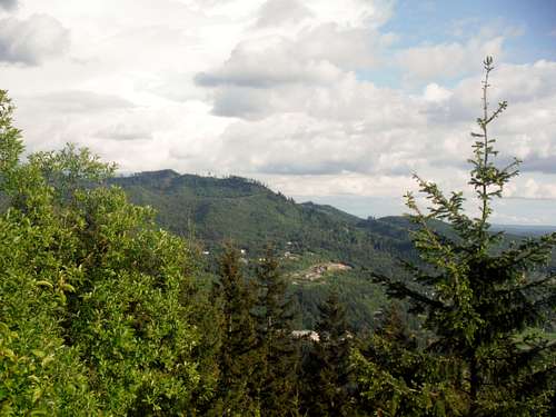
There is as great getaway that is tucked into a really beautiful and residential neighborhood in Renton, Washington. Cedar (Echo) mountain has great views of the ridgelines of mountains far and wide. The view is pretty and the Evergreens are still big for this littler trail. The view could be even better with a bit of a clearing of two or three trees, but they probably don't want to cut them down, and of course, that is another issue. That being said, it is a cute trail which is closeby and easy to get to.
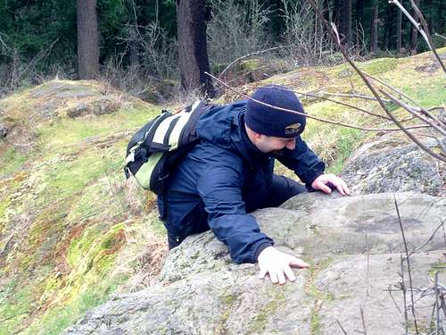
It is called Cedar (Echo) Mountain. The trail is not well marked, so it is easy to veer off course, as I did with my husband, EastKing. We ended up off trail running into some dirt bike trails and EastKing realized we were lost.
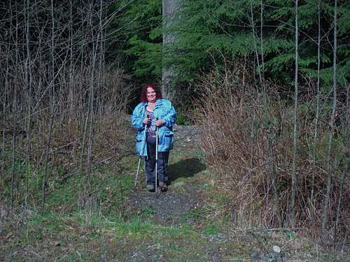
We got back on track after backtracking and heading all the way back almost to the beginning of the trail, only to realize there was a guy who was shortcutting and had found a much easier way to the top. At that point, I had already gotten quite a workout and had traveled two miles.
By the time we got back onto the trail, I had built my strength back up and we ended up back on track and I had picked up steam. The marker only gets better when you are well on your way to the summit with a sign with a horse and it says. "PEAK TRAIL". At this point, it becomes apparent that the summit is just a ways up. I like the tiny switchbacks and this mountain has a great feel of being on a larger hike though it is a small mountain.
I personally really love this trail as someone who is 100 pounds.
overweight and I am trying to practice and get back in shape after being hit hard with many challenges. I am still looking for hiking partners to do things like this.
When you get to the top, an odd happenstance is noticing that someone has built a private house right down below off the trail. Our speculation is that they have paid handsomely for this and they must have had to get a lot of permissions from King County since it is right down from the top. I feel that personally they had a personal connection to the land. The Native Americans would say that all of Seattle is all sacred land.
On the day I went, last weekend, on March 1st, it was a small amount of snow and light rain. The sun did break out at times, so that was rewarding of course. Again this is a great trail to do with friends and with anyone and a great practice trail for me.
Through all of the challenges, and with a car that won't take me very far, and constantly reaching out to find hiking buddies who understand my limitations, the questions I constantly ask is: WHY NOT ME?
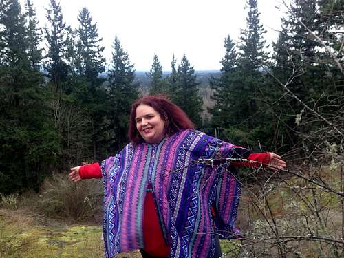
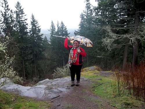
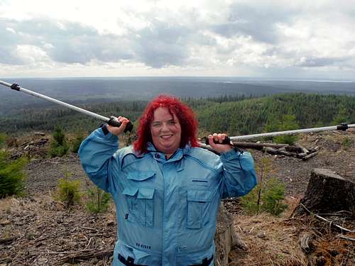
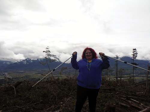
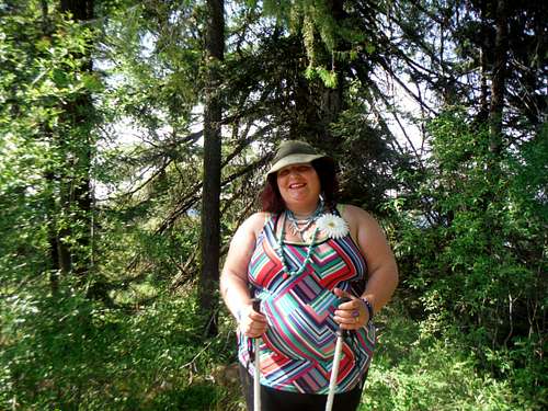
![BearQueen on top of the world]() On the summit of Cedar Mountain
On the summit of Cedar Mountain | ![COME ON!!!]() EastKing having fun!!
EastKing having fun!! |
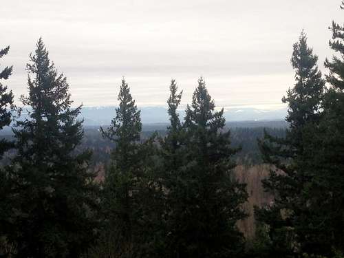
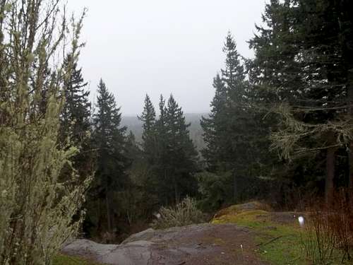
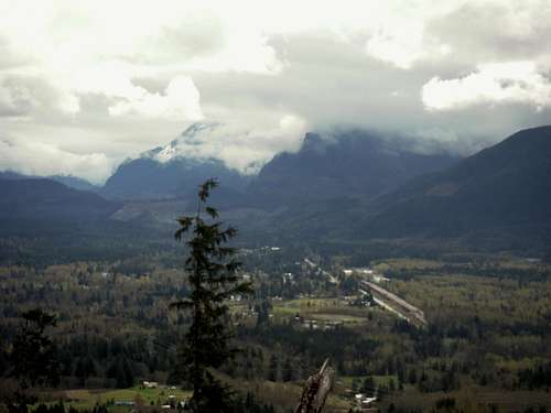
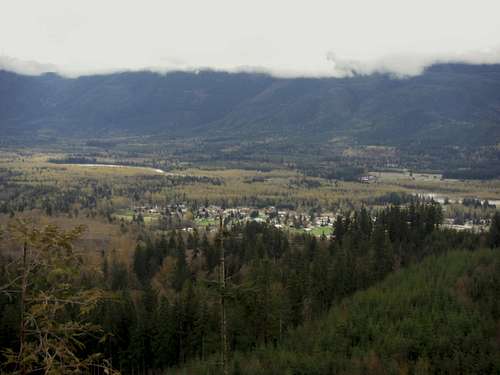
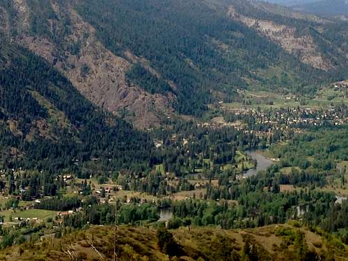
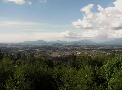
![The foothills from Cedar (Echo) Mountain]() Views from the summit
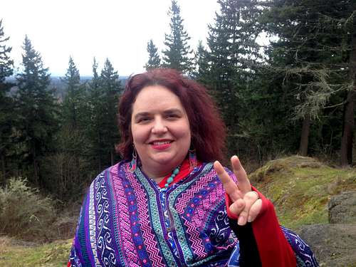
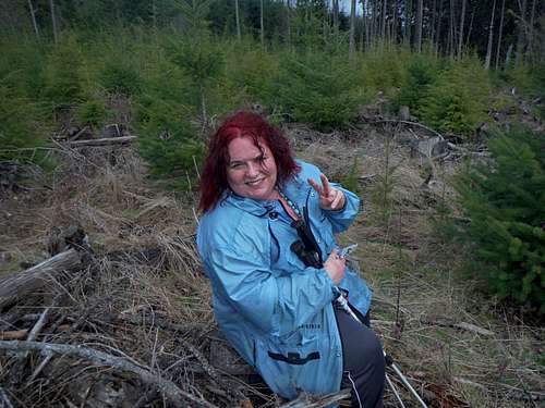
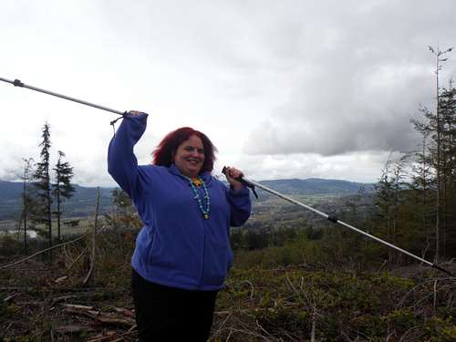
Views from the summit | ![Peace out on Echo Mountain]() Peace out from Cedar (Echo) Mountain
Peace out from Cedar (Echo) Mountain |
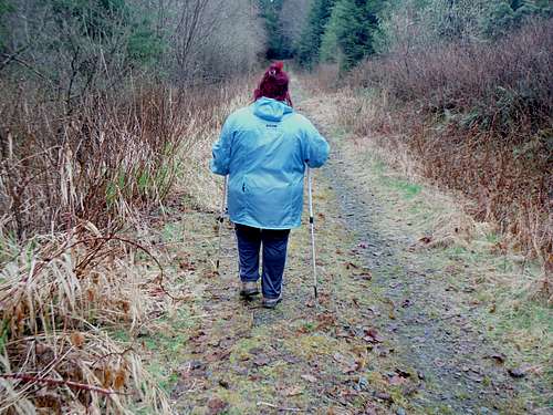
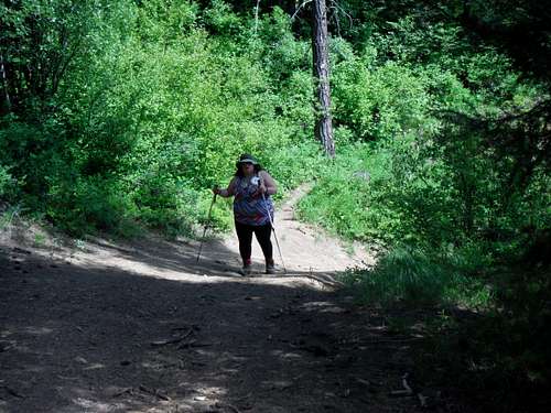
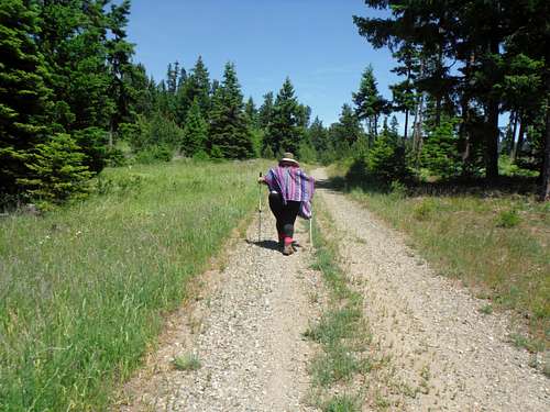
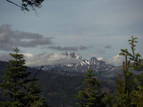
Cedar (Echo) Mountain (3/8/14)
Today, I call the theme of this day: "Wet Rat" day. It felt pretty blah outside, and I did not dress warm enough, so it was also pretty cold and the rain was constant and consistent. Since EastKing and I were smart this time and already knew how to cut right to the top, it was easier finding the right trail to get there.
However, due to the nasty Sinus Infection and sharp, stabbing head pains I have been dealing with due to something called Occipital Neuralgia and the symptoms I have been getting from the Sinus Infection, I have been extremely lethargic and the medicine I have taken has made me extremely lethargic as well.
I realized that there is something that happens when I am on the trail: All of my emotions kind of well up into a heap as I have so many emotions from all of the struggling, from past hopes, past hikes of the past eleven years when I was 100 pounds less, and all that has happened since then...It is often hard for me to deal with this rushing, torrent of emotions when I see flashes of what I am capable of. But I keep going. Today was one of those days, when all of the emotions of never giving up just catch up to you and you realize how weakened you are, and the fact that I was so sick and struggling made it even harder for me to stomach how far behind I have gotten and how many times I have been knocked down.
These are moments when I am glad I am alive, but also realize how much life I have not lived, and it is humbling, sad, and happy all at the same time. These feelings overpower me.
When I got to the top this time, it was still consistently, relentlessly raining, and EastKing eagerly and immediately wanted to take a picture of me. I let him, but also had some of my choices pouty expressions that have been carefully cultivated over 40 years time.
Therefore, I have to say I was proud of myself, and yet, it is bittersweet, b/c I know once I gather my strength back after this illness, it is time to challenge myself slowly and to build myself back up again.
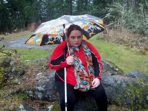
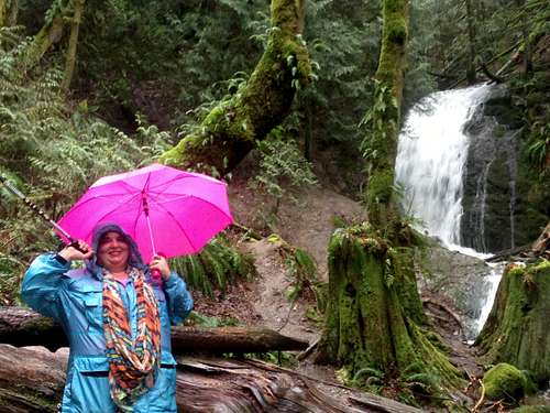
![BearQueen with the umbrella]() BearQueen on the summit during a rainstorm
BearQueen on the summit during a rainstorm | ![View of the rain]() View of the rain from the summit
View of the rain from the summit |
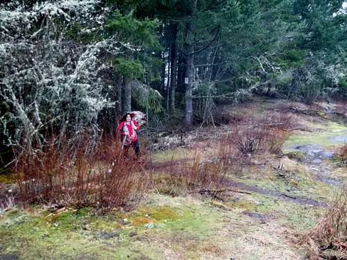
![Cold and wet]() Cold, sick, wet, and at this point miserable
Cold, sick, wet, and at this point miserable | ![Nearing the top]() Literally feet from the summit
Literally feet from the summit |
Coal Creek Falls (3/16/14)
Sorry, no summits on this day. This was another "Wet Rat" day. I cannot wait to find some hiking partners. I have someone to call and I am still looking for partners who understand what it is like to be 100 pounds overweight. I am always looking for better.
Recently, the “wet rat” phenomena seems to be very common and seems to be very common. Between getting over a massive Sinus Infection and strange head pains from a pain condition in my head called Occipital Neuralgia, not having a car that is able to go very far, having limited energy, having a husband who had a cold and was sick, and not having enough gas money to go anywhere, I settled on Coal Creek Falls.
When I first started hiking Coal Creek Falls, it seemed like there was more rocks and gravel. The road has become more natural partly, and part of it has been washed away. I guess I have gotten truly out of shape because I used to be able to do this hike with more ease, but it was also b/c I am still sick, I believe. I also started working with a personal trainer, who uses boot camp, military style tactics with me and he believes that I can handle it. I couldn’t walk the next day after I worked with him. Wait…it took TWO days for the really bad delayed onset to show up…I had told Rob that I have severe fibromyalgia, but I don’t think he got it. So, I literally couldn’t walk Friday but I got through. Since this was on Sunday, my legs had a chance to recover.
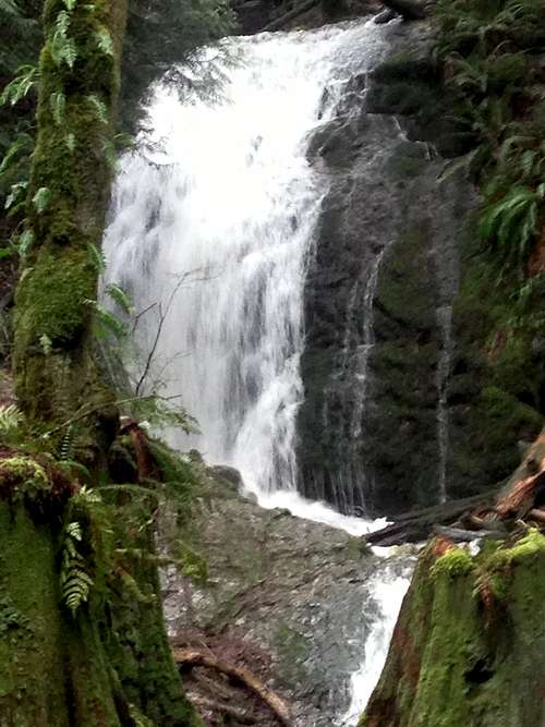
Other than the fact that this trail is a basic, light trail to the falls, the FALLS THEMSELVES WERE THE TRUE REWARD, and since I perk right up when I am around water, The falls looked awesome, and EastKing and I took a “selfie” and we took some wet rat pictures. I am always amazed at the beauty of the waterfall at Coal Creek Falls.
The trail was basically raining and miserable and both my husband I were wet rats. We had brought two umbrellas: One with pink and purple and blue hearts and peace signs, and the other that was neon pink, and Greg decided to go without both of them.
![Victory]() Happy to be at Coal Creek Falls
Happy to be at Coal Creek Falls | ![Roaring Coal Creek Falls]() Closeup of the roaring Coal Creek Falls
Closeup of the roaring Coal Creek Falls |
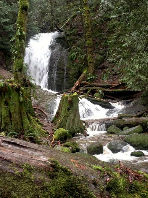
![Coal Creek Falls]() Coal Creek Falls
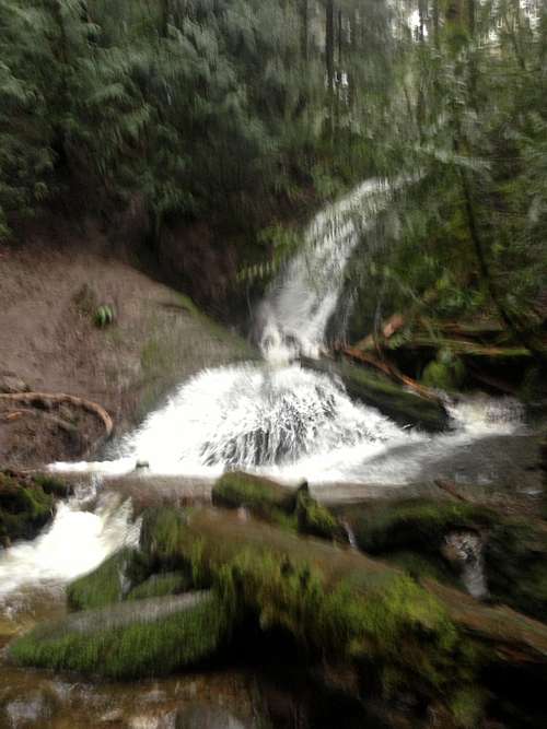
Coal Creek Falls | ![Last shot..]() Final shot of Coal Creek Falls
Final shot of Coal Creek Falls |
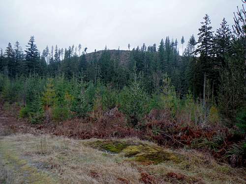
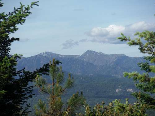
Miniature Mountain (3/22/14)
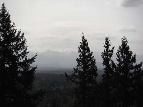
We had heard about the fact that there wasn’t much of a view. Well the view was hidden behind the bushwhack to the hidden summit and behind the trees. One can see a ranging Panorama of the Cascades on the left and Mt. Rainier and then the Olympics on the right, with a view of lakes and the out skirting villages of the towns below. The trail is a road walk most of the way up and then it graduates into a more difficult gradient until you hit the top, when you have to bushwhack through dead forest to find the true summit.
I also feel that this trail is gratifying enough with the views and close enough to the areas that it could appeal to many people, especially those like me who need to lose 100 pounds. EastKing and I were able to go despite our beater car and the fact that our car cannot go very far.
I really think that this mountain, aside from the wonderment of it being a lesser known mountain in Washington State, is highly underrated. This mountain has majestic, mossy green trees (with pictures to back it up) which start soon into the trail, and remind me of being in The Hobbit. Morever, there was so much privacy here, even though it is right past Granite Falls (a town that, on the way to the hike, was absolutely charming, and had a feel to me of a true blooded American town mixed with rural and rustic old world New England charm).
I truly loved the way the trail started out. The water in the river went in both directions and it is separated by a bridge. Ironically, there is some kind of Masonic camping grounds there, which lends to a camp-like ambience.
Beware of a couple of things: Hunters, and people doing Target practice! The sign clearly states (which we did not see until we finished the trail) that target practice is not allowed, and yet the guy we encountered was doing it repeatedly. It scared the hell out of me on the way up, so Greg waved to the person to let them know we were there. That kind of stuff brings up my anxiety level a lot, and since I am just working on gaining more experience and getting better on the trail, it is sort of the last thing I needed. We got passed that guy, and continued on up the road with tranquil peace, and passed another bridge on the way. Again, this was beautiful, just like the first bridge.
I loved the many birds I saw on the water, and on the second bridge, there is a marsh with two geese who look like lovebirds and appear to be a geese “couple” that make their home there. That added more mysterious enchantment to this little known trail.
![Mount Pilchuck from south side of Miniature Mountain]() EastKing wants me to do this peak over the summer.
EastKing wants me to do this peak over the summer. | ![Road of moss covered trees]() Road of moss covered trees
Road of moss covered trees |
This trail is long and it is a bit of a workout. I am amazed at how all the way up, the trail was beautifully lined with Evergreen trees and beautiful green moss trees. That was something I could not get over! At times, these trees looked like they had faces and were staring at you!
I loved this trail for that reason and the fact that the waterfall you could hear throughout the trail. I loved that aspect of this trail and I love hearing water throughout the trail. It makes me feel at home. It is a wonderful thing and something that really adds to the ambience of this trail.
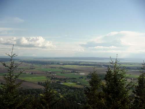
![The Olympic Mountain view from near the summit of Miniature Mountain]() The Olympics from Miniature Mountain
The Olympics from Miniature Mountain | ![Looking down the river]() Looking up the river
Looking up the river |
After the two bridges, the trail graduates from just a road walk and gets a little more difficult in grade. For me, I am able to appreciate this type of hike. Others might call it is a dive, but I love this type of trail and it is great training grounds as a beautiful road walk for someone who is 100 pounds overweight.
![BearQueen heading up the road]() Heading up to Miniature Mountain
Heading up to Miniature Mountain | ![Ducks at a pond while heading up Miniature Mountain]() Looking up at all of the cute ducks
Looking up at all of the cute ducks |
I WAS pouting from bushwhacking, but truly, once we got up there, after stepping on basically rotted out trees and branches from the logging they did, it was not that bad. My favorite parts of hikes; Hitting the summit, and then getting in the car! So anyway, EastKing always scouts out really hard to find out what the “true” summit is, and we found the true summit AND THE VIEWS JUST TO THE SOUTH. The true summit turned out to be a high spot on the land hard to distinguish from the rest of the area. EastKing and I noticed a road below, and then EastKing discovered the first amazing view, which was gorgeous, but when we walked down to the second view, it was stunning and amazing.
At the end of the hike, we sat and relaxed, and looked at the amazing view. I feel we had a really good time together, and bonded in a way we had not in a long time. I share this with you b/c it is really important to have this time with the person you love, and I couldn’t think of a better way to have a good time and have fun. This trail is majestic and beautiful and I would truly recommend it to anyone, and as I said above, it is great for anyone who is out of shape like me. Majestic Miniature Mountain!
Chitwood Peak (3/30/14)
I had, and still have, a massive sinus infection going up this trail, so it was hard for me to find the strength to do it with sharp, stabbing pains and neck pains going up the trail. However, I wanted to tough it out and I felt like I was worth the fight, and it is worth the fight to bond with EastKing too, and these times are what I look forward to all week. I was also proud of both of us that we have learned to be “wet rats” and that even with a dumpy car that can only go so far that is about to die, and crappy weather, we do not find excuses and we still keep fighting to get out there in nature, and that is worth the good fight, every time.
![BearQueen on the start of the trail]() Starting up the trail
Starting up the trail
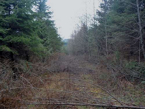
The trail is very interesting…It is past a farm type of area (Like a good old American town) with one house on one side and one on the other. It sort of made us wonder if it was not complete private property. When you pull up, you are not supposed to park in the areas on the side, even though it looks like your vehicle should be able to park there. There IS a space on the side of the road that you can park. Greg, (EastKing), fortunately was able to call his friend Gimpilator and ask him if we were even supposed to be there due to it being private property. Gimpilator said that it was okay. Little did we know that later on down the trail, EastKing would be calling him later to ask him where we missed the beginning of the trail.
This trail starts out as a roadwalk, and then starts looking like a trail that is covered with bright green moss which makes you feel like you are in a 1960’s psychedelic video. We had reached a certain point on this trail, and then we had realized that there were two hills: Which one was the summit? We were confused, but according to Greg, since the trail we were one led to nowhere, which was to the left, he said the summit must lead to the right. This was very frustrating for both of us. Fortunately, we did not take it out on each other. We just headed back towards where we were going, Greg yet again called Gimpilator. Gimpilator said that the actual opening to the trial was a ways back from where we were, so we knew we had to head back. He said it was hard to see.
![Chitwood Peak]() If you see this view of Chitwood Peak you have gone too far.
If you see this view of Chitwood Peak you have gone too far. | ![Cool little creek you go over]() Nice little creek we passed by.
Nice little creek we passed by. |
We still were not sure how to get back to that, and we still did not know where we were, so there are some times when an I PHONE can come in handy. I looked up on Google maps where we were, and Greg was able to tell from the “You are here” dot where we supposed to go. Since EastKing is a cartographer and map maker and reader by trade, there are times when it does come in really handy.
I started out the RIGHT trail in good spirits, and there are some interesting creek crossings where we had to pay close attention to our footing to the muddiness of everything. As we made it across that, things started getting really interesting.
![BearQueen on the entrance to the old road]() On the road entrance
On the road entrance | ![THE NOT SO NICE PART OF THE ROUTE]() THE NOT SO NICE PART OF THE TRAIL!!
THE NOT SO NICE PART OF THE TRAIL!! |
As we graduated up the trail, and I was feeling more and more weak at this point, and really struggling, we noticed that an angry logger had cut down all of the trees on the trail, and to us, it seemed like he was blocking the entire way up the trail. This created a “booby trap” of thorns and logs (Fortunately, they were thinner or medium sized branches or trees that were dying) and we had to dodge through it so it was like bushwhacking except we were not bushwhacking because were won the actual trail. It was hard for me, because aside from the energy I normally exert on the trail, I had to exert and use a lot of stamina and energy to get through these booby traps. EastKing knows that with my fibromyalgia and with the fact that I had this horrible Sinus infection my energy was dropping, so EastKing gave me some powergel and tried to help motivate me. He also seems to get the most opportune pictures of me when I am in a foul mood on the trail and I am pouting or angry or upset. At that moment, I was, but I also try to be fun for the camera, so EastKing got one of these of me and LOVES to post the pouty ones on the website.
EastKing did say at that point when we were not sure how long the booby trapped logs would go on that I could turn around, but I did not want to. I said we had to keep going, and I felt a deeper second wind coming on, and I felt resolved to keep going. We did keep going, and we made it to the top in what felt triumphant to me, but I also was not used to such a workout, and therefore, I was not on the greatest mood on the top. I wished I had been in a better mood on the top of the mountain, but I was not. EastKing, as a great predictor of weather, said he felt a storm coming on and pointed to it on the top of the mountain. He said we need to get off soon, so we headed down. We both remarked that on the way down, the booby traps did not seem as bad, and I told him it is probably because we knew we had already triumphed on it and had been exposed to it so it was not as bad.
![Overlooking towards the sound]() Overlooking the Sound!!
Overlooking the Sound!! | ![BearQueen celebrating her success]() Yeah, I did it!!!
Yeah, I did it!!! |
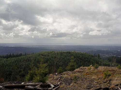
The views were pretty amazing and the summit was huge, like a big circle with cut down trees, so one could see in a 360 direction, which was and is pretty awesome. We could see Seattle in the distance, which appeared to be like a little ant town, and we saw many of the villages below.
![BearQueen on the summit area]() Resting on the summit area
Resting on the summit area | ![The nice part of the road walk]() Heading back down!
Heading back down! |
Fortunately, to our surprise, the storm seemed to completely bypass Granite Falls and the sun came out, drying us and our wet rat outfits and my hair. We ended up having a great burger in town at this place called the Spar Tree Tavern where they have Angus meat and burgers. I felt content with that kind of meal after all the effort we made. We also went to an ice cream place next door and I made a new friend who loved my bright red hair, and I had an amazing triple chocolate ice cream sundae with hot fudge and it was pretty darn awesome. We ate that ice cream at Mark’s Country Store and this was a combination convenient store and country store that had a great country feel to it. I grew up in the Washington D.C. area, but my grandfather had a farm in Mt. Airy, Maryland, and I used to go there every summer and we would eat at this homemade ice cream place that was totally awesome and had an awesome feel to it. This place made me feel at home.
I noticed a huge difference on this trail in terms of how fit I am becoming, even in spite of the sinus infection, fibromyalgia and other physical challenges. It is my deepest hope that next March I am 100 pounds less, and that I am much more dedicated EVERY SINGLE DAY to dedicate towards weight loss, and to make me stronger on the trail. I have not lost much weight yet which s really bothersome, but that is a topic for another day. However, I developed that second wind on the trail, which really helped me get through the ongoing maze of log booby traps and make it to the top. As I had said above, the views were amazing from the top, but I am not sure if I would recommend Chitwood Peak to others due to the unexpected booby traps on top.
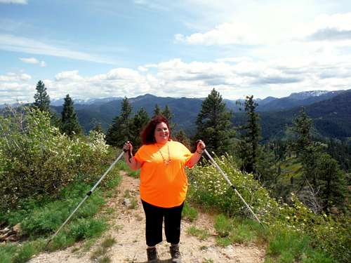
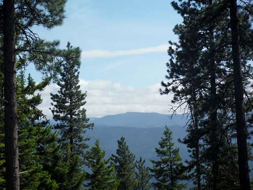
Highwire (4/6/14)
EastKing and I found this mountain up on Summitpost so we both decided to give it a try. It is located on private timber but hiking and horseback riding is legal. Parking is very limited here. For many of you this would be a light evening stroll but for me is was a nice challenge. With the roundtrip distance being 4 miles (??) and the elevation gain being 400 feet this would a great light hike to fill the weekend.
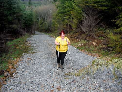
![BearQueen heading up Highwire]() On the move for the next summit!
On the move for the next summit!
From a gravel road walk to the summit this was a quick hike. Since it was a logging road, there were not as many trees as one would normally see, but it was still quiet green, and this beautiful region is quintessentially Northwest.
![Highwire]() Getting close to the final summit area!
Getting close to the final summit area!
The great thing about this trail is the fact that it had a few stretches that personally challenged me and that I was afraid of, but I just kept pushing myself through. This trail was basically easy most of the way up except for when I hit the bushwhack finale. Due to the initial steepness I “psyched” myself out. I told EastKing that I could not do it but EastKing told me to pull on through. Once I started planning each place to put my foot, and trusting EastKing, my confidence grew on the scramble/bushwhack. These things are like small victories for me and I was glad that EastKing believed in me. That means a lot and when I can stop panicking, which I know the best climbers and hikers do, and overcome my fears, then I become stronger. I did that on this bushwhack, and used my leg strength. It was tough for me but I pulled through.
![BearQueen posing on the summit]() Victory!!
Victory!! | ![A happy BearQueen!!]() Yeah!! I am on top!!
Yeah!! I am on top!! |
![The view east]() Looking east from the summit. It is a shame that those clouds are in the way!!
Looking east from the summit. It is a shame that those clouds are in the way!! | ![The town of Gold Bar]() Looking down at Gold Bar
Looking down at Gold Bar |
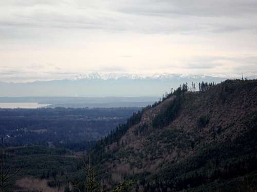
The trail was actually a beautiful logging road. It was a cute road walk to me. The views were peeking through the openings on the way up, but when we got to the top, the views were incredible all the way around, but the clouds were hiding them all the way around too. THIS SUMMIT WOULD BE GREAT TO DO WHEN THE SUN IS OUT! However, a few of the views were STILL incredible. This trail had some great views of Sultan and some villages below and of the Olympics and Cascades. Like the last summit I did, there are plenty of views from the top and the top of this mountain is one you can roam on and that has amazing views. Overall it was another great day in the mountains and for me it was my fourth different summit in as many weeks.
The Arboretum (4/13/14)
Greg and I celebrated my birthday early by going to the Spring Fair Saturday, and I was dog tired from it the next day due to recovering from a Sinus Infection that was quite serious.
I went to the Arboretum last weekend on APRIL 13TH, and I am counting it for a hike, because the hiking just did not work out with Greg due to his work schedule and our challenging situation with not having a car, and not being able to get around in the car due to it not being reliable.
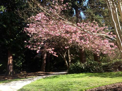
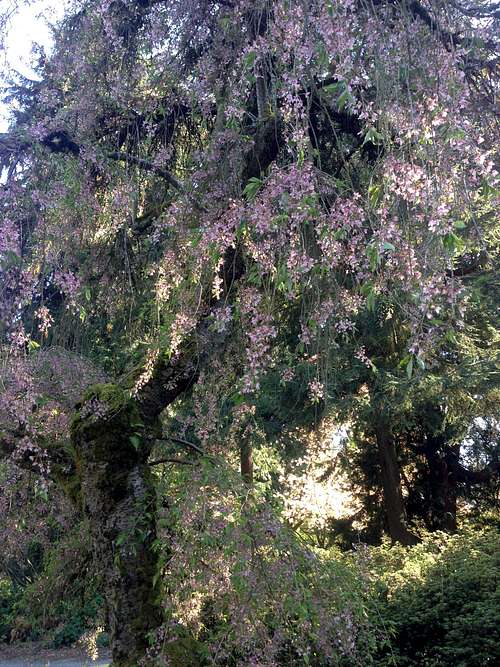
I was a bit depressed this day after going to a pow wow that wasn’t as good as others that I have been to. So, I went over to the Arboretum, and took a mile and a half walk, but did not get a lot of pictures in b/c my storage was full, I was so tired, still dealing with these sharp pains in my head, and did not feel like removing all of them. However, EVERYONE was out on this day. This place is quite fascinating, with many Master Gardener’s and great garden intellects who apparently have worked on this place with a huge labor of love.
![Sitting in the Spring Sun]() Laying in sun!
Laying in sun! | ![Beautiful Cherry Tree]() Spring comes to Seattle!
Spring comes to Seattle! |
![Spring Flowers]() More Spring Flowers!
More Spring Flowers! | ![Beautiful Cherry Tree]() Nothing greater than flowering trees!
Nothing greater than flowering trees! |
I started soaking up sun rays, and before you knew it, I was out and about walking around this beautiful Arboretum, which has magical and mystical wonders all over and is a generally great place to go and hang out. It is a spiritual place, a place of wonder, and a place one can walk. I want to truly go back and study the Arboretum, learn a lot more about it and its amazing trails, and I want to be more of a part of it. I was contemplating a lot on this day and I really felt fortunate that at least on sunny days, Seattle is a place I can feel at home. Seattle is a place I can feel at home in. The beautiful greenery of the Arboretum, with many exotic plants and flowers made for a pretty awesome day.
![Heading back to civilization]() The way back!
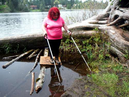
The way back!Cedar (Echo) Mountain and Lake Desire (finally!!) (4/20/14)
Greg and I (EastKing) are still trying to make the best of a tough situation of having a car that barely runs, hardly any money for gas, and me not feeling well and still dealing with some health issues . My fibromyalgia (muscular pain) and my sinus infections have taken a lot out of me, so I struggled on this hike.
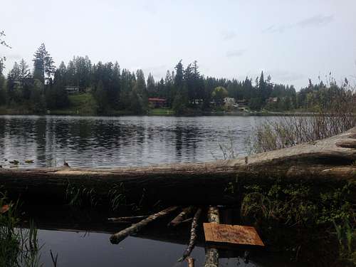
Due to the short Easter EastKing and I decided to go up to Echo Mountain again and Lake Desire. This trip was beneficial to me because this is the first time I was on Cedar Mountain on a sunny day. Along with that, it was the first time I had seen Lake Desire. Although I felt the Lake was very pretty, there really were not comfortable places to sit. There was a log, but to me, it was hard to maneuver to get to. However, it was a beautiful lake and it was a great day to see something so beautiful and a great way to work off Easter Breakfast.
![Ready to hike]() Heading back to Cedar Mountain!
Heading back to Cedar Mountain! | ![Rainier is still hiding in the clouds]() Damn, Rainier is still hiding!
Damn, Rainier is still hiding! |
![Finally, Lake Desire!!]() Finally Lake Desire!! Not as desirable as I would have wanted!!
Finally Lake Desire!! Not as desirable as I would have wanted!! | ![Finding my way back]() Okay, I really don't want to get my feet wet.
Okay, I really don't want to get my feet wet. |
We actually ate at Old Country Buffet and then went on a hike. It was really fatiguing and it was hard, but I was glad that I made it.
My birthday was the next day and Easter is usually a hard time for me. The holidays are in general because I think of my family and it is hard for me to be away from home on holidays. So, it was good to get my mind off of it and go outside.
Injury/ Seattle High Point/ Lincoln Park (4/26/14)
HIGH POINT WEST SEATTLE:
I cannot wait to be on my blog for my next hike, and EastKing and I continue to make the best out of our situation of not having a car, and having limited circumstances. We are doing the best we can with very little. I had painfully injured my leg by running across the street last Tuesday, and I could not figure out why my leg muscle exploded so badly like an “event” had happened, but when I went to the doctor he said I most likely tore a tendon. So, I was in pain all last week, and sad that I could not go hiking last weekend. EastKing was positive about it and supportive of my injury recovering, so he wanted us to be productive about it.
So, well, it is always a good thing to make great lemonade out of lemons and last week, on Saturday, April 26th, Greg decided it would be a good idea to go to High Point and at least say that I hit the highest point of Seattle. Don't worry; none of us plan on putting up a SummitPost page on it. So, we went on our “adventure” a few blocks away and it was really fun to be able to have one of these a few blocks away in my own neighborhood to the “High Point” area and neighborhood of West Seattle. This quote and excerpt is taken from Wikipedia: “The hill is dominated by two huge water towers, and is also the location of Our Lady of Guadalupe School and Parish, on the peak of the highest hill in West Seattle. It is also known for the High Point Projects which were torn down in 2005 to make way for new mixed income housing. High Point is one of Seattle's most diverse neighborhoods, with a substantial immigrant population from Southeast Asia and East Africa.”
So, we went to the two water towers and we stood on the bench and Greg took a picture of me. This is a really cool and amazing view of Seattle and one can see the Seattle city in all of its scenic beauty and the skyline that shapes it. Also, I finally fully grasped why “High Point” is called High Point, mostly because of the two water towers. It meant a lot to me to do this because I have wanted to build up the momentum of the hikes I have been doing and to be honest, I was quite sad about it. However, a temporary setback is just that: A Temporary setback. Thanks to all those who have made positive comments on my blog. It has meant so much to me, and I would not be able to thank you enough.
![Amazing alpine views]() Amazing alpine views
Amazing alpine views | ![On the high point of Seattle]() Peace from the highest point in Seattle!
Peace from the highest point in Seattle! |
LINCOLN PARK:
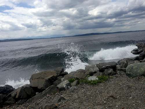
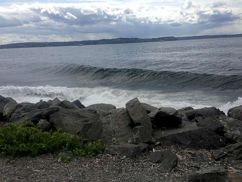
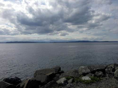
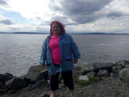
Then, we went to Lincoln Park and we have been going to Lincoln Park all week. I have to say that there is nothing quite like Lincoln Park on a beautiful day. It can be almost like a resort. I have seen amazing ripples across the Puget Sound created from the ferry boats, that create such beautiful scenery, waves across the water, and the sun beaming down, that it really feels like you are on a small vacation. I have spent many days this past week, including Saturday, April 26th, going to Lincoln Park and taking pictures and continuing to walk a 2-3 mile stretch so I can stretch out my injured muscle in my leg and continue to be in the outdoors. I have taken some great pictures of Lincoln Park this week, many of which I truly think are worth of sharing Here is what I found on Wikipedia about Lincoln Park: “The park, with its old growth canopy, is a major migratory destination for many species of birds and water fowl, and provides critical nesting habitat during mating season for bald eagles, owls and many other birds. It is also home to over 300 species of birds, many of them year-round residents.
As an urban sanctuary and preserve, Lincoln Park is highly unusual due to its old growth forest, relatively well conserved natural undergrowth, and ease of access. Over the course of a given year, thousands of hours of volunteer effort go into maintaining this sanctuary for the use by all as a respite from the stresses of a fast paced urban environment.”
![Surf s Up]() Surf's up
Surf's up | ![Another line]() Wave coming!!
Wave coming!! |
![Looking at the distant Olympics]() My goals are the Sound!!
My goals are the Sound!! | ![Striking a pose!!]() Me at Lincoln Park!!
Me at Lincoln Park!! |
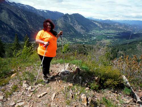
Boundary Butte (5/10/14)
I was not able to truly appreciate Boundary Butte until I was actually on it, since we had to go up a road that is a local road, well used, and is littered with scary potholes. We thought it was bad ion the way up in our new Ford Escort until we were coming down, and we dodged a lot of potholes and burned a lot of rubber. I am absolutely shocked that people bring up new Subarus and other minivans and try to drive to the summit. Then, I found that the potholes only stopped when there was housing sprinkled behind these country roads. It seemed like quite a hidden country sanctuary to live up in there, and quite spiritual.
![May 10th on Boundary Butte]() Stunning mountains
Stunning mountains
The trail started out with the weather was truly wonderful: It was sunny, but many interesting and powerful spurts of wind kept coming along. Greg has thought of this great hike for us to do before we hit Leavenworth, my favorite town in Washington state. We drove our new (used) Ford Escort, and I had an anxiety attack for finally getting over the pass and going that far in a car. I have not been outside of Seattle metro area (Granite Falls doesn’t count) for at least over a year, and have been living in a (miserable) fish bowl because of us being poor and not having a car that was able to run on the Interstate.
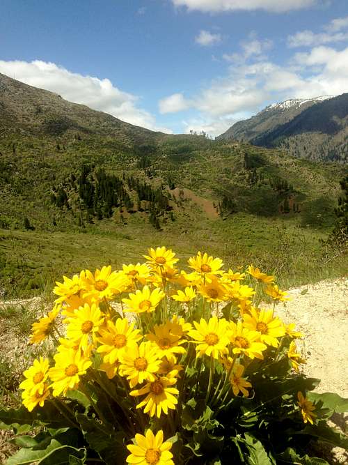
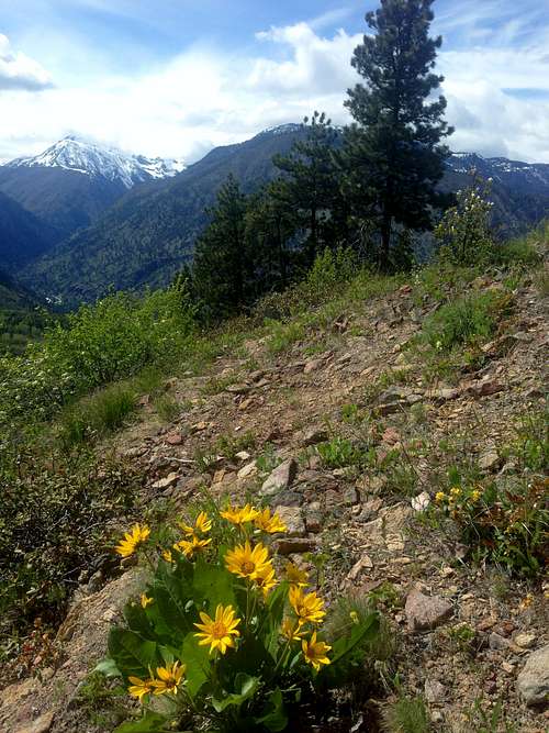
EastKing was wonderful with me starting out, and we started out on a good trail. Being that far away from home was very emotional. The trip was also anxiety producing, along with an overbearing sense of surroundings. I truly felt I was in the Alps. It was absolutely amazing, and there were these flowers that looked like yellow sunflowers. I just googled it and researched it, and I cannot find what these flowers are called. They come in bunches, and are not quite sunflowers, but man, they are beautiful and to me, just as charming as sunflowers. I personally could not get over the bare and raw, starker beauty of this region and these brightly dotted yellow flowers that dotted the landscape.
![May 10th on Boundary Butte]() Flowers on Boundary Butte!
Flowers on Boundary Butte! | ![May 10th on Boundary Butte]() Looking back on the road
Looking back on the road |
This trail is a beautiful road, with amazing 360 views all the way around as you are going up and as you get to the top. You will see a cell phone tower at the top and as you are heading up. You are also sharing the road on the trail with moped and motor bikers, and people who actually attempt to drive up a very scary road, Forest Road 600 up to the summit.
![May 10th on Boundary Butte]() The stunning yellow flowers
The stunning yellow flowers | ![May 10th on Boundary Butte]() More flowers and mountains
More flowers and mountains |
We waved to many people along the way and it was a nice feeling. We saw two tents near a lot of the beautiful overlooks and flowers, and one guy who was looking for his dog. I felt bad for him that his little hound dog was lost, but we had not seen any.
![May 10th on Boundary Butte]() Our summit goal
Our summit goal | ![May 10th on Boundary Butte]() Looking down at Leavenworth from the summit area
Looking down at Leavenworth from the summit area |
When we made it to the top, EastKing and I had a nice bonding time, got lots of great pictures, and spent quality time together. We enjoyed the peace of being away from home, and that we made it on our own. We felt redeemed, and a certain vindication of having our summer back. Now, while making the right choices with my health (losing 100 pounds), my life (getting a permanent, full time job and keeping it) and making time for fun, EastKing and I are going to have a great summer. We are going to take good care of our car so we can go and do many more of these beautiful hikes. I know I do not get to see everything EastKing sees, but I am blessed to see what I do with him and I am so grateful to him for all I do see.
![BearQueen tags her summit!]() I got the summit
I got the summit | ![BearQueen on the survey marker]() I am at a survey marker
I am at a survey marker |
![BearQueen and her favorite flowers]() Grinning with joy to be out in nature
Grinning with joy to be out in nature | ![Heading off the mountain]() Heading off to the next mountain
Heading off to the next mountain |
We then went into town, after driving down the scary Mountain Home Road and dodging the many potholes, and we walked around town, had some amazing German Bratwurst and sauerkraut, and some ice cream, saw some German music and I cried when I heard “Adelveis” and then headed home.
Little Mountain (5/18/14)
First, before I go into anything that seems like a complaint, I want to state that I really loved this trail. It had a great community feel and had an amazing and fantastic overlook. It was also one of the FEW Washington state trails I have been on with good signage. That impresses me. On the East Coast, we like signage. I found this trail to be pretty, and enchanting once I got to the top.
When EastKing told me about this trail, he said it would be steep and short. On this day, the weather was about 65 degrees. The trail was so steep that I had extreme foot spasms and pain. My husband had me take a break so he could message my feet. That was so sweet of him because by doing that he made my feet much stronger so I could survive the steep section. Our trail was called the “Up Only” Trail, but I would like to call it the “Steep Only” trail. We were in the town of Mt. Vernon.
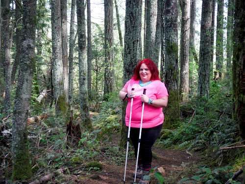
On the first overlook, we came across a couple of guys who were at least 100 pounds less than me with their dog (a friendly German Shepherd) who said they could not hike the trail because they were not fit enough! It made me feel proud of myself! As a larger woman, I have to push myself hard to do it in spite of the chronic pain and fibromyalgia because I know I can bond with EastKing and I know how important it is.
![Little Mountain (5/18/14)]() Hitting the steep section of the trail
Hitting the steep section of the trail | ![Little Mountain (5/18/14)]() No driving up for BearQueen
No driving up for BearQueen |
It was fairly crowded on the trail, although we ran into one large family that did all of the trails. They had done all of the trails in the park in the past and were trying to do many of those trails today. We kept running into them everywhere we went especially on the way down . We saw a lot of people driving up and motorcyclists going up the road, but it felt to me like people were copping out and that they could have walked up to the summit.
Once we got up to the top, we walked around the radio towers to grab all the places we could that were the absolute high point. We heard thunder throughout the entire time we were hiking, and we were wondering how it would manifest later. The view from the top was a beautiful view of the Puget Sound and the Skagit River below going through Burlington and Mt. Vernon. There were picnic tables as well and seeing that most people drove up there, I felt especially triumphant.
![Little Mountain (5/18/14)]() Made to the summit the proper way!!
Made to the summit the proper way!! | ![Little Mountain (5/18/14)]() One of the views!!
One of the views!! |
![Little Mountain (5/18/14)]() Looking at one of my other accomplishments!!
Looking at one of my other accomplishments!! | ![Little Mountain (5/18/14)]() The Puget Sound
The Puget Sound |
After walking the summit, we got something to eat, and my husband decided it would be best for us to walk back to the car via the road due to the trail being way too steep for me on the way down. Once we got down, I was thrilled to not have to do another steep section and the road-walk was peaceful at times. However, you need to keep your eye out for motorists and motorcycles going up and down the hill, so you need to walk on the side.
Driving back from the trail we drove through a nasty storm that had a black cloud over Tulalip that looked at the time to be a wall cloud. We made sure not to stop anywhere on the way back and were both in fear of the nasty weather. Both of us got a bad vibe from the storm. Luckily though nothing formed beyond that.
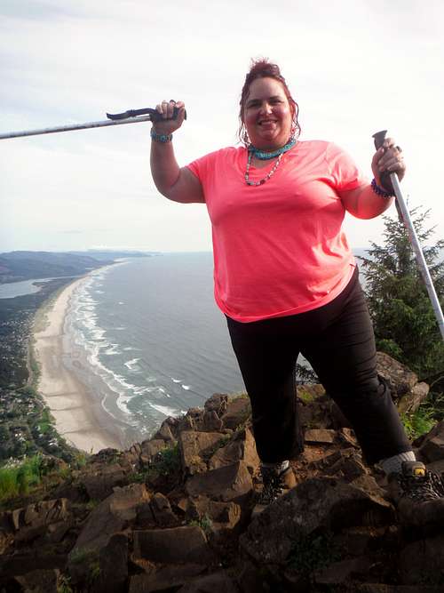
Neahkahnie Mountain (5/24/14)
This peak was very special to me. It was so special that I decided to put it up as a separate trip report. Neahkahnie Mountain clearly was a major highlight in my life and I believe that this mountain deserves it own page.
Click on this link to read the trip report.
![BearQueen on Neahkahnie Mountain (5/16/14)]() BearQueen on Neahkahnie Mountain (5/16/14)
BearQueen on Neahkahnie Mountain (5/16/14)Humbug Mountain (5/31/14)
I want to start out by thanking my nature and mountain loving husband for encouraging me to get out there as much as possible. I also am extremely grateful we got a car and even though it is a 1991 Ford Escort bought at an Auto Auction (all we could afford) it has 55,000 miles on it and runs well.
I really enjoyed this beautiful logging road.
This is a well-kept secret of the Oregon Coast, for sure. It is a rare hike. It is on private property, but it is open to hikers, not cars. The reason why it is rare is because it is overshadowed, both physically and literally by its sister/brother mountain, Saddle Mountain. Also, Neahkahnie is not far and that mountain really has better views that Humbug. With that being said, this mountain has a gorgeous, gentle, and beautiful trail and a road all the way up to the top. These road hikes, though considered dumpster dives for so many, including EastKing, are amazing for me because they allow me to really not focus on struggling and how I am going to balance 100 pounds of being overweight on my feet for the next scramble, but rather it helps me to appreciate the beauty of nature. I feel most close to EastKing at these times, and I am truly in my element when I go hiking with him and I can truly enjoy nature with him.
![Flowers and the Coast Range]() Flowers and the Coast Range
Flowers and the Coast Range | ![The summit of Humbug Mountain]() The summit of Humbug Mountain
The summit of Humbug Mountain |
![Views while heading up the road]() Views while heading up the road
Views while heading up the road | ![Flowering bush along the trail]() Flowering bush on the road
Flowering bush on the road |
There are some great views along the way. The thing I love about hiking with EastKing is how there are always amazing surprises from the hikes. We waited on top of Humbug Mountain for the mist to clear. When it did, there were some amazing views, all of which EastKing pointed out. Also, when one looks far off to the right, you can see the water. Because we were there on a day that is not especially clear, and being an ocean and water lover, I was sad to not see it in the background. However, I love waiting with EastKing for the mist to clear, and we were up there for at least an hour waiting for that to happen, hanging out with the cell towers. It is somewhat intrusive, but I still found a way to appreciate the beautiful view of the entire mountain region in Oregon. EastKing is the expert on what mountains you can see from the top.
![Successful summit shot]() Another successful summit
Another successful summit | ![Looking southeast from the summit]() Looking south from the summit!
Looking south from the summit! |
It is easy to truly enjoy the greenery, fresh smelling air, beautiful wildflowers of the Oregon Coast and Pacific Northwest on a trail like this for me. There is a lot of reward without a lot of toil and struggle. The trail did not feel as long as Neahkahnie which I had done a week earlier. I truly will never forget the magnificent beauty of the area, and the gentle greenery, wildflowers, soft winds and great views that Humbug had to offer.
No Bah Humbug here.
Cle Elum Ridge (6/14/14)
I loved this road walk. It was quite beautiful and gave me a chance to appreciate the rugged and extremely green beauty of the Roslyn and Cle Elum area. I notice that this trail was extremely well maintained, and I just wish the other trails that we have been on in the past two months (Ahem: Humbug. There were MANY stray branches and rocks on this trail that made it much scarier than it needed to be for me) so I give a lot of credit to the people maintaining the trail (I would love to find out who they are) and how well they took care of it. I loved this trail almost as much asi loved the The sun patches and the greenery were very charming. The only thing I missed from other trails were water, but that is because I am a lover of water and waterfalls. If you want that, you might sorely miss it on this trail like I did.
![Heading up the trail]() Heading up the trail
Heading up the trail | ![Heading up to Cle Elum Ridge]() Starting up the trail
Starting up the trail |
What is magical about this trail is the many beautiful wildflowers noted on the way up, like long flowers in bunches that look like purses. I also though the road was extremely well maintained and taken care of, and it is obvious that the abundance of friendly townspeople combined with the summit seeking enthusiast s a wonderful mixture because a lot of these people love their town of Roslyn (the famous set of the filming of Northern Exposure) and probably care a lot about cleaning it up and probably spend a lot of time cleaning it up.
![Views of the Enchantments]() Looking at the distant Enchantments
Looking at the distant Enchantments | ![Views of Mount Stuart]() "Why not me"; Maybe Mount Stuart in the future for me
"Why not me"; Maybe Mount Stuart in the future for me |
When we got to the top, we saw many mountains from just west of the top. The true summit was a little annoying with it being covered with trees. But just west of it is a great view of the Enchantments. One day I will be able to get up one of the Enchantment peaks. A little ways to the east of the true summit is yet another great view to the east.
![More Teanaway summits]() Miller Peak in the distance
Miller Peak in the distance | ![View to the south while heading up]() Looking south
Looking south |
What is great about my husband and what makes me love and respect him more and more is that even though he has done much bigger and greater mountains, I can always see him getting excited and antsy for the summit, like a little kid, and I always admire how he wants me to succeed and get better, and yet he finds trails that are doable for me and that fit me and make me feel a strong sense of accomplishment to build on. EastKing knows I have fibromyalgia, chronic pain and inflammation in my body as well as a 100 pound backpack, and yet I see his love for me by bringing me on these trails and then encouraging me to write about them. I am so grateful for these times with EastKing. I work a very thankless job and it is very stressful, so to be able to do this with my husband means so much to me.
![On the boring summit]() Yeah, another summit bites the dust!
Yeah, another summit bites the dust!
I am so much more determined than ever to lose 100 pounds, but being with EastKing and seeing his undying passion and how dedicated he has been to SummitPost and to NWHikers and the years worth of trips he has dedicated himself to writing makes me proud to be married to him and I truly do admire him and want to make him proud. Like Russell Wilson, who we love, I want to say, “Why not me? Why not us?”


Comments
Post a Comment