
-
 3953 Hits
-
 77.48% Score
-
 8 Votes
|
|
Route |
|---|---|
|
|
42.89122°N / 0.30594°W |
|
|
Hiking, Skiing |
|
|
Spring, Summer, Fall, Winter |
|
|
Most of a day |
|
|
Moderate hike / ski tour |
|
|
Overview
 Barrage de Migouélou
The Val d`Arrens has many possibilities for hikes and for mountaineering. It is a beautiful and in many ways enchanting part of the Bigorre and the Hautes Pyrénées. This route, located in that region, is about traversing a col and visiting several lakes, natural ones and a dam lake, the Lac de Migouélou.
The col is called Col d´Hospitalet. It is the col north of Lac de Migouélou, the deepest part of the ridge between Pic des Tourettes to the west and Pic Arrouy to the east, connecting the Migouélou valley in the south with the Lac de Pouey Laün to the north.
Migouélou lake is a dammed lake and the dam is an extraordinary one: several concrete semi-circles, pushing their concave side into the lake, are holding back the water, coming down from every direction within the upper Migouélou valley. Huge tubes are channeling down the water over 800 meters of altitude difference to the Migouélou power plant, thus feeding the region with water generated energy. When viewed from below the dam looks like a crown sitting in the middle of the valley.
The trailheads of the hike to Col d´Hospitalet are near another dammed lake: Barrage du Tech, deep down in the Arrens valley south of Arrens-Marsous, one of the main villages within Val d´Azun.
 Pic des Tourettes, Le Milhas
When I hiked up Col d´Hospitalet the plan was to summit Pic des Tourettes. It looked like an easy prey in the IGN topo map. Just follow the ridge from the col and up to the summit. That was wrong! You always should take the denomination of a mountain seriously. Tourettes meens: little rock towers and that was it where we ended at last: the easy ridge was in fact an arete full of little rock spires and towers - good rock to climb but too long and too difficult for us. The normal route to Pic des Tourettes is another one as I learned now from a French internet site. So hopefully this will be another adventure in another year .....
But Col d`Hospitalet is absolutely worth a hike. The lakes are just beautiful, the views from the col are very nice and can be enhancend by climbing the first (and rather easy accessible) “Tourette” (point 2667 m of the IGN topo map)- which we did this day (see the pics on this site) - or climbing Pic Arrouy, which needs some UIAA grade I to II scramble on the west ridge route. Balaitous, Pallas, Arriel and Lurien, together with Grand and Petit Gabizos can be studied thoroughly.
The traverse into Lacs de Pouey Laün valley is a rather long hike and needs some preparation as you start and end at different trailheads. Two cars for the two trailheads, hitchhiking or some bikes are needed to overcome these difficulties (about 3,5 km on the valley road).
Or if you intend to visit only Migouélou valley, there is a nice and in some parts off-trail detour via Réfuge de Migouélou, Col d´Artouste and then the west and northwest side of Migouélou lake below Pic de Palada, Le Milhas and the Tourettes east ridge up to Col d´Hospitalet.
Note: the above mentioned Pic Arrouy is not that Pic Arrouy, which is situated above Vallée de Marcadau! Arrouy means "red coloured" and is a rather common name within the Hautes Pyrénées
Getting There
 Val d´Arrens
You reach the trailheads of Val d´Arrens
The trailhead for Lac de Pouey Laün and Col d´Hospitalet is at the southern end of Barrage du Tech near the camping ground.
The trailhead for Lac de Migouélou and Col d´Hospitalet is some 3,5 km further on. It is the first parking area after Barrage du Tech on the right hand side of the road (Plaa d´Aste).
A second parking area is at the end of the road about 1 km south of the Plaa d´Aste trailhead. This second parking area is the starting point for the ski route to Lac de Migouélou.
Routes
From Barrage du Tech
Follow the road to Bouleste and Col d` Uzious for about 1 km. At a trail junction take the left hand trail into the left hand valley and ascent to Pla d´Artigou. Follow the zigzag trail to Bassia det Pi and at last to Lac de Pouey Laün below Pic Estibère and Pic des Tourettes. Pass the lake on its north and northwest shore and continue on the trail up to Col d´Hospitalet.
The ski route from Barrage du Tech uses the Pic Arrouy north slopes, called Peyralagor, to reach the Lac de Pouey Laün, starting at Pla d´Artigou. Below Pla d´Artigou and above Lac de Pouey Laün summer and winter route are the same.
 Pic d`Estibère Pic d`Estibère |  Lac de Pouey Laün Lac de Pouey Laün |  Lurien as seen from the first Tourette Lurien as seen from the first Tourette |
From Plaa d´Aste
Take the trail to Réfuge de Migouélou (signposts at the parking area). Ascent on that trail in many zigzags to La Mouric above the Vallon de l´Arriougrand and gain the south slopes of Pic Arrouy high above that Vallon. Traverse these south slopes to a trail junction below the dam of Lac de Migouélou. Take the right hand trail which leads steeply up to Col d´Hospitalet (signpost). The Réfuge de Migouélou is about 5 minutes from the trail junction below the dam via the left hand trail.
The ski route to Lac de Migouélou and Col d´Hospitalet starts some 1 km south of the summer trailhead at the last parking area of the Val d´Arrens and uses the steep slopes up to Lac des Touest, before traversing to Lac de Lassiédouat and Lac de Migouélou. From there the ski route follows the summer route. This ascent seems to be very steep.
 Lac de Migouélou Lac de Migouélou |  Pic du Midi d´Azun Pic du Midi d´Azun |  Vignemale and Balaitous Vignemale and Balaitous |
Pleasant encores to do
Pic Arrouy (2708 m): west ridge, UIAA grade I / II, off-trail
Pic des Tourettes (2771 m): From the col ascend the east ridge and traverse the south slopes of that east ridge where it is possible (steep meadows about 150 meters below the ridge crest) in western direction. Ascent over scree and easy rocks to Col de Milhas. Use the south ridge from Col de Milhas to Pic des Tourettes (UIAA grade I / II) or use the north ridge to the summit “Le Milhas” (2739 m; rock and steep meadow scramble)
 Migouélou surroundings Migouélou surroundings |  On the first "Tourette" On the first "Tourette" |  Val d´Arrens Val d´Arrens |
First “Tourette” of the Pic des Tourettes east ridge (2667 m): Follow the east ridge from the Col; bypass steep rock parts in the lower section on their south side (easy rock and steep meadow scramble).
 Panorama from Col d´Hospitalet
Red Tape & Accommodation
 National Parc regulation
Red Tape
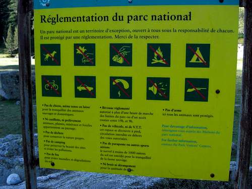
The Col d´Hospitalet and the routes are within the “Parc National des Pyrénées”. This huge national park covers about 2060 km² and has many restrictions as you can see on the picture.
Camping is generally forbidden in the national park and in a zone half an hour from outside the park borders. Near the mountain club huts normally special zones are reserved for overnight camping.
There are no fees for entering the park. The parking areas at Barrage du Tech and Plaa d´Aste are free (2011).
Fishing is possible with some regulations at the Lac de Migouélou.
Accommodation
You find all kinds of accommodation in the surrounding villages:
 Réfuge and Lac de Migouélou
Nearby villages are:
Mountain hut
Gear & Mountain Condition
 Pic Pallas and Arriel
Col d´Hospitalet is a normal hiking route in summer and autumn. You need hiking gear and - in early summer - some gaiters.
If you intend to summit one of the surrounding peaks you should master UIAA grade I to II in off-trail terrain, steep meadow and scree slopes with some exposure.
In winter / spring you need full ski tour gear and your avalanche gear when venturing out for Col d´Hospitalet.
Check the Hautes Pyrénées avalanche conditions here .
Réfuge de Migouélou is a guarded hut, normally from end of june through september. In unguarded times there is an open room for overnight stays and a huge bath tube in front of the hut: Lac de Migouélou.
Current Weather:
Maps & Guide Book
MapsIGN Institut Géographique National, scale 1 : 25.000
Number 1647 OT, Vignemale, Ossau, Arrens, Cauterets, Parc National des Pyrénées
Guidebooks
Please add some good guide books for that region, if you know any.