
-
 9946 Hits
-
 79.04% Score
-
 10 Votes
|
|
Mountain/Rock |
|---|---|
|
|
46.58628°N / 11.78390°E |
|
|
Hiking, Skiing |
|
|
Summer, Fall, Winter |
|
|
9026 ft / 2751 m |
|
|
Overview
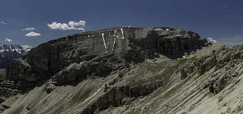 Col da la Pieres seen during the descent from Piz Duleda Col da la Pieres seen during the descent from Piz Duleda |
At 2751m Col da la Pieres is the highest mountain of the Stevia subgroup of the Puez - Geisler Group. It pales in comparison to the mountains of its surroundings, yet its solitary location and huge bulk make it visible from almost all points of the Puez - Geisler Group. It stands out above the entry of beautiful Langental / Vallunga looking like a sentinel guarding the entry.
 |  |  |
Being solitary makes for good views from its summit, mainly towards the Geisler Group up north but also towards the Sella and Langkofel Groups in the south as well as Rosengarten and Schlern to the south-west. By chance the summit of Col da la Pieres aligns perfectly with Peitlerkofel and Forcella de la Roa so that the mountain can be seen through the saddle.
 Sella Group Sella Group |  Langkofel Group Langkofel Group |  Rosengarten Rosengarten |
 Vallaccia and Cima d'Asta Vallaccia and Cima d'Asta |  Peitlerkofel Peitlerkofel |  Sas Rigais Sas Rigais |
 Pizes de Puez Pizes de Puez |  Furchetta Furchetta | 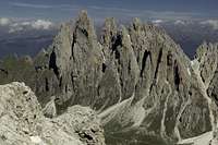 Fermeda Towers Fermeda Towers |
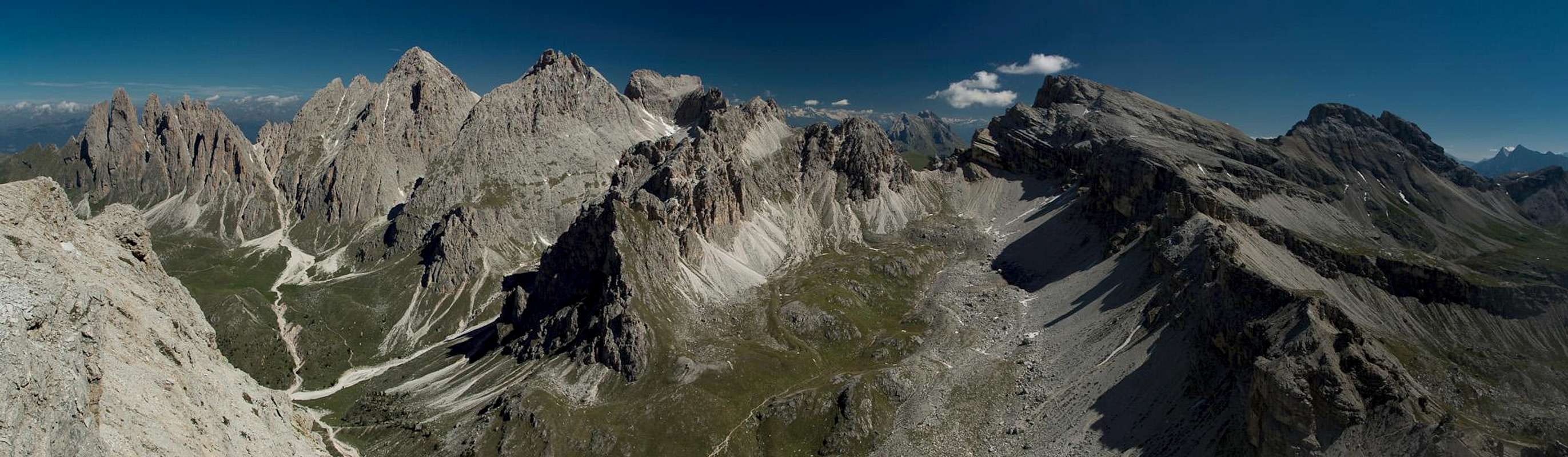
Col da la Pieres is a broad backed mountain with rather steep slopes all around, culminating in the west and north faces, which at the same time are where the ascent trails are located. The summit ridge is shaped like an L with the short end in the south-west on the cross summit (2729m) and the long end in the east on the eas summit (2747m). The main summit in between reaches 2751m. Unfurtunately - due to this topology - there is no 360° panorama but rather single smaller panoramas on these three highpoints.
 |  |  |
Like its northern neighbour, Piz Duleda, Col da la Pieres makes its appearance in any of the ferrata guidebooks of the area. There are protected sections on the path through the mountain's west face as well as around Forcella Forces de Sieles, the saddle in which the north face descent ends. Together with a short protected section between Forcella de la Roa and Sella Nivea you can connect the two mountains in a long day loop hike. The ferrata parts are very easy so it is rather the scenery which grabs your attention.
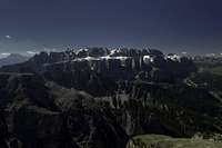
Northern Panorama from the main summit
  |
Getting There
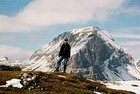
 Langkofel (left) and Col da la Pieres (right) guarding the entry to Langental
Trailhead for Col da la Pieres is Wolkenstein / Selva di Val Gardena. Several routes start here or in the hamlet Daunei above Wolkenstein.
- Take the Brenner Motorway A22 to the exit of Waidbruck / Ponte Gardena.
- Turn onto S242 east to Wolkenstein / Selva di Val Gardena.
Red Tape
Col da la Pieres is located within the Natural Park Puez - Geisler, which has been created in 1977 and contains an area of 10,703ha. Within park boundaries any building activities are prohibited. Flowers, berries, mushrooms, minerals have to be left in their environment. Camping is prohibited and cars have to be parked in the official lots.For further information on the park, take a look at the official website (German and Italian).
Accommodation
Accommodation is easy to find in the Gröden / Val Gardena Area. In July / August you'll need reservations, since the area can be quite crowded.The closest campground I know is at Seis, about 20 minutes by car from the trailhead:
Weather Conditions
Maps & Books
Books
- Alpenvereinsführer Dolomiten: Puez / Peitlerkofel
E.E. Striebitz
Rother Verlag
ISBN: 3 7633 1307 9
- Klettersteige Dolomiten
H. Höfler, P. Werner
Rother Verlag
ISBN: 3 7633 3096 8
- Hülslers Klettersteigführer
E.E.Hülsler
Bruckmann Verlag
ISBN: 3 7654 4161 9
- Dolomiten 1
F. Hauleitner
Rother Verlag
ISBN: 3 7633 4248 6
Maps
- Gröden - Seiser Alm / Val Gardena - Alpe di Siusi
Kompass Map WK 076
1:25000
ISBN: 978-3850265164
- Bressanone/Brixen - Val di Funes/Villnösstal
Tabacco Map 30
1:25000
ISBN: 978-8883150302
- Val Gardena - Alpe di Siusi/Gröden - Seiseralm
Tabacco Map 30
1:25000
ISBN: 978-8883150050