
-
 13597 Hits
-
 72.08% Score
-
 2 Votes
|
|
Trailhead |
|---|---|
|
|
48.33124°N / 114.08149°W |
|
|
Spring, Summer, Fall, Winter |
Directions ot the Columbia Mountain Trailhead
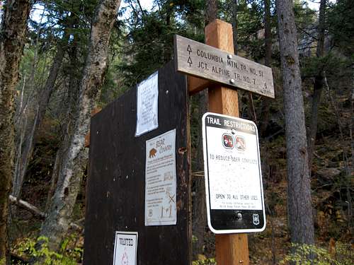 Trailhead sign, cougar14 image.
Columbia Mountain
Columbia Mountain is part of the the Swan Range in Northwestern Montana.
To reach the Columbia Mountain Trailhead, drive east of Columbia Falls on U.S. Highway 2 and turn east at the junction with Highway 206 (from Bigfork). Shortly after the junction and 3.5 miles from Columbia Falls, turn right off US 2 on an unmarked dirt road just past the House of Mystery. Follow this road south for 0.2 mile until you see the Columbia Mountain Trailhead on your left. (This is a newer trailhead that became necessary to avoid crossing private land.) Columbia Mountain Trail (51) starts to the southeast of the parking area.
The USGS Quap Topo map needed to locate this trailhead as well as climb Columbia Mountain is Doris Mountain.
Other Hiking Options from the Columbia Mountain Trailhead
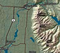 Map Overview
Continue along Alpine Trail Number 7 for over 70 miles and end up on the south side of the Jewel Basin. This trail takes one past Six Mile Peak and eventually skirts along side of the Bob Marshall Wilderness.
Trails also lead to Alpha and Beta Lakes as well as other locations above Hungry Horse Dam, but there are MUCH easier ways to reach these destinations than climbing over Columbia Mountain.