Welcome to SP!  -   
 
 New features are here! - Read More... 
Areas & Ranges·Mountains & Rocks·Routes·Images·Articles·Trip Reports·Gear·Other·People·Plans & Partners·What's New·Forum

Conejos route. Yellow is the...

 
[ Sizes: Orig | Med | Small | Thumb ]
Conejos route. Yellow is the...
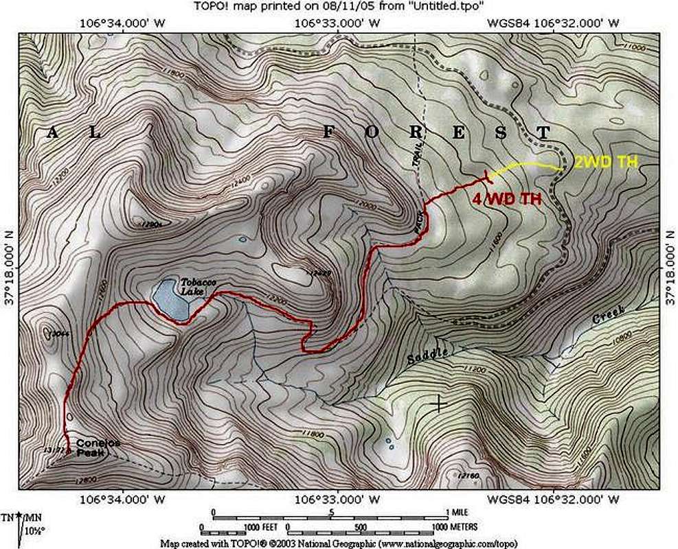
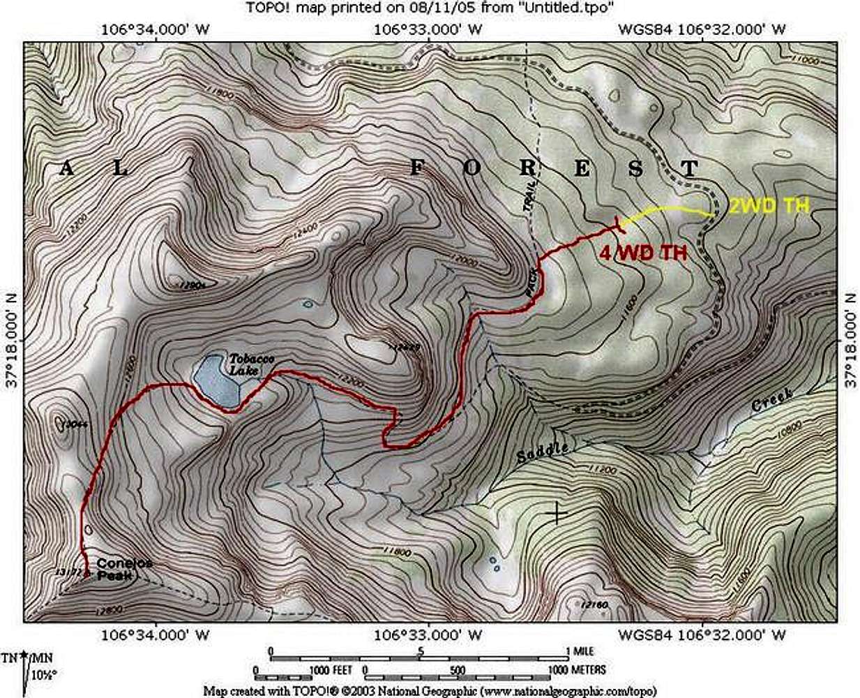
Conejos route. Yellow is the 4WD road to the upper trailhead. A sturdy 2WD (SUV) could also drive the yellow road. Red is the hiking route and climb route. Note that the drawn route is different than the map which shows the route going further north and intersecting the road at a different point. I actually drove over to that point and there appeared to be an abandoned road and TH there.
Map by National Geographic TOPO!
Editing by Alan Ellis


Comments

No comments posted yet.


Sign in to post!

Don't have an account? Register now.


Rate This Image
Current Score: 81.05

Log In To Vote
 Conejos Peak (Mountain/Rock)

Reflections of the South San...
« PREV

Viewing
#19 of 42
GALLERY
The summit ridge of Conejos...
NEXT »

 Alan Ellis's Image Gallery

Flowering cacti in the Charon...
« PREV

Viewing
#332 of 468
GALLERY
View from the CMC camp. Mount...
NEXT »
Image Data

Alan EllisSubmitted by Alan Ellis
on Aug 11, 2005 10:01 pm

Image ID: 119820
Hits: 2246 

Lat/Lon: 37.28870°N / 106.5709°W


"You tried your best and failed miserably. The lesson: Never try."   --Homer Simpson   

© 2006-2012 SummitPost.org. All Rights Reserved.