|
|
Mountain/Rock |
|---|---|
|
|
37.28870°N / 106.5709°W |
|
|
Conejos |
|
|
Hiking, Skiing |
|
|
Spring, Summer, Fall, Winter |
|
|
13176 ft / 4016 m |
|
|
Overview
The Southern San Juan Mountains are one of Colorado's more remote places. There aren't any major citiers, infrastructure is hard to come by and most of the roads that penetrate into this wilderness area are forest service roads (though weirdly in good shape).
This is one of two of Colorado's wildest corners. A wild place that was carved eons ago by receding glaciers, elk herds are large here and ranchers use the lands for free-grazing cattle. At almost 159,000 acres, the South San Juan Wilderness is among the larger wilderness tracts. There are roughly 180+ miles of trails that weave, dance and cut through staggeringly dense forest and volcanic cliffs/peaks. It is also the location of the last confirmed grizzly bear sighting in 1979. Because of unconfirmed and unvalidated track sightings throughout the 1980's, there is a small portion of the local populace that still believes a small, reticent population exists undiscovered. As wild and undeveloped as this part of the country is, I can see why this belief persists. This is also a good place to potentially see wolverine, due to the same reasons.
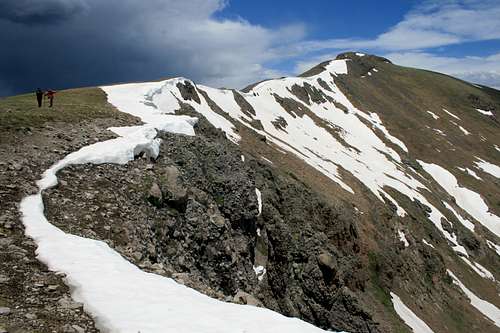
Conejos Peak is a class-1, gentle and rolling mountain and one of only a handful of peaks here that rise above the 13,000' mark. But keep in mind if you visit this easy peak, have a full tank of gas and everything you need in the vehicle. Because help will be hard to find.
Area highlights include: Platoro Reservoir, the ghost town of Summitville, quiet campgrounds, the Cumbrec & Toltec Narrow-Gauge Railroad and some of the most scenic trout fishing to be had in the lower-48.
For more information, contact:
Pagosa Ranger District- San Juan National Forest 180 Pagosa Street. Pagosa Springs, CO. 81147 (#970.264.2268)
Conejos Peak Ranger District- Rio Grande National Forest 15571 CR T.5 La Jara, CO. 81140 (#719.274.8971)
| Topographic Maps for the South San Juan Mountains | ||||
|
|
|
|
|
|
|
|
|
|
|
|
|
||
| Trails Illustrated Maps #142: South San Juan, Del Norte | ||||
Getting There

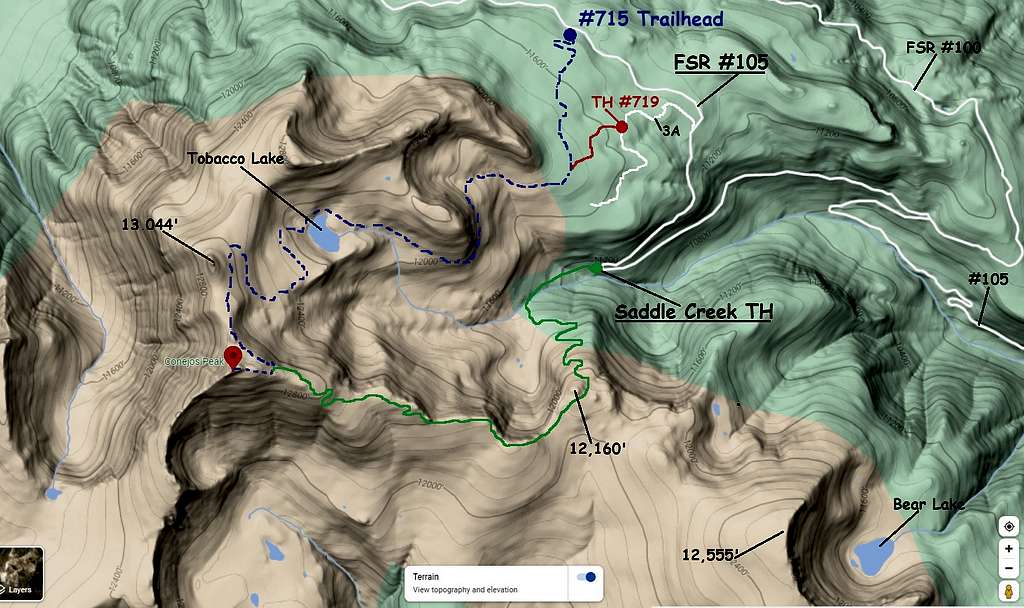
Make no mistake, getting to Conejos Peak is going to take a while regardless of where you're coming from. Add to that, the miles and miles of dirt forest service roads will only compound the time it takes. Fortunately, most of the roads are in surprisingly good shape, baring the occasional potholed section. The final few miles to the Conejos Trailhead are however, faily rough. Not 4x4 rough, but rough in that, it's a flat road with rocks embedded in every direction. A Subaru Outback (or equivelent) can make it just fine. Just drive carefully.
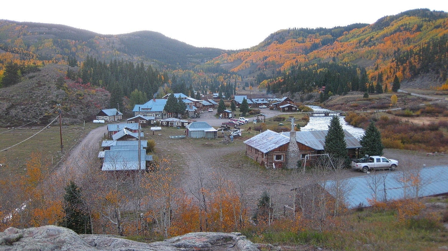
From Durango: Drive east for about 128 miles. Plan on a 4 hour drive as you cruise through towns like: Bayfield, Chimney Rock and Pagosa Springs. Continue east on hwy. 160 towards and over Wolf Creek Pass. Once you reach Park Creek Campground, drive .1 mile further and turn right on FSR #380. It is about 23 miles to Lakes Annella and De Nolda. Stay left onto #380 and keep following for an additional 4.2 miles to the junction (pass Stunner campground) with FSR #250. There will be signs for Platoro. Turn right onto FSR #250 and follow it for 6 miles until you reach Platoro (nothing more than a seasonal fishing and off-roading encampment).
From Platoro continue on #250 for 6.3 miles until you reach a junction with FSR #105. There will also be a sign for Conejos Lake Fork Ranch. Follow #105 for about 6.6 miles on an increasingly rocky road to the trailhead.
The trailhead is exceedingly small and easy to miss. It will be on the left side of the road but it is marked by a forest service sign, trail #715. I also built a small cairn and piled some branches to better mark it. The elevation here is about 11,440'.
From Antonito: From the small town of Antonito, travel west on highway 285/17 for approximately 23 miles to the intersection with hwy. 250. Turn right (a slight jog) and follow #250 for 17 miles to the Conejos Lake Fork Ranch/FSR #105. Follow #105 for 6.6 miles on an increasingly rough road as it gains elevation to the trailhead.
Trailheads
The original trail for Conejos Peak (#715) is still there and marked on 'some' maps. It is 8.3 miles from the lower intersection of #250/#105. Fact, there is a forest service wand marking it. And now, as of August 2022, a medium-sized cairn and branches also mark it. There is no parking along FSR #105 near the trailhead. The only options are to park .3 mile BEFORE the trailhead at a small widening of the road near an old campsite (room for 3-4 vehicles at most- *See Inset) or continue .3 mile AFTER the trailhead and park in a clearing created by bulldozed scree and talus. There is enough room for several vehicles here.
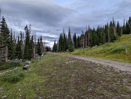
This trail doesn't get used much anymore and the condition of the trail for the first .5 miles shows it. It's EXTREMELY primitive and disappears all together in a wetland/marsh area. Gaia shows this trail segment on its maps but the trail is decidedly NOT THERE. Even the lower segment is full of branches, plants and shows erosion marks from rain runoff. I'm guessing the situation and inability to park near the trailhead combined with the 'trail' going through an alpine wetland is why this version doesn't get used anymore. But there is an alternative that starts higher with a better parking situation.
The new trailhead is trail #719 and starts at about 11,440'. This trailhead is equally hard to see and easy to miss as you're driving. It is also located on the left side of the road and starts as a primitive Jeep road with grass/plants growing between the tracks. Jeep Road #3A is about .4 mile BEFORE the aforementioned #715. The road does get better and any higer-clearance vehicle (truck, Jeep, Subaru Outback) can make it the trailhead proper (roughly .2 mile). I recommend taking this option as it avoids the sensitive wetlands from trail #715 or utilizing Saddle Creek as detailed below. Alpine wetlands and marshes are sensitive micro-envronments and we should do what we can to protect them. After all, it's not everyday you come across a Western Tiger Salamander at 11,000'!
For Saddle Creek, head up FR105 (also known as the Saddle Creek Road). At 1.7 mile appx., the road will go through a pair of switchbacks. At 3.1 miles, there will be another pair of switchbacks. At 4.8 miles appx., there will be a road intersection where FR100 turns off to the right on a switchback. Remain on FR105 which will turn back to the west. Go 2 more miles to another sharp curve. Park here for the trailhead to Conejos Peak and Saddle Creek. There is enough room for a few vehicles. Check out the directions from Climbing Cooney's. They're pretty good.
Red Tape
The legal definition of Wilderness, as outlined by Congress in 1964, follows: "In contrast with those areas where man and hid own works dominate the landscape, [wilderness] is hereby recognized as an area where the Earth and its community of life are untrammeled by man, where man himself is a visitor who does not remain."
Conejos Peak is located in the South San Juan Wilderness of the Rio Grande National Forest. Conejos Peak Ranger Station is a “service first” office, which means that the Forest Service and the BLM share the office and work together to manage these public lands for a variety of uses including: recreation, grazing and timbering. With the mixed usage, please ensure things aren't spoiled for future hikers, climbers etc.
Conejos Peak Wilderness is reached after hiking approximately one mile down the trail. No motorized travel: vehicles, ATVs, motocross or even bicycles are allowed in the wilderness. About a half-mile down the trail, a gate is reached. Please do the responsible thing and secure/close the gate after passing through to prevent the local cattle from wandering off.
Conejos Peak Ranger District- Rio Grande National Forest
15571 County Road T-5, La Jara, CO. 81140
(719) 274-8971

Camping
As we all know, wilderness areas exist to keep the forest wild. It's to protect and give the wildlife a secure and comfortable place to dwell and live without the impacts of human habitation and development. As frustrating as wilderness rules and regulations can sometimes be, they are there for a very good reason. So please adhere by these rules to help manage the place we are enjoying for their benefit and ours.
-
Camp at least 100 feet (average 35 adult steps) from water.
-
If campfires are allowed, they must also be 100 feet from water.
-
Do all washing of yourself, clothes, and dishes 100 feet from water sources, using biodegradable soap or no soap. Scatter wash water 100 feet from camp and water sources.
-
Pack out all trash
-
Human waste: Use Human Waste Disposal System or bury human waste six inches deep in individual catholes at least 100 (average 35 adult steps) feet from camp, trails, and water sources. Do not bury toliet paper, please pack it out.
Camping, campfires, and restraining or grazing of recreational livestock are NOT permitted within 200 feet of Bear Lake, Blue Lake, Green Lake, and Red Lake.
South San Juan trip planning and camping .pdf regulations

Camping along FSR #105 can be hard to come by. There is a wide turnout just uphill from the Saddle Creek Trailhead that would provide for good car-camping. There's even enough room to pitch a tent as well.
Closer to the trailhead for Conejos Peak by trails #715 and #719, space is very limited. There are some spots along #105 with enough room to accomodate a couple vehicles for the #715 approach. For the #719 approach, the small trailhead will accomodate a few more vehicles but expect uneven tundra and plenty of "cow-patties." So again, it will be a bit of a challenge. Car camping might be the best option.
When To Climb/Conditions
Forest Service Road #250 is only open from May to November. This road is closed in winter. Beware of the area surrounding Tobacco Lake in winter. The whole basin is a terrain trap. So if you cross-country ski back there, just make sure to have avy gear. You'll need to check with the ranger station above to make sure FS 250 is open if you're planning an early-season climb. Also check to see if the road to the trailhead is open.
Afternoon thunderstorms are a daily occurrence in the South San Juans. Start early and plan to be down low back at camp or at the very least, off the mountain by 'noon-ish' to avoid the storms. Practically the entire hike & scramble is above treeline, so there is very little shelter in the event of a storm. Large segments of the trail is also used by the area cattle. So if it's rained or wet, the trail is going to be a complete diaster. For anyone who thinks mountain-bikers do damagae to a trail after a good rain, hasn't seen what a herd of cattle can do. Generally speaking, the higher you hike along the trail, you'll leave the cows behind.
Topographic Map