Toggle navigation
Mountains
Routes
Images
Trip Reports
Forum
What's New
People
Areas & Ranges
Articles
Trailheads
Canyons
Huts & Campgrounds
Albums
Logistical Centers
Fact Sheets
Lists
Custom Objects
Gear
Plans & Partners
WELCOME TO SUMMITPOST
SIGN IN
REGISTER
Conger Mountain (UT)
Additional Parents
Image
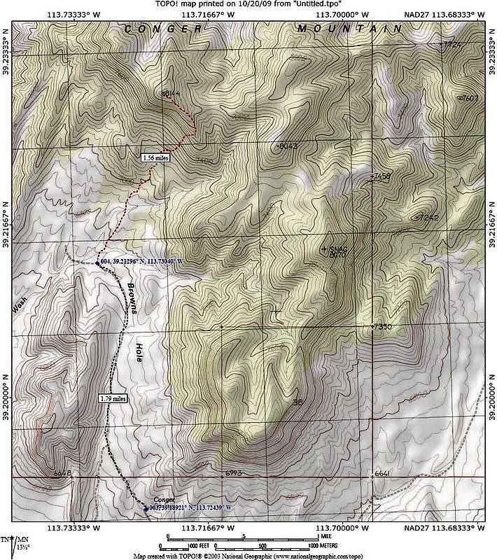
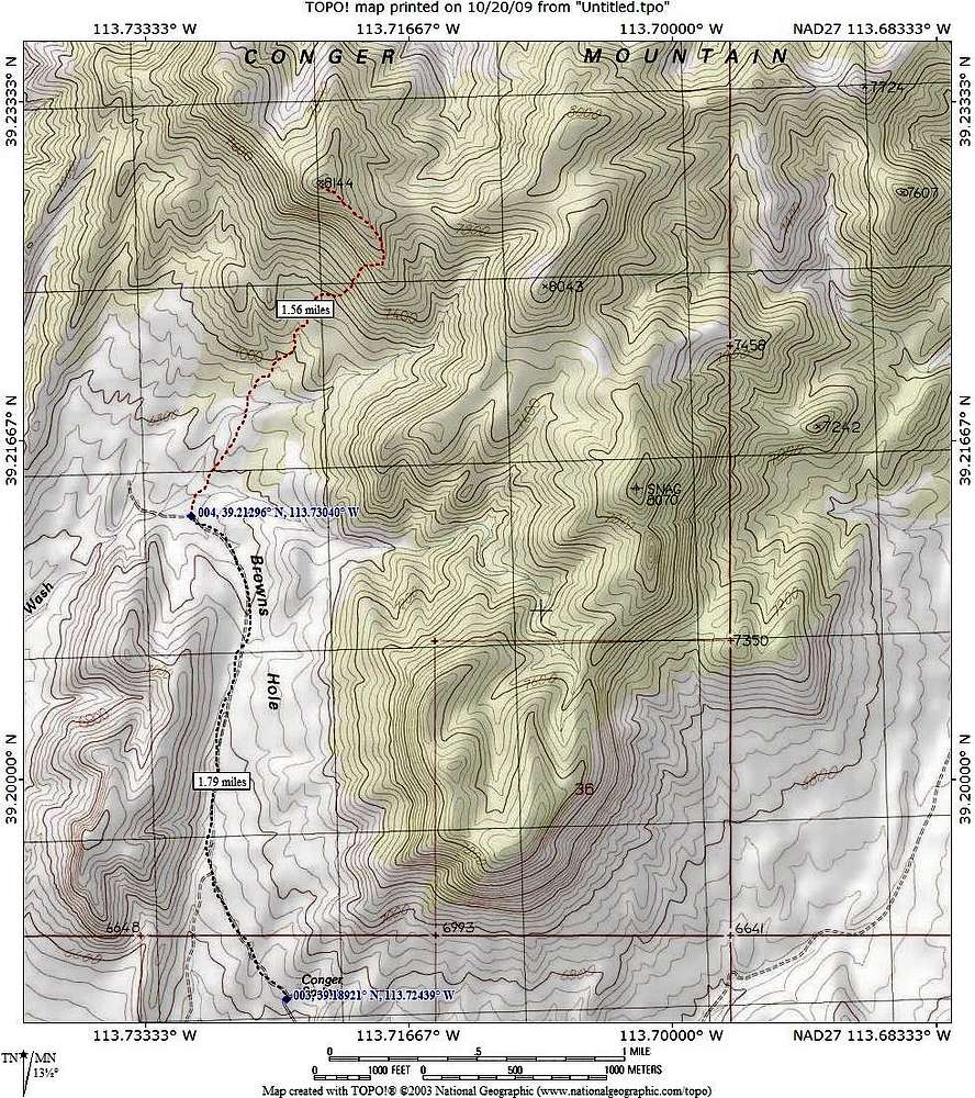
Conger Mtn route map
View High-Resolution Image
Conger Mtn route map
If you hike from Conger Spring, this is a reasonable route. However, your vehicle can cut the distance down some if it is high clearance and has 4WD. A washout stopped us from proceeding to Brown's Hole.
« PREV
NEXT »
Dean
on
Oct 22, 2009 10:59 am
Comments & voting
Other parents
Image ID:
566431
1982 Hits
77.48
% Score
8
Votes
Log in to vote
Comments
No comments posted yet.
to post!
Don't have an account?
Conger Mountain (UT)
(Mountain/Rock)
« PREV
Viewing
#19 of 40
GALLERY
NEXT »
Dean's Image Gallery
« PREV
Viewing
#2658 of 7927
GALLERY
NEXT »
×
You need to login in order to vote!
User Name
Password
Remember me
Forgot your password?
Log me out when I close my browser.
Keep me logged in all the time.
sign in as a user
Don't have an account?
Register now for FREE
Rating available
Suggested routes for you
People who climb the same things as you
Comments Available
Create Albums
Register Here


