Overview
The complete ridge trail of Rodnei Mountains /Munţii Rodnei, Radnai-havasok, Rodnaer Gebirge/ spans over 57 km in east-west direction, connecting Pasul Şetref (818m, west end) and Pasul Rotunda (1271m, east end). The trail is marked by red stripe, and can be split into three parts (see Route Description section below). Backpacking along the main ridge of Rodnei Mountains is a very nice experience, especially in nice weather. If you can devote a few days for this beautiful area, perhaps this is the best journey to take. The trail is long, but has no difficult parts (walking is all you have to do). As there are no huts nearby along the route, prepare for nomadic circumstances. Nevertheless, designated camping sites are quite well partitioned over the range, and most of them are situated near springs. Sharing your own experiences about this trail is very welcome. Also, feel free to report any typos, broken links, etc.
Getting There
Pasul Şetref /Şetref pass, Szacsali-hágó/ is located on car road 17C between Dealu Ştefăniţei /Szalanca/ and Săcel /Izaszacsal/, and can directly be approached only by car. According to the map, there is a motel and a camping place here. If you plan to come by train, the closest stop is Dealu Ştefăniţei. From there, blue triangle leads up along the Fundoaia creek to La Jgheaburi, where it joins red stripe coming from Pasul Şetref.
![Cabana Alpina of Pasul Rotunda]() Cabana of Pasul Rotunda
Cabana of Pasul RotundaPasul Rotunda /Rotunda pass, Radnai-hágó/ is located on car road 17D between Valea Mare /Máriavölgy/ and Rotunda /Borsaszéplak/ villages. This section of road 17D is dirt road, asphalt cover extends only until Valea Mare! Rotunda village can also be approached on car road 18 from Borşa or Cârlibaba. At Pasul Rotunda you can find a camping place and Cabana Rotunda mountain hut. No train access, though. Midpoints of the trail can be approached from several other starting points (these are covered in the Route Description section below). The three most popular are: 1) Borşa /Borsa/, 2) Rodna /Óradna, Alt-Rodna/ or Şanţ /Újradna, Neu-Rodna/ and 3) Staţiunea Borşa /Borsafüred/. Getting to these places is covered on the pages of Buhăescu Mare /Nagy-Bukuly/, Ineu /Ünőkő, Kuhhorn/ and Gărgalău /Gargaló/ pages, respectively.
Route Description
The following description follows the route in west-to-east direction, split into three parts. Of course, it can be done the opposite way as well.
Part 1: Pasul Şetref (818m) - Tarniţa La Cruce (1985m)
From P. Şetref the trail ascends onto the Bătrâna plateau mostly in woods, following a cart road. There are two camping places along this section of the trail: La Jgheaburi (cca. 1400m) and Pasul Pietrii (1196m). The trail leaves Bătrâna plateau at Tarniţa Bătrânei, and climbs up to the Pietrosu massif, where it will not drop below 1800m (in fact, it levels around 2000+/-100m most of the time). Vegetation changes to be dominanted by alpine grass. Between Tarniţa Bătrânei and Tarniţa La Cruce there are two "parallel" variants of the trail: one follows the cart road (moderate slope), the other climbs up Vf. Gropilor (2063m) and Vf. Rebra (2119m) before reaching Tarniţa La Cruce. This latter is joined from the north by the blue stripe (coming from Borşa - access to Buhăescu Mare /Nagy-Bukuly/ and Pietrosu /Nagy-Pietrosz/ peaks) at Vf. Rebra. The cart road ends at Tarniţa La Cruce, a pass under which you find Rebra lake, a designated campsite. From here the main ridge trail is only a simple footpath.
Part 2: Tarniţa La Cruce (1985m) - Vf. Ineuţ (2222m)
![Pietrosu and Buhăescu peaks]() view of Pietrosu and Buhăescu peaks from Vf. Repede view of Pietrosu and Buhăescu peaks from Vf. Repede |
This is where the main part of the trail begins. First comes Vf. Obârşia-Rebri (2052m) and Şaua (saddle) Obârşia-Rebri (1985m). Here you can choose again: this time between dropping directly to Şaua Între Izvoare (cca. 1850m) or climbing Vf. Cormaia (2033m) and Vf. Repede (2074m) on the way there.
Şaua Între Izvoare is a designated camping site by a spring, but with not much comfortable place (there is limited wind shelter, some of which is in a rather stony depression). So the sooner you arrive, the easier job you will have setting up the tent and surviving a windy night. |
![On the main ridge of Rodnei Mountains]() near Şaua Între Izvoare near Şaua Între Izvoare |
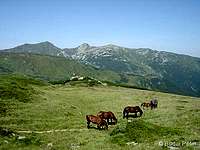
![Horses in Rodnei Mountains]() soon after leaving Şaua Între Izvoare soon after leaving Şaua Între Izvoare |
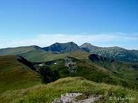
From Şaua Între Izvoare the trail levels in the side of Vf. Negoiasa Mare (2041m). This place offers another nice view on Pietrosu and Buhăescu Mare.
After leaving Negoiasa Mare, the trail moderately ascends to Tarniţa Bârsanului (1970m) and further to Şaua Puzdrelor (Puzdra pass, cca. 2030m).
Here you can take short (but steep) side-tours to the two highpoints of the central ridge region: Vf. Puzdrelor (2189m) and Vf. Laptelui Mare (2172m). |
![Vf. Negoiasa Mare]() looking back on Vf. Negoiasa Mare looking back on Vf. Negoiasa Mare |
![West panorama from Laptelui Mare]() looking west (down to Şaua Puzdrelor pass) from Vf. Laptelui Mare
looking west (down to Şaua Puzdrelor pass) from Vf. Laptelui Mare
![East view from Laptelui Mare]() looking east from Vf. Laptelui Mare towards Vf. Gărgalău looking east from Vf. Laptelui Mare towards Vf. Gărgalău |
The trail itself continues towards Şaua Laptelui (cca. 1930m). Poorly marked blue dot leads down to the ruins of Cabana Puzdrele and further to Staţiunea Borşa (not recommended due to high chances of getting lost).
From Şaua Laptelui the trail climbs up to Vf. Galaţului (2048m), then descends to Şaua Galaţului (1882m, blue triangle to Cabana Puzdrele).
Here it joins a cart road, which passes by a small lake (L. Cailor) and little later a small spring. The area by this spring is desigated camping place. |
![Ideal campsite]() the spring by the campsite near Şaua Galaţului the spring by the campsite near Şaua Galaţului |
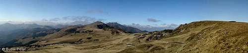
![Smooth ridge]() west view from Şaua Gărgalău pass
west view from Şaua Gărgalău pass
![View to the west from Gărgalău saddle]() at Şaua Gărgalău at Şaua Gărgalău |
From the spring, the trail heads for Şaua Gărgalău (1907m), leaving the Pietrosu massif and entering the Ineu massif. Two side-trails leave the main ridge trail at this saddle:
- blue stripe north to Poiana Ştiol, from where you can take red triangle to Cascada Cailor /Lóhavasi-vízesés/ (waterfall, designated camping place) and further to Staţiunea Borşa
- blue cross (continuation of the cart road) south to Anieş /Dombhátfürdõ/ village (24km)
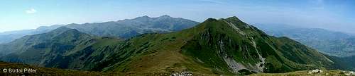
The main ridge trail continues southeast as a simple footpath again, and climbs up to Vf. Gărgalău (2159m). |
![The central part of the main ridge]() west view from Vf. Gărgalău west view from Vf. Gărgalău |
![West view from Vf. Omului]() on the top of Vf. Omului on the top of Vf. Omului |
From Gărgalău, the trail follows the ridge southwards through Vf. Clăii (2121m) and turns back to eastern direction just below Vf. Omului (2134m - worth to take a few steps up to check out the peak).
The "roller-coaster" goes on along the asymmetric ridge: Şaua Cişa (1950m) - Vf. Cişa (2036m) - Tarniţa Lui Putredu (1960m, poorly marked blue triangle takes south to Valea Vinului /Radnaborberek/) - Vf. Coasta Neteadă (2060m) - Şaua Putredă (cca. 2000m) - Şaua Ineului (2223m). |
![On the ridge trail towards Ineu]() en route from Vf. Omului to Vf. Ineu en route from Vf. Omului to Vf. Ineu |
From here you can go up to Vf. Ineu (2279m) or get around it in level, through Şaua cu Lac (2140m) to Şaua Ineuţului (cca. 2100m).
- from Şaua cu Lac blue dot south to Salvamont Curatel refuge and further to Rodna or Valea Vinului via red triangle
- from Şaua Ineuţului blue dot north to nearby Lala Mică lake (designated camping place with spring along the trail) and further all the way down to Gura Lalei)
From Şaua Ineuţului the main ridge trail climbs up Vf. Ineuţ (2222m) and continues east on red stripe towards Pasul Rotunda.
- from Vf. Ineuţ you can descend south on the blue cross to Şanţ via Valea Blaznei
|
![Fluffy vegetation]() Lala Mică lake - campsite Lala Mică lake - campsite |
![East panorama from Vf. Ineu]() View towards the the final part of the main ridge from Vf. Ineu
View towards the the final part of the main ridge from Vf. Ineu![Lala Mica]() Lala Mică Lake - somewhat below the main ridge
Lala Mică Lake - somewhat below the main ridgePart 3: Vf. Ineuţ (2222m) - Pasul Rotunda (1271m)
In this final section, the trail descends to Şaua Gajei (1721m) where it merges into a cart road, which leads all the way down to Pasul Rotunda. There is an almost-parallel trail, descending in the Lala Valley, situated north from the main ridge (this trail ends at Gura Lalei, north from Pasul Rotunda).
![Lala Mare]() Lala Mare Lake (photographed from the valley-trail)
Lala Mare Lake (photographed from the valley-trail)![Valea Lala]() In the Lala Valley (photographed from the valley-trail)
In the Lala Valley (photographed from the valley-trail)![Pasul Rotunda]() The eastern endpoint of the main ridge: Pasul Rotunda
The eastern endpoint of the main ridge: Pasul Rotunda
Overview Image Map
The image map below gives an overview about the marked trails of Rodnei Mountains. Red line indicates the main ridge route, yellow lines indicate all other routes. Bold black lines denote main asphalted roads (the one dotted section is the unpaved portion of road 17D). Further key to symbols - blue triangles: mountain peaks - green pentagons: settlements - red dots: huts - white dots: designated campsites - blue squares: pensions (note that there are a lot more around, i.e.: in Borşa town or in Complex Turistic Borşa) Some featured points are clickable - these contain links to subsequent webpages (both SP and external).
![]()
My Personal Experience
I have been on the middle portion of the trail ("Part 2" in the description above), which I think is the most exciting. Both ends of this section can be approached more easily with train/bus than the main ridge route endpoints. Also, since Vf. Pietrosu, the highest peak of the range (and thus, a "must-visit"), is located on a side-ridge along the blue stripe (which connects Borşa with Tarniţa La Cruce), it is very straightforward to start or finish the hike in Borşa and stay overnight at the meteo station campsite (1760m), just below the northern face of Pietrosu. The image below shows the transect of the path I have taken. Optionally, in case of bad weather or emergency, you can also leave the main ridge at Şaua Gărgalău towards (the ruins of) Cabana Puzdrele or Cascada Cailor to the nearest settlement: Staţiunea Borşa). Southern "escapes", except for the one from Vf. Ineuţ to Şanţ, are rather long (and most of them poorly marked, hence not mentioned here - for these please refer to Rodnei Mountains parent page).
![Borsa > Rodna trail transect]() Borşa > Rodna trail transect (enlarge for better resolution)
Borşa > Rodna trail transect (enlarge for better resolution)
Weather Conditions
The best season for a "ridge ride" is (late) summer. In wintertime, the middle section can be uncomfortable at certain points, full winter gear and good orientation is needed. Wind is frequent and can be quite strong, especially on the ridge. Annual mean temperature at about 2000m is 0C°. Most precipitation is in the summer. Actual weather situation for Borşa (north side) and Şanţ (south side) can be seen below (idea borrowed from Nanuls). Please note that these are data for towns/villages at the feet of the mountains, they're good to get a general feeling of what's around. In the high regions the situation may be quite different.
The data of the meteo station by the Iezer Lake (on 1786 m) is available online here (on the right side of the page, under "IEZER"). This is the direct "high-altitude" situation in the north side of Pietrosu.
Essential Gear
Tent, food, cooking set definitely. Rain and windproof stuff can be useful. Bag for trash is a must. And don't forget to take your camera, so that you can upload here some new pics :)
Maps
- The 1:50,000 map of Rodnei Mountains by Dimap (with guiding text on the backside in English, Romanian and Hungarian) can be ordered online from Dimap here (8 €)
- An interactive online map can be found here
- An overview map of Rodnei Mountains in black&white can be found online here, however this is insufficient on the terrain
Miscellaneuous
Shepherd dogs Flocks of sheep are frequent in the Rodnei Mountains, especially around the passes. While sheep are not dangerous, care must be taken with the aggressive shepherd dogs whose role is to keep bears away from the sheep. Direct approach of the flock is not advisable, it's better to get around them in a proper distance, without stopping. Traditional lifestyle In the Rodnei Mountains you can still find many people living according to their ancestors' tradition. Sometimes you might have the feeling of traveling back in time, meeting your own ancestors...
Description
This is my backyard page for pre-publishment stage works. In other words, PERMANENTLY UNDER CONSTRUCTION!!! :) Please do not vote on it.
![Zemplén Mountains]() Zemplén Mountains
Zemplén MountainsHigh Tatras
Biography of Dávid Frölich with his experiences in the High Tatras at the bottom of p176 and several other interesting non mountain-related things... A Magas-Tátra feltárása Zamkovského chata
Salvamont info
General emergency number: 112 National dispatcher: 0-SALVAMONT (0725-826668) Salvamont Bihor | salvamontbihor(at)yahoo.com | 0359-436022 Salvamont Mureş | salvamont(at)cjmures.ro | 0729-988844 Salvamont Gheorgheni | 0724-212586 Salvamont Sibiu A list - not known how up-to-date
Egyebek

OLD (2016) CARPATHIANS Overview
| Karpaty - Munţii Carpaţi - Kárpátok - Карпати - Karpaten |
![The Carpathians and their neighbors]() Carpathians in the Center - the Big Five - subregions we have identified. The neighborhood: Alps to the West, Dinarides (SW – across Great Hungarian Plain), Balkans (S), Sudetes (NW). Carpathians in the Center - the Big Five - subregions we have identified. The neighborhood: Alps to the West, Dinarides (SW – across Great Hungarian Plain), Balkans (S), Sudetes (NW). |
![Rhododendron kotschyi]() Rhododendron kotschyi - token flower of E&S Carpathians
Rhododendron kotschyi - token flower of E&S CarpathiansThe Carpathian Mountains constitute one of Europe's main mountain systems, whose characteristic arc spans some 1,500 km across, separating the Carpathian Basin from the vast lowlands of Eastern Europe. At both ends, it is cut off from the neighboring mountains – the Alps in the west, and the Stara Planina/Balkan Mountains in the south – by the Danube River (although in geologic terms the Carpathians extend a bit beyond the Danube - further discussion in the SW chapter). The Carpathians run across the political borders between half a dozen countries: the Czech Republic, Slovakia, Poland, Hungary, Ukraine and Romania. Bearing in mind the sheer size of the Carpathian mountains, we are not going to provide a plethora of information about all the ranges. Our objective is to give an overview and some clues for fellow SPers - detailed information is expected of the child pages. The existing SP pages have been attached (they vary considerably in quality), the most anticipated (IOHO) of the missing pages have been highlighted in bold print in the tables. With this page, we would like to challenge other SP'ers and hope to see more SP pages about the most beautiful segments of the Carpathian Mountains.
![Geological map of the Carpathians]() Geological map of the Carpathian Basin - 1922
Geological map of the Carpathian Basin - 1922Geology and Physiography
The Carpathians presented here have been split into five groups: Northwestern, Northeastern, Eastern, Southern (Northeastern and Eastern Carpathians are often classified as one region named the East Carpathians), and finally the Southwestern Carpathians. The Carpathians are typically composed of three lithologic belts: the outer flysch belt (of relatively hard sandstone and soft shale), which is usually broad but low; the central crystalline (i.e. metamorphic/granitoid) belt, which contains nearly all of the highest ranges; and the inner volcanic belt (usually low). This pattern is best displayed in the Northwestern Carpathians, and also in the Eastern Carpathians. The crystalline chain is very poorly exposed in the relatively low Northeastern Carpathians (only a couple of crystalline mountains of Marmarosh break through the sedimentary cover). Also, the make-up of the Southern Carpathians, which are almost exclusively composed of crystalline blocks, is different.
![Obidza Waterfall]() Flysch belt binds Carpathians (Beskid Sądecki Mts)
Flysch belt binds Carpathians (Beskid Sądecki Mts)Within the Carpathians, the eastern sibling of the Alps, there are many blocks whose rocks were (trans-)formed by orogenic cycles older than the Alpine orogeny. Some of those blocks, e.g. the Rodnei Mountains constitute well-preserved pre-Mesozoic orogens, i.e. mountains last folded during the Hercynian (Variscan) or older cycles. Generally, what is now metamorphic rocks used to be pre-Mesozoic sediments (e.g. flysch or limestone) which were altered - mostly through contact with magma – in the late Paleozoic. The metamorphic rocks (usually gneiss and schists) along with the granitoid rocks (magma that has set) form the so-called crystalline cores of numerous ranges on the inner side of the flysch belt. These crystalline blocks are – to varying extent – covered by Mesozoic limestone, especially on the flanks, since prolonged erosion has usually removed the limestone from the central part of the range.
![View to the west from Gărgalău saddle]() Ancient orogen of Rodnei Mountains
Ancient orogen of Rodnei MountainsHowever, regardless of how old the rocks are, the geomorphology of the Carpathians was virtually determined by the Alpine (Tertiary) mountain-building cycle, which: 1)folded vast areas of limestone and flysch deposited in the post-Paleozoic seas that covered most of what is now the Carpathians 2)uplifted a number of old, crystalline blocks along fault lines (cracks in the Earth's crust) 3)towards the end of the Tertiary, was completed with eruptions of lava inside the Carpathian arc In contrast to the Alps, limestone nappes (i.e. huge folds) are neither well developed nor well preserved. In the Carpathians, it is flysch which plays their part. Limestone (or more precisely calcareous rocks - limestone and dolomite - white triangles on our maps) occurs mainly on the sides of the crystalline massifs. Limestone 'splinters' can also be found immersed in the flysch. But like elsewhere the outcrops of calcareous rocks, especially mid-Mesozoic (Jurassic), often boast precipitous bluffs and crags, narrow gorges or caves. At present there aren't any glaciers left in the Carpathians, although the highest ranges did undergo intensive glacial activity in the Ice Age. As a result, their relief is bold and they are dotted by cirques and blue tarns, which makes for spectacular scenery. (A virtual NW to E to S to SW Carpathian traverse above the tree line is possible on SP by clicking here.)
|
|
![Calm before the storm]() Granite and Tarns Granite and Tarns |
![Magosfa (Tátralátó)]() Volcanoes Inside Volcanoes Inside |
In the following chapters, we will aim to list all particular ranges of each part of the Carpathian Big Five in a separate table, split into columns according to the dominant rock type. Below each table, you will find a list of the most attractive limestone areas.
Babel of Toponyms
![On the ridge]() Romanian shepherds (cioban, pronounced chobbun) in Făgăraş Mountains
Romanian shepherds (cioban, pronounced chobbun) in Făgăraş MountainsThe Carpathians have always been inhabited by a handful of peoples. In recent centuries, among those nations are the Czechs, Slovaks, Poles, Ukrainians, Romanians, Hungarians and Germans (Saxons). Hence, for most of the Carpathian ranges and sub-ranges there are names in several languages. Since including all the names in each of the languages would make the tables too crowded, we will normally use the name in the language of the country whose territory a particular area is part of at the present time (most of the Carpathians lies in Slovakia, Ukraine and Romania today), with some exceptions (when an English name is commonly used or when the translation brings out the meaning, and occasionally when local ethnic proportions justify it). However, we believe it would be appropriate to list all the different names on subsequent area and mountain pages. A dictionary of toponyms has been initiated for this purpose. Also, a little Carpathian Picture Dictionary, which lists about 150 words in eight languages, is available on SP.
Wilderness
![the bear]() Brown bear in theCarpathian Bend Brown bear in theCarpathian Bend |
| Per 100 sq km of Woodland |
Romania |
Slovakia |
Slovenia(top non-Carpathian) |
|
|
| 7 (3.5?) |
| 3 |
| <center6 to 5</center |
|
|
|
|
The Carpathians cannot compete with the Alps in height, but they are one of the few remaining areas in Europe that boast true wilderness. The Northwestern Carpathians are the most touristy. Especially the High Tatras, where the custom of hiking and mountaineering dates all the way back to the 16th century, are packed with visitors in summertime. However, some of the mountain ranges just south of the Tatra Mountains, such as parts of the Low Tatras and Greater Fatra, resemble the remote corners of Transylvania, where you can easily find solitude in the mountains.
The Carpathians are home to various endangered and endemic species of plants and animals, including Europe's second largest (after Russia) brown bear population, especially strong in the Carpathian Bend. According to officials, there are five to six thousand brown bears in Romania although many ecologists claim half of the bears have been shot down over the past two decades. If you are seeking an adventure package which encompasses crossing the bear country, the Carpathians by all means have it on offer. Check out the following link, full of information on the Carpathian bear, including detailed safety advice: for starters. Here is a map of the major protected areas.
![Chamois family]() Carpathian chamois Carpathian chamois |
![Marmot]() High Tatra Marmot High Tatra Marmot |
![the flower 3]() Pink: Dianthus callizonus Pink: Dianthus callizonus |
![Fire Salamander of Devil s Rock]() Fire salamander Fire salamander |
![Black Stork of the Dunajec]() Black stork Black stork |
![Rosalia longicorn (<i>Rosalia alpina</i>)]() Rosalia longicorn Rosalia longicorn |
OLD Northwestern Carpathians
The widest and most complex part of the Carpathians, stretching from the Danube River at Devín to the valley of the Topľa River, inside which rises the highest range of all in the Carpathian Mountains: the High Tatras (highest point: Gerlachovský štít, 2655 m). The table below lists the member ranges of the group from west to east, sorted by the dominant rock type, in the following format: mountain range - highest peak - elevation (in meters). Information about limestone areas is to be found below the map and the following table. An SP album Polish and Slovakian Carpathians houses a large number of photos from the area.
| Flysch belt |
Crystalline belt |
Volcanic belt |
Northern chain
| Moravskoslezské Beskydy * |
Lysá hora |
1323 |
| Beskid Śląski * |
Skrzyczne |
1257 |
| Beskid Mały * |
Czupel |
933 |
| Beskid Makowski * |
Lubomir |
904 |
| Beskid Wyspowy * |
Mogielica |
1170 |
| White Carpathians |
Veľká Javorina |
970 |
| Javorníky Mts. |
Veľký Javorník |
1071 |
| High Beskid * |
Babia Góra |
1725 |
| Gorce * |
Turbacz |
1310 |
| Beskid Sądecki * |
Radziejowa |
1262 |
| Čergov |
Minčol |
1157 |
| Oravská Magura |
Minčol |
1394 |
| Skorušinské vrchy &Pogórze Gubałowskie |
Skorušina |
1314 |
| Spišská Magura |
Repisko |
1259 |
| Levočské vrchy |
Čierna hora |
1289 |
Ranges marked with * make up the Western Beskids group.The High Beskid Mountains, straddling the Poland-Slovakia border, are called Beskid Żywiecki in Poland and Kysucké a Oravské Beskydy in Slovakia. |
Outer chain
Inner chain
Central (SE) massifs
| Veporské vrchy |
Fabova hoľa |
1438 |
| Stolické vrchy |
Stolica |
1476 |
| Volovské vrchy |
Volovec |
1284 |
The Western Tatras (mostly metamorphic rocks and limestone) and the High Tatras (granite) are in fact one range.The central massifs are often grouped together as Slovenské rudohorie or Spišsko-gemerské rudohorie (Slovak / Spiš-Gemer Ore Mountains) |
Central (Slovakian) massifs
| Vtáčnik |
Vtáčnik |
1345 |
| Štiavnické vrchy |
Sitno |
1009 |
| Kremnické vrchy |
Flochová |
1317 |
| Javorie-Ostrôžky |
Lažtek |
1044 |
| Poľana |
Poľana |
1458 |
| Slanské vrchy |
Šimonka |
1092 |
| Zempléni-hegység |
Nagy-Milic |
894 |
Slanské and Zemplén Mountains actually make up a single range, cut in half by the political border between Slovakia and Hungary - hence the two names. The complete range is also referred to sometimes as Eperjes-Tokaj Mountains, after the two towns on its two ends (the Slovak name of Eperjes is Prešov). However, the traditional name of the range was Sátor (Tent) Mountains, after the shape of its mountains. |
![High Tatras]() Vysoké Tatry /High Tatras/ from Nízké Tatry /Low Tatras/ - autumn
Vysoké Tatry /High Tatras/ from Nízké Tatry /Low Tatras/ - autumn
![Babia Gora 1725m]() Babia Góra, highest point of the Western Beskids Babia Góra, highest point of the Western Beskids |
![Nizke Tatry - Dumbier summit]() Ďumbier /Ginger/, highest summit in the Low Tatras Ďumbier /Ginger/, highest summit in the Low Tatras |
![Vadálló kövek]() Vadálló-kövek in the Visegrád Mountains Vadálló-kövek in the Visegrád Mountains |
The most distinct limestone blocks in the north:
- Belianské Tatry (Havran, 2152 m) - the distinct limestone/dolomite ridge adjoining the High Tatras, along with which it's often classified as the Eastern Tatras
- Pieniny (Wysoka, 1052 m) - see also the SP photo album about Pieniny - the most outstanding group of the limestone rocks scattered along the inner rim of the flysch belt (nice crags also stick out of flysch within the Orava-Podhale basin and in the White Carpathians), right opposite the outer edge of the crystalline belt
- Chočské vrchy (Veľký Choč, 1611 m) - a link between the Western Tatras and the two Fatras
- Súľovské skaly (Veľký Manín, 891 m) - plenty of rock towers made of limestone conglomerate, at the northern end of the Strážovské vrchy
Limestone plateaus and canyon lands on the peripheries of the Slovenské rudohorie:
- Spišsko-gemerský kras - consisting of two distinct parts:- Muránska planina (Kľak, 1409 m)- Slovenský raj (Ondrejisko, 1270 m)
- Gömör-Torna karst - cut in half by the political border between Slovakia and Hungary:- northern part: Slovak karst (Matesova skala, 925 m) - see SP page Zadielská Dolina- southern part: Aggtelek karst (Fertős-tető, 604 m).
- Bükk (Istállós-kő - 959 m) - inside the Carpathian Arc, within the Hungarian volcanic belt, which runs toward Lake Balaton
![Sulov breathtaking...]() Súľov Rocks in the Strážovské vrchy Súľov Rocks in the Strážovské vrchy |
![View of Rozsutec from Stefanowa]() Veľký Rozsutecin the Little Fatra Veľký Rozsutecin the Little Fatra |
![View from Velky Choc summit....]() Veľký Choč Veľký Choč |
![Belian Tatras]() Belianské Tatry - autumn
Belianské Tatry - autumnOLD Northeastern Carpathians
The lowest group of the Carpathians, located at the NE reaches of the Pannonian basin, forms a stout flysch bridge between the old orogens of the Northwestern Carpathians and those of the Eastern Carpathians. The topography of the Northeastern Carpathians is rather monotonous. The outer belt of flysch is accompanied by an inner belt of Tertiary volcanoes. The elevation of the mountains and passes generally increases toward the southeast to finally culminate in the highest summits of the Chornohora Range (Black Mountains) and the Marmarosh Mountains, but the highest point hardly exceeds 2000 m. Most of the other ranges generally rise within the 1000-1500 m bracket. The borders of this quarter of the Carpathians are drawn somewhat arbitrarily: usually the valley of the Topľa River in the NW and Prislop/Borşa pass in the SE. In the tables below, the member ranges of the NE Carpathians have been listed from northwest to southeast, sorted by rock type; in the following format: mountain range - highest peak - elevation (in meters). The divisions and names of the subgroups within the sandstone chain are plenty and confusing. A case in point can be the borderline between the Eastern Beskids and the Marmarosh Mts., which has completely different versions: 1) Użocka/Uzhots'kyi pass at the Polish/Ukrainian border, 2) Verets'kyi pass, 3) the source of Bela Tysa (White Tisa) River by the Ukrainian/Romanian border. Here we have used the last one, as it is the most commonly applied today.
| Sandstone (flysch) belt |
Volcanic belt |
| Central / Low Beskidbetween the Topľa River and Lupkovský/Łupków pass, in Poland known as Beskid Niski, in Slovakia as Ondavské vrchy |
Bušov |
1002 |
| Eastern Beskyds (a.k.a. Ukrainian Carpathians)usually split into two subgroups: the Polonyna Ridge and the Wooded Beskyds/Carpathians - details in a separate table below |
Hoverla |
2061 |
| Marmarosh Mountainsthe most complex and unique of all the mountains in the Northeastern Carpathians, in geological and geomorphological terms - more info below this table |
Farcău |
1956 |
| Bukovina Carpathiansa group of parallel ranges within the borders of the historic Bukovina (now in Ukraine and Romania):UA - Mountains of Northeastern Bukovyna (Lungul, 1377), Putyls'ki Hory (Yarovytsia, 1575)RO - Obcina Mestecăniş (Ţapul Mare, 1661), Obcina Feredeu (Veju Mare, 1494) and Obcina Mare (Skoruşet, 1223) |
Ţapul Mare |
1661 |
|
| Vihorlatské vrchy |
Vihorlat |
1076 |
| Makovytsia-Synyak |
Dunauka |
1019 |
| Velykyi Dil |
Buzhora |
1085 |
| Tupyi Mts. |
Tupij |
878 |
| Munţii Oaş |
Piatra Vâscului |
917 |
| Creasta Pietrii |
Igniş |
1307 |
| Munţii Gutâi |
Gutâiul Mare |
1445 |
| Munţii Lăpuş |
Văratec |
1348 |
| Munţii Ţibleş |
Bran |
1840 |
Sometimes the Oaş and Lăpuş Mountains, along with Creasta Pietrii, are incorporated into the Gutâi Mountains. |
![Pearl of the Chornohora]() Chornohora Chornohora |
![Maramures seen from Chornohora]() Marmarosh from Chornohora Marmarosh from Chornohora |
![His majesty]() Marmarosh Mts Marmarosh Mts |
![Mount Cergowa ( 716 m )]() Low Beskid Low Beskid |
![Bukovina Carpathians - Obcina Mestecanis]() Obcina Mestecăniş Obcina Mestecăniş |
![Gutai]() Gutâi Mountains Gutâi Mountains |
![Cearcănul]() Cearcănul (Sárkány)
Cearcănul (Sárkány)To demonstrate the complexity of the Marmarosh Mountains, it should suffice to list their highest peaks along with the rocks they are composed of:
- Pop Ivan (1937 m) - Precambrian gneiss, one of the oldest rocks in the Carpathians
- Farcău (1956 m) - submarine basalt
- Mihailecu (1920 m) - alternate beds of limestone and basalt, folded and set vertically
- Toroiaga (1930 m) - andesite (lava intrusion)
The above peaks once comprised the main ridge of the Marmarosh Mountains, which has been cut by headward erosion of the tributaries of the Vişeu (Vyshov) river. (This part of the Carpathians - in contrast to the NW Carpathians - is still being lifted relatively quickly.) Therefore most of today's main ridge is a much lower, mostly flysch ridge (its central part is often called the Chyvchyn Mts), and the isolated, non-flysch, highest summits of the Marmarosh stand alone and tall. This interesting geomorphology is enhanced by traces of little glaciers of the Ice Age. The highest range of the Bukovina Carpathians (Obcina Mestecăniş) is geologically similarly patchworked, although it is less prominent.
![Maramureş Mountains]() Marmarosh Mountains viewed from the Rodnei Mountains - summer
Marmarosh Mountains viewed from the Rodnei Mountains - summerAs to the Eastern Beskids / Ukrainian Carpathians, the various divisions, names (Ukrainian/Polish/Rusyn) and elevations found on the maps and in the guidebooks can be perplexing. In the table below, we have aimed to provide an accurate and reasonably comprehensive list. Providing you are able to decipher Cyrillic, you can also enjoy these excellent maps.
| Wooded Beskyds / Wooded Carpathians(In Polish: Beskidy Lesiste. In Ukraine, the term Beskydy is not normally used for any mountains east of Toruns'kyi/Vyshkovskyi Pass.) |
Polonyna Ridge(Polonyns'kyj chrebet) |
| Western Bieszczady (Polish: Bieszczady Zachodnie)between Lupkovský/Łupkowska and Użocka/Uzhots'kyi pass |
Tarnica |
1346 |
| Eastern Bieszczady (Polish: Bieszczady Wschodnie)or Skolivs'ki Beskydyseveral parallel ridges between Użocka/Uzhots'kyi and Toruns'kyi/Vyshkovskyi pass |
Pikui |
1405 |
| Gorgany (Horhany)SE of the Bieszczady/Skolivs'ki Beskydy as far as the Prut river |
Syvulia |
1836 |
| Pokuts'ki Karpaty between the Prut and the Cheremosh rivers |
Rotylo |
1483 |
|
| Polonyna-Runa (Rivna) |
Runa/Rivna |
1480 |
| Polonyna Borzhava |
Stiy (Stohy) |
1682 |
| Polonyna Krasna |
Syhlianskyi |
1564 |
| Svydovets' |
Blyznytsia |
1881 |
| Chornohora |
Hoverla |
2061 |
| Hryniavs'ki Hory |
Pohreptyna / Polonyna Myhailova |
1605 |
|
Issues that complicate the situation:
- The SW part of the Western Bieszczady lies in Slovakia, where it is known as Bukovské vrchy.
- The NE threshold of the Bieszczady is named the Sanok-Turka Mts (Polish: Góry Sanocko-Turczańskie - Magura Łomniańska, 1022) or the Upper Dniester Beskyds (Ukrainian: Verkhnio-Dnistrovs'ki Beskydy).
- In Ukraine, the term Eastern Beskydy is used for the parts of both the Western and the Eastern Bieszczady that lie north-east of the main ridge. What Poles call Beskidy Skolskie (Parashka, 1269) is the northeasternmost range of the Eastern Bieszczady.
![The Sun of Bieszczady]() Western Bieszczady Western Bieszczady |
![Mt.Starostyna - Eastern Bieszczady]() Eastern Bieszczady Eastern Bieszczady |
![Mount Syvula - Gorgany mtns.]() Gorgany Gorgany |
![Three polonynas]() Toward Polonyna Runa Toward Polonyna Runa |
![Karst arch]() Polonyna Krasna Polonyna Krasna |
![Sunrise viewed from Svydovets]() Svydovets Svydovets |
OLD Eastern Carpathians
![Ferdinand ;)]() Face to face
Face to faceThe Eastern Carpathians run southwardly from Prislop/Borşa and the valley of the Bistriţa Aurie at least as far as Predeal Pass, beyond which rises the dramatic wall of the Bucegi Mountains towering over the Prahova Valley. If more attention is drawn to the rock type than to the topography, the west frontier of the Eastern Carpathians will have to be pushed farther west and the most logical border line will be Giuvala Pass (Bran-Rucar corridor). If you have read the previous chapters, you will not be surprised that we have opted for the latter division line. The location of the highest point of the Eastern Carpathians depends on the answer to the question where the southwestern reaches of these mountains are. Having decided on Giuvala Pass, we have to look towards the Bucegi Mountains and point to their highest summit Omu, 2509 m. Had we opted for Predeal Pass and the Prahova Valley, it would be the highest peak of the Rodnei Mountains (Pietrosu Mare, 2303 m). Except for these two ranges, most of the other mountains in this part of the Carpathians reach elevations from 1500 to 2000 m. In the Eastern Carpathians, all the three lithologic belts characteristic of the Northwestern Carpathians get exposed again. The volcanic range is of great importance and boasts the highest volcanic massifs across the Carpathians. The flysch belt is well developed, as wide as the flysch belt of the Northeastern Carpathians but - especially on the Transylvanian side - differs from the typical Carpathian flysch in that it contains large amounts of calcium. As a result, several ranges of the Eastern Carpathians show off scenic, bizarre, mighty rock formations of calcareous conglomerate (or arenaceous, i.e. sandy, limestone). The table below lists member ranges of the Eastern Carpathians from north to south, sorted by rock type, in the following format: mountain range - highest peak - elevation (in meters).
| Flysch belt |
Crystalline belt |
Volcanic belt |
We have split the great number of mountain ranges within this group into these two (subsequent ranges are listed in a separate table below):
- Moldovan-Transylvanian subgroup
- Carpathian Bend subgroup
The term Carpathian Bend, (Romanian: Carpaţii Curburii; Hungarian: Kárpátkanyar) is in widespread use for the mountains between Oituz pass and Giuvala pass, where the great Carpathian arc takes a sharp turn (from N-S to E-W). |
|
| Munţii Rodnei |
Pietrosu |
2303 |
| Munţii Suhard |
Omului |
1932 |
| Munţii Giumalău-Rarău |
Giumalău |
1856 |
| Munţii Bârgău |
Heniul Mare |
1612 |
| Munţii Bistriţei |
Budacu |
1859 |
| Munţii Giurgeu |
Şipoş |
1576 |
| Munţii Perşani |
Măgura Codlei |
1292 |
| Munţii Ciucului |
Noşcolat |
1553 |
| Munţii Leaota |
Leaota |
2133 |
The Perşani Mountains are geologically complex and display sedimentary and volcanic rocks as well as crystalline rocks.The southern part of Munţii Ciucului consists of sedimentary rocks. |
| Munţii Căliman |
Pietrosu |
2102 |
| Munţii Gurghiului |
Saca Mare |
1777 |
| Munţii Harghita |
Harghita-Mădăraş |
1800 |
| Ciomat |
Ciomatul Mare |
1301 |
Ciomat is a relatively small volcanic block situated on the periphery of the flysch Bodoc Mts., but geologically related to the Harghita Mts.Ciomat is the youngest and best preserved volcano of the group, cradling the beautiful Szent-Anna Lake in its main crater. There is still intensive post-volcanic activity in the area.SP photo album about Ciomat |
![Pietrosu and Grohotu]() Rodnei Mountains (Vf. Pietrosu) - highest crystalline
Rodnei Mountains (Vf. Pietrosu) - highest crystalline
![Lake St. Anna]() Ciomat Mountains Ciomat Mountains |
![Dripping Stone , Transylvania]() Gurghiului Mts Gurghiului Mts |
![Leaota]() Leaota Mts Leaota Mts |
![Calimani]() Călimani Mts - highest volcano
Călimani Mts - highest volcanoRanges of the flysch belt in detail:
| Moldovan-Transylvanian subgroup |
Carpathian Bend subgroup |
Moldovan ranges
| Munţii Stânişoarei |
Bivolul |
1530 |
| Ceahlău * |
Ocolaşul Mare |
1907 |
| Munţii Goşman |
Cracul Geamăna |
1442 |
| Munţii Tarcăului |
Grinduşul |
1664 |
| Munţii Nemira |
Nemira Mare |
1649 |
| Munţii Ciucului (S) |
Şoiul Mare |
1553 |
| Munţii Bodoc |
Cărpiniş |
1241 |
| Munţii Baraolt |
Gurgău |
1017 |
The northern part of Munţii Ciucului consists of crystalline rocks. |
| Munţii Vrancei |
Goru |
1783 |
| Munţii Penteleu |
Penteleu |
1772 |
| Podu Calului |
Podul Calului |
1440 |
| Munţii Siriu |
Siriu/Bocârne |
1657 |
| Munţii Ciucaş * |
Ciucaş |
1954 |
| Munţii Grohotiş |
Grohotiş |
1767 |
| Munţii Baiului (Gârbova) |
Neamţului |
1923 |
| Munţii Bucegi * |
Omu |
2507 |
The Ciucaş, Baiului, Grohotiş and Bârsei (mostly limestone, see below) mountains are often grouped together as Munţii Braşovului. Likewise, the Penteleu, Podu Calului and Siriu mountains (along with the small Întorsurii and Ivăneţu mountains, which are neglected here) are often grouped together as Munţii Buzăului. |
Ranges marked with an asterisk (*) in the above table are composed mostly of calcareous conglomerates (and arenaceous limestone) and boast scenic rock formations.
Spectacular limestone ranges and blocks:
- Rarău in the Giumalău-Rarău Mountains (Rarău, 1651 m)
- Munţii Hăşmaş (Hăşmaşul Mare, 1793 m) - featuring Egyeskő/Piatra Singuratică, Oltár-kő/Piatra Altarului, Fekete-Hagymás/Hăghimaşul Negru, the breathtaking Békás/Bicaz gorge, and Gyilkos-tó/Lacul Roşu (a lake created by a 19th century landslide blocking a stream)
- Vargyas (Vârghiş) gorge and Măgura Codlei in the Perşani Mountains
- Bârsei Mountains - consisting of two distinct massifs: Postavarul (Cristianul Mare, 1804 m) and Piatra Mare (Piatra Mare, 1843 m)
OLD Southern Carpathians
The Southern Carpathians (also known as the
Transylvanian Alps) extend from the
Mountains of Banat in the west to
Giuvala Pass, or - according to a diverse vision -
Predeal Pass in the east, where the mountain system meets the Eastern Carpathians. If the latter endpoint is assumed, the
Bucegi and
Leaota mountains, which we have included in the Eastern Carpathians, belong to the Southern Carpathians.
![The Iezer-Papusa mt.., the hihghest summit ( 2391 m), in the center]() Iezer-Papuşa - winter
Iezer-Papuşa - winter
The Southern Carpathians differ from the Northwestern, Northeastern and Eastern Carpathians in that both flysch and volcanic belts are completely missing from them. These mountains are the most elevated, southern edge of the ancient
Tisa-Dacia platform. They contain about a dozen ranges that exceed 2000 m in elevation, including eight ranges rising above 2200 m - more than the other parts of the Carpathian Mountains altogether. However, many of the high ranges of the Southern Carpathians are rather monotonous. The ridges, usually of metamorphic schists and gneiss, are generally broad and constitute remnants of a Tertiary plain - best preserved and easily recognizable in the
Godeanu mountains - lifted high, deeply cut by the rivers and since time immemorial used as pastureland. These natural meadows have been extended by clearing the bushes of the mountain pine above the tree line, which may also have been lowered; especially on the less rocky, warmer, southern slopes. The bold alpine, or rather Tatra-like relief, is to be found in the
Făgăraş and the
Retezat mountains, and also in the highest part of the
Parâng. Limestone karst is fabulously developed in the southwestern, lower ranges, whereas at the east end of the Southern Carpathians stands the most spectacular limestone ridge in the Carpathian Mountains, the
Piatra Craiului (
Royal Rock), which offers plenty of climbing opportunities and shelters stunning wildlife.
![Bucura cirque panorama]() Retezat Mountains - spring
Retezat Mountains - spring
The table below lists member ranges of the Southern Carpathians from east to west, split into three major mountain groups, in the following format: mountain range -
highest peak - elevation (in meters).
| Făgăraş Group |
Parâng Group |
Retezat Group |
|
|
| Munţii Cândrel |
Cândrel |
2244 |
| Munţii Lotru |
Ştefleşti |
2242 |
| Munţii Şureanu |
lui Pătru |
2130 |
| Munţii Parâng |
Parângu Mare |
2519 |
| Munţii Căpăţânii |
Nedeia |
2130 |
|
|
![view]() Făgăraş Făgăraş |
![rocky wall of Gruiul peak (2345m)]() Parâng Parâng |
![Bucura from Pietrele valley]() Retezat Retezat |
![Muntii Sureanu]() Șureanu Șureanu |
![The Land of Serenity - Lotru mountains]() Lotru Lotru |
![Gugu (2291m)]() Godeanu Godeanu |
![Leontopodium alpinum II]() Edelweiss
Edelweiss:
- Piatra Craiului (La Om, 2238 m) - the most majestic limestone range of all in the Carpathians, whose name translates as Royal Rock
- Munţii Cozia (Cozia / Ciuha Mare, 1668 m) - on the western edge of the Făgăraş Group, across the Olt river from the limestone part of the Căpăţânii Mountains
- Buila-Vânturariţa massif (Vânturariţa I, 1885 m) - interesting, prominent dolomite ridge in the southeastern corner of the Căpăţânii Mountains
- Munţii Cernei (Dobrii, 1928 m) - southerly extension of the Godeanu Mountains
- Munţii Mehedinţi (lui Stan, 1466 m) - vast karst area dotted with caves and gorges, southwestern extension of the Vâlcan Mountains
![Karst Paradise]() Buila-Vânturariţa
Buila-Vânturariţa
![Piatra Craiului]() Piatra Craiului Piatra Craiului |
![Mount Arjana]() Cernei Mountains Cernei Mountains |
![Romania]() Mehedinţi Mehedinţi |
![South Ridge]() Piatra Craiului
Piatra CraiuluiOLD Southwestern Carpathians
![Nera s Gorges]() Nera Gorges (Aninei Mountains)
Nera Gorges (Aninei Mountains)![NERA S GORGES]() Beusnita Falls (Aninei Mountains)
Beusnita Falls (Aninei Mountains)
What we have identified as the Southwestern Carpathians consists of three separate mountain groups.
1) By the
Danube River, in the historic province of
Banat, sits the last segment of the Carpathian Arc.
The mountains of Banat and the northernmost mountains of Eastern Serbia can be seen as parts of the same mountain group - a link between the Carpathian chain and the
Balkan (Stara Planina) Mountains - split by the canyon of the Danube. In fact, there are three options for the SW end of the Carpathians: a) The gorges of the Danube, for which we have opted here. b) The Juzna (South) Morava and the Timok rivers in Serbia. c) The Timiş (Temes) and Mehadica rivers in Romania. Regardless of whereabouts the Carpathians end, the eastern border of the mountains of Banat runs straight north from the Iron Gate proper, along the tectonic fault line which determines the course of the Mehadica and Timiş rivers, between the towns of Orşova and Caranşebeş.
2) To the north-east of these mountains, north-west of the
Retezat Mountains, lies the massif of
Poiana Ruscă - for centuries heavily grazed, and more recently heavily mined for iron. Both the mountains of Banat and the Poiana Ruscă contain fairly low mountains (below 1500 m a.s.l.) and are often regarded as parts of the Southern Carpathians.
3) Finally, north of the Poiana Ruscă, across the valley of the Mureş (Maros) River, stands the largest and highest (above 1800 m) Carpathian "island" (some geological classifications exclude it from the Carpathians, however), bounded by the Pannonian Plain in the west and separated from the Carpathian Arc by the upland of Transylvania in the east. Romanian people call it
Munţii Apuseni, which translates as the Western Mountains (before World War I, they were called the
Island Mountains of Eastern Hungary, nowadays Hungarians refer to them as the
Island Mountains of Transylvania).
![Bihor Mountains]() The highest range of the Apuseni Mountains
The highest range of the Apuseni Mountains
The Southwestern Carpathians are the lowest and least forested of the five major parts of the Carpathians we have depicted on this page, each in a different chapter. What makes these mountains fascinating is the fact that they embrace vast limestone areas, including the most spectacular karst paradise of all in the Carpathians: the
Padiş Plateau in the
Bihor Mountains. Some evidence suggests that the ancient core of the
Apuseni differs from that of the Carpathian Basin and could have once been part of the Dinarides. On the flanks of the
Apuseni, besides limestone plateaus, post-Paleozoic lava (most of the
Vlădeasa Mountains) and flysch are also present. In the tables below, the member ranges of each group are listed from north to south, in the following format: mountain range -
highest peak - elevation (in meters). Ranges marked with an asterisk
(*) in the tables display
spectacular limestone karst.
| Apuseni Mountains (Western Transylvania) |
Northern group
| Pădurea Craiului * |
Hodrâncuşa |
1027 |
| Munţii Plopişului / Şes |
Măgura Mare |
918 |
| Munţii Meseş |
Măgura Priei |
996 |
| Codru Moma |
Pleşu |
1112 |
| Munţii Bihor * |
Cucurbăta Mare |
1849 |
| Vlădeasa |
Vlădeasa |
1836 |
| Munţii Gilău |
Muntele Mare |
1826 |
| Munţii Zarand |
Drocea |
836 |
| Munţii Metalliferi |
Poieniţa |
1437 |
| Munţii Trascău * |
Dâmbău |
1369 |
|
|
![Truly Transylvania]() Padiş/Pádis karst plateau Padiş/Pádis karst plateau
| Poiana Ruscă and Mountains of Banat |
| Munţii Semenic |
Semenic / Piatra Goznei |
1446 |
| Munţii Aninei * |
Leordis |
1160 |
| Munţii Almăjului |
Svinecea Mare |
1224 |
| Munţii Locvei |
Corhanul Mare |
735 |
|
|
![Eminenciás-vízesés / Cascada Evantai]() Galbena Gorge(Padiş plateau) Galbena Gorge(Padiş plateau) |
![Turnul Ascuţit (Éles-torony)]() Turda/Torda Gorge(Trascău/Torockó Mts) Turda/Torda Gorge(Trascău/Torockó Mts) |
![Rock in Cheile Rameti]() Râmeţ/Remete Gorge(Trascău/Torockó Mts) Râmeţ/Remete Gorge(Trascău/Torockó Mts) |
![Inside the caldron]() Padiş/Pádis karst world Padiş/Pádis karst world |
![Craciunesti main wall]() Munţii Metaliferi (Ore Mts) Munţii Metaliferi (Ore Mts) |
![NERA S GORGES]() Danube River at Carpathians' SW end Danube River at Carpathians' SW end |
Hiking
![Gendarmes of Retezat]() from Tău Porţii
from Tău Porţii![Bucura valley]() from Viorica lake
from Viorica lake![Hanging lake]() Agătat lake and Poarta Bucurei ridge
Agătat lake and Poarta Bucurei ridge![Slaveiului ridge]() Slaveiului ridge
Slaveiului ridge
First of all, let's mention that no marked trail leads to the summit of Judele (so, if you take the NP rules very strictly, it is not allowed to climb it). However, one of the marked trails crosses the Judele saddle, which is so near to the peak that temptation is hard to resist if you are not afraid of a little scrambling. The saddle can be approached in four possible ways:
1) Bucura Lake – Tăul Porţii - Ăgatat Lake – Şaua Judele Difficulty: difficult
Time: 1.5 - 2 h
Level rising: + 400 m
Marking: blue stripe -> yellow stripe -> red dot
2) Bucura Lake – Ana Lake - Viorica Lake - Florica Lake - Ăgatat Lake – Şaua Judele Difficulty: difficult
Time: 1 - 1.5 h
Level rising: + 400 m
Marking: red dot Routes #1 and #2 merge by the well-hidden
Ăgatat Lake, situated just below
Turnu Porţii. From here a steep ascent follows up to Judele saddle - this part of the route is usually covered with snow until summer, and can be dangerous to tackle unprepared in such conditions.
3) Zănoaga Lake - Şaua Judele Difficulty: moderate
Time: 1 - 1.5 h
Level rising: + ... m
Marking: red dot
4) Bucura Lake – “La Pintenul Slăveiului” – Creasta Slăveiului (Slaveiului ridge) – Şaua Judele Difficulty: difficult
Time: 2 - 3 h
Level rising: + 550 m
Marking: blue cross, yellow dot, red triangle -> stone marking Route #4 has unmarked parts, so the hiker must be prepared for some route finding. But this probably makes it even more interesting.
![Judele peak]() Judele from Judele saddle
Judele from Judele saddle
Once you have reached the Judele saddle, take the obvious ridge (unmarked) towards the peak. The first section is wide and comfortable. When you reach the base of the summit, it gets more exposed (see the photo on the left). The safest route is a path on the western side of the ridge (the photo on the left shows the exposed eastern face), which is occasionally marked with stone piles. Soon you will reach the summit of Judele, marked with a wooden pole.
flagging
 Piatra Craiului
  Königstein
  Királykő
Retyezat Overview Resummited
Instead of "Geography" Granite, take away the High Tatras, is not a common rock in the Carpathians at all. But the bulk of the Retezat Mountains which sit between the Parâng group in the east and the Godeanu and Ţarcu mountains in the west is of granite. Were the Retezat Mountains just two hundred meters higher, they would be most likely as jagged as the High Tatras are. Hardly rising above 2500 m, the Retezat Mountains are no doubt gentler, however, the northern walls of some of their peaks house several fine rock-climbing routes at UIAA grade V (YDS 5.8) and over, not to mention a number of routes which are less demanding but no less fun.
The Retezat Mountains have 55 peaks over 2000 m and are probably the most prominent mountainous area in the Southern Carpathians (sometimes called "Transylvanian Alps"), covering almost 500 square km. Its average elevation is over 1500 m, with a quarter of its territory rising above 1800 m (and still rising in our days, by about 3.5 mm/year). Since the Retezat Mountains were sculpted by glaciers in the Pleistocene epoch, they are rich in beautiful, turquoise tarns and tumbling waterfalls. The biggest of the glaciers gouged the pits which have filled up with water and now shine as the lakes of Bucura Cirque. That longest glacier had a length of about 15 km, thus ranking longest of all in the Southern Carpathians. Due to mechanical erosion in periglacial climatic conditions, the highest terrain is almost completely covered with granite blocks and scree. Take caution when walking over this rubble – not only because the rocks are loose but also because the trail marks are more difficult to spot (more on the marking in the Routes section).
The Retezat Mountains are made up of two parallel main ridges that run southwest to northeast and are connected by a short perpendicular ridge, thus forming a letter H. The east part of the mountains is lower than their west part. Also, the northern ridge is considerably higher than the southern ridge (Custura, 2457 m), which runs on the other side of the valleys of the Lăpuşnicul Mare and Bărbaţ rivers. Therefore it is the northwest part of the mountains - boasting the highest peaks and series of tarns (see next chapter) on both sides of the main ridge - that attracts the most visitors. The west part of the southern ridge (Piule-Iorgovanu) is mostly formed of limestone. This area, often referred to as "Little Retezat" (Retezatul Mic /Kis-Retyezát/) contains typical karst forms, such as narrow gorges and caves. The most interesting scenery can be found at a group of limestone rocks forming the summit of Piatra Iorgovanului (1997 m) in the southwest corner of the Retezat Mountains, where bears often roam at dusk or dawn. Limestone also forms the ridge of Oslea (1946 m) – the highest summit in the Vâlcan Mountains – rising south of Piatra Iorgovanului, across the Jiu de Vest River.
|
|
![After the storm]() Little Retezat Little Retezat |
![Lacul Lia]() Oslea on horizon Oslea on horizon |
2015 NE Carpathians
The lowest group of the Carpathians, located at the NE reaches of the Pannonian basin, forms a stout flysch bridge between the old orogens of the Northwestern Carpathians and those of the Eastern Carpathians. The topography of the Northeastern Carpathians is rather monotonous. The outer belt of flysch is accompanied by an inner belt of Tertiary volcanoes. The elevation of the mountains and passes generally increases toward the southeast to finally culminate in the highest summits of the Chornohora Range (Black Mountains) and the Marmarosh Mountains, but the highest point hardly exceeds 2000 m. Most of the other ranges generally rise within the 1000-1500 m bracket. The borders of this quarter of the Carpathians are drawn somewhat arbitrarily: usually the valley of the Topľa River in the NW and Prislop/Borşa pass in the SE. In the tables below, the member ranges of the NE Carpathians have been listed from northwest to southeast, sorted by rock type; in the following format: mountain range - highest peak - elevation (in meters). The divisions and names of the subgroups within the sandstone chain are plenty and confusing. A case in point can be the borderline between the Eastern Beskids and the Marmarosh Mts., which has completely different versions: 1) Użocka/Uzhots'kyi pass at the Polish/Ukrainian border, 2) Verets'kyi pass, 3) the source of Bela Tysa (White Tisa) River by the Ukrainian/Romanian border. Here we have used the last one, as it is the most commonly applied today.
| Sandstone (flysch) belt |
Volcanic belt |
| Central / Low Beskidbetween the Topľa River and Lupkovský/Łupków pass, in Poland known as Beskid Niski, in Slovakia as Ondavské vrchy |
Bušov |
1002 |
| Eastern Beskyds (a.k.a. Ukrainian Carpathians)usually split into two subgroups: the Polonyna Ridge and the Wooded Beskyds/Carpathians - details in a separate table below |
Hoverla |
2061 |
| Marmarosh Mountainsthe most complex and unique of all the mountains in the Northeastern Carpathians, in geological and geomorphological terms - more info below this table |
Farcău |
1956 |
| Bukovina Carpathiansa group of parallel ranges within the borders of the historic Bukovina (now in Ukraine and Romania):UA - Mountains of Northeastern Bukovyna (Lungul, 1377), Putyls'ki Hory (Yarovytsia, 1575)RO - Obcina Mestecăniş (Ţapul Mare, 1661), Obcina Feredeu (Veju Mare, 1494) and Obcina Mare (Skoruşet, 1223) |
Ţapul Mare |
1661 |
|
| Vihorlatské vrchy |
Vihorlat |
1076 |
| Makovytsia-Synyak |
Dunauka |
1019 |
| Velykyi Dil |
Buzhora |
1085 |
| Tupyi Mts. |
Tupij |
878 |
| Munţii Oaş |
Piatra Vâscului |
917 |
| Creasta Pietrii |
Igniş |
1307 |
| Munţii Gutâi |
Gutâiul Mare |
1445 |
| Munţii Lăpuş |
Văratec |
1348 |
| Munţii Ţibleş |
Bran |
1840 |
Sometimes the Oaş and Lăpuş Mountains, along with Creasta Pietrii, are incorporated into the Gutâi Mountains. |
![Hoverla]() Chornohora - winter Chornohora - winter |
![Pearl of the Chornohora]() Chornohora - summer Chornohora - summer |
![Cliff of Pip Ivan s corrie]() Marmarosh Mts. Marmarosh Mts. |
![Mount Cergowa ( 716 m )]() Low Beskid Low Beskid |
![Karst arch]() Polonyna Krasna - fall Polonyna Krasna - fall |
![Gutai]() Gutâi Mountains Gutâi Mountains |
![Cearcănul]() Cearcănul (Sárkány)
Cearcănul (Sárkány)To demonstrate the complexity of the Marmarosh Mountains, it should suffice to list their highest peaks along with the rocks they are composed of:
- Pop Ivan (1937 m) - Precambrian gneiss, one of the oldest rocks in the Carpathians
- Farcău (1956 m) - submarine basalt
- Mihailecu (1920 m) - alternate beds of limestone and basalt, folded and set vertically
- Toroiaga (1930 m) - andesite (lava intrusion)
The above peaks once comprised the main ridge of the Marmarosh Mountains, which has been cut by headward erosion of the tributaries of the Vişeu (Vyshov) river. (This part of the Carpathians - in contrast to the NW Carpathians - is still being lifted relatively quickly.) Therefore most of today's main ridge is a much lower, mostly flysch ridge (its central part is often called the Chyvchyn Mts), and the isolated, non-flysch, highest summits of the Marmarosh stand alone and tall. This interesting geomorphology is enhanced by traces of little glaciers of the Ice Age. The highest range of the Bukovina Carpathians (Obcina Mestecăniş) is geologically similarly patchworked, although it is less prominent.
![Maramureş Mountains]() Marmarosh Mountains viewed from the Rodnei Mountains - summer
Marmarosh Mountains viewed from the Rodnei Mountains - summerAs to the Eastern Beskids / Ukrainian Carpathians, the various divisions, names (Ukrainian/Polish/Rusyn) and elevations found on the maps and in the guidebooks can be perplexing. In the table below, we have aimed to provide an accurate and reasonably comprehensive list. Providing you are able to decipher Cyrillic, you can also enjoy these excellent maps.
| Wooded Beskyds / Wooded Carpathians(In Polish: Beskidy Lesiste. In Ukraine, the term Beskydy is not normally used for any mountains east of Toruns'kyi/Vyshkovskyi Pass.) |
Polonyna Ridge(Polonyns'kyj chrebet) |
| Western Bieszczady (Polish: Bieszczady Zachodnie)between Lupkovský/Łupkowska and Użocka/Uzhots'kyi pass |
Tarnica |
1346 |
| Eastern Bieszczady (Polish: Bieszczady Wschodnie)or Skolivs'ki Beskydyseveral parallel ridges between Użocka/Uzhots'kyi and Toruns'kyi/Vyshkovskyi pass |
Pikui |
1405 |
| Gorgany (Horhany)SE of the Bieszczady/Skolivs'ki Beskydy as far as the Prut river |
Syvulia |
1836 |
| Pokuts'ki Karpaty between the Prut and the Cheremosh rivers |
Rotylo |
1483 |
|
| Polonyna-Runa (Rivna) |
Runa/Rivna |
1480 |
| Polonyna Borzhava |
Stiy (Stohy) |
1682 |
| Polonyna Krasna |
Hropa (Gropa) |
1564 |
| Svydovets' |
Blyznytsia |
1881 |
| Chornohora |
Hoverla |
2061 |
| Hryniavs'ki Hory |
Pohreptyna / Polonyna Myhailova |
1605 |
|
Issues that complicate the situation:
- The SW part of the Western Bieszczady lies in Slovakia, where it is known as Bukovské vrchy.
- The NE threshold of the Bieszczady is named the Sanok-Turka Mts (Polish: Góry Sanocko-Turczańskie - Magura Łomniańska, 1022) or the Upper Dniester Beskyds (Ukrainian: Verkhnio-Dnistrovs'ki Beskydy).
- In Ukraine, the term Eastern Beskydy is used for the parts of both the Western and the Eastern Bieszczady that lie north-east of the main ridge. What Poles call Beskidy Skolskie (Parashka, 1269) is the northeasternmost range of the Eastern Bieszczady.
![The Sun of Bieszczady]() W Bieszczady - winter W Bieszczady - winter |
![Three polonynas]() Toward Polonyna Runa Toward Polonyna Runa |
![Sunrise viewed from Svydovets]() Svydovets' - summer Svydovets' - summer |
![View from Wyzna Pass (872 m) towards Mount Tarnica (1364 m)]() W Bieszczady - fall W Bieszczady - fall |
![Swidowiec,Ukraine]() Svydovets' - fall Svydovets' - fall |
![His majesty]() Marmarosh Mts. - summer Marmarosh Mts. - summer |
2015 E Carpathians
![Ferdinand ;)]() Face to face
Face to faceThe Eastern Carpathians run southwardly from Prislop/Borşa and the valley of the Bistriţa Aurie at least as far as Predeal Pass, beyond which rises the dramatic wall of the Bucegi Mountains towering over the Prahova Valley. If more attention is drawn to the rock type than to the topography, the west frontier of the Eastern Carpathians will have to be pushed farther west and the most logical border line will be Giuvala Pass (Bran-Rucar corridor). If you have read the previous chapters, you will not be surprised that we have opted for the latter division line. The location of the highest point of the Eastern Carpathians depends on the answer to the question where the southwestern reaches of these mountains are. Having decided on Giuvala Pass, we have to look towards the Bucegi Mountains and point to their highest summit Omu, 2509 m. Had we opted for Predeal Pass and the Prahova Valley, it would be the highest peak of the Rodnei Mountains (Pietrosu Mare, 2303 m). Except for these two ranges, most of the other mountains in this part of the Carpathians reach elevations from 1500 to 2000 m. In the Eastern Carpathians, all the three lithologic belts characteristic of the Northwestern Carpathians get exposed again. The volcanic range is of great importance and boasts the highest volcanic massifs across the Carpathians. The flysch belt is well developed, as wide as the flysch belt of the Northeastern Carpathians but - especially on the Transylvanian side - differs from the typical Carpathian flysch in that it contains large amounts of calcium. As a result, several ranges of the Eastern Carpathians show off scenic, bizarre, mighty rock formations of calcareous conglomerate (or arenaceous, i.e. sandy, limestone). The table below lists member ranges of the Eastern Carpathians from north to south, sorted by rock type, in the following format: mountain range - highest peak - elevation (in meters).
| Flysch belt |
Crystalline belt |
Volcanic belt |
We have split the great number of mountain ranges within this group into these two (subsequent ranges are listed in a separate table below):
- Moldovan-Transylvanian subgroup
- Carpathian Bend subgroup
The term Carpathian Bend, (Romanian: Carpaţii Curburii; Hungarian: Kárpátkanyar) is in widespread use for the mountains between Oituz pass and Giuvala pass, where the great Carpathian arc takes a sharp turn (from N-S to E-W). |
|
| Munţii Rodnei |
Pietrosu |
2303 |
| Munţii Suhard |
Omului |
1932 |
| Munţii Giumalău-Rarău |
Giumalău |
1856 |
| Munţii Bârgău |
Heniul Mare |
1612 |
| Munţii Bistriţei |
Budacu |
1859 |
| Munţii Giurgeu |
Şipoş |
1576 |
| Munţii Perşani |
Măgura Codlei |
1292 |
| Munţii Ciucului |
Noşcolat |
1553 |
| Munţii Leaota |
Leaota |
2133 |
The Perşani Mountains are geologically complex and display sedimentary and volcanic rocks as well as crystalline rocks.The southern part of Munţii Ciucului consists of sedimentary rocks. |
| Munţii Căliman |
Pietrosu |
2102 |
| Munţii Gurghiului |
Saca Mare |
1777 |
| Munţii Harghita |
Harghita-Mădăraş |
1800 |
| Ciomat |
Ciomatul Mare |
1301 |
Ciomat is a relatively small volcanic block situated on the periphery of the flysch Bodoc Mts., but geologically related to the Harghita Mts.Ciomat is the youngest and best preserved volcano of the group, cradling the beautiful Szent-Anna Lake in its main crater. There is still intensive post-volcanic activity in the area.SP photo album about Ciomat |
![Pietrosu and Grohotu]() Rodnei Mountains (Vf. Pietrosu) - highest crystalline
Rodnei Mountains (Vf. Pietrosu) - highest crystalline
![Ocolaşul Mare - Ceahlău mountains]() Ocolaşul Mare, Ceahlău Mts Ocolaşul Mare, Ceahlău Mts |
![Dripping Stone , Transylvania]() Gurghiului Mts Gurghiului Mts |
![Leaota]() Leaota Mts Leaota Mts |
![Calimani]() Călimani Mts - highest volcano
Călimani Mts - highest volcanoRanges of the flysch belt in detail:
| Moldovan-Transylvanian subgroup |
Carpathian Bend subgroup |
Moldovan ranges
| Munţii Stânişoarei |
Bivolul |
1530 |
| Ceahlău * |
Ocolaşul Mare |
1907 |
| Munţii Goşman |
Cracul Geamăna |
1442 |
| Munţii Tarcăului |
Grinduşul |
1664 |
| Munţii Nemira |
Nemira Mare |
1649 |
| Munţii Ciucului (S) |
Şoiul Mare |
1553 |
| Munţii Bodoc |
Cărpiniş |
1241 |
| Munţii Baraolt |
Gurgău |
1017 |
The northern part of Munţii Ciucului consists of crystalline rocks. |
| Munţii Vrancei |
Goru |
1783 |
| Munţii Penteleu |
Penteleu |
1772 |
| Podu Calului |
Podul Calului |
1440 |
| Munţii Siriu |
Siriu/Bocârne |
1657 |
| Munţii Ciucaş * |
Ciucaş |
1954 |
| Munţii Grohotiş |
Grohotiş |
1767 |
| Munţii Baiului (Gârbova) |
Neamţului |
1923 |
| Munţii Bucegi * |
Omu |
2507 |
The Ciucaş, Baiului, Grohotiş and Bârsei (mostly limestone, see below) mountains are often grouped together as Munţii Braşovului. Likewise, the Penteleu, Podu Calului and Siriu mountains (along with the small Întorsurii and Ivăneţu mountains, which are neglected here) are often grouped together as Munţii Buzăului. |
Ranges marked with an asterisk (*) in the above table are composed mostly of calcareous conglomerates (and arenaceous limestone) and boast scenic rock formations.
Spectacular limestone ranges and blocks:
- Rarău in the Giumalău-Rarău Mountains (Rarău, 1651 m)
- Munţii Hăşmaş (Hăşmaşul Mare, 1793 m) - featuring Egyeskő/Piatra Singuratică, Oltár-kő/Piatra Altarului, Fekete-Hagymás/Hăghimaşul Negru, the breathtaking Békás/Bicaz gorge, and Gyilkos-tó/Lacul Roşu (a lake created by a 19th century landslide blocking a stream)
- Vargyas (Vârghiş) gorge and Măgura Codlei in the Perşani Mountains
- Bârsei Mountains - consisting of two distinct massifs: Postavarul (Cristianul Mare, 1804 m) and Piatra Mare (Piatra Mare, 1843 m)
2015 S Carpathians
The Southern Carpathians (also known as the Transylvanian Alps) extend from the Mountains of Banat in the west to Giuvala Pass, or - according to a diverse vision - Predeal Pass in the east, where the mountain system meets the Eastern Carpathians. If the latter endpoint is assumed, the Bucegi and Leaota mountains, which we have included in the Eastern Carpathians, belong to the Southern Carpathians.
![Bucura cirque panorama]() Retezat Mountains - spring
Retezat Mountains - springThe Southern Carpathians differ from the Northwestern, Northeastern and Eastern Carpathians in that both flysch and volcanic belts are completely missing from them. These mountains are the most elevated, southern edge of the ancient Tisa-Dacia platform. They contain about a dozen ranges that exceed 2000 m in elevation, including eight ranges rising above 2200 m - more than the other parts of the Carpathian Mountains altogether. However, many of the high ranges of the Southern Carpathians are rather monotonous. The ridges, usually of metamorphic schists and gneiss, are generally broad and constitute remnants of a Tertiary plain - best preserved and easily recognizable in the Godeanu mountains - lifted high, deeply cut by the rivers and since time immemorial used as pastureland. These natural meadows have been extended by clearing the bushes of the mountain pine above the tree line, which may also have been lowered; especially on the less rocky, warmer, southern slopes. The bold alpine, or rather Tatra-like relief, is to be found in the Făgăraş and the Retezat mountains, and also in the highest part of the Parâng. Limestone karst is fabulously developed in the southwestern, lower ranges, whereas at the east end of the Southern Carpathians stands the most spectacular limestone ridge in the Carpathian Mountains, the Piatra Craiului (Royal Rock), which offers plenty of climbing opportunities and shelters stunning wildlife.
![The gentle surface of Godeanu]() Godeanu Mountains - summer
Godeanu Mountains - summerThe table below lists member ranges of the Southern Carpathians from east to west, split into three major mountain groups, in the following format: mountain range - highest peak - elevation (in meters).
| Făgăraş Group |
Parâng Group |
Retezat Group |
|
|
| Munţii Cândrel |
Cândrel |
2244 |
| Munţii Lotru |
Ştefleşti |
2242 |
| Munţii Şureanu |
lui Pătru |
2130 |
| Munţii Parâng |
Parângu Mare |
2519 |
| Munţii Căpăţânii |
Nedeia |
2130 |
|
|
![The Iezer-Papusa mt.., the hihghest summit ( 2391 m), in the center]() Iezer-Papuşa - winter
Iezer-Papuşa - winter![Leontopodium alpinum II]() Edelweiss
EdelweissRemarkable limestone blocks:
- Piatra Craiului (La Om, 2238 m) - the most majestic limestone range of all in the Carpathians, whose name translates as Royal Rock
- Munţii Cozia (Cozia / Ciuha Mare, 1668 m) - on the western edge of the Făgăraş Group, across the Olt river from the limestone part of the Căpăţânii Mountains
- Buila-Vânturariţa massif (Vânturariţa I, 1885 m) - interesting, prominent dolomite ridge in the southeastern corner of the Căpăţânii Mountains
- Munţii Cernei (Dobrii, 1928 m) - southerly extension of the Godeanu Mountains
- Munţii Mehedinţi (lui Stan, 1466 m) - vast karst area dotted with caves and gorges, southwestern extension of the Vâlcan Mountains
![Piatra Craiului]() Piatra Craiului Piatra Craiului |
![Romania]() From Cozia to Buila From Cozia to Buila |
![Romania]() Mehedinţi Mehedinţi |
![South Ridge]() Piatra Craiului - winter
Piatra Craiului - winter2015 SW Carpathians
![Nera s Gorges]() Nera Gorges (Munţii Aninei)
Nera Gorges (Munţii Aninei)![NERA S GORGES]() Beusnita Falls (Aninei)
Beusnita Falls (Aninei)What we have identified as the Southwestern Carpathians consists of three separate mountain groups. 1) By the Danube River, in the historic province of Banat, sits the last segment of the Carpathian Arc. The mountains of Banat and the northernmost mountains of Eastern Serbia can be seen as parts of the same mountain group - a link between the Carpathian chain and the Balkan (Stara Planina) Mountains - split by the canyon of the Danube. In fact, there are three options for the SW end of the Carpathians: a) The gorges of the Danube, for which we have opted here. b) The Juzna (South) Morava and the Timok rivers in Serbia. c) The Timiş (Temes) and Mehadica rivers in Romania. Regardless of whereabouts the Carpathians end, the eastern border of the mountains of Banat runs straight north from the Iron Gate proper, along the tectonic fault line which determines the course of the Mehadica and Timiş rivers, between the towns of Orşova and Caranşebeş. 2) To the north-east of these mountains, north-west of the Retezat Mountains, lies the massif of Poiana Ruscă - for centuries heavily grazed, and more recently heavily mined for iron. Both the mountains of Banat and the Poiana Ruscă contain fairly low mountains (below 1500 m a.s.l.) and are often regarded as parts of the Southern Carpathians. 3) Finally, north of the Poiana Ruscă, across the valley of the Mureş (Maros) River, stands the largest and highest (above 1800 m) Carpathian "island" (some geological classifications exclude it from the Carpathians, however), bounded by the Pannonian Plain in the west and separated from the Carpathian Arc by the upland of Transylvania in the east. Romanian people call it Munţii Apuseni, which translates as the Western Mountains (before World War I, they were called the Island Mountains of Eastern Hungary, nowadays Hungarians refer to them as Island Mountains of Transylvania).
![Craciunesti main wall]() Munţii Metaliferi (Ore Mts) Munţii Metaliferi (Ore Mts) |
![Cheiile Manastirii]() Trascău/Torockó Mts Trascău/Torockó Mts |
![Inside the caldron]() Padiş/Pádis karst world Padiş/Pádis karst world |
The Southwestern Carpathians are the lowest and least forested of the five major parts of the Carpathians we have depicted on this page, each in a different chapter. What makes these mountains fascinating is the fact that they embrace vast limestone areas, including the most spectacular karst paradise of all in the Carpathians: the Padiş Plateau in the Bihor Mountains. Some evidence suggests that the ancient core of the Apuseni differs from that of the Carpathian Basin and could have once been part of the Dinarides. On the flanks of the Apuseni, besides limestone plateaus, post-Paleozoic lava (most of the Vlădeasa Mountains) and flysch are also present. In the tables below, the member ranges of each group are listed from north to south, in the following format: mountain range - highest peak - elevation (in meters). Ranges marked with an asterisk (*) in the tables display spectacular limestone karst.
| Apuseni Mountains (Western Transylvania) |
Northern group
| Pădurea Craiului * |
Hodrâncuşa |
1027 |
| Munţii Plopişului / Şes |
Măgura Mare |
918 |
| Munţii Meseş |
Măgura Priei |
996 |
| Codru Moma |
Pleşu |
1112 |
| Munţii Bihor * |
Cucurbăta Mare |
1849 |
| Vlădeasa |
Vlădeasa |
1836 |
| Munţii Gilău |
Muntele Mare |
1826 |
| Munţii Zarand |
Drocea |
836 |
| Munţii Metalliferi |
Poieniţa |
1437 |
| Munţii Trascău * |
Dâmbău |
1369 |
|
|
| Poiana Ruscă and Mountains of Banat |
| Munţii Semenic |
Semenic / Piatra Goznei |
1446 |
| Munţii Aninei * |
Leordis |
1160 |
| Munţii Almăjului |
Svinecea Mare |
1224 |
| Munţii Locvei |
Corhanul Mare |
735 |
|
![NERA S GORGES]() Danube River atCarpathians' SW end Danube River atCarpathians' SW end |
![Eminenciás-vízesés / Cascada Evantai]() Galbena Gorge(Padiş plateau) Galbena Gorge(Padiş plateau) |
![Turnul Ascuţit (Éles-torony)]() Turda/Torda Gorge(Trascău/Torockó Mts) Turda/Torda Gorge(Trascău/Torockó Mts) |
![Rock in Cheile Rameti]() Râmeţ/Remete Gorge(Trascău/Torockó Mts) Râmeţ/Remete Gorge(Trascău/Torockó Mts) |
![Truly Transylvania]() Padiş/Pádis karst plateau
Padiş/Pádis karst plateau


 looking west (down to Şaua Puzdrelor pass) from Vf. Laptelui Mare

 west view from Şaua Gărgalău pass


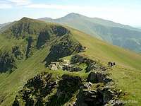

 View towards the the final part of the main ridge from Vf. Ineu
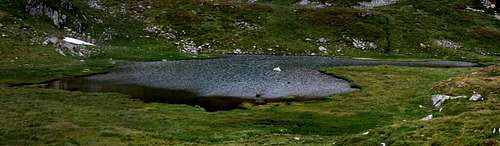 Lala Mică Lake - somewhat below the main ridge
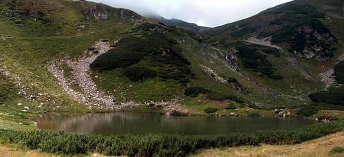 Lala Mare Lake (photographed from the valley-trail)
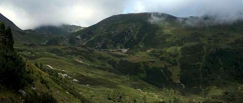 In the Lala Valley (photographed from the valley-trail)
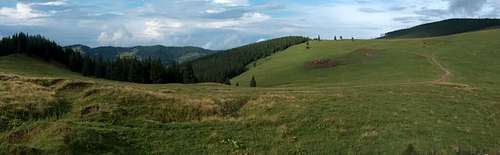 The eastern endpoint of the main ridge: Pasul Rotunda
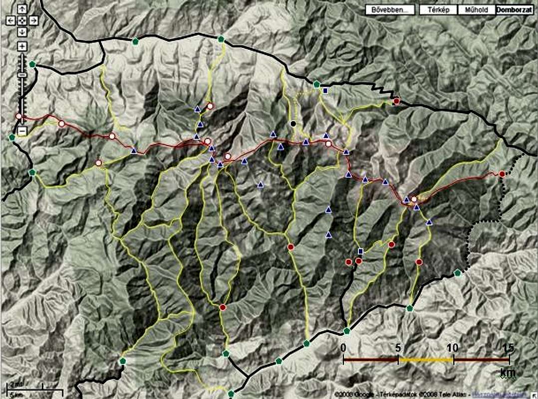
 Borşa > Rodna trail transect (enlarge for better resolution)
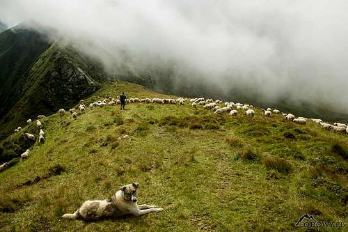
 Zemplén Mountains
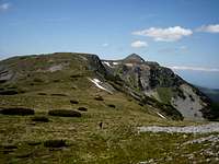
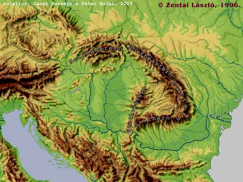 Carpathians in the Center - the Big Five - subregions we have identified. The neighborhood: Alps to the West, Dinarides (SW – across Great Hungarian Plain), Balkans (S), Sudetes (NW).
 Rhododendron kotschyi - token flower of E&S Carpathians
 Geological map of the Carpathian Basin - 1922
 Flysch belt binds Carpathians (Beskid Sądecki Mts)
 Granite and Tarns
 Volcanoes Inside
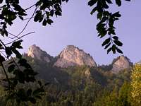
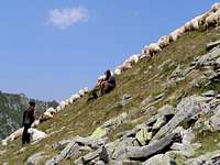 Romanian shepherds (cioban, pronounced chobbun) in Făgăraş Mountains
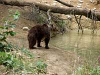 Brown bear in theCarpathian Bend
 Carpathian chamois
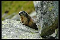 High Tatra Marmot
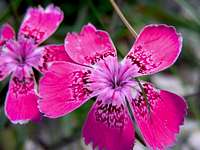 Pink: Dianthus callizonus
 Fire salamander
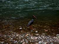 Black stork
 Rosalia longicorn
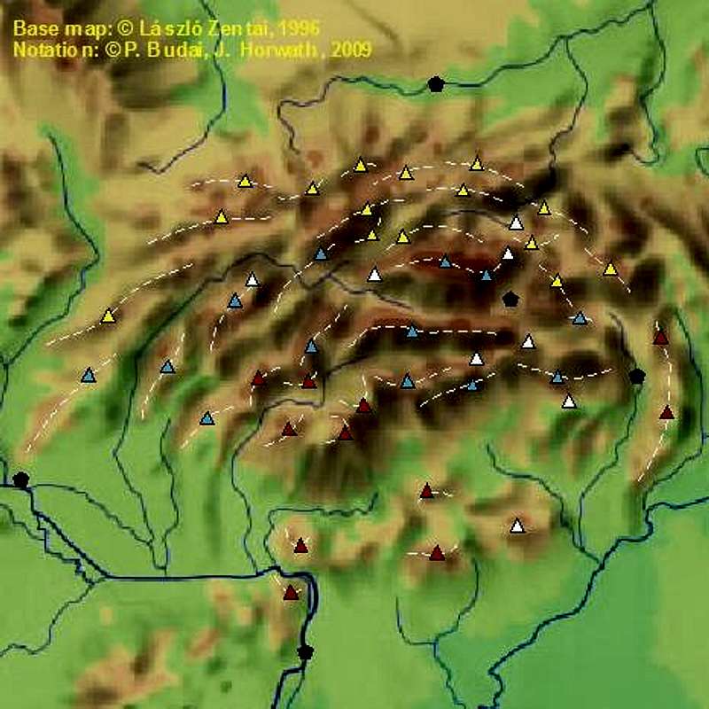

 Belianske Tatry - spring
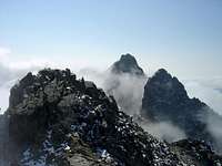 High Tatras - summer
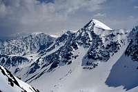 West Tatras - winter
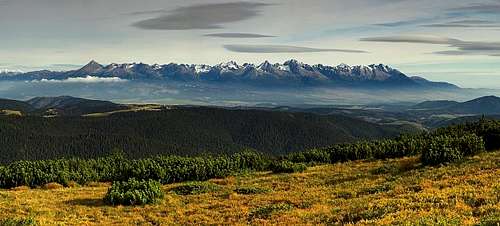 Vysoké Tatry /High Tatras/ from Nízké Tatry /Low Tatras/ - autumn
 Babia Góra, highest point of the Western Beskids
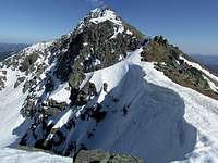 Ďumbier /Ginger/, highest summit in the Low Tatras
 Vadálló-kövek in the Visegrád Mountains
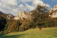 Súľov Rocks in the Strážovské vrchy
 Veľký Rozsutecin the Little Fatra
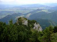 Veľký Choč
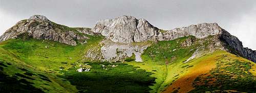 Belianské Tatry - autumn
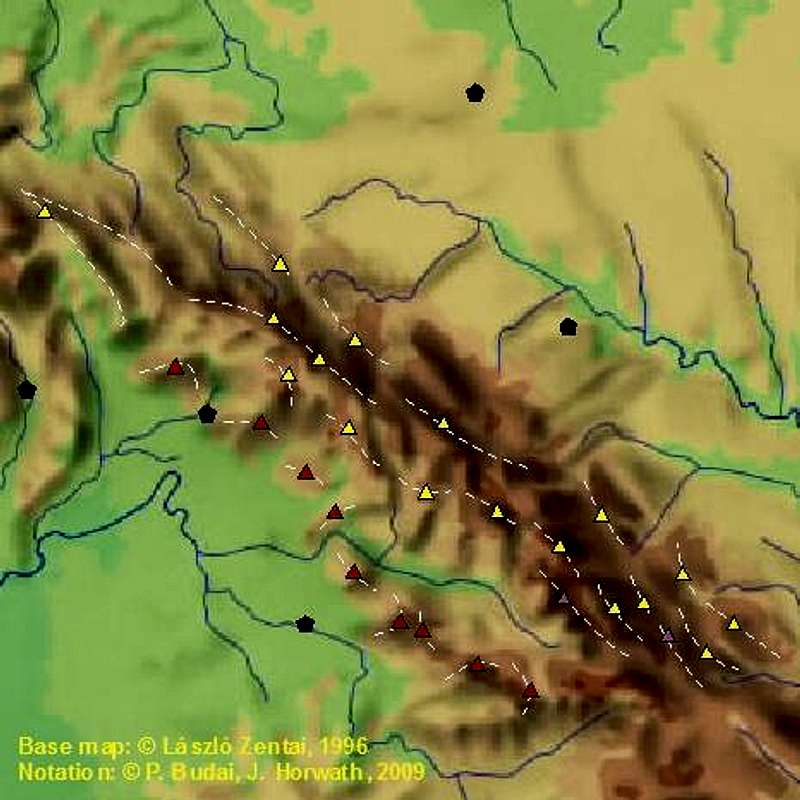
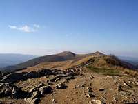 Western Bieszczady - fall
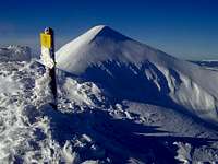 Chornohora - winter
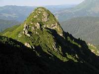 Marmarosh Mts - summer
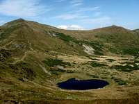 Chornohora
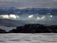 Marmarosh from Chornohora
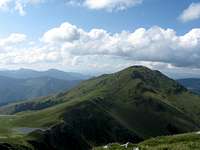 Marmarosh Mts
 Low Beskid
 Obcina Mestecăniş
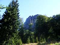 Gutâi Mountains
 Cearcănul (Sárkány)
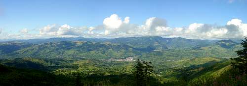 Marmarosh Mountains viewed from the Rodnei Mountains - summer
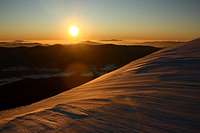 Western Bieszczady
 Eastern Bieszczady
 Gorgany
 Toward Polonyna Runa
 Polonyna Krasna
 Svydovets
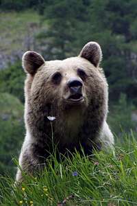 Face to face
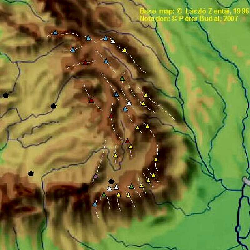
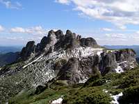 Ciucaş Mountains - spring
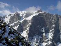 Bucegi Mountains - spring
 Rodnei Mountains (Vf. Pietrosu) - highest crystalline
 Ciomat Mountains
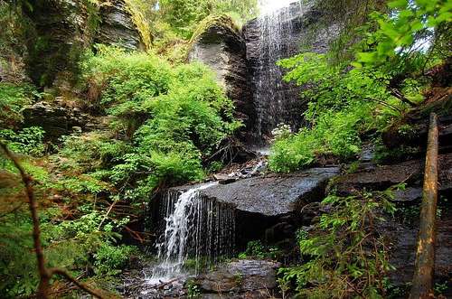 Gurghiului Mts
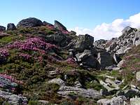 Leaota Mts
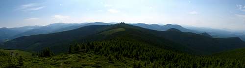 Călimani Mts - highest volcano
 , Ceahlău
  Ciucas
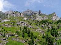 Bucegi
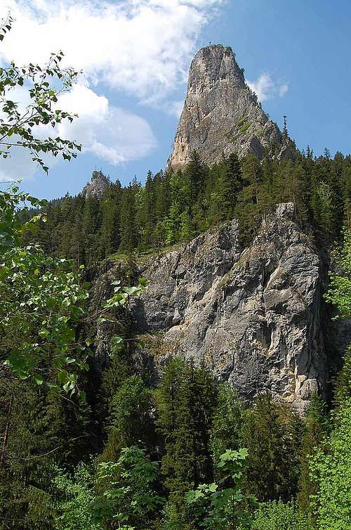
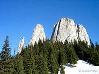

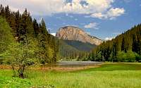
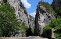
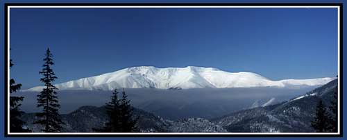 Iezer-Papuşa - winter
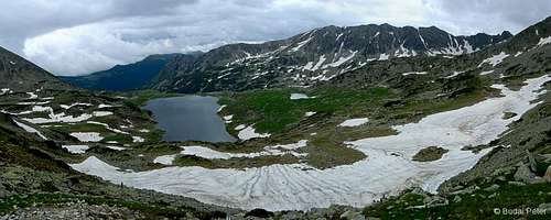 Retezat Mountains - spring
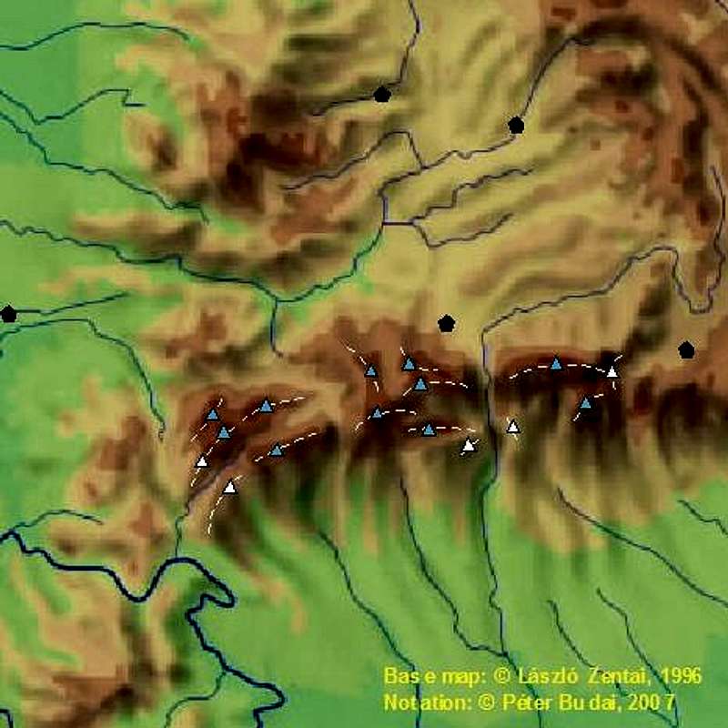
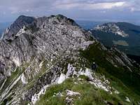 Piatra Craiului - summer
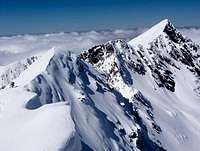 Făgăraş Mountains - winter
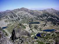 Retezat Mountains - summer
 Făgăraş
 Parâng
 Retezat
 Șureanu
 Lotru
Lotru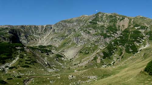 Godeanu
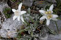 Edelweiss
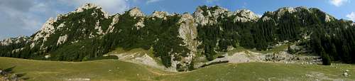 Buila-Vânturariţa
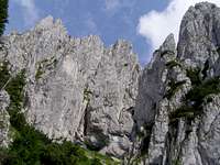 Piatra Craiului
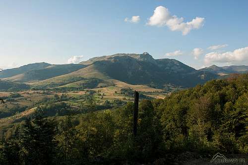 Cernei Mountains
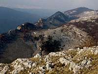 Mehedinţi
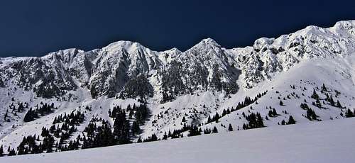 Piatra Craiului
 Nera Gorges (Aninei Mountains)
 Beusnita Falls (Aninei Mountains)
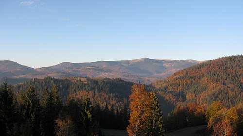 The highest range of the Apuseni Mountains
 Székelykő (Szeklers' Rock)
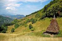 From Trascău to Gilău
 Turda/Torda Gorge
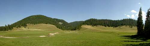 Padiş/Pádis karst plateau
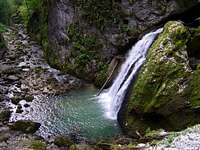 Galbena Gorge(Padiş plateau)
 Turda/Torda Gorge(Trascău/Torockó Mts)
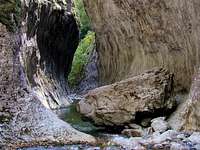 Râmeţ/Remete Gorge(Trascău/Torockó Mts)
 Padiş/Pádis karst world
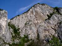 Munţii Metaliferi (Ore Mts)
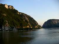 Danube River at Carpathians' SW end
 from Tău Porţii
 from Viorica lake
 Agătat lake and Poarta Bucurei ridge
 Slaveiului ridge
 Judele from Judele saddle
 Piatra Craiului
  Königstein
  Királykő
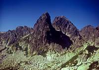


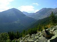
 Little Retezat
 Oslea on horizon
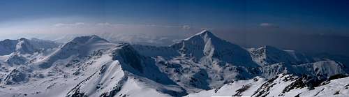
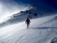
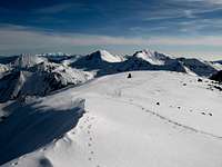


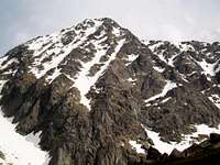
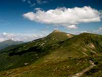 Chornohora - summer
 W Bieszczady - fall
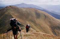 Svydovets' - fall
 Gurghiului Mts
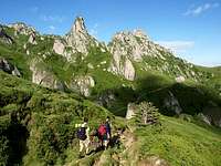 Ciucas
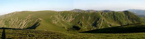 Godeanu Mountains - summer
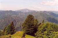 From Cozia to Buila
 Trascău/Torockó Mts