
-
 10992 Hits
-
 80.42% Score
-
 13 Votes
|
|
Route |
|---|---|
|
|
45.91620°N / 7.86270°E |
|
|
Mountaineering, Ice Climbing |
|
|
Spring, Summer |
|
|
Most of a day |
|
|
Alpine PD |
|
|
Approach
Corno Nero 4322 m Normal route
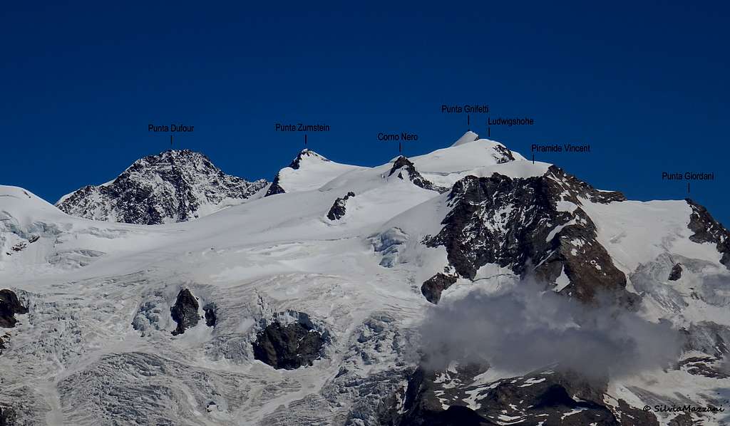
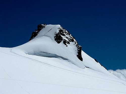
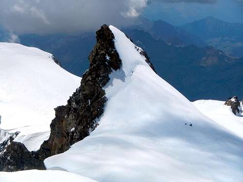
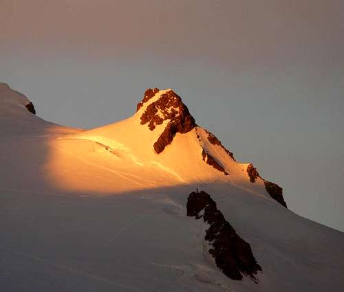
Corno Nero 4322 m is a mountain belonging to the Pennine Alps, Monte Rosa Massif, and located on the Swiss-Italian watershed, along the line starting from Lyskamm and heading to Punta Gnifetti and Punta Dufour. It forms a small group made up of three "toy Fourthousander" together with Parrotspitze, the highest and the Northernmost, and Ludwigshöhe. Check here the complete list of the 82 alpine Fourthousanders and the 46 minor summits: Club4000.
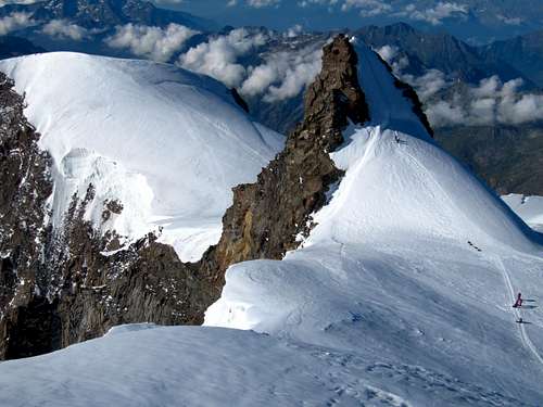
These mountains appear small only when considered from the Lys Glacier side. In fact, there is to be observed that this set of three peaks takes on a completely different and extremely crabby look when viewed from the Valsesia side. Corno Nero opposite sides are totally dissimilar: gentle, brief and snowy the Swiss one, impressive and high the Italian, overlooking Alagna and Val Sesia, falling towards the Piode glacier and the Valsesia with a 700 m high face and part of the so-called majestic "Valsesiana" wall of Monte Rosa.
Getting there
Two different road approachs are possible depending if coming from the Valle di Gressoney (Aosta) or from Val Sesia.
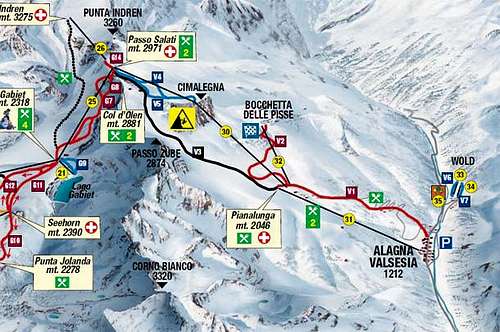
Access via Valle di Gressoney (Aosta Valley) - From the A5 Torino – Aosta Highway, exit to Pont St. Martin and take the Valle di Gressoney, getting to Gressoney St. Jean, Gressoney La Trinité and Staffal. From Staffal take the Cable car to Alpe Gabiet – Passo dei Salati - Indren
Access via Val Sesia (Piedmont) - From the A26 Highway exit to Romagnano Sesia and take the road to Varallo Sesia. Here continue following all the Val Sesia road to Alagna Valsesia. From Alagna Valsesia take the Cable car to Pianalunga - Passo dei Salati – Indren
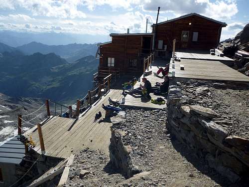
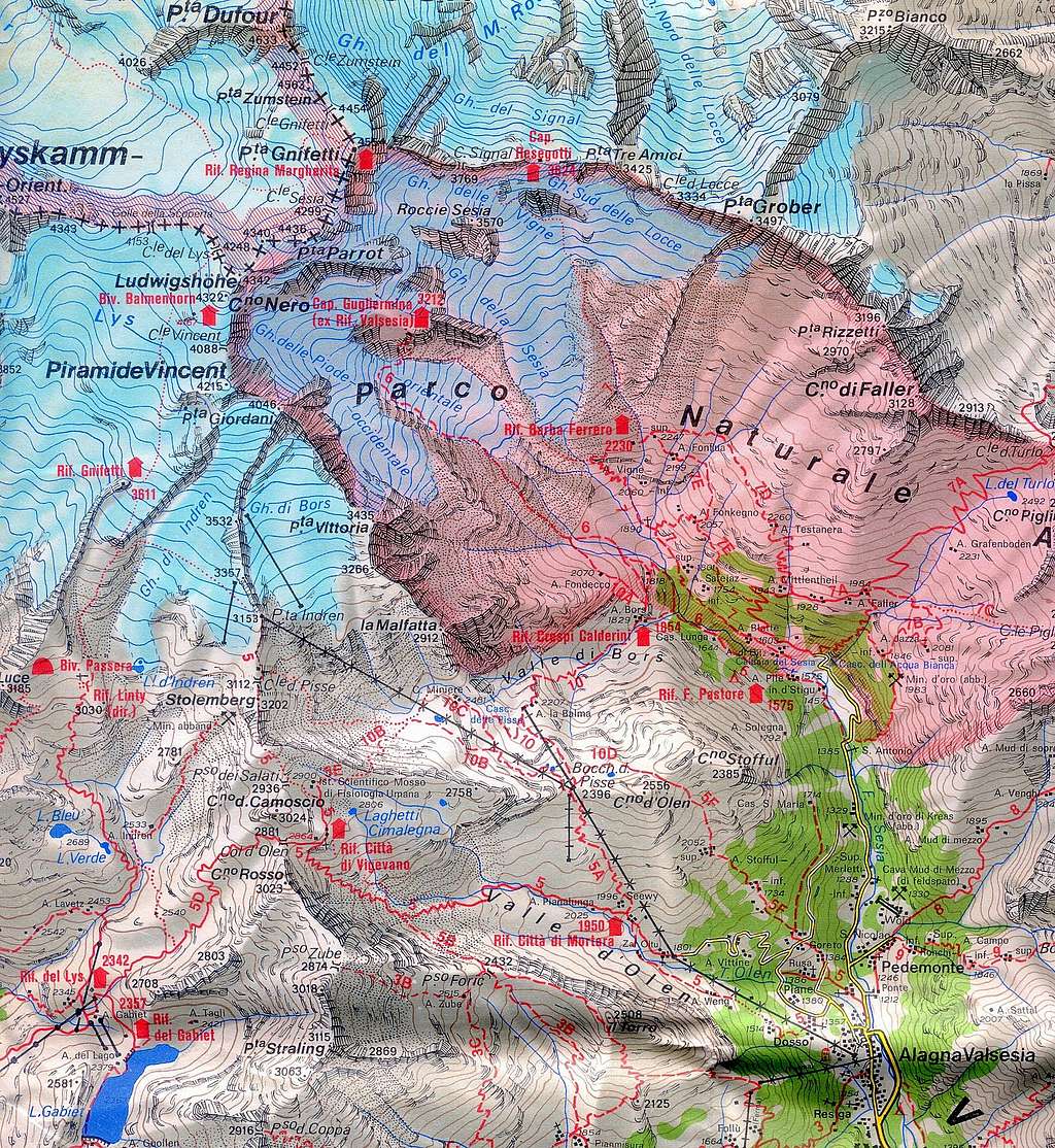
Access to the Rif. Città di Mantova 3498 m and Rif. Gnifetti 3611 m
From Punta Indren, 3260 m (cable car from Alagna or Gressoney) get the Rif. Città di Mantova in 1 hour and Capanna Gnifetti in 1,30 h. In the lower part, it is a marked path (n. 5). The traverse of the glacier is not marked. From Punta Indren, traverse the ski-run, slowly going up on the Indrenglacier till you reach the outstanding rock band above which the Mantova-hut is situated (yellow-red signs). Climb up the rock steps (fixed ropes) to the hut. To reach the Capanna Gnifetti from the Rifugio Mantova Hut cross the glacier going up over the E-side of the glacier to the N and at the end on the rocks to the Gnifetti hut. This will take up to 30 minutes longer.
Route Description
Corno Nero Normal route
Difficulty: PD (Alpine scale)
Difference in level: 830 m from Capanna Gnifetti - 965 m from Rifugio Mantova
A minor summit in the Monte Rosa group, anyhow the climb is a must for those looking for a simple itinerary on a fine mountain. The climb is rather easy, but involves a full glacier's equipment. Lys Glacier has several crevasses - often hidden in early summer - so it is necessary to cross it by proceeding enroped.
Route report
Approach
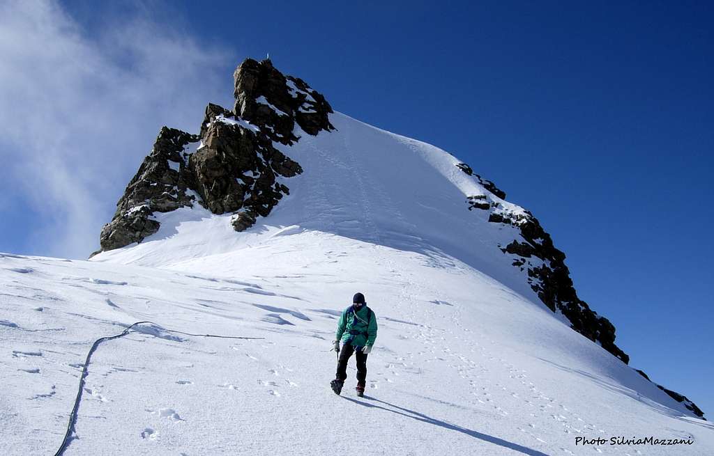
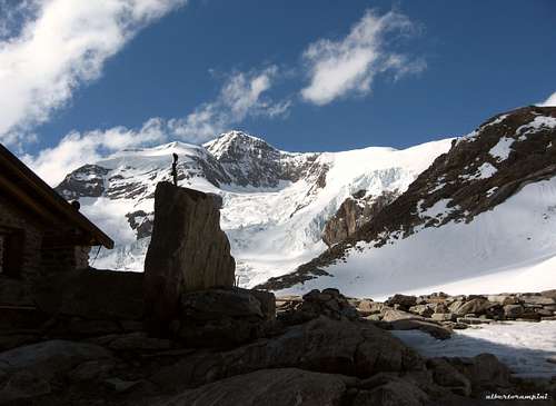
The approach to Corno Nero starts from either Capanna Gnifetti m. 3611 or Rifugio Mantova m. 3470. From the shelters – Rifugio Mantova or Capanna Gnifetti – gain the starting point of the Lys Glacier, which begins behind Capanna Gnifetti. Enter the glacier and follow it at first diagonally to the left (toward North-East) along a steep ramp, then toward North rising on moderate ice-slopes, never too away from the steep slopes of Piramide Vincent. In some sections the glacier presents a few passages between wide crevasses. Continue always along the track, usually present in summer, heading to the Colle del Lys. After passing a series of irregular slopes, the itinerary gets the snowy basin below the Balmenhorn at about 4000 m. with the statue of Christ on its summit, below which it's located the little Bivacco Felice Giordano.
Route
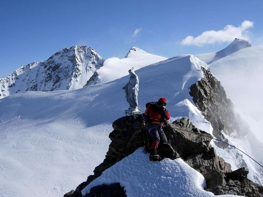
About 100 metres before the Colle del Lys leave the main track which continues towards Punta Gnifetti and turn right heading in the direction of to the stunning pyramid of the Corno Nero. Along the snowy slopes reach the bottom of the wall and start to climb the steep slope (50°). In case of hard ice a couple of ice screws can be useful. The steep but short wall ends nearby the summit. Follow to the left the brief airy summit crest on snow and blocks to the Madonnina on the narrow top.
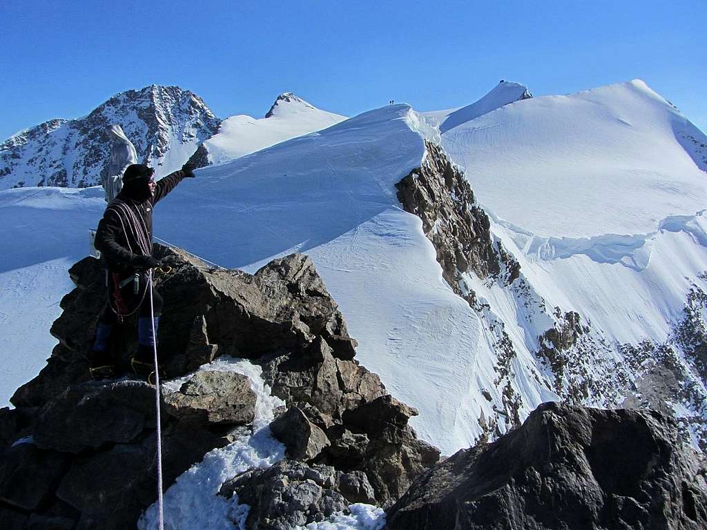
Descent: the slope can be descended in abseil using the belay on the summit ridge
|
|
Essential Gear
Rope, helmet, ice-axe, crampons, full glacier gear.
Red Tape
No fees no permits required.
When to climb
Mountaineering: best months are June, July, August and September
Ski-mountaineering: from the end of March to the end of May
Huts
- Rifugio Città di Mantova m. 3470
Situation: Garstelet Glacier
Open: from June to September
Guardian: Guide di Gressoney
Size: 85 persons Winter shelter: 15 persons
Phone: +39-0163-78150 / Mobile: +393470802910
|
|
Situation: Garstelet Glacier
Open: from February to April and from June to September
Size: 176 persons Winter shelter: 4 persons
E-mail: info@rifugimonterosa.it
Meteo
Meteo Valle d'Aosta
Meteo Piemonte
Guidebooks


 Guidebook")

"Il grande libro dei 4000" by Marco Romelli and Valentino Cividini - Idea Montagna ed.
"Tutti i 4000" - L'aria sottile dell'alta quota - Club4000/CAI Torino
“4000 delle Alpi” by Richard Goedeke - Ed. Libris
“Monte Rosa” by Gino Buscaini – Collana Guide dei Monti d'Italia C.A.I.-T.C.I.
Maps
"Breuil/Cervinia-Zermatt" Kompass map 1:50.000
"Cervino-Matterhorn e Monte Rosa" n. 5 - Istituto Geografico Centrale 1:50.000