Toggle navigation
Mountains
Routes
Images
Trip Reports
Forum
What's New
People
Areas & Ranges
Articles
Trailheads
Canyons
Huts & Campgrounds
Albums
Logistical Centers
Fact Sheets
Lists
Custom Objects
Gear
Plans & Partners
WELCOME TO SUMMITPOST
SIGN IN
REGISTER
Cottonwood Peak's West Ridge...
View High-Resolution Image
Cottonwood Peak's West Ridge...
Cottonwood Peak's
West Ridge
route.
RED - West Ridge via Hot Springs Canyon
BLUE - alternate descent route via UN 13,123 and Garner Creek
(the trails up Garner Creek and Hot Springs Canyon share a trailhead)
« PREV
NEXT »
RyanS
on
Dec 15, 2004 2:24 pm
Comments & voting
Other parents
Lat/Lon:
38.21940°N / 105.7559°W
Image ID:
81522
6929 Hits
76.87
% Score
8
Votes
Log in to vote
Comments
Post a Comment
Viewing: 1-1 of 1
Scott
-
Dec 15, 2004 2:55 pm - Voted 10/10
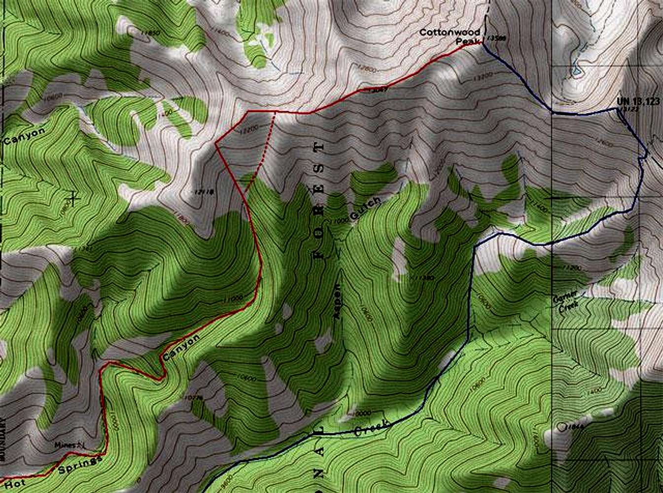
Useful pic
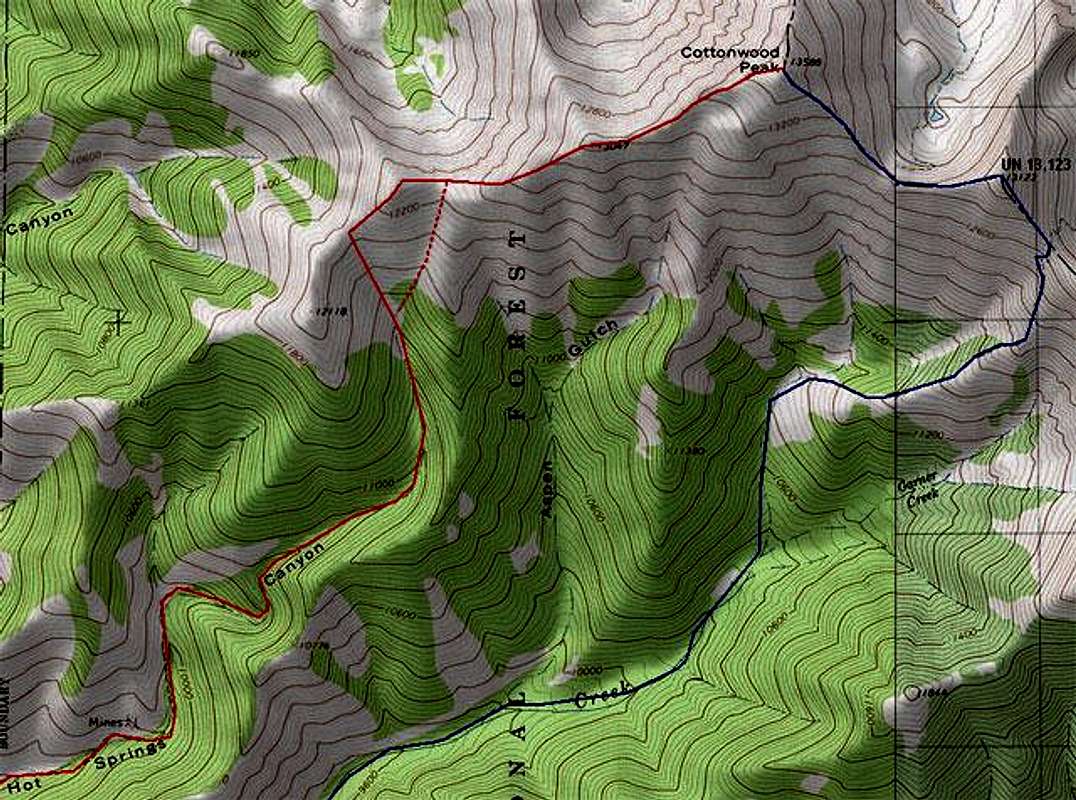
Pics like this are always useful. Thanks for posting.
Viewing: 1-1 of 1
to post!
Don't have an account?
Cottonwood Peak
(Mountain/Rock)
You are at
the First
Image
Viewing
#1 of 1
GALLERY
You are at
the Last
Image
RyanS's Image Gallery
« PREV
Viewing
#320 of 811
GALLERY
NEXT »
Cottonwood Peak
(Mountain/Rock)
Loading....
West Ridge via Hot Springs Canyon
(Route)
Loading....
×
You need to login in order to vote!
User Name
Password
Remember me
Forgot your password?
Log me out when I close my browser.
Keep me logged in all the time.
sign in as a user
Don't have an account?
Register now for FREE
Rating available
Suggested routes for you
People who climb the same things as you
Comments Available
Create Albums
Register Here
Comments
Post a Comment