
|
|
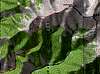
Route |
|---|---|
|
|
38.21940°N / 105.7559°W |
|
|
Hike |
|
|
A long day |
|
|
Class 2 |
|
|
Approach
Start at the Hot Springs Trailhead. To reach the Hot Springs TH from Poncha Springs, head south on US-285 over Poncha Pass into the San Luis Valley. Once ~4 miles south of Villa Grove, leave US-285 for southbound SH-17. Immediately after this junction, look sharp for the left-hand turn onto Saguache CR-GG. The junction between 285 and 17 was reconfigured in 2003, so CR-GG is no longer accessed directly from 285.
Follow GG for ~6 miles to a fork. The left fork remains GG and leads to Valley View Hot Springs. The right fork is CR-65 and leads to the Hot Springs Trailhead after ~.5 mile (continuing a bit further leads to the Major Creek TH, incidentally). The left turn to the Hot Springs TH is indicated by a brown FS sign.
These roads are among the best dirt roads in Colorado for mountain access and are very accessible with low-clearance 2WD.
Route Description
RT Distance: 11 miles
Elevation Gain: 5300'
The Hot Springs TH provides access to both the Hot Springs Canyon and Garner Creek Trails, affording an opportunity for a loop hike if so desired.
From the TH, follow the sign for Hot Springs Canyon and begin the quick hike to the canyon (FYI, this is not a canyon in the classic sense, but it is rather narrow for a drainage in the Sangres). After a couple of miles through glorious, tall aspen, you reach a meadow at 10,000'. Here, you could make a routefinding error, so be sure to head to the right once in this meadow and not to the left. Continue to follow the trail until you reach the end of the canyon and a split in the drainage. The standard route follows the right fork to the ridgeline above you, though if you're dealing with some snowpack, you may want to choose the left fork, as these slopes seem to melt out sooner.
Once on the ridge, turn right, and head up the gentle ridge all the way to the summit. There is a false summit, and Cottonwood Peak is striking once it comes into view, .5 miles away and 500 feet above you.
From Cottonwood, you can either return via your ascent route, or you can descend to the saddle between Cottonwood and UN 13,123. Climb UN 13,123 as a bonus peak (this is a ranked thirteener), and then descend to Garner Pass. From Garner Pass, descend south on the Garner Creek Trail, as it heads along a minor ridge and ultimately to the Garner Creek drainage. This trail continues through prime beaver country for five miles all the way back to the Hot Springs TH. (Author's note: I did not personally descend from Garner Pass on the explicit trail, as it was snow-covered, and I did not find it until I had bottomed out in the drainage, so I don't have first-hand knowledge of how the trail gets from Garner Pass to Garner Creek). This variation adds ~1 mile and 325 feet to your trek, but you get a complete loop hike (not a single step retraced!) for your extra efforts.
 |  |
Essential Gear
Typical hiking gear, unless weather/conditions dictate otherwise. I appreciated my ice axe when I climbed Cottonwood in mid-May.