
-
 10280 Hits
-
 79.04% Score
-
 10 Votes
|
|
Route |
|---|---|
|
|
44.40399°N / 103.97118°W |
|
|
Download GPX » View Route on Map |
|
|
Overview
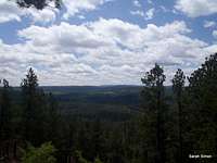
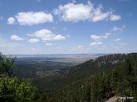
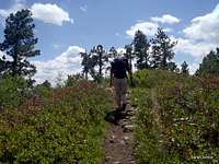
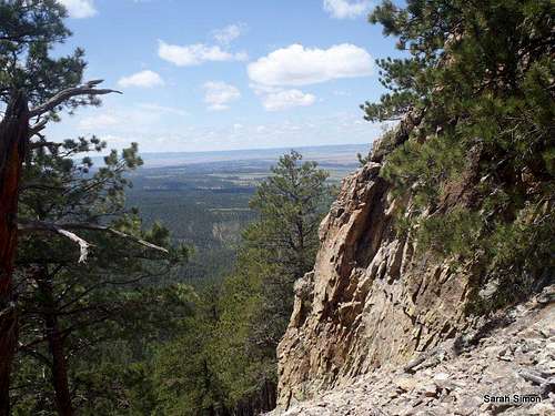 Nice views mid-trail
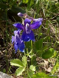
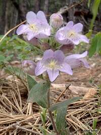
This mellow, graded trail winds through pine forest to the open summit of Crow Peak. A well-maintained trail, combined with mild and gradual elevation gain, make this an ideal day outing for visitors to our residents of nearby Spearfish, South Dakota. In late spring, the slopes of Crow Peak boast a wild variety of wild flowers. The route to the top of this peak is straightforward, allowing you to zone out and enjoy your surroundings.
Roundtrip Distance: 6.5 – 7.0 miles (US Forest Service material suggests 6.4 miles; my GPS indicated a 7 mile roundtrip)
Elevation Gain: 1,560 feet
YDS Class: 1
Planning Map: Trails Illustrated #751 | Black Hills North
USFS Trail: #64
 Wild Rose Wild Rose | 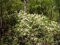 Blooming shrub Blooming shrub |
Getting There
 Trailhead sign
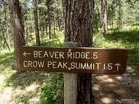 Just 1.5 miles to go!
• From Main Street in Spearfish, head southwest on Hillsview Road for 3.9 miles to Higgins Gulch Road / FS 214.
• Travel about 7 miles on Higgins Gulch Road to a trailhead on the right / north side of the road
• Note that the trailhead sign is not immediately apparent from the parking area.
Route Description
 Big, bold daisy
 Daisies on the slopes
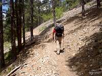
• From the trailhead, the trail heads southwest, roughly paralleling Higgins Gulch Road and the stream for nearly 1 mile.
• The trail then turns west through pine forest and begins ascending away from the creekbed.
• After roughly 2 miles of travel, you will encounter the Beaver Ridge Spur trail. Continue uphill to the righty on the trail to Crow Peak.
 |  |  |
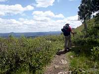
• From here, the trail traverses gradually up the slopes to the north-northwest before switching-back up a west ridge of Crow Peak.
 |  |  | 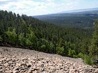 |
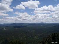
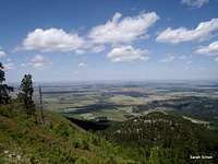
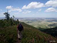
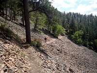
• After cresting the ridge, the peak heads due north along a traverse through talus where nice views of the hills to the west can be enjoyed.
• The trail winds around to catch the north ridge of Crow Peak for the final push to the top.
 |  |  |  |
• The top of the peak is marked by a wooden summit sign and a register notebook is present. The summit area is a great place to enjoy a snack and the views before retracing your steps back to the parking lot.
 |  |  |  |
Essential Gear
Outerwear appropriate to the season and plenty of water, along with a map (and compass or GPS, as always) should be sufficient!
Aprés Hike
 Aprés Hike
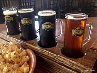
How often can you summit a mountain then have a cold microbrew at the peak’s namesake brewery? To complete the Crow Peak experience, be SURE to stop at the nearby Crow Peak Brewery!
125 W Hwy 14
Spearfish SD
(605) 717-0006
My favorites are the Pile ‘O Dirt Porter and the refreshing Canyon Cream Ale.