
|
|
Route |
|---|---|
|
|
51.86838°N / 3.35372°W |
|
|
Hiking |
|
|
Spring, Summer, Fall |
|
|
Most of a day |
|
|
Overview
Situated on the eastern side of the main Brecon Beacons range and just south east of the town of Brecon, this route provides – on a clear day - excellent views of the main summits and their northern ridges as well as views further eastwards to the Black Mountains. This area tends to be a bit quieter than the main summits of the Brecon Beacons and you are likely to meet fewer hikers than you would on the more popular routes.
Most of this route is on rough but discernable paths across steep grassy hillsides. Although, in poor visibility it may be necessary to use your map and compass skills to traverse the higher, plateau - like ground.
Attempting it in Winter could be a different proposition. Care would be needed in route finding, particularly if snow covered the ground. In this case, Ice and crampons would be essential.
Getting There
Car is the best option for this route. Take the A40 south east from Brecon or north west from Crickhowell to Llansantffraed and turn on to a minor road heading south for Talybont on Usk.
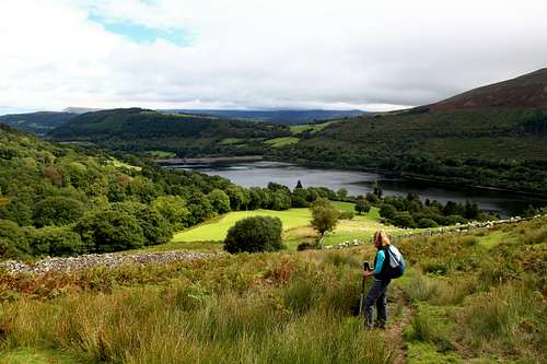
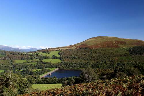
Drive through the village and head for the Talybont reservoir through the hamlet of Aber. Soon the reservoir dam will appear on your left, continue along the road for about a kilometer until reaching a car park on your left. (Some cars also parked on the road near the dam but this is not always possible.)
Route Description
From the car park, cross the road and take the public footpath uphill with a stone wall on your left. This track lasts for a short time before entering a signposted “Open Access” area.
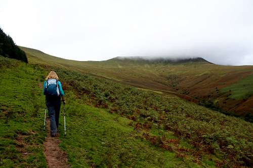
Continue upwards on a path across a steep, bracken covered slope, head to your left, you will see a forestry commission plantation beyond a wall. Ahead is the grassy headwall of Craig y Fan. On your right, the slope drops away towards the Nant Tarthwynni (Nant = brook or stream) and beyond this, you can see the slopes that will provide the descent route later on.
Continue upwards and left to where the wall and plantation trees end and there is a gate.
Beyond the gate is the open hillside of Allt Lwyd. Follow the path in a south west direction up to a rather unspectacular top at 654m. There was a tiny cairn when we visited but this looked like it may be a temporary construction!
The route now drops a little and heads north west to an open saddle before ascending towards Craig y Fan.
At this point the views really start to open up. Eastwards across the Talybont reservoir towards the Black mountains and southwards across the Nant Cynafon valley towards the hills of the south Brecons. Continue steeply up the grassy ridge.
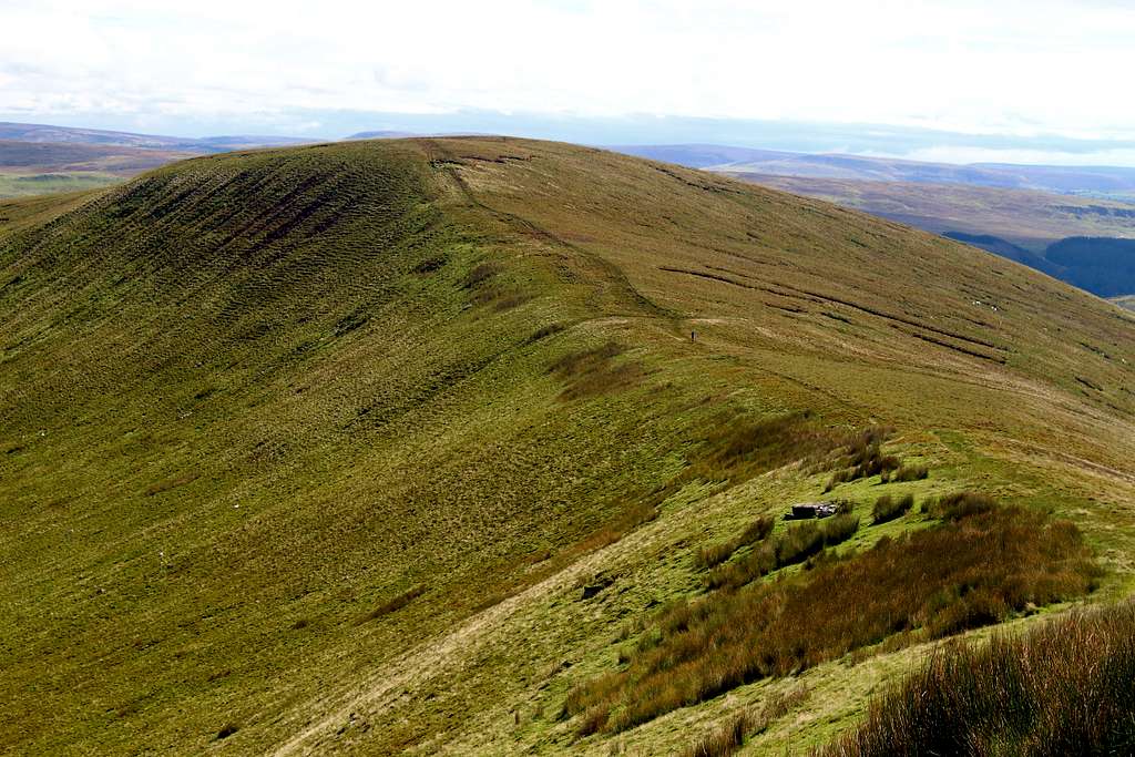
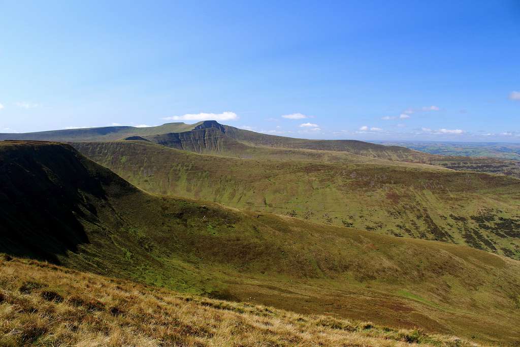
At the top of the grassy ridge is a plateau of grass, bracken and heather with steep slopes on either side. Head westwards along the edge of the plateau with the steep drop to your left. This continues for a short while before heading south again on the edge of a cliff overlooking Gwalciau’r Cwm. There is a large, well built cairn here, big enough to shelter from the wind if needs be.
Turn north west, again along a cliff edge shown as Cwar y Gigfran on the map. Across the valley, beyond Graig Fan Las, it’s possible to see the tops of Pen y Fan (886m) and Corn Ddu (873m), the highest of the Brecon Beacons.
The cliff to your left end and becomes a gentler but boggy slope. Continue onwards towards the obvious ridge in front of you and a confluence of paths at the ridge crest.
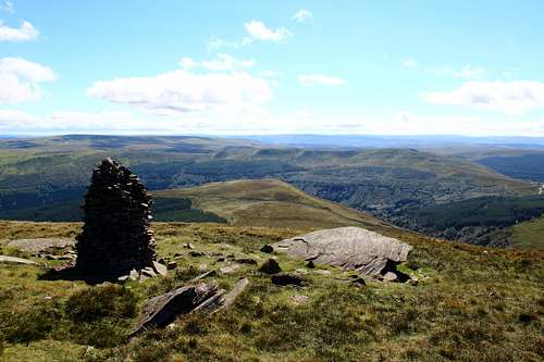
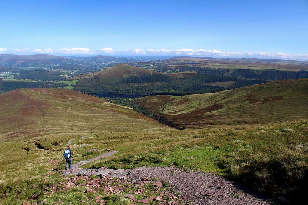
At this point, if the view is clear it’s worth wandering further westwards on the path that skirts the northern Cwms of the Brecons just for the great views. Fan y Big (719m), and Cribin (795m) are now also in sight and offer a spectacular panorama with Pen y Fan and Corn Ddu in clear weather.
Return to the confluence of paths and head eastwards over the top and centre of the plateau. The path here has been made into a hard surface using crushed rock bought from the valley to help stop erosion.
Cross to the eastern side of the plateau until reaching a large cairn marked as Carn Pica on the map.
The route descends steeply eastwards from here in parallel to the ascent route made earlier. Great views of the Black mountains lie in front of you and the Talybont reservoir below gets nearer as you descend.
Before reaching the road, look out for the signposted footpath to take you southwards on a shortcut through fields, parallel to the reservoir. This avoids any road walking save for the last 100m before returning to the car park.
Essential Gear
Good boots, waterproofs and hill walking kit. Map and compass (and the ability to use them). Food, drink.
Maps
Ordnance Survey OL12 (1: 25 000 scale)