
Comments
No comments posted yet.
|
|
Trip Report |
|---|---|
|
|
40.79860°N / 110.4254°W |
|
|
May 22, 2005 |
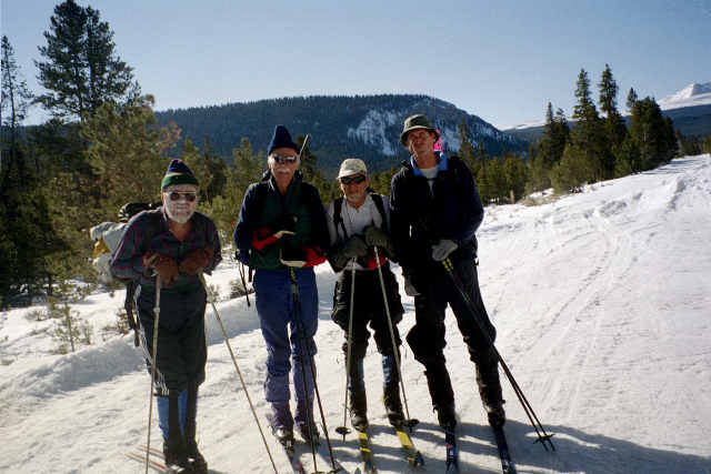 But year 2004 wasn't a usual one. Larry was down undergoing chemo, and the snow conditions sucked big way, so Steve just couldn't get the prep done. He enlisted some oldtimer friends, such as Alexis Kelner (author of 'Wasatch Touring' but more of an armchair skier) and 82 years old Milt Hollander, but just to be sure that the job is done, he also invited some young blood (Rob and myself). The two of us figured that we'd zip into Elkhorn Basin in a nick of time, and hatched a plan to continue on to Flat Top, to sneek a peek at the famous Red Castle on the other side.
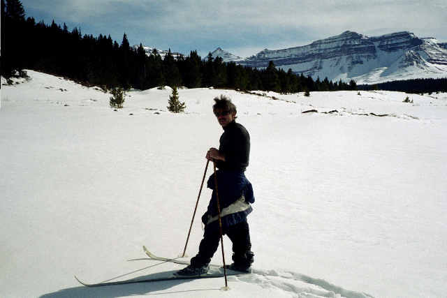 The snow in March 2004 was awfull, the ever-collapsing breakable crust which may make you mentally exhausted even before it drains you physically. It took me and Rob whopping 5 hours to reach Elkhorn Crossing. We continued for another mile, flagging the route through the meadows and fully knowing that our track won't last even a day in this windy cirque. The crust kept collapsing, and it was clear that we are not making it to Flat Top. So we called it a day.
  We leave Salt Lake at 6pm on 5/21/05 and stop in Evanston to grab some beer (of course) and a bite to eat. It is kind of funny to find our car, with a ski rack, parked next to a boat trailer between a liquor store and a triple-X video joint!
 Lotty's Diner in Evanston is the traditional pit stop for Swanson brothers' annual Kings Peak ski run, and we are not about to break with the tradition on this attempt to ski Powell. My own theory about Lotty's goes like this:
 It is still twilight when we reach Dahlgreen's turnoff. Just three weeks back, when we skied Gilbert, it was all snowed in. But now, the road is driveable! It is kind of cool to watch Henrys Narrows from up above as we drive. 4.5 miles later, we settle for the night - and by the way, I doubt if it will get cold enough for my prime rib buffet theory to work :)
 But at 4am, everything is frozen. The dawn barely lights the Eastern corner of the sky when we put on the skis a quarter mile up a logging spur road. Minutes later, we are at the saddle with the official sign for the trail leading from China Meadows up towards Flat Top.
 The trail, marked with cairns, contninues along the Western edge of the old overgrown clearcuts, and then we loose it. Much to my surprise, we find the trail again on the ridge overlooking Henrys Fork, good half mile East of the Big Meadow where it is supposed to be, according to the map! (I guess that this ridgeline trail continues up the Western-most of the logging roads from here?). And boy did somebody spend time making trail blazes on the trees!
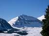
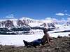
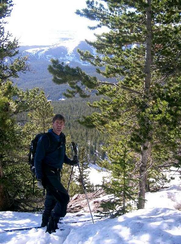 The snow refroze on the meadows and openings, but not, unfortunately, under the shade of the trees. So it is a bit of a struggle up the trail, and it takes us about 4 hours to reach the overlook near the unnamed lake just South of Elkhorn. Now the views South and East open like in a fairy tale! Gilbert and Gunsight and Henrys Peaks with huge avalanches scouring their sides, and Kings Peak, still unbelieavably white, and to the right through the trees - our destination!
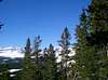
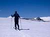
 As the trees part near the timberline, the snow finally becomes consistently firm, and our pace improves. It is now about mid-way through our 10 mile treck to the summit.
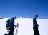
 3 miles into Flat Top traverse, the North Summit looms ahead at last! And then, just above 12,000 ft, Red Castle is finally opening up. The first of the 3 goals of the trip is now accomplished - all what's left is to get to the top of the Flat Top, and then to Powell.
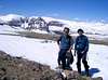


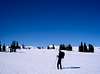
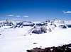
 Ahead, across a shallow saddle to the South, looms our destination. It is a bit hard to gauge how steep are the slopes. And we don't want to cross steep snow on a hot day like this one, having seen so many humongous avalanches on nearby peaks. So we decide to cross the low part of the saddle, along the snaking black line of scree, and maybe a bit beyond, and then just to boot straight up. It is really not as steep as it seemed. From the North shoulder, a short, nearly flat stretch of the ridge leads to the summit.

 Just 40 minutes after leaving Flat Top, we relax at the North (main) summit. The Middle summit ahead is probably a nudge more challenging because of a dual cliff band guarding the approach.
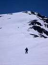
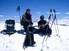
 The temperatures really soar, but there is nothing a little paraffin can't fix. Once we reach a small stash of warm-weather clothing, food, and water left on ascent at 11,500, I can finally change into shorts :)
 Just ahead of a treeline, we have a spooky encounter with a huge cornice. A good advice to all of you - do not bypass this hump on the East side! Then, unfortunately, we get into the trees, where the snow wasn't supportive in the morning - and it didn't get any better in the afternoon. Some parts of our track are thawed to the ground over the course of just one day! The forest part leaves us more than a bit tired, but what fun it is to get back to the car and rinse my salt-crusted face and body with balmy spring water! The patch of snow, in which we stashed the beer, is gone, and the bottles are sun-warmed, but it takes just a few minutes to cool them back again in the remnants of snow in the shadow of pines.