
|
|
Route |
|---|---|
|
|
44.83686°N / 118.3206°W |
|
|
Hiking |
|
|
Spring, Summer, Fall |
|
|
Half a day |
|
|
easy walkup |
|
|
Deep Creek Route
Finding the trailhead can be a little difficult, but its manageable. About three miles from the pavement you will find the trailhead sign hidden back in the brush on the left side of the road. Once your on foot follow the condemned logging road a quarter of a mile to the the first fork, take a left here. Shortly after this you will come to another fork where you will take a right. Walk a short distance up the road, which is fairly overgrown in places and doesnt look like trail maintenance has been done here in a few years. After a few hundred yards the old road will start to climb steeply and you should notice some narrow lodgepole laying across it. This is where you turn left onto the singletrack, from here on its gravy.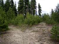 |  |  |
From the logging roads its one mile up the path to where it crosses an ATV trail at some alpine springs. You will see the trail marked here with a sign notifying you its 2 miles up to the lookout. These next two miles climb more steeply than the previous mile, but its a fairly easy hike on up to the summit. About one mile away from the actual summit the trail connects in with a narrow ATV path which you will follow up the southeast ridgeline to the lookout. Although quad-riders do occassionaly attempt to climb this mountain, it is fairly treacherous in places and isnt attempted very often. Most likely you will not run into anyone making this attempt.
Getting There
Taken directly from the main page...With roads and trails poorly marked in the wallowa-whitman forest, this is one of the more difficult trailheads to locate in eastern Oregon. Start by finding Sumpter, from the west end of town heading NW on highway 220 it is a little over 11 miles to Forest Service Road 7370 on the right hand side of the road. Once you turn off the pavement onto 7370 you'll see a sign that says its 3 miles to the Mt Ireland L.O. trailhead, if you dont see this sign you're on the wrong road. Travel 2.2 miles up Deep Creek ignoring turn offs to the right and left. At 2.2 miles you will come to a fork, turn left here. Follow the road another half mile and take a right at the next fork, from there its less than half a mile to the trailhead hidden in the brush to the left.
