
-
 6298 Hits
-
 78.27% Score
-
 9 Votes
|
|
Route |
|---|---|
|
|
38.60320°N / 105.3845°W |
|
|
Hiking, Scrambling |
|
|
Spring, Summer, Fall, Winter |
|
|
Half a day |
|
|
Overview
 Thompson Mountain
This route is an interesting mishmash of old ranch roads, equestrian paths, foot and game paths, cross-country travel and easy scrambling. Neat views abound, including the Sangre de Cristos, the southern end of the Sawatch, and Pikes Peak. While the route-finding isn’t particularly gnarly, you’ll want solid basic navigation skills to reach this summit (and, more importantly, return safely to parking) as there is no simple trail directly to the summit. Careful route-finding can keep the summit scramble to a dog-friendly Class 2+, but more exciting bouldering exists to reach the summit. This route outlined here provides the chance to see slightly different scenery on the way up vs. the way down.
Roundtrip Distance: 6 miles
Elevation Gain: 500 feet NET gain
YDS Class: 2+ (summit boulder scramble)
Getting There
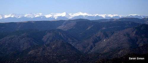 Sangre de Cristos
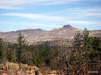 Views from western trailhead
 Heading westbound on an old road
From US Hwy 50 west of Cañon City.
Continue westbound on US Hwy 50 to CO 9.
Turn right (northwest) on CO 9 for about 8 ½ miles to CR 11 (High Park Road).
Turn right on CR 11.
Travel a few (roughly 5) miles keeping an eye out for CR 69.
Turn right (south) on CR 69 and travel southbound for about 1 mile (roughly mile marker 17.5 on CR 69) to a dirt road (BLM Road 5828) leading into BLM land. The road is not well-marked and rather inconspicuous.
Travel less than a mile (conditions permitted) to the gate and the trailhead, marked by a kiosk.
Route Description
 Deer Haven Route Map
Ascent
From the trailhead, where the road is gated, head west along a dirt road.
The route eases around a gentle ridge – either stay on the road proper or cross over the ridge on a horse path.
Here the road turns southward ascending a gentle gully before topping off on small ridge.
Descend into the broad drainage, crossing into state lands, passing a couple cattle tanks.
From here, we opted to go cross-country to ascend to the top of the ridgeline to pick up a horse path that runs along the edge of the escarpment and offers up fine views of the Sangre de Cristo Mountains.
Continue running generally south-southeast along the edge of the escarpment to a broad saddle, where you’ll begin trending east toward Thompson Mountain.
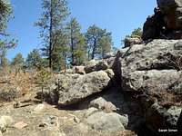
Zig northeast toward the jumble of summit boulders, selecting your choice ascent line (the options are numerous). (We found dog-friendly weaknesses in both the southeast aspect and the west aspect.)
Return
Descend the peak heading southwest to a wide clearing in the trees.
Head northeast down a drainage, perhaps finding a faint two-track road to follow.
When you bottom up near where two drainages converge, head northwest up the northern fork, topping out on a gentle ridge.
Descend back into the broad valley area with the cattle tanks to regain your old route (dirt road) for the hike back to your vehicle.
 Typical conditions early on Typical conditions early on |  Pikes Peak en route Pikes Peak en route | 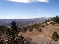 Sawatch to the northwest Sawatch to the northwest |
 From the west From the west |  From the south From the south |  Summit ridge Summit ridge |
Essential Gear
 Cattle Tanks in state land
 Open country on the descent
 Outerwear appropriate to the season
Map, compass & GPS
Colorado Gazetteer for road navigation