
|
|
Trailhead |
|---|---|
|
|
42.19149°N / 74.32702°W |
|
|
Spring, Summer, Fall, Winter |
|
|
1850 ft / 564 m |
Overview
This parking area/trailhead gives close access to 3 of the Catskill 3500'ers and also serves as the western terminus of the Devils Path, one of most beautiful and ruggged hikes in the Catskills. The Devils Path, a 25 mile hike, traverses over the summits of 5 of the Catskill 3500'ers and comes within a close proximity to 4 others. The eastern terminus of this trail is located on Prediger road.Mountains closely accesable from this parking area/trailhead
-Westkill (3880 Ft.): 4.8 Mi. 2030 Ft. Elev Gain.From the trailhead, follow the Devils Path (red markers) to the summit of Westkill.
 The area around Westkill
-North Dome (3610 Ft.): approx 2.25 Mi. 1660 Ft. Elev. Gain.
This is a bushwack only mountain. Follow the Devils Path for approx. 1.4 Mi. at this point the Devils Path turns sharp left. Turning right here (west), you will soon be climbing North Dome, negotiating it's eastern cliffs.
-Sherrill (3540 Ft.): approx 3.4 Mi. 2100 Ft. Elev. Gain.
This too is a Bushwack mountain. Follow the directions above for North Dome. From the summit of North Dome continue down the western side of North Dome crossing the col and climbing Sherrill's east side, reaching the summit at approx. 1.15 Mi.
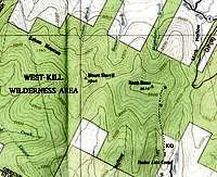 The area around North Dome & Sherrill
Note: these hikes/bushwacks are only a general description and one option for hiking these trailess peaks. See the recommended map/book section below for a proper and accurate trip.
Other mountains along the Devils path:
-Hunter (4040 Ft.)
-Plateau (3840 Ft.)
-Sugarloaf (3800 Ft.)
-Twin (3640 Ft.)
-Indian Head (3573 Ft.)
Recommended maps/books
I highly suggest the maps by the New York/New Jersey Trail Conference. These maps are quite accurate making both trail travel and trailhead locating by road very easy.For further details on this area & trails, a copy of the Catskill Mountain Guide by Peter W. Kick, an Appalachian Mountain Club book, would be an excellent resource.
Getting There
-Take exit 19 of the New York State Thruway (Interstate 87), follow signs for Rt. 28 west.-once on 28 west, travel 27.6 miles
-turn right onto Ny 42 and follow for 7.3 miles
-turn right onto Spruceton Road and the parking area/trailhead will be on the right in 3.7 miles
Red Tape/ Backcountry Camping
If camping in the wilderness, these regulations are to be followed:For backcountry camping permits (when neccesary, see below) visit the DEC website under services.
-Pack it in-pack it out
-No more than three succesive nights or more than ten nights per year can be spent in trailside lean-tos.
-A permit must be obtained from the DEC forest rangers if camping more than three succesive nights or in groups of ten or more. No permits will be issued to anyone under the age of 18.
-The DEC may take down & remove any tent or camping structure that is left alone for more than 48 hours
-No camping above 3500' between March 22 and December 20.
-No fires shall be left unattended
-No camping within 150 feet of any road, trail, spring, stream, or other bodies of water except in camping areas designated by the DEC.
-Rangers do Frequent these mountains.
Some images from this area
 The view south from Westkill
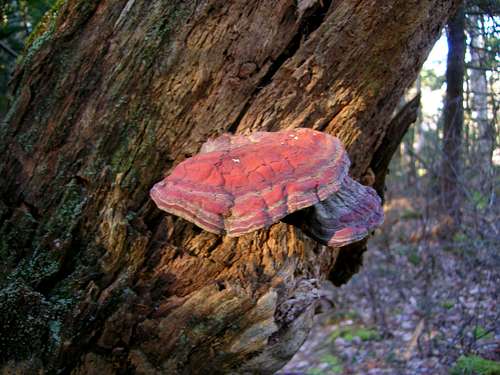 Some tree growth in the sunshine, along the Devils Path
 The Blackhead range from Westkill