-
 1069 Hits
-
 77.48% Score
-
 8 Votes
|
|
Mountain/Rock |
|---|---|
|
|
36.00600°N / 115.466°W |
|
|
Overview
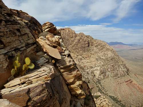
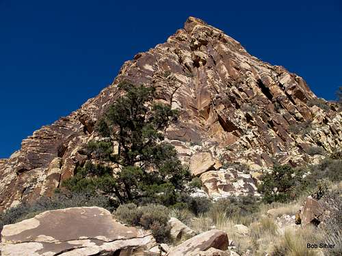
Disappearing Buttress is a prominent face on the southeast side of Hollow Rock Peak. It is clearly visible from the parking area, and although it can be a bit of a hassle to get to it, it certainly isn't hard to locate.
By Red Rock standards, Disappearing Buttress is an obscure crag. Located near the southern end of the conservation area, Hollow Rock Peak is arguably the last "major" sandstone peak and is most easily approached via a sometimes-brushy hike from an unsigned dirt road departing SR 160. Most traffic on that dirt road heads for Windy Peak and the climbing and hiking routes on it.
I climbed Hollow Rock Peak back in January 2013, and no one else was out there. On a lovely Saturday in March 2020 about a week before the country started shutting down to slow the spread of Covid-19, my climbing partner and I headed out to climb a multi-pitch route on Disappearing Buttress. No one else was out there.
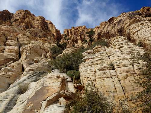
Disappearing Buttress is a trad area. There are single-pitch routes, and there are multi-pitch routes up to five pitches. Some bolted anchors exist, but for the most part, expect to have to build your own anchors. Based on my one day there, I also advise expecting runouts, scary rock, and the need for creativity with anchors in case the belays do not match their descriptions in the Handren guide or on their Mountain Project pages.
Getting There
From the intersection of 159 and 160 (159 is Charleston Boulevard until it leaves Summerlin, and 160 is a highway leading west out of Vegas over the mountains to Pahrump), drive west for 4.5 miles until you see a large, obvious trailhead and parking area on your right. This is just after a 4wd underpass of 160. Keep driving. In half a mile, you pass a dirt road on the right that is open to motor vehicles. Do not turn onto this road. Instead, drive another 0.7 mi to the next open dirt road on the right. It is just before the beginning of a passing lane. Turn onto this road.
Note: In March 2020, road construction complicated this, but the road was still accessible. The road immediately bends west and follows a sandy wash. In about half a mile, there is a junction where a road heads off to the north sharply. Although there is a sign marking this as a designated route, it is very easy to miss it. If you do, you will find that the road gets more and more rugged and eventually ends about a mile from the highway. So turn right onto that north-heading road and drive a half-mile or so, using a pullout to park in. High clearance is strongly recommended. I found different trailhead instructions and route details here. This way sounds a little longer and less challenging, but it has the advantage of not requiring a high-clearance vehicle in order to approach the peak.
Routes
From the pullout, hike to the buttress. There are a lot of cairns, and most are useless, but some point out the easiest ways to enter and exit the washes you have to cross along the way. The approach will take 45-60 minutes for most people.
The following routes are the numbered routes listed in the Handren book, and they are from left to right. The book has other routes described, but I am not sure where all of them are, so I am not including them. MP may have other routes or more information. Since I have only climbed here once and did only one route, my primary purpose for this listing is to give an idea of what's out there. For more details, get the guidebook or go to MP.
- Ms. Management, 5.8, 3-4 pitches, 600'
- Prime Rib, 5.7, 5 pitches, 500'
- Pricks and Ticks, 5.9, 4 pitches, 500'
- Adam's Rib, 5.11b, 140'
- Vanishing Act, 5.9-, 3 pitches, 500'
- Into Thin Air, 5.10b, 190'
- Missing Nothing, 5.8+, 5 pitches, 560'
- Sunday Cruise, 5.6 PG 13, 3 pitches, 360'-- The book and the MP description that copies it say it's 500', but it isn't. Coming soon is a route page with more details. Also, the PG 13 is my addition because P1 has a long runout that presents a huge swing and possibly groundfall.
Getting down is easy. Go west along a ledge system beneath cliffs to a huge feature, marked by big cairns, that could be described either as a wide gully or a wide slab. That's your way down. Once off it, pick up use trails and return to the car.