
-
 6919 Hits
-
 90.04% Score
-
 31 Votes
|
|
Route |
|---|---|
|
|
46.27027°N / 9.75040°E |
|
|
Mountaineering |
|
|
Spring, Summer |
|
|
Most of a day |
|
|
Alpine PD, UIAA II+, 40° |
|
|
Overview
Disgràzia WNW ridge or Cresta di Pioda
The normal route to climb the highest peak of the Val Masino Alps
Cresta di Pioda (Pioda Ridge) follows the West-North-West ridge of Monte Disgrazia 3678 m and it’s the normal way to climb this mighty peak located between Val Màsino and Val Malenco, in the Western Rhaetian Alps. This popular route starting from the Sella di Monte Pioda m. 3387 (a saddle lying between Monte Pioda and Monte Disgrazia) is frequently climbed in reason of its beauty and its moderate difficulty; it’s a mixed “course”, alternating snowy ridges and easy rocky steps.
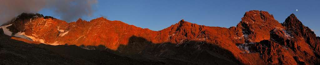
Disgràzia on the left and the S ridge with Corni Bruciati on the right from Rif. Ponti - Ph. morceaux
The peak is built in by a good kind of “serpentino”, a greenish rock having a metamorphic origin. Cresta di Pioda is the route climbed in the summer 1862 by the first summiters of the mountain, the British pioneers E. S. Kennedy and Leslie Stephen with the guide M. Anderegg and T. Cox.


The view from the summit is quite spectacular and 360° wide, towards the neighbouring peaks and valleys of Masino-Bregaglia region, Bernina group and also far off over the Western Alps.
Getting There
Road Approach
The starting point to climb the route is the village of Filorera in Val Masino
From Milano to Filorera (Val Masino) - Follow the East Motorway to Lecco, then the road n. 36 running on the East shore of Lago di Lecco, reaching Mandello del Lario, Varenna, Dervio and Colico m. 202 (90 km. from Milano). In Colico leave the road n. 36 (getting to Chiavenna), turn to right, take the road n. 38 (signposts Sondrio- Morbegno) entering the Valtellina, pass Morbegno and follow it as far as Talamona. After Talamona leave the Valtellina road and turn to left (signpost Val Masino), taking the road SP9 which enters the Val Masino , getting to Cataéggio and Filorera.
From Filorera to the Preda Rossa parking - In Filorera follow the signpost to “Piana di Predarossa” and Rifugio Ponti. Leave the main road and turn to right, following a toll-road entering the long Valley of Sasso Bisolo (5€ - you can buy the ticket in Cataeggio or Filorera snack-bars). Where the road is blocked by an old landslide nearby a cave, follow an alternative unsurfaced road running on the other side of the valley (km. 1,8) and joining the original road above the landslide. The last part of the road reach the wide parking of Predarossa.

Walking approach to Rifugio Ponti
From the parking nearby the Alpe di Preda Rossa (m. 1950) follow the path (signpost Rifugio Ponti) leading soon to a the plain of Preda Rossa where Monte Disgrazia shows its superb shape. Cross the plain on its right side (some wooden bridges), getting the upper plain. On the left a good path with some hairpins rises to reach a morainic terrace lying nearby the Glacier od Preda Rossa. A long traverse heading NNE leads to the hut (2 hours and a half from the Preda Rossa parking, red-white marks along the path).
Route Description

Monte Disgrazia West–North–West ridge report - UIAA Scale
Summit altitude: m. 3678
Difficulty: Alpine PD/PD+, II+ UIAA
Difference in level: 27200 m. from Preda Rossa, 1120 m. from Rif. Ponti
Exposure: WNW
First ascent: : E.S. Kennedy – Leslie Stephen – M. Anderegg – T. Cox 1862, August, 24th
Hut: Rifugio Ponti m. 2559
Starting point: Alpe Predarossa m. 1950
Monte Disgrazia West-North-West ridge – or Cresta di Pioda – is the easiest way to get the summit of this mountain, the highest one of Lombardia. It’s a frequently climbed mixed “course”, alternating snowy ridges and easy rocky steps.


Part I – Scrambling approach from Rifugio Ponti m. 2559 to Sella di Monte Pioda m. 3387
Sella di Monte Pioda m. 3387 is a wide saddle lying between Monte Pioda and Monte Disgrazia. From the hut take a well worn path heading East (red-white marks), getting the edge of the right lateral moraine of Preda Rossa Glacier. Follow the moraine edge; when it ends (cairn), turn to left and rise on a stones-ground (some cairns) heading to a steep rock wall on the orographical right side of the glacier. The route gains the edge of the Preda Rossa Glacier; cross the glacier and climb its steepest section on the left, near the rocks, to avoid the crevasses, getting a terrace below the wide saddle of Preda Rossa, then the saddle m. 3387, where a breathtaking view over the Bernina Group appears (2 hours from the hut).


Part II – Climbing section from Sella di Monte Pioda m. 3387 to the summit of Monte Disgrazia m. 3678
The climb starts from Sella di Monte Pioda. Skirts the first rocks on the right for about 50 meters, then take the ridge, alternating Up the fine ridge, alternating snowy slopes and rocky steps, being aware to the huge cornice protruding to the Disgrazia Glacier.


After a steep snow- slope (40°), climb some rocky steps (max II grade UIAA), reaching two small rocky prominces. The rocks are of good quality and are engraved by the crampons’ points. After this rocky section, climb an easier but airy snow ridge, reaching the fore-summit called “Syber-Gysi". After having climbed a steep boulder 5 meters high called “Cavallo di Bronzo” (“Bronze Horse”, II+ UIAA) follow the ending ridge to the tiny summit.

Descent: following the same route
Essential Gear
Rope, helmet, ice-axe, crampons, some ribbons, glacier-gear, some quickdraws.
Red Tape
No particulary restrictions in climbing and hiking. The road running from Filorera to Preda Rossa is a toll-road.
Hut

Rifugio Ponti
Rifugio Cesare Ponti m. 2559
Owner: C.A.I. Club Alpino Italiano Sez. Milano
Situation: South Disgrazia - Shore of Preda Rossa Glacier
Open: from June, 20th to September, 30th
Size: 60 persons + 6 in the winter-shelter
Guardian: Ezio Cassina
Hut's phone : +390342611455 - +390342640138
Email address: gestore@rifugioponti.it
When to climb
The best season is the late spring and the early summer.
Meteo

Guidebooks and maps
Guidebook

“Masino – Bregaglia – Disgrazia Vol. II” by Aldo Bonacossa – Giovanni Rossi – Collana Guide dei Monti d'Italia C.A.I.-T.C.I.
Maps
- Kompass n° 92 "Bernina - Sondrio" 1:50.000
- Multigraphic “Pizzo Bernina – Monte Disgrazia”
- CNS “Monte Disgrazia” 1:50.000