
-
 6576 Hits
-
 71.06% Score
-
 1 Votes
|
|
Route |
|---|---|
|
|
46.35380°N / 14.54195°E |
|
|
Mountaineering, Scrambling |
|
|
Summer, Fall |
|
|
Most of a day |
|
|
Class 3 |
|
|
UIAA I+ |
|
|
Rating the Route (By Hiking Standards)
0. General: 901 m (from the W) or 601 m (from the E) to 2558 m. Exposition south, on the ridge not marked, no path. Gear: good shoes, poles.1. Effort: 1660 m, 4 h 30 min (from the W) or 1960 m, 5 h (from the E).
2. Power: 3 - medium
3. Psyche: 3 - medium
4. Orientation: 2 - easy
Approach
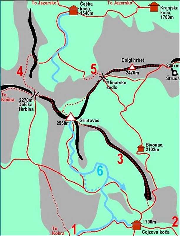
Grintovec and its routes
For more details how to reach Kokrško sedlo see the parent page!
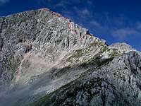
 Dolge stene is the long ridge on the right Dolge stene is the long ridge on the right |
Route Description
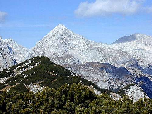
Skuta from Dolge stene
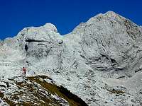
On Dolge stene ridge
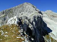
Now you follow the flat and easy ridge towards the NW. You go best just on top of it. The left slopes are grassy, while on the right there are vertical drops (stene=walls). On the altitude of some 2250 m the long and quite flat ridge gets steeper, we approach the summit ridge, which must be climbed.
The last part of the ridge