
-
 4060 Hits
-
 70.83% Score
-
 1 Votes
|
|
Route |
|---|---|
|
|
34.26181°N / 118.23877°W |
|
|
Hiking |
|
|
Half a day |
|
|
Overview
This route is accessed from the parking lot in the City of Glendale Deukmejian Wilderness Park. Take the trail going up Dunsmore Canyon; when this trail ends, keep going across the stream, to the right (East) and find your way up the canyon along the stream. At some point that looks good, climb up the riverbed, which is the crux of this route, then, upon gaining ground above the riverbed, head up the ridge. When you reach the Mount Lukens Road you can take it for a much longer way to the summit, or just keep going up off trail to reach the summit. Return can be had by established routes to either the East or West. The ridge portion of this hike is off-trail. The hike is probably about 2.5 to 3 miles in length from start to summit with an elevation gain of about 2,750 feet. Here is a picture of the hike starting up the Dunsmore Canyon trail, the ridge being visible by following the top of the summit (which is flat with communications gear) down until it hits a v.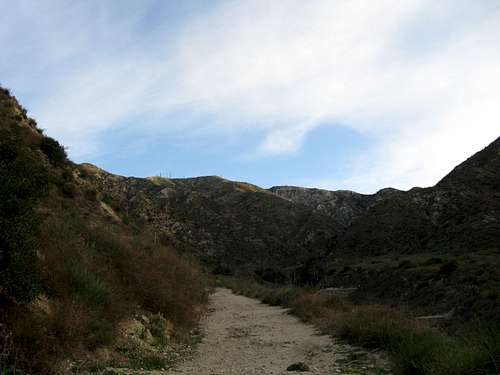
Heading up the trail before the off-trail ridge is begun
Getting There
Follow the directions from the Mount Lukens page to the parking lot in the City of Glendale Deukmejian Wilderness Park.Route Description
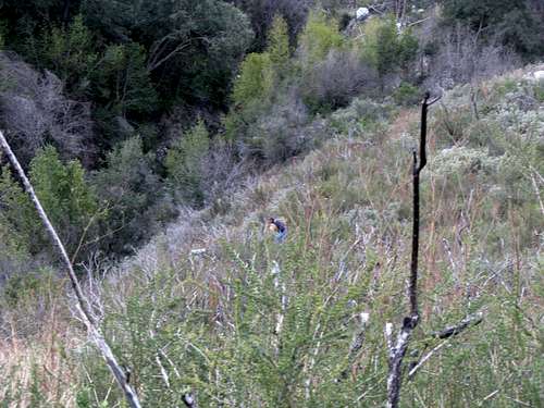
Be careful in getting up the riverbed stream to the beginning of the ridge. There is no right way to do it, you just have to get up a little over 20+ feet of very steep crumbly hillside. Be careful what you grap hold of because it is likely to pull out, and make sure you are not behind anybody else going up this section because large rocks are easily dislodged. In addition, there is plenty of poison oak at this point, and everybody in our group of 3 got it. The following picture was taken on the ridge above the riverbed area, looking back down on it.
Once you are on the ridgeline, it is just a matter of proceeding up in any way that looks good to you. There is no trail.
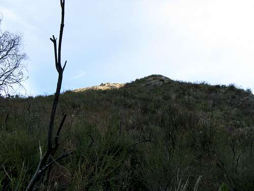
Looking up the Ridge
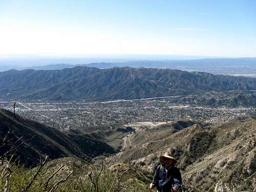
This shot is along the ridge. Looking down the center of the picture you will see in the distance below a trail, which is the Dunsmore Canyon trail.
There is a lot of brush on the ridge, but nothing so much that you can not get through it, although we went in February 2012 after a lot of brush had been cleared by the Station Fire, and we ended up with charcoal all over our clothes. If you keep going up the ridge instead of taking the Mount Lukens Road at the top you will run into an area of bushes that must be navigated, but it is better (in my opinion) than taking the much longer and meandering road.
Essential Gear
Long sleeves and pants, and a hat, are very desirable due to bushwhacking required on the ridge. Water is essential as there is none on the route and this is a South facing route that gets the sun.Topo Overview
The ridge is highlighted on this topo between the two parallel lines drawn in, with the X being a gneral description of where the riverbank must be climbed to gain access to the ridge. The trail up the conventional trail is marked on the topo.

Ridge Portion of Hike