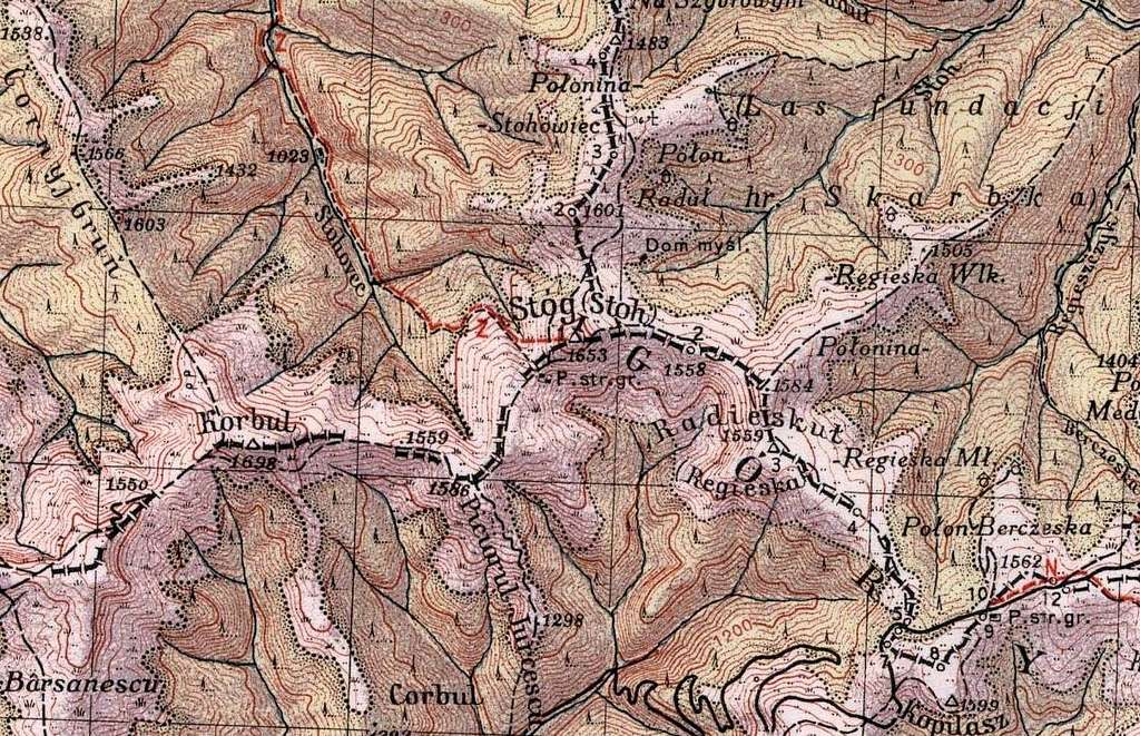
These were the easternmost reaches of
Czechoslovakia before World War II, when three countries
met on the summit of
Stóg/Stoh in the
Mar(a)marosh Carpathians:
Poland (top-right), Romania (bottom, i.e. south) and Czechoslovakia (top-left).
This image shows a piece of a
map made in 1932 (2nd, hiker's edition 1938) by
WIG, i.e. the Polish Military Geographic Institute.
And here is a happy
Czech on Stoh,
October 2010.

Comments
Post a Comment