
-
 5339 Hits
-
 83.1% Score
-
 16 Votes
|
|
Mountain/Rock |
|---|---|
|
|
34.02168°N / 116.16025°W |
|
|
Riverside |
|
|
Trad Climbing, Sport Climbing, Toprope |
|
|
Spring, Summer, Fall, Winter |
|
|
4210 ft / 1283 m |
|
|
Overview


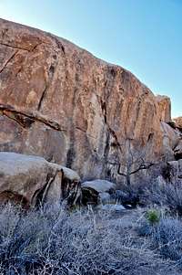
In contrast to most of the Joshua Tree formations that are bunched together into a family, or grouping, of rocks, Peyote Cracks formation rises out of the level landscape all by itself and without an immediate neighbor. This formation is rather long and narrow with a north south orientation and situated some 250 yards northeast of Rock Hudson and a few hundred yards directly to the west of Echo Cove area. The Peyote Cracks, West Face is low angle with easy to moderate climbing difficulty levels. The three crack systems of the west face offer a good intermediate practice ground for leading, gear placement, or toproping possibilities.
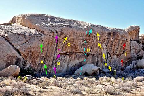
The case with the east face of this formation is completely different from the west face. It is important to mention that I have never climbed on the east face. I have only belayed friends with greater ambitions than my own. The east face of Peyote Cracks used to be called "John Bachar toprope wall" and if you are familiar with this climbing icon's name then you get an idea what the east face is all about. The east face is overhanging for its entire length. The routes are difficult and you better come prepared to fail. There are mega classics such as The Watusi, rated 12c and Dial Africa, 12c here. If you are comfortable on these climbs then you can try The Moonbeam Crack, 13a or Rastafarian, 13b. Are you tired yet? These test pieces may have been toprope problems in the long past, but they all have been done on lead, starting with John Bachar and his daring free solo ascent of Baby Apes, 12c. Although most of these routes are now protected by a combination of bolts and gear, most climbers still opt to toprope the routes of the east face.
List of the routes
Route of John Bachar Toprope Wall | |
| A | The Moonbeam Crack, 13a |
| B | Baby Apes, 12c |
| C | Rastafarian, 13b |
| D | The Watusi, 12c |
| E | Dial Africa, 12c |
| F | Buffalo Soldier, 12b |
Topo of the routes
 |  |  |
Getting there
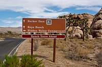
Just past Intersection Rock, take the road to Barker Dam for a short distance. Shortly after getting on this road you’ll see a sign for “Key’s Ranch” Road. Take this dirt road to a large parking area on the right. Just beyond the parking area there is a sign for “Key’s Ranch Guided Tours.” You can drive further on this road to access several other climbing formations, but you will run into a locked gate for “Key’s Ranch.” Walk along the dirt road and within less than a minute the South Face Of Echo Cove will be on your right, and right next to the road. Continue walking along the road to the end of the south face where you will see another small parking area. Looking in the direction of the west, you will see a long and not particularly large formation a few hundred yards away. That is Peyote Cracks formation and you are looking at it's east face.
Camping, noise considerations, Environmental concerns, Fees & Food
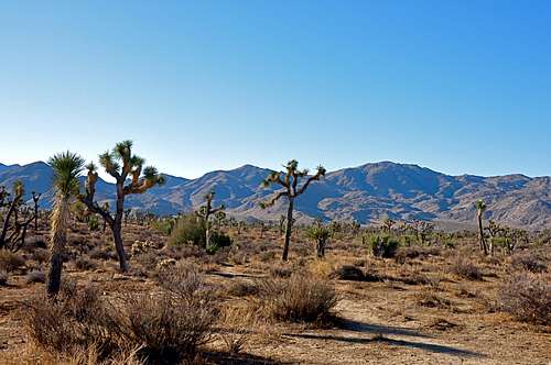
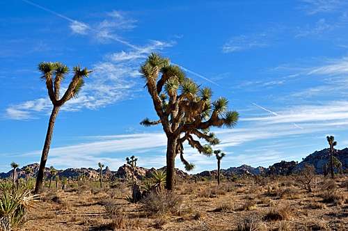
Typical Joshua Tree landscape
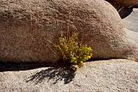
Desert Flowers
Please tread lightly. The Access Fund has gone to great lengths posting trail marker for approaches to many of the more popular crags. Do your best to stay on these trails, and where you are forced to use a different path, choose the ones that rain can mend in time. Drainages make for good trails where there are no established trails.
Avoid stepping on native and fragile plants, and do not feed the coyotes. Coyotes are very much used to people and often hang around picnic areas and camp grounds in hopes of getting a hand out. It’s better to let them live their natural life.
Camping
Joshua Tree Camping
Noise considerations
When you are camping with friends and sitting around the fire, it is easy to forget that there are other people trying to sleep in the nearby campsites. It is important to put yourself in their shoes. Keep the noise and music to a minimum and certainly not too much past 10 p.m. Your neighbors will smile at you in the morning instead of giving you dirty looks.
Fees and Food
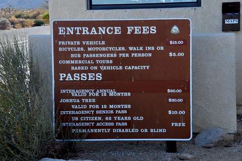

My wife and I have had Thai food in many different restaurants and cities. This Thai place beats them all. In November when the number of visitors to Joshua Tree reaches its peak, this restaurant puts on a Thai buffet, all you can eat for 10.95$/person. But, you must get there early, or be prepared to wait by the door for a table. The latest information indicates that the buffet style will be terminated by the end of February and will resume in November of 2010.