
-
 35391 Hits
-
 78.27% Score
-
 9 Votes
|
|
Mountain/Rock |
|---|---|
|
|
35.91300°N / 105.6541°W |
|
|
Hiking, Scrambling, Skiing |
|
|
Spring, Summer, Fall, Winter |
|
|
12529 ft / 3819 m |
|
|
Overview
At 12,529 feet, East Pecos Baldy is New Mexico's 20th highest ranked peak. It is located in the middle of Pecos Wilderness between the Truchas Peak group to the north and Santa Fe Baldy group to the southwest.
 East Pecos Baldy from the west East Pecos Baldy from the west |
 East Pecos Baldy from the west East Pecos Baldy from the west |
 Summit view north Summit view north |
 Summit view down to Pecos Baldy Lake Summit view down to Pecos Baldy Lake |
|---|
Trailhead/Route Information
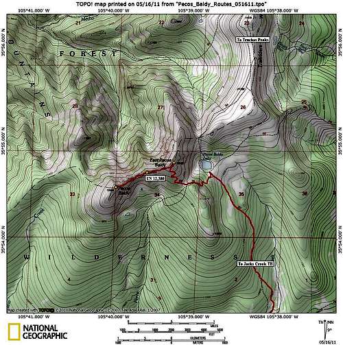
There is a good trail access to East Pecos Baldy from south, north and west. The southern approach from Jacks Creek trailhead is the shortest and most popular one.
Directions to Jacks Creek Trailhead:
Drive for 15 miles on I-25 east from Santa Fe and take Exit 299. After exit ramp, turn left at stop sign, cross the interstate on the bridge and turn right onto NM-50. After ~6 miles you will reach the village of Pecos. Turn left onto NM-63 at the intersection and continue on driving on NM-63 for about 20 miles to Cowles. After reaching Cowles (you will see a large parking lot and a bridge across the river on the left), continue straight for 3 miles to the parking area near Jacks Creek Campground. The trailhead area has water, restrooms and information board. There is a $2 per day/per vehicle fee for parking at Jacks Creek trailhead.
Jacks Creek Approach (Jacks Creek TH-Pecos Baldy Lake):
Distance: 12.5 mi RT
Elevation Gain: 2,800 feet
The route starts at Jacks Creek trailhead parking lot and follows Beatty's Trail (Trail #25). The trail starts switchbacking to the ridge crest and gains ~1000 feet in the first 1.5 miles. After 2.5 miles, you will come to junction with Jacks Creek Trail (Trail #257). Turn left onto Trail #257 and follow it north through grasslands and aspen groves on the west slopes of Round Mountain. After crossing Jacks Creek, turn right (and continue hiking along the creek heading up the canyon to the intersection with Trail 259. At the junction, take a left fork to stay on Trail 257. 3 miles of steady uphill hiking through the woods takes one to the intersection with Skyline Trail (Trail 251). A short walk northwest takes you to Pecos Baldy Lake. Camping is not permitted in the lake basin, but there are nice campsites in the trees to the north and southwest of the lake.
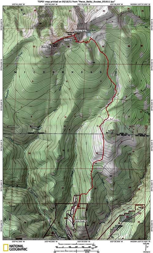 Jacks Creek Route Map Jacks Creek Route Map |
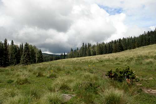 Jacks Creek Trail Jacks Creek Trail |
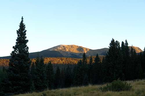 Pecos Baldy from Jacks Creek Trail Pecos Baldy from Jacks Creek Trail |
|---|
Climb from Pecos Baldy Lake
YDS Class:1+
Head southwest on a Trail 251 climbing switchbacks through the woods to the saddle on the southeast ridge of East Pecos Baldy. At the saddle, turn right and follow East Pecos Baldy Trail (Trail 275) as it switchbacks up the southeast face of East Pecos Baldy (0.5 miles/~700 feet elevation gain). Alternatively, one can climb directly to the saddle from the southwestern corner of the lake and then take Trail 275 to the summit.
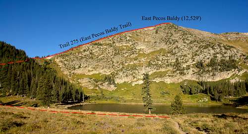 East Pecos Baldy route from Pecos Baldy Lake East Pecos Baldy route from Pecos Baldy Lake |
 East Pecos Baldy area map East Pecos Baldy area map |
|---|
Red Tape
The summit of East Pecos Baldy and access routes are located in Pecos Wilderness. Wilderness regulations apply. No permits are required for both day-hikes and overnight backpack trips. Camping is not permitted in the Pecos Baldy Lake basin. For more information, contact Santa Fe National Forest (505-438-5300)
When to Climb
Mid-June through October is considered the best time to climb. July-August are the typical monsoon season, with regular afternoon thunderstorms. Plan your day accordingly to be off the exposed slopes and ridges and below the treeline before noon. Winter/early spring ascents are possible, but the long approach makes it a VERY long day or requires an overnight backpack. Bring your snowshoes or skis and be aware of current avalanche conditions.
Miscellaneous Info
Pecos Wilderness map (published by the US Forest Service)
USGS Map Quads: Cowles and Truchas Peak
Santa Fe National Forest webpage
Pecos Wilderness webpage