
|
|
Route |
|---|---|
|
|
39.44310°N / 106.102°W |
|
|
Hike |
|
|
Half a day |
|
|
Class 2 |
|
|
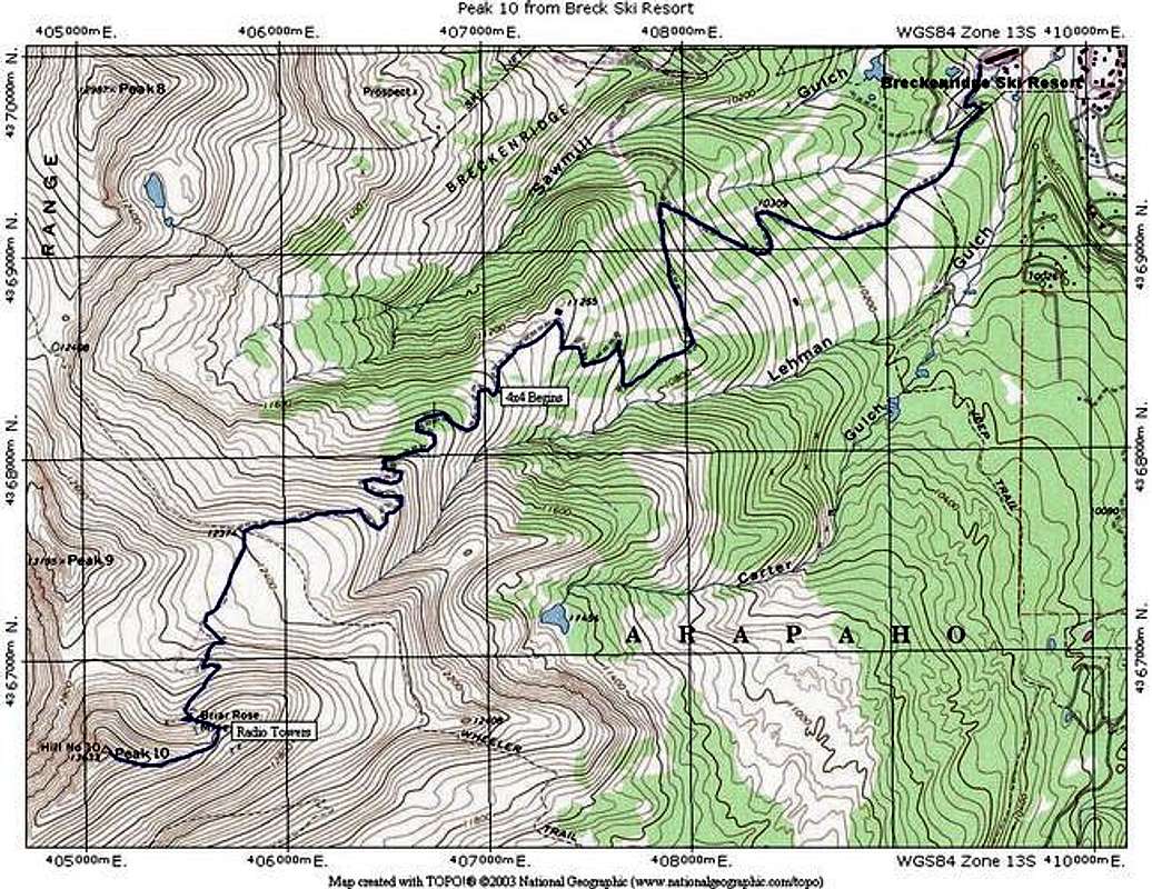
Approach
For this route, you begin at the Breckenridge ski resort. Your starting point will differ based upon snow and whether Breck is still operating.
Drive to South Park Avenue on the south end of Breckenridge. Turn west and drive 0.2 miles and turn left on Village Road. Drive 0.2 miles on Village Road and turn left into a large parking lot near the Beaver Run complex. Turn left, cross the lot and turn right onto County Road (CR) 751 (dirt). This road leads to the top of the Peak 9 section of the ski area. After 0.5 miles keep left. There is a gated road on the right. Pass a lift and drive around to another intersection near 0.8 miles. Stay right on the main road and begin the climb into the ski area. Near 1.5 miles, stay right. Near 3.0 miles, go under a lift. Stay on the main road and pass the Peak 9 Restaurant. Continue up to the highest lifts near 3.6 miles. This is the trailhead. Past this point, the road is rough and 4WD is required.
In winter and spring while Breckenridge Ski Resort is still operating, you can take the Mercury Super Chair to the start of this route. Above the lift, start up the road. Backcountry access is not always open here, so call the ski patrol to check on the status before you plan a trip. Never duck closed backcountry gates. This violates the Colorado Skier Act, and will get you a hefty fine.
Route Description
Depending on where you park, follow the road to Peak 10. Your first goal will be a large radio antenna array on the lower portion of the ridge at approximately 13, 200 feet. There is a road that goes to this point that switches back up this slope, and is very easy to follow, even on snow.
From the end of the road near the radio antennae, simply follow the east ridge to the summit. You will go over a few small bumps on your way up the remaining 400 feet to the summit.
In winter and spring, a large cornice can form along the northeast side of this ridge. Take care to avoid it.
Starting at Breck Ski Resort:
Round Trip Mileage: 12 miles
Elevation Gain: 3,900 feet
Starting at the top of the Mercury Superchair or from the top of the road:
Round Trip Mileage: 6.6 miles
Elevation Gain: 2,800 feet
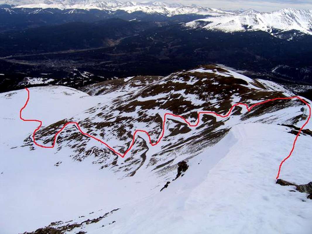
The Red Line Shows the Upper Route to the Saddle
 |  |  |
Essential Gear
For summer and fall, just standard hiking gear.
Winter and Spring will require full winter gear.