|
|
Route |
|---|---|
|
|
40.18560°N / 105.6706°W |
|
|
Steep snow/ice/rock |
|
|
A long day |
|
|
Low 5th class |
|
|
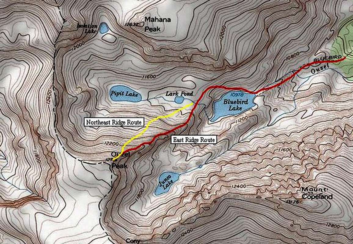
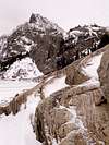
Approach
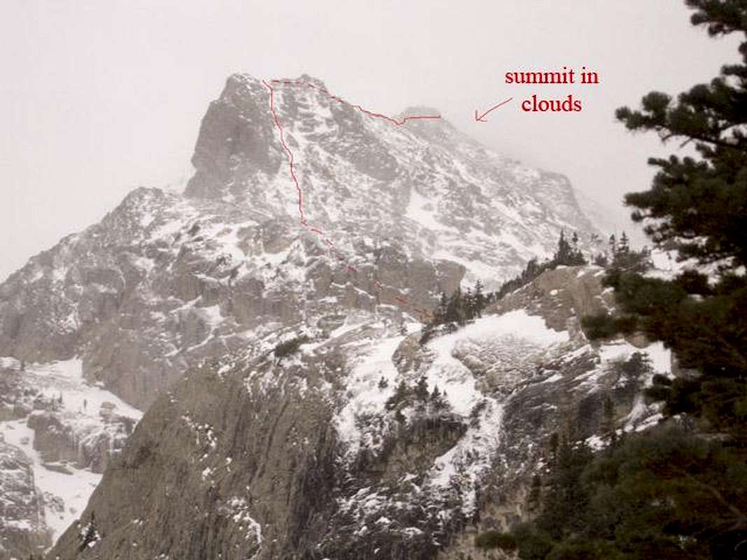
The East Ridge Route as seen from just above Bluebird Lake.
The best way to reach the East Ridge of Ouzel Peak is to hike from the Wild Basin Ranger Station to Bluebird Lake.
You will need to enter the National Park at the "Wild Basin" Entrance. This is the Southern most entrance on the East side of the Park, about 20 minutes South of Estes Park on Hwy 7. From the entrance to the Park, you will follow a dirt road around Copeland Lake, following North St. Vrain Creek until you reach the Wild Basin Ranger Station and Trailhead. You will then hike along the Thunder Lake Trail, passing Calypso Cascades and Ouzel Falls.
Shortly after Ouzel Falls, you will take the Bluebird Lake trail junction. This will lead you all the way up to Bluebird Lake. From here, the route is the prominent ridge that leads to the summit of Ouzel Peak. Once at the lake, skirt around the North side and gain the shelf to the west of the lake. Gain the ridge at the most convenient point which will most likely be once you cross Lark Pond's outlet stream at the top of the rock shelf you will be on.
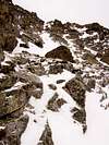
Once on the ridge, pick the best way up though the slabs and snow lines working your way up the ridge. The terrain gradually steepens. There is a prominant "couloir" (more like a thin line of snow and ice) that will be the best way to ascend this ridge. About halfway up this prominant line of snow you will come to the crux of the route. It is a low 5th class "V" in the rock that must be climbed to continue the route. The exposure is not terribly bad but a fall could be your last.
The rock is very solid and there are very handy ribs in the rock about knee high that your outside crampons fit perfectly on. There is also a crack on your left that you can jam you hand into for added support. And by chopping into the ice above and over the rock you can pull yourself up with relative ease.
Some might want to set protection, but I'm guessing most won't find it needed. I am a chicken and didn't feel any was needed. But keep it in mind.
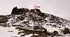
Now just finish the upper steep section of the snow gully until you top out on this point at about 12,100 feet. Just 600 feet of scrambling over 2nd and 3rd class terrain to the summit is all that is left.
If you wish to avoid any of the obstacles on this route, just head to the right (north) of the ridge, where 2nd class terrain awaits...
You typical winter hiking gear. Snowshoes for the approach. You will need and Axe and Crampons. Again, you may want to consider protection, but for most, this most likely won't be needed. Plenty of food and water as this is a long day.
Keep an eye on the weather, as this wouldn't be a good place to be caught in a bad winter storm.
You will need to enter the National Park at the "Wild Basin" Entrance. This is the Southern most entrance on the East side of the Park, about 20 minutes South of Estes Park on Hwy 7. From the entrance to the Park, you will follow a dirt road around Copeland Lake, following North St. Vrain Creek until you reach the Wild Basin Ranger Station and Trailhead. You will then hike along the Thunder Lake Trail, passing Calypso Cascades and Ouzel Falls.
Shortly after Ouzel Falls, you will take the Bluebird Lake trail junction. This will lead you all the way up to Bluebird Lake. From here, the route is the prominent ridge that leads to the summit of Ouzel Peak. Once at the lake, skirt around the North side and gain the shelf to the west of the lake. Gain the ridge at the most convenient point which will most likely be once you cross Lark Pond's outlet stream at the top of the rock shelf you will be on.
 |  |  |  |  |
Route Description
Once on the ridge, pick the best way up though the slabs and snow lines working your way up the ridge. The terrain gradually steepens. There is a prominant "couloir" (more like a thin line of snow and ice) that will be the best way to ascend this ridge. About halfway up this prominant line of snow you will come to the crux of the route. It is a low 5th class "V" in the rock that must be climbed to continue the route. The exposure is not terribly bad but a fall could be your last.
The rock is very solid and there are very handy ribs in the rock about knee high that your outside crampons fit perfectly on. There is also a crack on your left that you can jam you hand into for added support. And by chopping into the ice above and over the rock you can pull yourself up with relative ease.
Some might want to set protection, but I'm guessing most won't find it needed. I am a chicken and didn't feel any was needed. But keep it in mind.
Now just finish the upper steep section of the snow gully until you top out on this point at about 12,100 feet. Just 600 feet of scrambling over 2nd and 3rd class terrain to the summit is all that is left.
If you wish to avoid any of the obstacles on this route, just head to the right (north) of the ridge, where 2nd class terrain awaits...
Essential Gear
You typical winter hiking gear. Snowshoes for the approach. You will need and Axe and Crampons. Again, you may want to consider protection, but for most, this most likely won't be needed. Plenty of food and water as this is a long day.
Keep an eye on the weather, as this wouldn't be a good place to be caught in a bad winter storm.