
-
 3458 Hits
-
 71.06% Score
-
 1 Votes
|
|
Route |
|---|---|
|
|
46.38100°N / 14.25710°E |
|
|
Skiing |
|
|
Winter |
|
|
Half a day |
|
|
Easy |
|
|
Overview & Rating the Tour
Overview
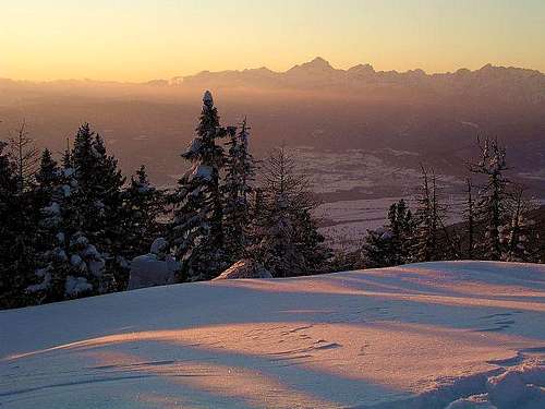
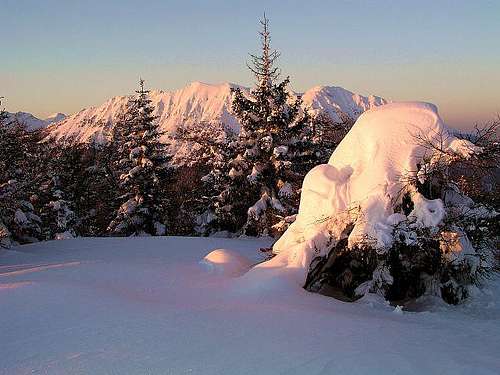
This is a nice, easy ski tour on a modest mountain, appropriate for times, when the tours on high mountains are too dangerous. It can be done also in hard winter and deep snow. The direct ascent route is often trudged, so Dobrča is also a fine goal for boarders. A round tour is recommendable and when skiing down, you can do shortcuts through light woods.
Rating the Tour (By Hiking Standards)
0. General. From 700 m to 1634 m, exposition E, SE, easy ski tour. Gear: Usual ski touring equipment.
1. Effort (ascent). 950 m, 2 h 30 min to 3 h.
2. Power. 1 - no difficulties.
3. Psyche. 1 - no difficulties.
4. Orientation. 2 - easy. If you're the first one to go, you'll have some problems.
Approach
| You start the tour in Brezje, a small village below Dobrča, West of Tržič. The village can be reached by the road, which connects Tržič and Begunje. Start altitude is 700 m, or you can drive up a bit more, if the road is cleaned and you have good winter equipment (or 4WD). |
Route Description
Ascent
You can ascend the summit either by the Eastern slopes, from Bistriška planina (alpine meadow), or directly, by the SE ridge. The latter approach is fine if you carry skis on your rucksack, the former can be done entirely with skis.

1. In good winter conditions the forest road to Bistriška planina is cleaned to be used with sledges. That's how you reach the altitude of 1060 m. From there you follow the forest road towards the W gaining altitude in a few long turns. Finally you reach just below Lešanska planina (alpine meadow), 1458 m. From there, the road continues ascending gently towards the SW, and you reach the crossroads on some 1465 m (private hut there). There you turn right and start ascending by the summit ridge of Dobrča, first towards the NW and from the trail branching right, towards the N, gaining soon the summit.
2. The direct marked path turns in Brezje left (towards the NW, plate: "Dobrča"). Already after a few meters of cart-road the marked trail deters right up. After some 30 minutes turns right (NE) and soon reaches the SE ridge of Dobrča (before it a steep section, but if the trail is really not icy, not difficult). The last elevation in this ridge is called Vaško, 1046 m, just SE of it, there's a meadow with a nice bench and the view southwards. On Vaško archaeologists found an evidence of prehistoric and antiquity settlement.
Then you continue by the forested SE of Dobrča, gaining altitude gently. On 1020 m there's a bench and the take-off place for paragliders (also the passage northwards, to the road). The continuation goes steeper, in short switchbacks, always towards the NW. On 1460 m you cross the forest road (connects Koča na Dobrči and Lešanska planina) and in a few minutes (at the private hut) you join the variant #1, which you follow to the summit.
Downhill


You best ski down from the summit first a short stretch towards the S and then on a small saddle left down from the summit ridge, towards the E, directly on Lešanska planina (meadow). From the lower part of this nice meadow, continue through a light forest towards the E, eventually following the mountain road. So you reach Bistriška planina, and then continue by the sledge piste to Brezje. So, from Lešanska planina you basically ski down by the ascent route #1.
External Links
- This description in Slovenian language, printable in pdf file is available here.
- Opis te ture, v pdf obliki, primerni za izpis in v slovenskem jeziku, se nahaja tukaj.