
|
|
Route |
|---|---|
|
|
39.42850°N / 106.0875°W |
|
|
Ski Descent |
|
|
Half a day |
|
|
Intermediate/Advanced |
|
|
Introduction
The East Slopes of Mount Helen are an excellent backcountry ski descent offering an intermediate area above treeline and an advanced tree skiing area just below treeline. This is a great daytrip for an exciting ski descent. If you time this right, you should be able to descend 2,700 feet to your car.
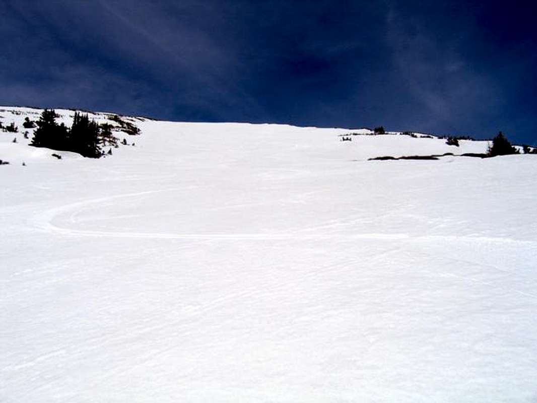
Fresh Tracks on the East Slopes of Mount Helen
Approach
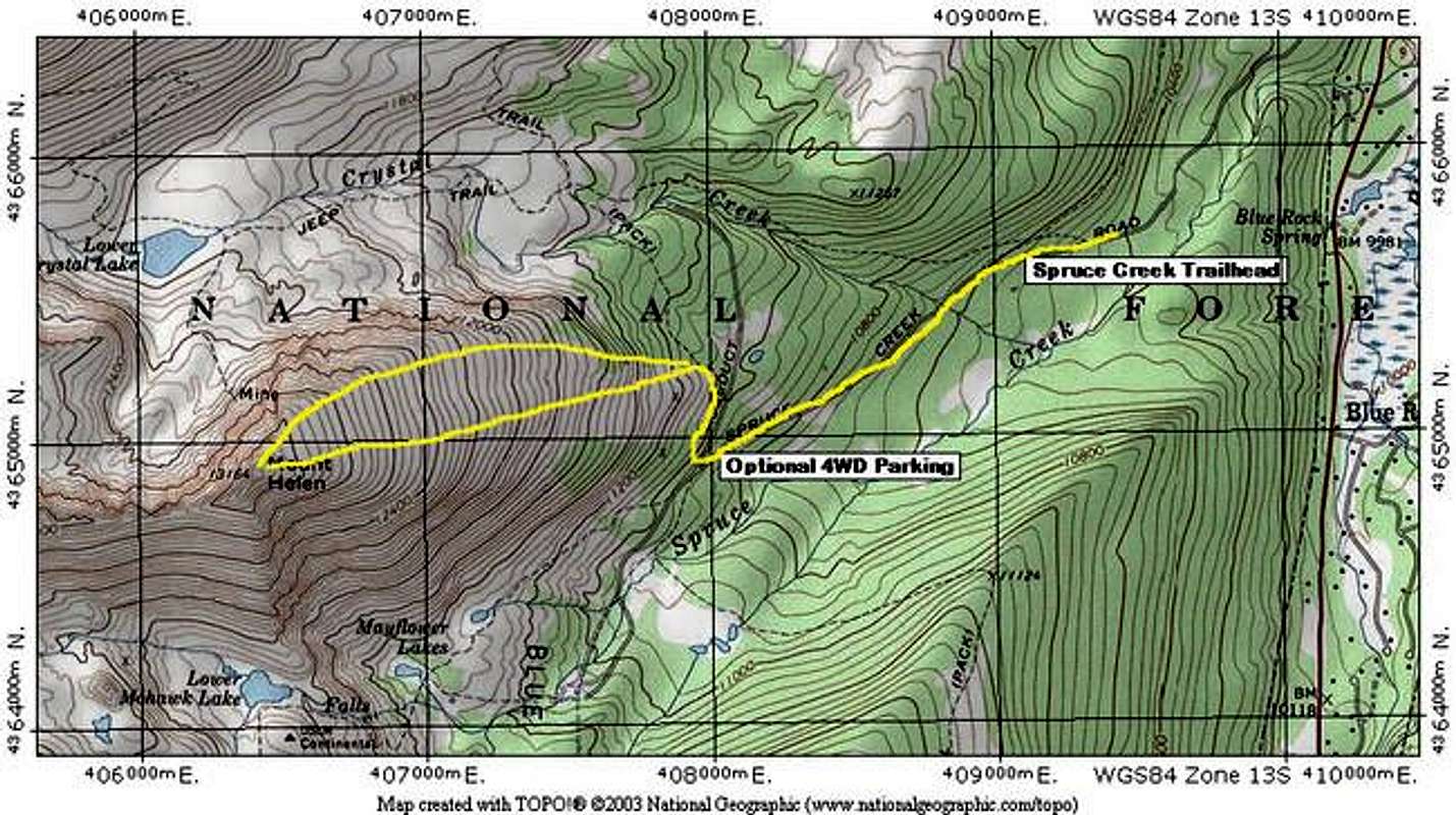
Use the East Slopes Route for the Approach to this ski. It will be possible to skin most of this route except the steep area right after you leave the Wheeler Trail and head for treeline. Gain the summit.
Route Description
On the way to the summit, carefully preview your ski route. Refer to the accompanying photos and TOPO for this ski.
The descent is very straightforward from the summit to treeline. This is an intermediate backcountry ski. Typically, the summit area will have less snow cover due to windscour, so you might have to meander here to stay on the snow. Once you reach the lower area of the east slopes, find the gully you should have climbed on the way up. This should give you the best snow on the descent. From the summit to here are low angled slopes. Many variations are possible on this wide slope. Use your judgment.
If you follow the wide gully above treeline, it will dump you into the steep, narrow gully referred to on the route description. This area is the most difficult to ski and is rated advanced. No matter what route you take here, you will either have to ski the narrow, steep gully or tight, steep trees back to the Aqueduct road. Beginners may want to pack their skis down this portion.
Once back on the Aqueduct Road, simply ski right to your car. These roads are low angled and hold good snow late in the season.
Round Trip Mileage: 5.1 miles
Elevation Gain: 2,700 feet
 |  |  |  |
Essential Gear
Skis, obviously. Skiers should carry avalanche gear, and know how to use it to test a slope.
Backcountry Ski Ratings and Disclaimer
Skiing in the backcountry is nothing like skiing at a resort. Ratings of "beginner," "intermediate," and "advanced" are backcountry ratings. They do not correspond to ski resorts. At ski resorts, beginner and intermediate runs are almost always groomed and cleared of obstacles. Not so in the backcountry. Expect to find rocks, trees, patchy snow, and all sorts of obstacles on the easiest of runs. Route selection and avalanche avoidance are also key to your safe navigation of backcountry ski terrain.
Don't think that you can safely ski a "beginner" backcountry route if you can ski green runs at resorts. It's like comparing apples and oranges. Being a "no falls" skier in all types of snow conditions is usually necessary before tackling backcountry terrain. Find an experienced partner or become an expert in resort terrain before trying backcountry.
Ok, lecture over. I just don't want anyone to get the wrong idea here and get hurt.
Avalanche Information
Colorado Avalanche information Center's Website for current information on Mount Helen.
The East Slopes of Mount Helen are generally low-angled, but there are several areas that could produce a serious slide in the right conditions. Pay special attention to the area between the Wheeler Trail and treeline. These slopes are directly east-facing and get early sun. Start early and be off these slopes early in Spring.
Current Conditions
Post current beta here under "Add Info." I will add it to the main text.
- May 18, 2005:
A little patchy near the summit, but great lower.