Overview
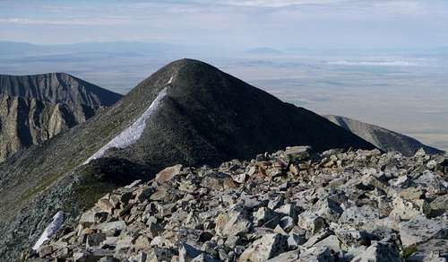
![South Summit of Twin Peaks from North Summit]() View of South Summit from the North Summit.
View of South Summit from the North Summit.This is the standard way to ascend Twin Peaks. The higher summit reaches 13,580 feet and is ranked as the 199th highest summit in Colorado. Although the total distance traveled is likely less than 13 miles, the route involves about 5,000 feet of elevation gain given uphills on the descent and makes for a long day, or a nice overnight adventure.
Getting There
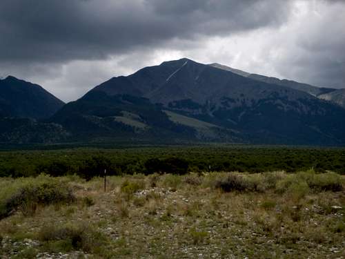
![Twin Peaks from Rt. 150]() Twin Peaks
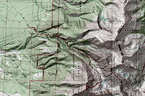
Twin Peaks![Map of Twin Peaks with Route to Summit Noted]() Map showing the route and approach
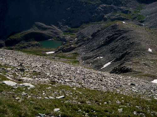
Map showing the route and approachFrom the Zapata Falls trailhead (there are actually 2 of them that merge about a hundred yards up the trail) walk for a quarter mile past some nice benches to rest on to the creek and waterfall. From here, the trail cuts right, switchbacking up the steep slope to get above the falls. There’s an old sign here with some scratches saying that the trail is long and steep and hard. Continue up this long, steep, and hard trail for about 4.5 miles to South Zapata Lake. Along the way, the trail first enters the Zapata Creek drainage again, crosses the creek, and works its way steeply up to an old cabin. From here, the trail continues to gain elevation steadily until it is high on the south side of the valley. It traverses just beneath a couple of large cliffs, eventually reaching a sign telling you that you are in Forest Service land. A bit after that there is a sign for the Sangre de Cristo Wilderness.
Eventually, you cross a creek, rise a bit more and then drop down a long ways to the valley floor. Supposedly, near the high point of the trail here, there is a branch that goes left and up into the North Zapata Creek Drainage although we did not see it. The trail you want continues along the north side of the creek at varying heights above it until about a mile from the lake. In the final mile, it crosses the creek and rises quickly through the last of the timber into alpine fields and marshes which it follows to South Zapata Lake at 11,900 feet.
By the time that the trail reaches the lake, it and the valley have curved around so that it is headed in a generally southerly direction. There are intermittent campsites along the trail that can be used for primitive camping once you have reached the Forest Service land. The entire hike and climb of the mountain could also be done as a dayhike of 12 or 13 miles.
Route Description
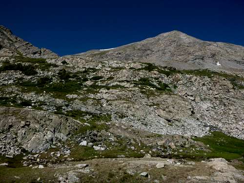
![Eastern Slope of Twin Peaks from South Zapata Lake]() Eastern Slopes from South Zapata Lake. The photo to the right is a mirror image taken from just below the snow at the ridgeline looking down.
Eastern Slopes from South Zapata Lake. The photo to the right is a mirror image taken from just below the snow at the ridgeline looking down.![Eastern Slopes of Twin Peaks from Above]() Eastern Slopes of Twin Peaks from Above.
Eastern Slopes of Twin Peaks from Above.From South Zapata Lake, Twin Peaks rises to the west. The bigger mountain to the south-east of the lake is Ellingwood Point. Generally, follow grassy slopes with a few spots of talus to the west in the direction of the peak. Walk up and into the small basin just to the north of a low flat topped ridge of about 12,660 feet. From this basin, work up stable talus and then a gully with some grass to reach the point where this low ridge merges with the eastern slopes of the peak. From here, continue generally west to the ridge between Twin Peaks two summits. The slope is steady but never terribly steep, starting as grass and ending as scattered talus. There may be a cornice or at least snow in places near the ridge, although we had no need for ice axes in early July when we were there. Once on the ridge, the main summit is to the north. From the top, there are wonderful views up into Great Sand Dunes National Park as well as south and east into the Blanca Massif. It is not hard to drop directly down to the east from near the southern summit on the descent.
Essential Gear
You need nothing special for this ascent. Early in the year, an ice ax might be useful.