
|
|
Route |
|---|---|
|
|
38.72500°N / 111.056°W |
|
|
Scrambling |
|
|
Spring, Fall |
|
|
Most of a day |
|
|
Class 4 |
|
|
Overview
Since this is in Utah, the proper name for the route is the Poncho Chute from Heck. This is the quickest way to do the entire Enigma Canyon without climbing all the way up the slot. This (opposite wall) is what I call the "Poncho Exit Chute from Heck". It's 800 feet of steep and loose rubble, but is the only route I know up up to the rim between Poncho Wash and Gem Canyon.
Getting There
A journey to out in the middle of no-where............As mentioned, just finding the trailhead is a navigational challenge. You must do the vehicle shuttle the day before the trip, as it will be a long day just getting through the canyon. You absolutely must have the 7.5 minute quads (maps) Big Bend Draw and Ireland Mesa for the drive to the trailhead. Even then, the maps are inaccurate especially near the trailhead. A 4wd is also required.
To get to the trailhead at the head of the canyon, drive west from Green River, or east of the Emery area along I-70 to exit 108. You must carefully follow the topo maps for the remainder of the drive. Take the southbound gravel road and veer right after a short distance. Stay on the main road until you reach Kimball Draw at an intersection with a sign. This is at about co-ordinates N38*47'16.47" W111*5'52.69". Turn left onto the dirt road signposted for Copper Globe. After following the bottom of the wash for a while, you will reach an intersection (no sign and it can be hard to spot[update: in 2007, there was a sign for "Designated Vehicle Route" here]) at about co-ordinates N38*47'4.42" W111*4'34.19". Turn right onto a seldom used track. Follow the track in and out of several drainages until you reach an intersection at a top of a hill at about co-ordinates N38*46'24.02" W111*3'57.04". Turn right here. The road weaves in and out of drainages and scenic and colorful badlands and is one of the most interesting pieces of road construction I've ever seen. There are some sections of the road that pass through sparkling gypsum beds. Not too far after the road climbs out of Dizzy Trail Canyon (see the topo map), you will reach a junction next to a small hill with a cairn (pile of rocks) on top.
From here on, the topo map is inaccurate as far as showing the many tracks go, so pay attention closely to the topographic features on the map. There are many routes to the trailhead, but here's the route we took. Turn right at the junction with the hill and cairn. You will cross a few very rough spots in the road while crossing two washes. After the second wash, make a very sharp left turn onto a track that heads east [update: this track was just about invisible when we were here in 2007, so see the alternate route below].
Note #1: In 2004, I found an alternate route to the trailhead. The road is not as rough from this alternate route, but the trailhead can be harder to recognize from this direction, as this route has no landmarks near the trailhead. At the hill with the cairn, continue straight instead of right. Look for a faint track to the right not far beyond the hill with the cairn. This road leads to the trailhead, but it’s hard to recognize. Hopefully the cairn I left will still be there!
The trailhead and where you're aiming for is very near the 6350 elevation marked on the Ireland Mesa quad NW of the word "DIKE" on the map. We parked here. There are actually several possible trailheads, including following the track marked on the topo map down to Poncho Wash. We chose to start here because we did Gem Canyon (see the mountain page on that canyon) on the same trip. Otherwise continue past the rough washes as mentioned above and park at the stock tank in Poncho Wash.
Make sure to leave Green River or Castle Dale with a full tank of gas! This area certainly is out in the middle of no-where!
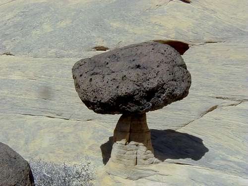 Humorous balanced rock in canyon.
Route Description
After taking the Standard Route down Enigma Canyon to Muddy Creek, you are now ready for this exit route at the mouth of the canyon.From the mouth of Enigma Canyon, hike up Muddy Creek for 1.4 miles to Poncho Wash. There will be at least two creek crossings.
Hike up Poncho Wash for 0.3 miles while keeping a close eye out to the right. After hiking up Poncho, you will notice a chute on both the right and left sides of the canyon. This is caused by a fault line. The left chute dead ends on a high cliff above Muddy Creek, so it’s the right chute you want. These chutes are just before a big bend in Poncho Wash. (If you hike up Poncho Wash, you will eventually reach a big falls).
Grind up the chute. Only one place is exposed and it was covered with slippery mud when we climbed it on April 13th and 14th 2007. It shouldn't be bad when dry. Loose rocks are a hazard, so use caution.
After climbing the chute, veer right and scramble up to the top of the rim. There is a nice break in the cliffs making the rest of the route fairly easy.
From here you need a map, compass, GPS if you have one, and navigating skills. Stay on the flat and broad ridge of sorts between Poncho Wash and Enigma Canyon and route-find back to the trailhead. There are few landmarks, so make sure to follow the map very carefully. The trailhead is about 2.5 miles from the base of the exit chute in Poncho Wash.
 Map of the exit chute out of Poncho Wash.
(Note mileages will be supplied shortly).