Toggle navigation
Mountains
Routes
Images
Trip Reports
Forum
What's New
People
Areas & Ranges
Articles
Trailheads
Canyons
Huts & Campgrounds
Albums
Logistical Centers
Fact Sheets
Lists
Custom Objects
Gear
Plans & Partners
WELCOME TO SUMMITPOST
SIGN IN
REGISTER
Fair Glacier Epic
Additional Parents
Image
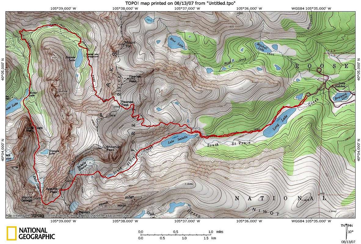
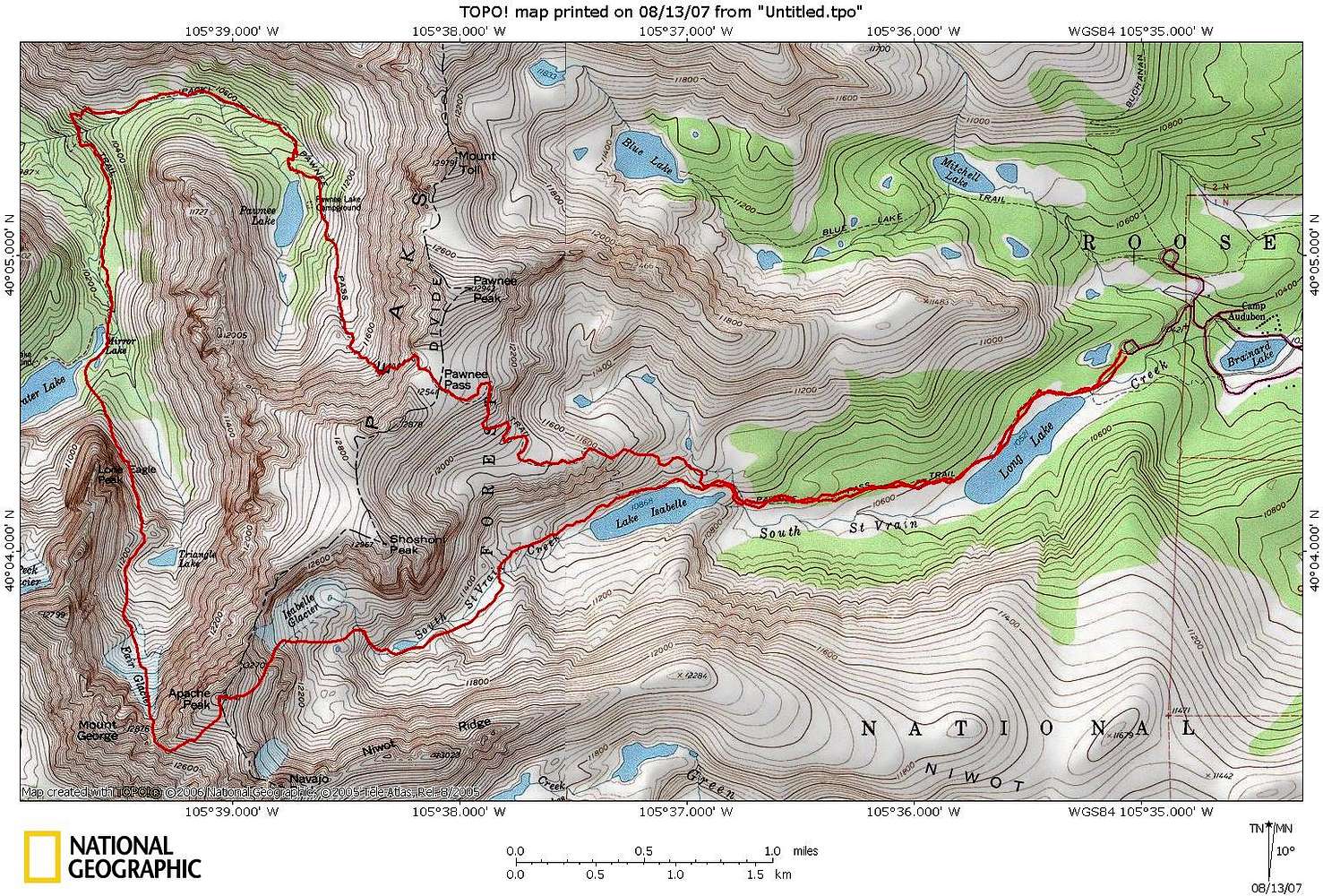
Fair Glacier Topo
View High-Resolution Image
Fair Glacier Topo
Topo Map of Fair Glacier from Long Lake Trailhead (5500-6000 feet, 13.6 miles).
« PREV
NEXT »
georgbetsy
on
Aug 13, 2007 11:48 am
Comments & voting
Other parents
Lat/Lon:
40.05800°N / 105.651°W
Image Type(s):
Alpine Climbing
Image ID:
323068
6812 Hits
71.06
% Score
1
Votes
Log in to vote
Comments
No comments posted yet.
to post!
Don't have an account?
Fair Glacier Epic
(Trip Report)
« PREV
Viewing
#4 of 15
GALLERY
NEXT »
georgbetsy's Image Gallery
« PREV
Viewing
#88 of 142
GALLERY
NEXT »
×
You need to login in order to vote!
User Name
Password
Remember me
Forgot your password?
Log me out when I close my browser.
Keep me logged in all the time.
sign in as a user
Don't have an account?
Register now for FREE
Rating available
Suggested routes for you
People who climb the same things as you
Comments Available
Create Albums
Register Here


